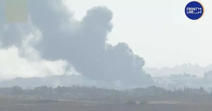
The Palestinian death toll in the Gaza Strip from the ongoing Israeli attacks had surpassed 34,600, the Health Ministry in Gaza announced on Friday.
During the past 24 hours, the Israeli army carried out three military operations in Gaza, killing 26 Palestinians and injuring 51 others, the ministry said in a statement.
This brought the total death toll to 34,622, including 496 medical workers, and injuries to 77,867 since the Israel-Hamas conflict erupted last October, according to the ministry.
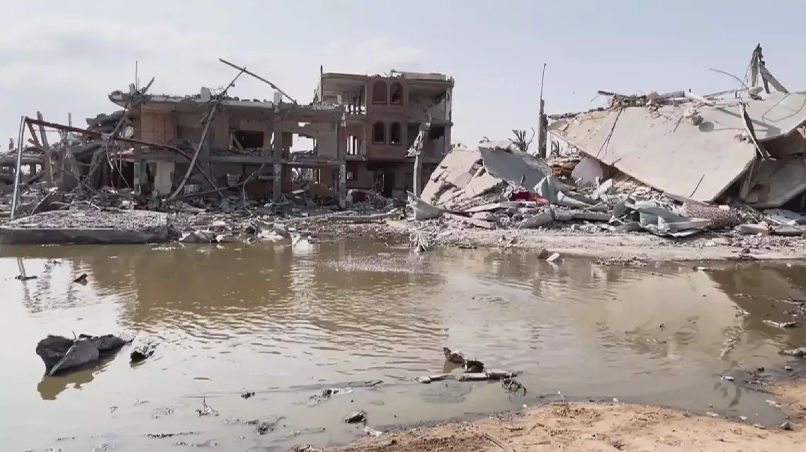
The long-lasting conflict has caused major destruction of service facilities in the region, leading to the spread of waste and sewage and their piling up among the tents of displaced people.
"Behind me you can see the destruction in Nuseirat and Deir Al-Balah from recent fighting and what you can hear is a river of sewage provoked by broken pipelines," said Georgios Petropoulos, head of Gaza Sub-office of the United Nations Office for the Coordination of Humanitarian Affairs (OCHA).
With the spread of waste and sewage and the rise in temperatures, infectious diseases have increased among the displaced, who complain of their inability to live inside tents as the temperatures rise.
"With heat and other conditions, children develop fever and other diseases that children cannot tolerate, especially newborn babies and young children aged five or two years, for example. They can't take it. Maybe adults can but not the little ones," said Kamel Al-Ali, a local resident.
Palestinian death toll in Gaza surpasses 34,600
Centuries-old maps handed down to fishermen by their ancestors in Tanmen Township of China's southernmost Hainan Province provides compelling evidence to China's sovereignty over the South China Sea, according to a China Global Television Network (CGTN) documentary released on Friday.
Like many people in Tanmen, Lu Jiabing was born into a fishermen' family going back generations. What distinguishes Lu's family is a treasured family heirloom -- a booklet used to navigate the South China Sea which Tanmen residents call "Genglubu", meaning "Route Map."
Each family's Genglubu is different from another. Passed down through successive generations, the documents embody the Tanmen fishermen's adventurer spirits, and have become an important basis for China's territorial rights in the South China Sea. "I'm not sure when this Genglubu was written. Anyway, it's been passed down from generation to generation, and I'm the sixth in line to inherit it. We used it along with a compass at sea. The needle of the compass points toward south and north. 'Zi' refers to north and 'Wu' to south. There are 24 squares, each containing one character. One square represents 15 degrees, and there are 360 degrees in total," Lu told CGTN.
Out on the vast ocean, the compass and Genglubu have forged new routes at sea for the fishermen over the past centuries. One line of text on the map indicates a route From the Xisha Islands' Panshiyu in the central part of the sea to the Nansha Islands' Shuangzi in its south, covering some 280 nautical miles.
Among Tanmen's fishermen of centuries past, there were several hundred Genglubu in circulation, and the Lu family's manuscript is one of the most detailed. It records 135 routes -- 84 in the Nansha Islands and 38 in the Xisha Islands.
"One red circle represents a single sea route. Our ancestors' exploration covered the entire South China Sea. It has been passed down through generations. Whenever my grandfather headed out to sea, he would read Genglubu by the light of kerosene lamp the previous night. I'd climb on his back to look at it along with him. In the beginning, I would follow my father to work in the Nansha Islands. We would stay there for six months. We sailed all over the Nansha Islands," said Lu.
Long before satellite navigation or even accurate nautical charts came into being, Hainan fishermen used Genglubu and drove wooden sailboats to cultivate the sea. These documents have survived to witness the development the South China Sea islands by local people.
"This is the sea chart passed down in my family. The names marked on the entire nautical chart were all left by our ancestors. Meiji Island (Panganiban Reef) was called 'Shuangmen.' These are the sections that are connected. We call them 'Duanjie' as it's easier to remember. Its official name is Ren'ai Reef. These places are known as the 'ancestral waters.' These are the places our ancestors explored and developed. So, I feel proud of them," Lu said.
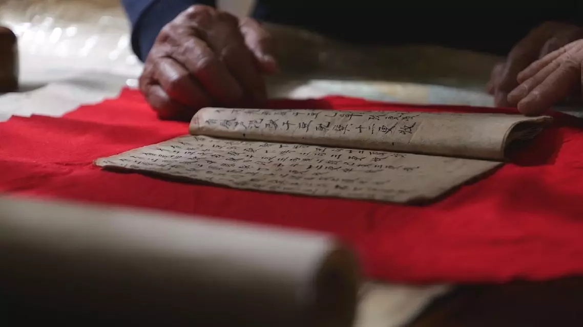
Centuries-old map shows how ancient Chinese fishermen navigated South China Sea