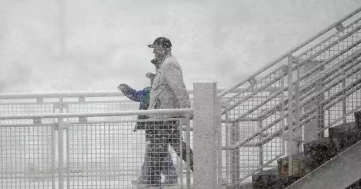
Due to the strong northeasterly monsoon, the temperature has dropped significantly on Wednesday morning.
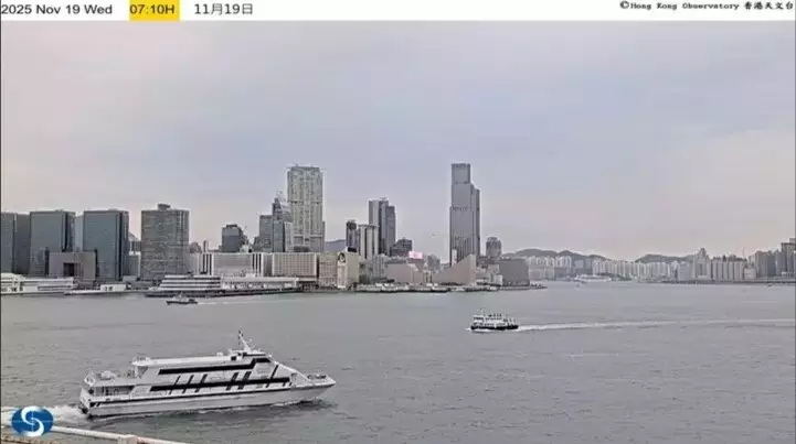
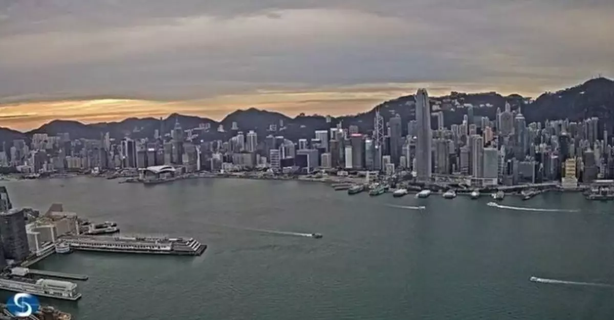
Hong Kong's weather for today, Photo source: The Hong Kong Observatory
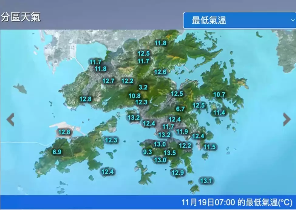
As of 6 a.m., the Hong Kong Observatory recorded a minimum temperature of 13.2 degrees Celsius, the lowest since the beginning of autumn this year. In the New Territories, the temperature was generally one or two degrees lower. In addition, a vast cloud band is covering South China. The observatory also said that some areas in the New Territories would be cold, expecting that strong northerly winds would blow in Hong Kong and bring an obvious wind-chill effect.
Click to Gallery
Hong Kong's weather for today, Photo source: The Hong Kong Observatory
Hong Kong's weather for today, Photo source: the Hong Kong Observatory
The weather forecast for the following days, Photo source: the Hong Kong Observatory
Hong Kong's weather for today, Photo source: the Hong Kong Observatory
Hong Kong's weather for today, Photo source: the Hong Kong Observatory
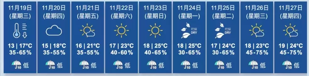
The observatory predicted that Hong Kong would be mostly cloudy on Wednesday, with one or two gusts of light rain at the start of the day. It would be quite cool in the urban area in the morning, while some parts of the New Territories would be cold. The weather is expected to be quite dry, with a daytime high of around 17 degrees Celsius. A strong northerly wind will blow, with strong winds offshore and on high ground. Later in the day, the wind will ease.
The weather forecast for the following days, Photo source: the Hong Kong Observatory
As for the weather tomorrow, it will be mostly cloudy, but still cool in the morning. In the following days, the weather will gradually brighten up. The daytime will be dry with a gradually rising temperature, but the temperature difference between day and night will be quite obvious.
The observatory reminded the public to pay attention to weather changes, keep warm, and show more care for the elderly and patients with chronic diseases.
Hong Kong's weather for today, Photo source: the Hong Kong Observatory
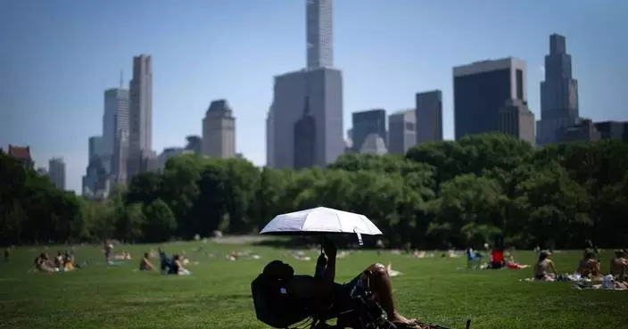
PARIS (AP) — Europe is baking under unseasonal heat that is shattering temperature records, including in the United Kingdom on Monday, and prompting government warnings after deaths were reported at amateur sports events in France.
The French sports minister, Marina Ferrari, posted condolences to the loved ones of a runner who died Sunday in a Paris race. Le Parisien newspaper reported that the 53-year-old man suffered a heart attack during the run in the capital’s 20th arrondissement, and that firefighters were unable to revive him.
It wasn’t yet known if the cause of the runner's death was heat-related, but Ferrari suggested a possible link. Temperatures in Paris went as high as 32 C ( 90 F) in the afternoon.
“The events that occurred today (Sunday) during running races are a reminder that practicing sports in extreme heat requires absolute vigilance,” Ferrari said in an X post. “My thoughts are with the family and loved ones of the runner who died in Paris, as well as with the people who were treated by emergency services.”
In the southeastern city of Lyon, local media Actu Lyon on Monday reported the death of a woman who suffered heat stroke there during another sports competition, also on Sunday.
The national weather service, Meteo France, said temperatures are breaking records for the month of May, soaring past 30 C (86 F) in many parts of the country and forecast to last into the week.
The United Kingdom broke its record Monday for the hottest temperature recorded in May, after a heat wave was declared in several parts of the country.
Residents and tourists sought relief at beaches, parks and searched for shade on the holiday as the temperature hit 34.8 C (94.6 F) at Kew Gardens in southwest London, breaking the previous record of 32.8 C (91.4 F) set in 1922 and matched again in 1944.
The U.K. Health Security Agency has issued its first amber health alert of the year, warning of a rise in deaths, particularly among the elderly, at the hottest times of the day.
Next-level weather wildness is occurring ever more frequently as Earth’s warming builds. Experts say unprecedented and deadly weather extremes that sometimes strike at abnormal times and in unusual places are putting more people in danger.
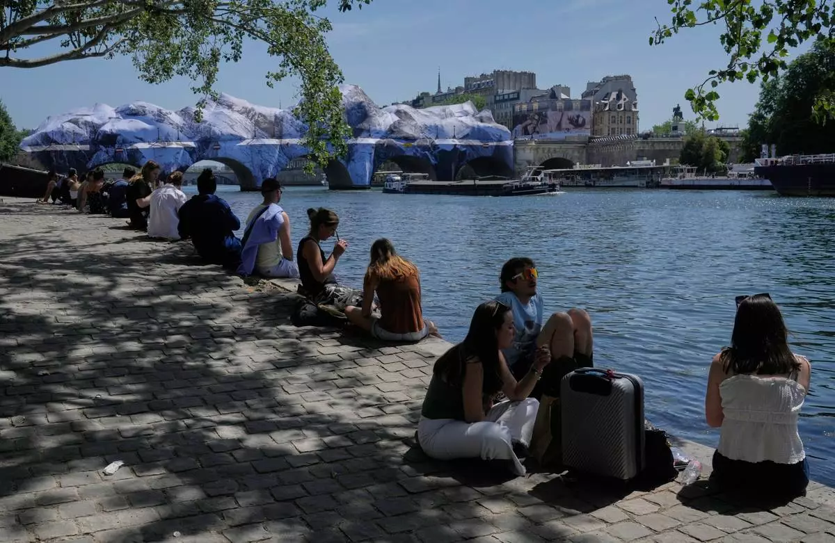
People seek relief from the heat along the Seine River in Paris, Monday, May 25, 2026. Artwork by street artist JR is seen on the Pont Neuf in the background. (AP Photo/Michel Euler)
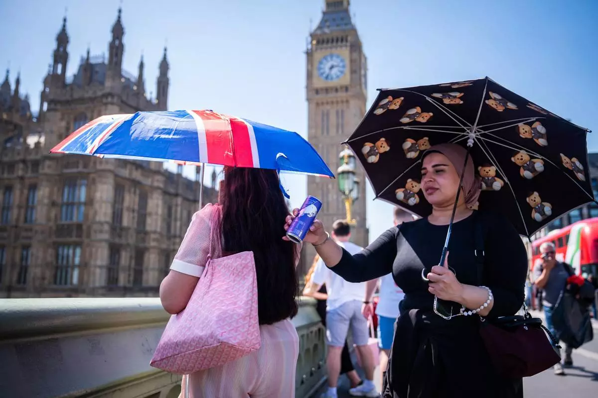
Tourists shelter from the sun beneath umbrellas during the hot weather on Westminster Bridge, central London, England, Monday, May 25, 2026. (James Manning/PA via AP)
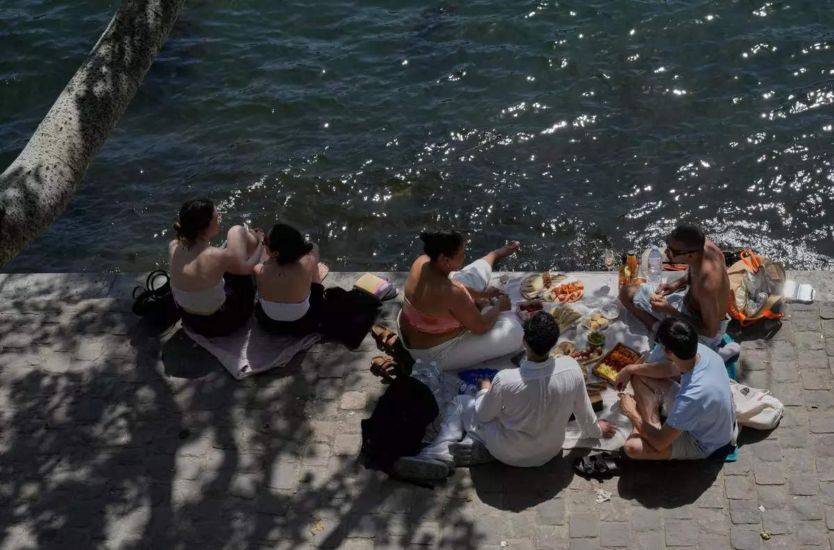
People picnics in along the Seine River during sunny day in Paris, Monday, May 25, 2026. (AP Photo/Michel Euler)
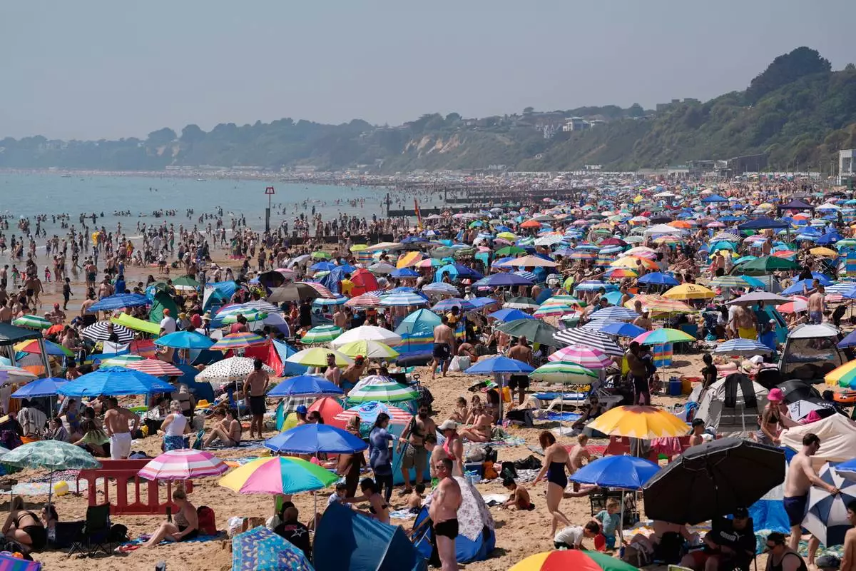
People visit Bournemouth beach, south England, Monday May 25, 2026. (Andrew Matthews/PA via AP)
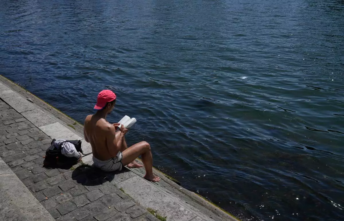
A man reads a book while sitting in the sun along the Seine River in Paris, Monday, May 25, 2026. (AP Photo/Michel Euler)