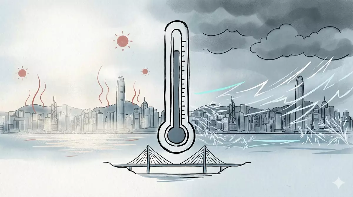
August features record-breaking high temperatures
Attributed to the warmer-than-normal sea surface temperature over the northern part of the South China Sea and the southwesterly flow in the lower atmosphere over the coast of southern China, as well as the high temperature weather brought by the outer subsiding air of Tropical Cyclone Dolphin, Hong Kong was much hotter than usual in August 2026. The monthly mean temperature of 29.5 degrees, mean minimum temperature of 27.6 degrees and mean maximum temperature of 32.1 degrees were 0.8 degrees, 0.9 degrees and 0.8 degrees above their respective normals and were respectively one of the third, fourth and one of the eighth highest on record for August. With a total of nine consecutive very hot days from August 5 to 13, this was one of the longest consecutive very hot days on record for August. Among these, there were three consecutive extremely hot days from August 9 to 11, being the highest number of extremely hot days and also the longest consecutive extremely hot days for August. Mainly attributed to the high temperature weather in August, the summer of this year from June to August was slightly hotter than usual. The mean temperature of 28.9 degrees was 0.2 degrees above the normal for the same period. The monthly rainfall was 380.0 millimetres, about 16 per cent below the normal figure of 453.2 millimetres. The accumulated rainfall recorded in the first eight months of the year was 2 357.6 millimetres, about 23 per cent above the normal figure of 1 921.5 millimetres for the same period.
The broad trough of low pressure that affected the coast of Guangdong since late July continued its dominance into the early part of August. Locally, it was mainly cloudy with occasional heavy showers on the first three days of the month. There were also thunderstorms on August 1 and 2. Heavy showers brought more than 100 millimetres of rainfall to most parts of the territory on these three days, with rainfall even exceeding 200 millimetres over the eastern part of Hong Kong Island and New Territories East. Under the showers, the temperature at the Observatory dropped to a minimum of 25.0 degrees on August 3, the lowest of the month. The Observatory recorded maximum temperatures below 30.0 degrees for nine consecutive days from July 26 to August 3, a rare occurrence during the usual hot season in July and August, with the last occurrence dating back to August 1937. As the broad trough weakened on August 4, local weather improved with sunny periods and a few showers. Winds were weak in the following two days. Local weather was very hot with more sunshine on the afternoon of August 5 and the next day.
The outer subsiding air of Tropical Cyclone Dolphin and the subsequent southwesterly airstream brought generally fine and very hot weather to the territory in the next seven days. In particular, it was extremely hot from August 9 to 11. The temperature at the Observatory in the afternoon of August 9 soared to an all-time record high of 36.9 degrees. Meanwhile, the temperature at Sheung Shui reached 39.8 degrees, the highest ever recorded in Hong Kong since the establishment of automatic weather stations in the 1980s. Furthermore, the minimum temperature recorded at the Observatory in the morning of August 12 was 30.2 degrees, setting another record as the highest daily minimum temperature on record.
Under the influence of upper-air disturbances and a southwesterly airstream, local weather was mainly cloudy with occasional showers and squally thunderstorms on August 14 and in the morning of August 15. Showers were heavy at times. More than 40 millimetres of rainfall were recorded over many places on these two days, with rainfall even exceeding 100 millimetres over the Southern District. With the departure of the upper-air disturbances and the moderation of the southwesterly airstream, apart from isolated showers in the morning, local weather turned mainly fine and very hot on August 16. Winds were weak over Guangdong the next day. Locally, it was mainly cloudy with a few showers and thunderstorms, with showers heavier in some areas around noon due to heat-triggered thunderstorms, and more than 30 millimetres of rainfall was recorded.
A broad trough of low pressure brought showers and thunderstorms to the coast of Guangdong and the northern part of the South China Sea from August 18 to 24. Locally, under the combined effect of an area of low pressure within the broad trough over the northern part of the South China Sea and the ridge of high pressure over southeastern China, local easterly winds were stronger at night on August 18 and the next day. Under the influence of the broad trough, it was mainly cloudy with a few showers and sunny intervals from August 18 to 24. Showers were heavier on August 20 with around 10 millimetres of rainfall recorded over many places, and rainfall even exceeding 40 millimetres over Hong Kong Island and parts of Kowloon. There were also isolated thunderstorms on August 21 and 22. Moreover, the area of low pressure within the broad trough intensified gradually into a tropical cyclone over Beibu Wan on August 20 and was later named as Narra. Narra lingered over the vicinity of Beibu Wan in the next few days. It made landfall near Wuchuan on August 26 after moving across Leizhou Peninsula and weakened into a low pressure area.
Under the influence of an active southerly airstream and a subsequent trough of low pressure, local weather was cloudy with occasional showers and squally thunderstorms from August 25 to 27. More than 80 millimetres of rainfall were recorded over many places on these three days, with rainfall even exceeding 200 millimetres over the eastern part of Hong Kong. The heavy downpour also necessitated the issuance of the Red Rainstorm Warning Signal in the morning of August 27. Unfortunately, a man was found unconscious on a sampan near the Tseung Kwan O Cross Bay Link and later died in hospital, with initial reports suggesting he may have been struck by lightning. Although it was hot with sunny periods due to the moderation of the active southerly airstream, a broad trough of low pressure also brought a few showers and thunderstorms on August 28 and 29. Showers were heavy in some areas during the small hours on August 28 with about 70 millimetres of rainfall recorded over Tai Po and Lau Fau Shan. With the dominance of the broad trough over the coastal regions, showers increased gradually on the last two days of the month. Showers were heavy at times with a few squally thunderstorms on August 31. About 30 millimetres of rainfall were recorded over many places, and rainfall even exceeded 50 millimetres over Kowloon and parts of the New Territories West. Moreover, Tropical Cyclone Saudel made landfall over Zhejiang on August 28 and, over the following day or two, moved across eastern China and central China before weakening into an area of low pressure over southern China. Its remnant tracked southwards across the Leizhou Peninsula and Hainan Island on August 31, and in the evening of that day emerged over the waters just off the southeast coast of Hainan Island, where it re-intensified into a tropical depression. The Observatory subsequently issued the Standby Signal No. 1.
Thirteen tropical cyclones occurred over the South China Sea and the western North Pacific in August 2026.
Please refer to the following link for the latest monthly forecast: www.hko.gov.hk/en/wxinfo/month/month.htm.
Source: AI-created image
AFCD explains regulatory arrangements for fighting dogs
In response to recent cases of suspected illegal keeping of fighting dogs that have aroused public concern and given rise to some misconceptions in the community, the Agriculture, Fisheries and Conservation Department (AFCD) today (September 2) issued the following explanation.
(1) Purpose of identifying fighting dogs
The purpose of identifying fighting dogs is to safeguard public and animal safety, thereby establishing a secure environment for harmonious human-pet coexistence in the community.
Fighting dogs may attack suddenly without warning due to their characteristics. Their well-developed musculature and powerful jaws, coupled with a tenacious biting tendency, often result in more severe injuries when attacks occur. In view of past local and overseas incidents involving fighting dog attacks on humans or other pets resulting in casualties, the Government must implement strict control measures, including requiring the use of specified identification collars, and mandating that such dogs be muzzled and kept on a leash in public places. This public-safety-driven approach to the strict regulation of fighting dogs aligns with the systems used in well-developed international jurisdictions, such as the United Kingdom, Singapore, and Australia.
(2) Definition of fighting dogs
Under Schedule 1 of the Dangerous Dogs Regulation (Cap. 167D), "fighting dogs" cover four statutory types: Pit Bull Terrier, Japanese Tosa, Dogo Argentino, and Fila Braziliero, as well as any crossbreed of these four types.
In particular, the "Pit Bull Terrier" is not a single breed but a type encompassing different breeds. Therefore, the legislation regulates based on "type" rather than "breed", meaning different breeds can fall under the same type. Taking the "Pit Bull Terrier" type as an example, the American Pit Bull Terrier, American Staffordshire Terrier, and American Bully breeds are commonly classified internationally under the Pit Bull Terrier type due to their highly similar physical structure and strength characteristics, as well as their close genetic associations, subjecting them to strict regulation.
(3) Common breeds of the Pit Bull Terrier type
The American Pit Bull Terrier, American Staffordshire Terrier, and American Bully have always been subject to strict regulation under the law as fighting dogs of the "Pit Bull Terrier" type. The policy and definition have not changed.
These three breeds possess highly similar physical structures. When professional identification is required for enforcement purposes, it is common international practice to regard these dogs as common breeds under the "Pit Bull Terrier" type. The Dogs and Cats Classification Board established under the Dogs and Cats Ordinance (Cap. 167) has previously discussed individual breeds (such as the American Bully) when considering cases, and confirmed that their physical characteristics meet the criteria for that fighting dog type.
(4) Law enforcement procedures of AFCD officers regarding suspected fighting dogs
Enforcement officers have statutory authority to take dogs away for investigation and identification where there is reasonable suspicion.
Under the Dogs and Cats Ordinance (Cap. 167) and related regulations, the illegal importation, breeding, and unlicensed keeping of fighting dogs are prohibited. Any police officer or AFCD authorised officer who has reasonable grounds to believe that the possession of a dog is suspected to be unlawful (e.g. suspected unlicensed fighting dog) has the authority to seize and detain the dog in accordance with the law for further professional identification and follow-up.
During enforcement operations, AFCD officers will proactively communicate with dog owners. Generally, officers will take dogs away for inspection and observation with the owner's consent. The AFCD understands owners' concerns; where the dog does not pose an immediate danger, and the owner is able to implement appropriate precautionary measures in the interim, the AFCD may allow the owner to bring the dog to an Animal Management Centre. Strict regulation of high-risk dogs is a necessary measure to safeguard public safety. The AFCD calls on members of the public to understand and co-operate with enforcement to jointly maintain community safety.
(5) Criteria for identifying fighting dogs
The allegation that AFCD enforcement officers "identify a dog as a fighting dog at a glance" is entire unfounded.
The determination of fighting dog types is the responsibility of the Department's Veterinary Officers. Veterinary Officers will carefully observe the dog's physical characteristics (such as skull, ears, eyes, muzzle shape) and external proportions (such as body conformation, height, body length), body structure, and related features to assess whether the dog truly possesses the high-risk traits characteristic of the fighting dog types, and thereby classify the dog. This is the common international practice for identifying fighting dog types, which meets scientific and professional standards and fully considers the actual safety risk posed by the dog.
Some have suggested that genetic testing should be used to identify dogs, but genetic testing is not the optimal method for identifying fighting dogs. The vast majority of dogs carry genes from various breeds to some extent. Dogs that carry genes from the four fighting dog types mentioned above do not necessarily develop all the physical characteristics and features of fighting dogs. Therefore, the current internationally common practice is to use the presence of fighting dog physical types and characteristics as the identification standard. Taking the "Pit Bull Terrier" as an example, international jurisdictions such as the United Kingdom's Dangerous Dogs Act similarly regulate the "Pit Bull Terrier" type based on physical characteristics.
The AFCD will continue to monitor relevant technological developments and actively study the latest applications of genetic testing methods, with a view to considering the possibility of using them as auxiliary identification tools in the future.
(6) Statutory requirements for keeping fighting dogs
Current legislation allows neutered fighting dogs (with valid neutering certificates) to be kept after licensing, provided that owners comply with regulatory conditions, including fitting the dog with a specified identification collar, implanting a microchip, muzzling the dog in public places, and keeping it securely on a leash not exceeding 1.5 metres in length.
(7) Appeal channels against the classification decision of fighting dogs
Under Section 17 of the Dangerous Dogs Regulation (Cap. 167D), if a dog owner disagrees with the AFCD's decision to classify their dog as a fighting dog, they have the right to lodge a statutory appeal.
The appeal procedures and steps are as follows:
- Lodging an appeal: Within 14 days of receiving the AFCD's classification notice, the dog owner may apply to the Dogs and Cats Classification Board (the Board). Board members include veterinarians, dog breeders, academics, and representatives from animal welfare organisations.
- Notification to the Board: The AFCD will notify the Board within seven days of receiving the application.
- Final decision: The Board's decision following review constitutes the statutory final decision.
During the appeal period, dog owners must still take precautionary measures in public places, such as complying with leash requirements for large dogs or any directions issued by the AFCD, to ensure public safety.
(8) Enquiries about fighting dog types
If a dog owner is uncertain whether his/her dog is a fighting dog, he/she may consult a registered veterinarian or contact the AFCD for assistance.
As long as strict regulatory conditions are met, current legislation allows owners to continue keeping neutered fighting dogs. The AFCD urges pet owners not to abandon their dogs and to be responsible pet owners. Abandoning dogs is an unlawful act and also poses a threat to public safety.
(9) Detention location of dogs and owner rights during assessment and identification
During the assessment period, the dog will be detained at the AFCD's Animal Management Centre, where it will receive care from veterinary officer and staff. Subject to safety requirements and without affecting the assessment, owners may make appointments to visit. Owners may also apply to arrange for a private veterinarian to accompany them on visits to assess the dog's health condition. Once the AFCD completes the assessment and the result is determined to be favourable, arrangements will be made for the release of the dog as soon as possible.
Members of the public who wish to learn more about proper dog control and how to be responsible pet owners may visit the AFCD website (www.pets.gov.hk).

Source: AI-found images