ORCHARD PARK, N.Y. (AP) — Buffalo Bills defensive lineman T.J. Sanders is out indefinitely after having an appendectomy, coach Joe Brady said on Wednesday.
Brady didn’t provide a timetable on Sanders’ return in announcing the player had surgery a day earlier. The second-year player was a projected starter, and has yet to appear in a game this season after missing Buffalo’s first two games with a knee injury.
Buffalo (2-0) has been off since a 41-31 win over Detroit on Thursday, and hosts the Los Angeles Chargers (0-2) on Sunday.
Brady didn’t have an update on receiver DJ Moore (shoulder) and defensive tackle Ed Oliver (hip). Moore was hurt during the game against Detroit, while Oliver was hurt during pregame warmups.
The Bills also signed defensive lineman Austin Johnson to their practice squad. Johnson previously played with Buffalo in 2024. He fills the spot left open after Miami signed linebacker Andre Jones on Tuesday.
See AP’s full NFL coverage here

FILE - Buffalo Bills defensive tackle T.J. Sanders (98) defends as Houston Texans guard Keylan Rutledge (66) attempts to block during an NFL football game, Sept. 13, 2026, in Houston. (AP Photo/Maria Lysaker, File)
MEXICO CITY (AP) — Southwestern Mexico braced for coastal flooding and mudslides Wednesday after Polo, a powerful Pacific cyclone, became a major hurricane. Forecasters also warned that Hawaii could face another onslaught of harsh weather later in the week.
Hurricane Polo, an “extremely dangerous” storm, is expected to skirt Mexico’s Guerrero state, submerging coastal areas with 4 to 6 inches (10 to 15 centimeters) of rain through Thursday, according to the National Hurricane Center in Miami.
At its peak, Polo was a Category 5 hurricane with maximum sustained winds of 180 mph (290 kph). It was a Category 4 by Wednesday afternoon, but still packing sustained winds of up to 145 mph (230 kph).
“Fluctuations in intensity are expected, but Polo is expected to remain a very powerful major hurricane during the next few days,” the NHC said.
Hurricane Polo was not expected to make landfall, meteorologists and Mexican President Claudia Sheinbaum said, but tropical storm conditions including torrential rain and extraordinary wind were expected along the Pacific coast in Guerrero, Michoacan and Colima states through Thursday. Guerrero has been repeatedly pummeled by hurricanes in recent years.
Concepción López Villegas was busily bolstering her seaside restaurant in Lázaro Cárdenas, Michoacán, against the expected onslaught of rain. Strong waves were already hitting some beaches and López Villegas said she feared the storm could destroy the small business she worked decades to build.
“We’re worried and trying to protect our businesses,” López Villegas said. “And of course, we’re sad because it’s our heritage, our legacy that from one moment to another could be destroyed.”
The region most under threat from the hurricane is rural and mountainous, scattered with a few small tourist towns and ports. Much of the area is market by poverty and residents routinely complain authorities abandon them to fend for themselves during natural disasters.
Mexico’s government has called for evacuations in some areas and set up shelters for those impacted. Thousands of Navy, Security and Red Cross personnel have been deployed to the region as a preventative measure.
Polo was named the third Category 5 hurricane of the Pacific season on Tuesday, following Genevieve and Lowell earlier this year. Although the hurricane weakened somewhat on Wednesday, its force still presented significant risks.
Polo was 150 miles (240 kilometers) south-southwest of Zihuatanejo and 275 miles (445 kilometers) south-southeast of Manzanillo on Wednesday afternoon, the hurricane center reported. Hurricane-force winds can extend up to 40 miles (65 kilometers) from the storm’s center while areas up to 105 miles (170 kilometers) from the eye will be hit by tropical storm-force winds, meteorologists said.
The rapid intensification of Hurricane Polo this week stunned scientists and authorities alike.
Philip Klotzbach, research scientist in the Department of Atmospheric Science at Colorado State University, attributed the intensification to the weather phenomenon known as El Nino, which has fueled crippling droughts in Mexico and Central America and floods elsewhere.
In the Pacific, it has resulted in warmer waters and wind patterns that act as fodder for hurricanes, he said.
“There are all the ingredients that hurricanes need to get really strong really fast,” Klotzbach said.
Hurricane Odalys, also in the Pacific, strengthened on Wednesday, carrying maximum sustained winds of 75 mph (120 kph). It churned about 1,265 miles (2,040 kilometers) west-southwest of the southern tip of Mexico’s Baja California peninsula and was not at risk of making landfall, according to the hurricane center.
An advisory said Odalys could increase in strength over the next couple of days but would likely weaken by the end of the week.
A tropical depression about 525 miles (845 kilometers) south-southeast of Hawaii's capital, Honolulu, could be a tropical storm by the end of the day and a hurricane by Thursday.
The hurricane center advised the island chain to monitor the progress of the system, which was projected to drop 15 to 20 inches (38 to 51 centimeters) of rain on the Big Island. Forecasters said this could cause “catastrophic life-threatening flooding and mudslides.”
The center of the cyclone was expected to approach the islands by Friday or Saturday.
Brooks reported from Atlanta.
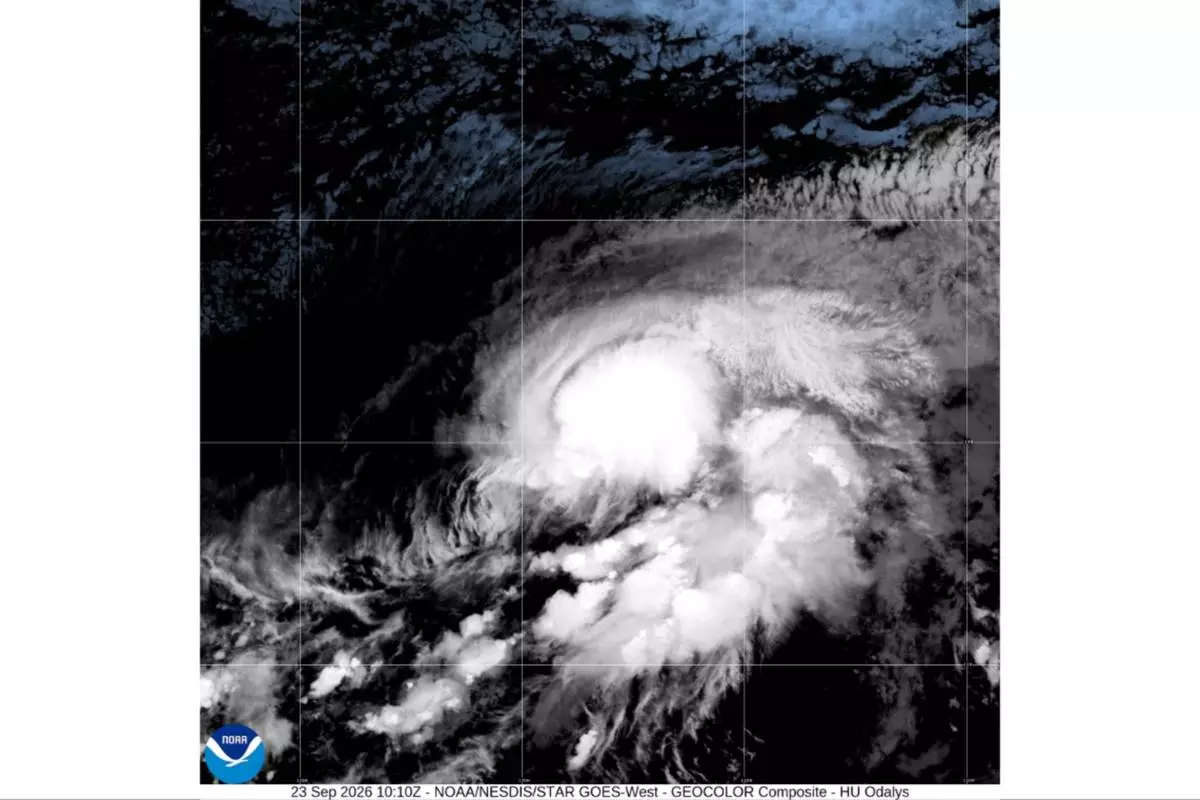
This satellite image from the National Oceanic and Atmospheric Administration shows Hurricane Odalys in the Pacific Ocean, Wednesday, Sept. 23, 2026. (NOAA via AP)
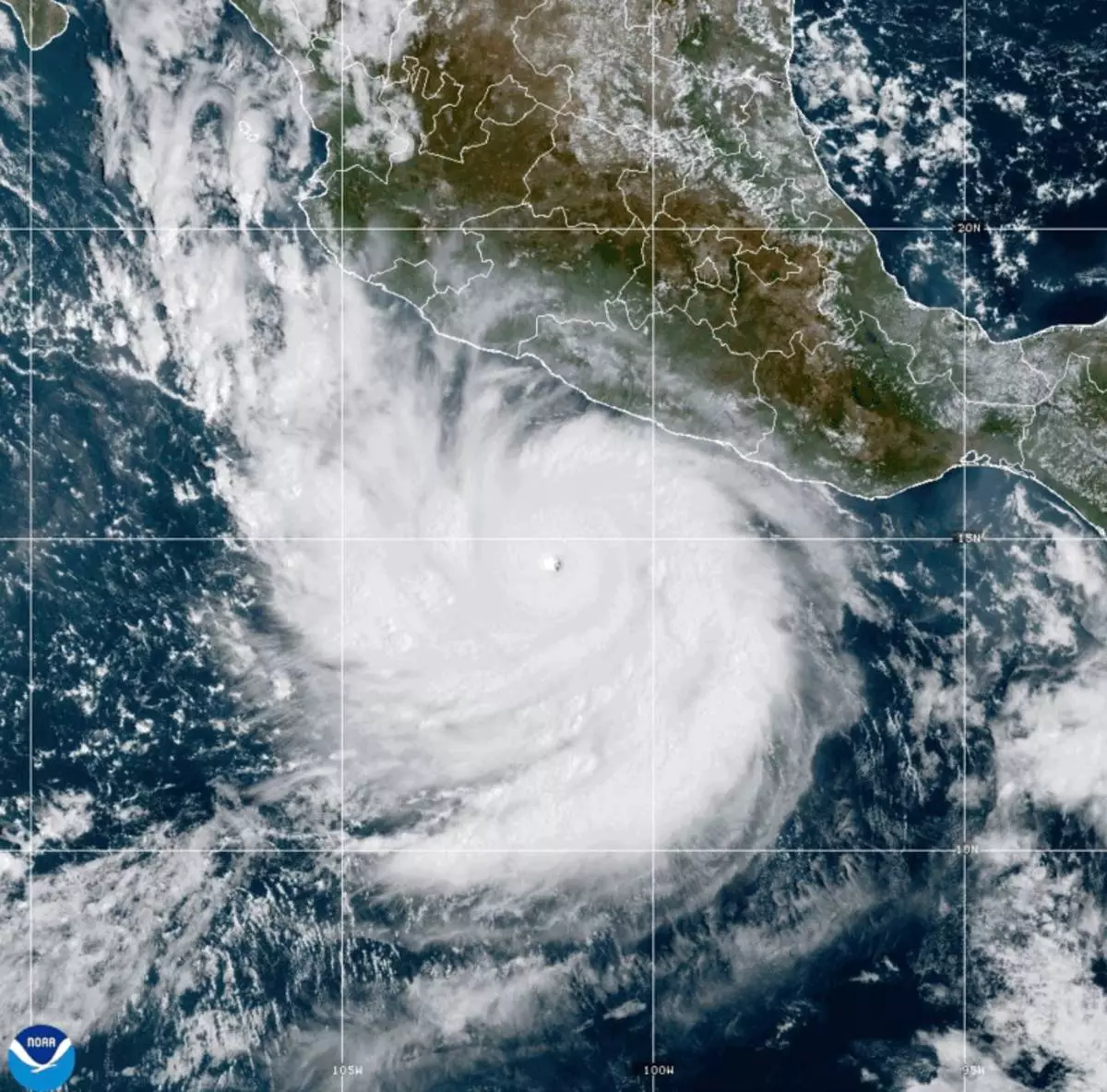
This photo provided by NOAA shows Hurricane Polo strengthening in the Pacific Ocean off the coast of Mexico on Tuesday, Sept. 22, 2026. (NOAA via AP)
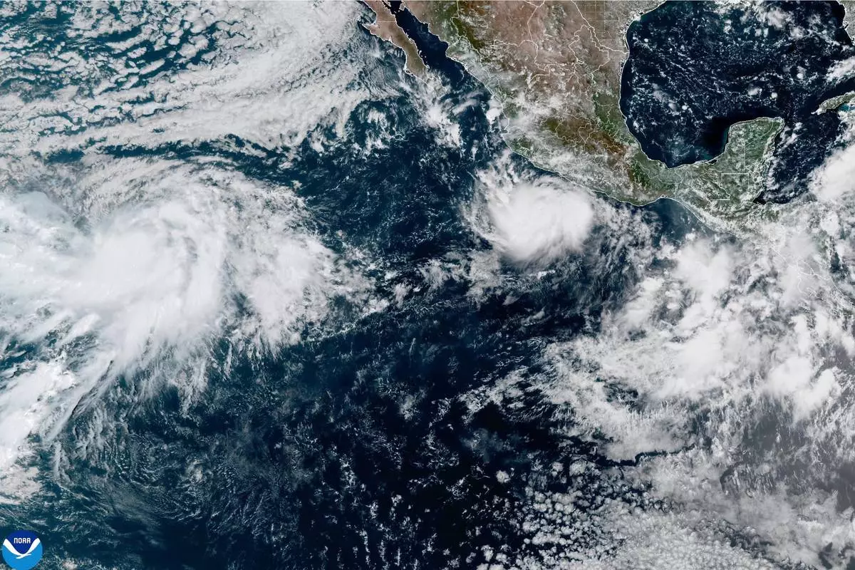
This photo provided by NOAA shows Hurricane Polo intensifying in the Pacific Ocean off the coast of Mexico on Monday, Sept. 21, 2026. (NOAA via AP)