PASCAGOULA, Miss.--(BUSINESS WIRE)--Sep 25, 2026--
Merchants & Marine Bancorp, Inc. (OTCQX: MNMB) (the “Company”) today announced that its wholly owned bank subsidiary, Merchants & Marine Bank, will change its legal name to TownBridge Bank, effective September 28, 2026.
This press release features multimedia. View the full release here: https://www.businesswire.com/news/home/20260925857654/en/
The name change does not reflect a sale, merger, acquisition, or change in ownership or leadership. Instead, TownBridge Bank establishes a shared bank charter identity for the Company’s growing Family of Brands while allowing its community banking brands to retain the local names, leadership, and relationships they have built within the communities they serve.
Beginning September 28, the Company’s community banking brands will operate as:
Beginning September 28, the Company’s ancillary brands will operate as:
Clients will begin seeing the TownBridge Bank name phased into legal and regulatory references in the days and weeks following the effective date. The Company’s individual brands will otherwise continue operating as they do today, and clients can expect to see the same familiar brands, locations, bankers, and local leadership teams they know and trust.
“TownBridge represents an important next step in the evolution of our company, but it doesn’t change who we are or how we serve our communities,” said Clayton Legear, Chairman and Chief Executive Officer of Merchants & Marine Bancorp, Inc. & TownBridge Bank. “We believe deeply in hometowns, small towns and Main Streets, and in the value of local bankers who know the people, businesses and communities they serve. TownBridge gives our Family of Brands a clearer common identity and a stronger foundation from which to continue growing.”
Historically, Merchants & Marine Bank has served two roles within the organization: as a local community banking brand in its Mississippi and Alabama markets, and as the legal bank charter supporting the Company’s other banking brands. As the Company has expanded its Family of Brands across multiple markets and multiple states, TownBridge creates a neutral shared charter identity that allows each community banking brand to operate equally as a division of TownBridge Bank.
The TownBridge name also reflects the Company’s longstanding community banking focus and philosophy. “Town” honors the hometowns and communities the Company’s brands serve and carries forward the ethos behind Merchants & Marine Bank’s longtime identity as “Hometown People That You Know.” “Bridge” represents the connections community bankers build among families, businesses, capital, opportunity, and the communities around them.
“Great community banks are deeply connected to the places they call home, and we believe that is something worth preserving,” Legear continued. “Our goal is to build a different kind of community banking company – one that combines the strength, resources and expertise of a larger organization with the local leadership, local decision-making, relationships and community focus that make great community banks special. TownBridge gives us an identity built to carry this model into the future; strengthening the communities we serve today while creating opportunities to serve new communities in the years ahead.”
TownBridge Bank will continue to be governed by the bank charter’s existing Board of Directors and led by the existing Corporate Executive Leadership Team that has overseen the Company’s sustained growth and development of its Family of Brands strategy. The Company’s ownership structure is unchanged, and Merchants & Marine Bancorp, Inc. will remain the parent company of TownBridge Bank.
As a next step, the Company intends to seek shareholder approval at its 2027 Annual Meeting of Shareholders to align the Merchants & Marine Bancorp, Inc. name with the TownBridge identity, subject to applicable requirements.
The TownBridge Bank name change itself will not require clients to take any action or change how they bank with the Company’s brands. Account and routing numbers will not change as a result of the name change, and clients may continue using their existing checks, cards, brand websites, and digital banking access as they do today.
Additional information about TownBridge Bank is available at TownBridge.bank.
About Merchants & Marine Bancorp, Inc.
Merchants & Marine Bancorp, Inc. (OTCQX: MNMB) is the parent company of TownBridge Bank, a Mississippi chartered community bank serving the Gulf South region. TownBridge Bank was originally founded as Merchants & Marine Bank in 1899, and the bank was reborn in 1932 during the middle of the worst economic disaster in the history of the United States: The Great Depression.
The Bank offers banking services to customers in Southern Mississippi and Coastal Alabama under its legacy Merchants & Marine Bank brand, in Southeastern Louisiana through its Mississippi River Bank brand, and in the Acadiana Region of Louisiana through its Farmers-Merchants Bank brand. It offers mortgage financing through its Canvas Mortgage brand, cannabis banking through its CannaFirst Financial brand, and access to government-guaranteed credit through its Voyager Lending brand. It provides bank operational, risk, and support services through its Community of Resources bank services brand.
Forward-looking statements are subject to significant risks and uncertainties. Any forward-looking statement made in this release is subject to the safe harbor protections set forth in the Private Securities Litigation Reform Act of 1995. Investors are cautioned against placing undue reliance on such statements. Actual results may differ materially from those set forth in the forward-looking statements.
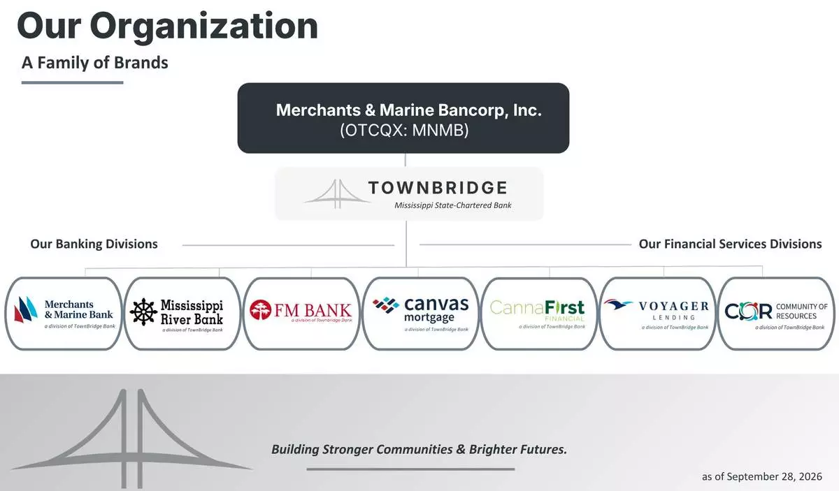
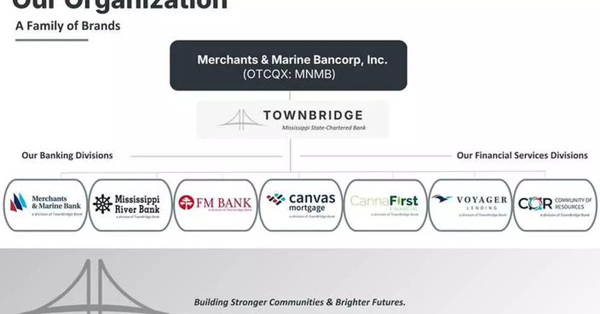
TownBridge Organization Chart
HILO, Hawaii (AP) — People on Hawaii’s Big Island are preparing for another potentially life-threatening and catastrophic storm as Hurricane Nolo is expected to bring flash floods and extreme surf as it churns just south of the islands through the weekend.
Nolo was expected to strengthen to a major hurricane on Saturday. Its maximum sustained winds increased to 105 mph (165 kph) Friday. The storm’s center was located about 185 miles (300 kilometers) south of Hawaii’s southernmost point.
Forecasters warned parts of the Big Island could see rainfall totals up to 15 inches (38 centimeters), with a possibility of up to 25 inches (64 centimeters). That was down from an earlier forecast that called for up to 35 inches (89 centimeters).
“People are going to want to kind of shelter in place on the Big Island, be in their safe place, certainly by later today, tonight, well into Saturday," Michael Brennan, director of the National Hurricane Center, said Friday. “Don’t venture out if you don’t have to into the dangerous flooding environment, but also high winds. We can have trees and power lines down.”
Heavy rainfall also was possible on Hawaii's other islands, the hurricane center said. Maui also could see heavy rainfall and potential life-threatening flooding and mudslides, forecasters said.
Crews on the Big Island spent hours Friday trying to build berms to guide water and move large debris ahead of the worst of the rain, said Erika Kapu, Hawaii program manager for the humanitarian nonprofit CORE.
CORE and other nonprofit partners spent the week packing and shipping supplies like camp stoves and hygiene products by air cargo from Oahu to the Big Island for a community relief hub that has been active since August's Hurricane Lala.
Hawaii officials told residents to put together emergency kits, and the governor issued an emergency proclamation, activating more than 230 Hawaii National Guard members. Schools were closed in some areas.
Hawaii County officials on the Big Island were urging residents in flood-prone areas to consider taking refuge at shelters being set up or other locations.
“We encourage everyone to complete their preparations, stay connected to official alerts and weather updates, and secure safe shelter before flooding strikes,” Mayor Kimo Alameda said in a statement.
The heaviest rain from Nolo is likely to fall over the same southeastern region of the Big Island that was hit by Lala and where grounds are still wet from additional precipitation. The storm surge could hit 1 to 3 feet (30 to 91 centimeters), creating large and dangerous waves and coastal flooding, the hurricane center said.
Hawaiian Electric, the state’s primary utility, said crews that had been helping restore power in Kauai after this month’s Hurricane Lowell would return to Oahu, Maui and the Big Island in preparation for the coming storm.
Residents and tourists on the Big Island were busy preparing.
In Hilo, where light rain was falling Friday, residents filled bags with sand and gravel at Francis Wong Stadium, where authorities set up a sand distribution center.
Dean Taise said water was starting to get into his driveway from the street, so he decided to get a few sandbags ready ahead of possible floods.
“They say, prepare for the worst, right? Hope for the best,” Taise said.
Hawaii Gov. Josh Green has requested an emergency disaster declaration for four Hawaii counties.
Meanwhile, Mexico is under the threat of Hurricane Polo as it heads toward the Baja California peninsula after bringing storm conditions to the southwestern coast.
The hurricane center said Polo gained significant force overnight into Friday morning and doused parts of Mexico's Pacific Coast. No major damage or flooding was reported along the coast overnight into Friday.
By midday Friday, attention turned to the peninsula, where the hurricane was slated to arch back and hit between Monday and Tuesday. Local authorities were preparing shelters, and Mexico’s government announced Friday afternoon that they were closing ports in the region as dark clouds swirled overhead.
The latest estimated sustained winds were 180 mph (290 kph).
Residents stacked sandbags to fortify beachfront shops and evacuated their homes in some coastal areas on Thursday. Mexican authorities opened shelters and cleared people from beaches, and 15,000 security personnel were deployed across the coast. Schools were closed.
In the port city of Lázaro Cárdenas in Michoacán, seawater swept through homes and left wooden planks and furniture strewn on the streets. Locals and government officials were clearing debris and shoveling thick mud coating much of the town.
Alicia Contreras said the walls and roof of her restaurant had been severely damaged by 15-foot (4.5-meter) waves. As officers and family helped pick through the damage, Contreras worried about how she would recover economically.
“This is huge because we have no other source of income. Now we’re just surviving,” Contreras said.
Brennan said some moisture associated with Polo will be pushed into parts of the southwestern U.S. by Monday, possibly producing scattered flash flooding in the Four Corners region, particularly portions of Arizona and New Mexico.
Biologists on Friday relocated eggs from two olive ridley sea turtle nests on Southern California beaches to the Aquarium of the Pacific in Long Beach over concern about high tides and hazardous surf as officials monitor Hurricane Polo.
El Niño is prompting major environmental shifts across the world, fueling drought in some areas and flooding in others. It traditionally dampens the Atlantic hurricane season, while it tends to rev up tropical cyclone activity in the Pacific with moist air and little wind shear.
A third storm in the Pacific, Hurricane Odalys, was at Category 4 status and was still far from land Friday, roughly 955 miles (1,537 kilometers) west-southwest of the southern tip of the Baja California peninsula.
Two other powerful storms were churning in the Atlantic Ocean but were not near land.
In the northern Atlantic, Tropical Storm Fay reformed early Thursday. As of Friday, it was about 1,040 miles (1,674 kilometers) west-southwest of the Azores, the hurricane center said. Off Africa's western coast, Tropical Storm Gonzalo strengthened early Friday as it approached the Cabo Verde Islands.
Associated Press writers Dave Collins in Hartford, Connecticut; Gabriela Aoun Angueira in San Diego; and Kathy McCormack in Concord, New Hampshire, contributed to this report.
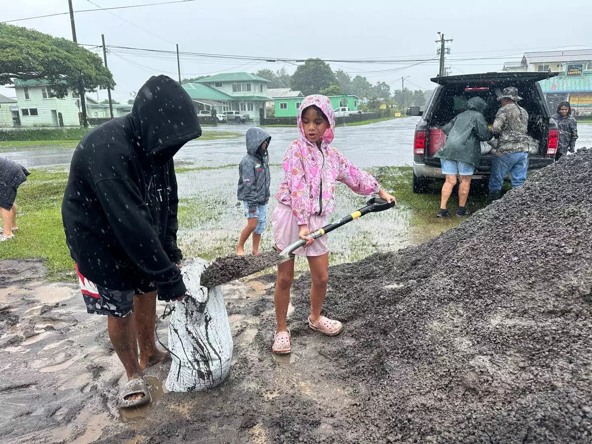
Kenzielynn Kekoa, center, of Hilo, Hawaii, helps her family fill sand bags as Hurricane Nolo sits nearby Friday, Sept. 25, 2026, in Hilo, Hawaii. (AP Photo/Eugene Garcia)
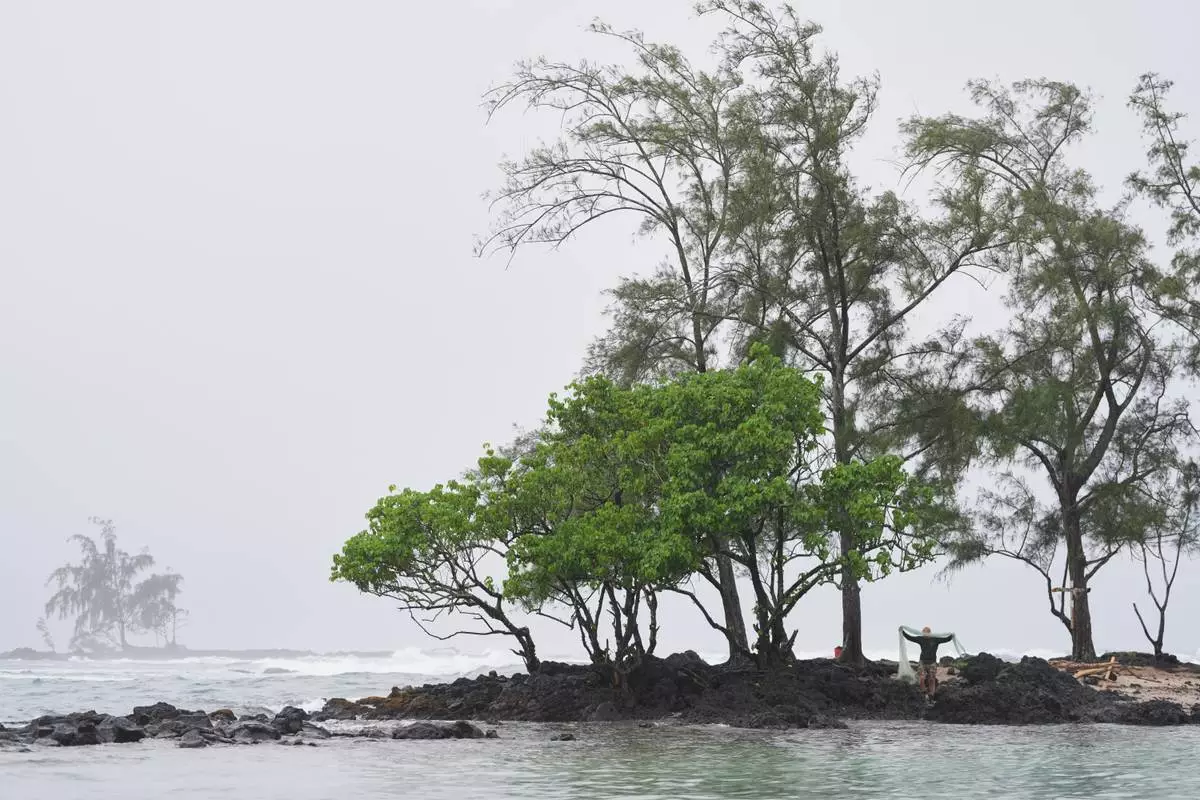
Kawika Ige fishes as Hurricane Nolo sits nearby Friday, Sept. 25, 2026, in Hilo, Hawaii. (AP Photo/Gregory Bull)
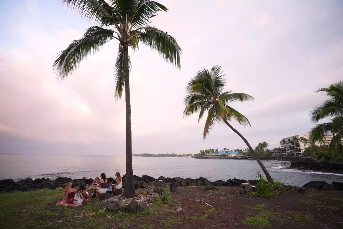
Members of Youth With A Mission read under a palm tree as Hurricane Nolo sits nearby Friday, Sept. 25, 2026, in Kona, Hawaii. (AP Photo/Gregory Bull)
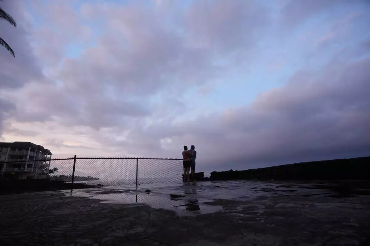
Ryanna and Jim Fry, of Kona, Hawaii, look out at clouds as Hurricane Nolo sits nearby Friday, Sept. 25, 2026, in Kona, Hawaii. (AP Photo/Gregory Bull)
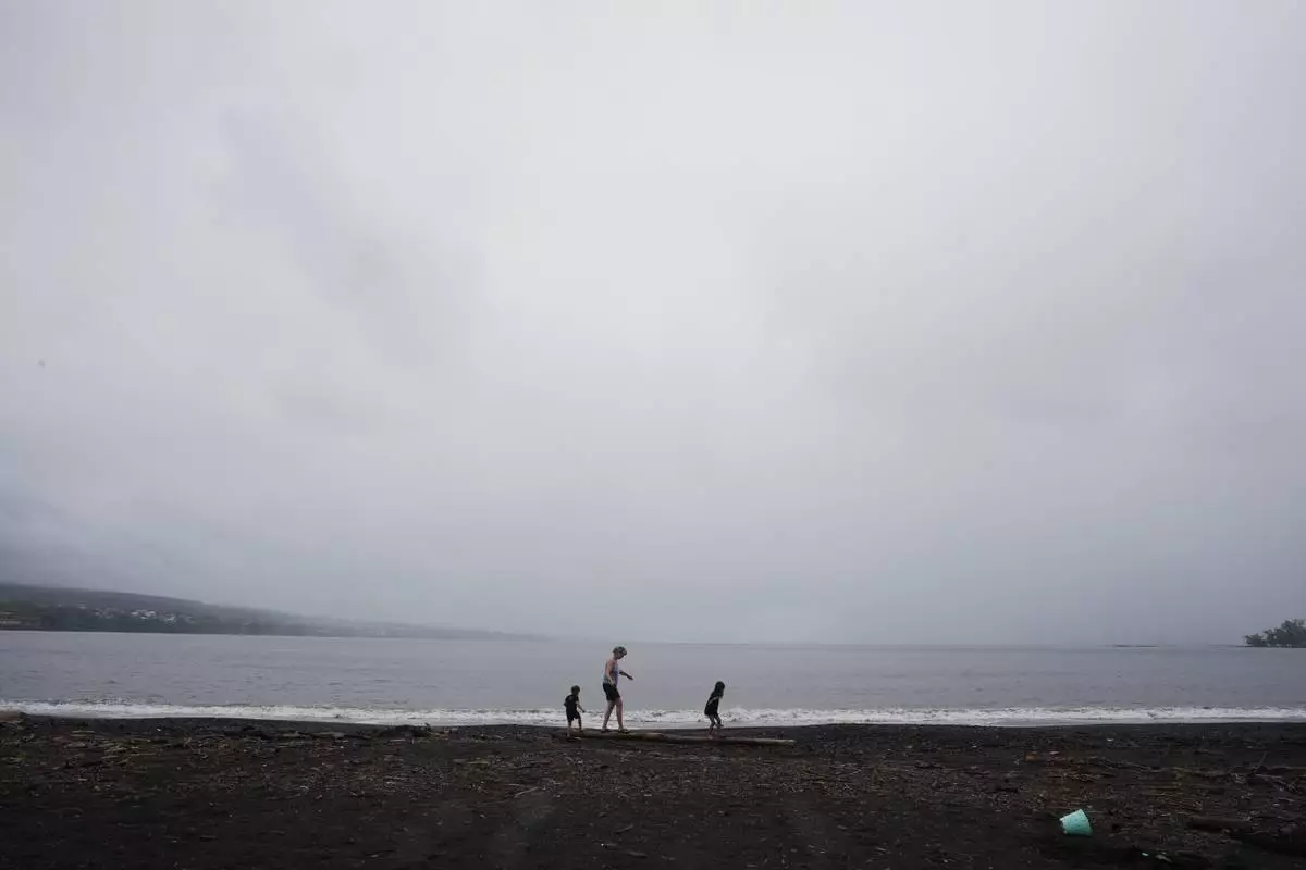
Sheila, of Hilo, Hawaii, plays with her grandchildren as clouds from nearby Hurricane Nolo blanket the skies Friday, Sept. 25, 2026, in Hilo, Hawaii. (AP Photo/Gregory Bull)
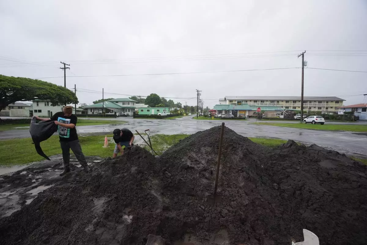
Austin, left, and Darren Montalvo load sand bags to help keep water out of their restaurant as Hurricane Nolo sits nearby Friday, Sept. 25, 2026, in Hilo, Hawaii. (AP Photo/Gregory Bull)
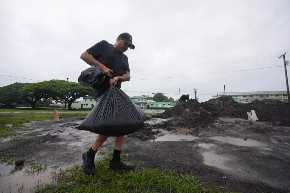
Darren Montalvo carries sand bags he will use to help keep water out of his restaurant as Hurricane Nolo approaches in Hilo, Hawaii, Friday, Sept. 25, 2026. (AP Photo/Gregory Bull)
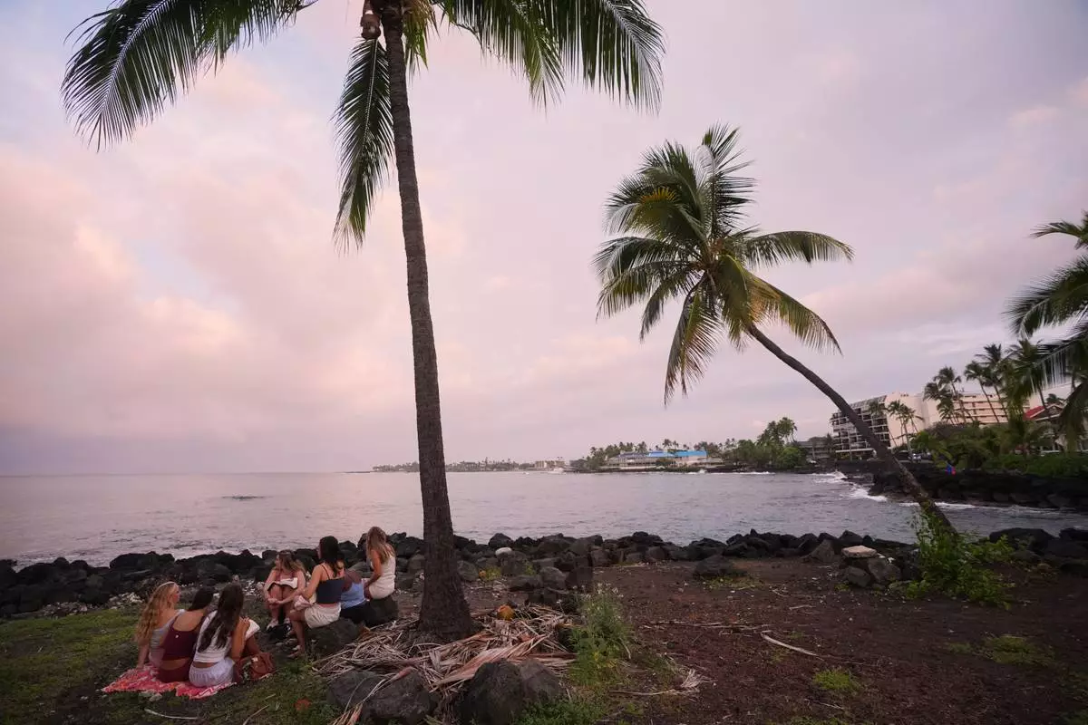
Members of Youth With A Mission read under a palm tree as Hurricane Nolo sits nearby Friday, Sept. 25, 2026, in Kona, Hawaii. (AP Photo/Gregory Bull)
Members of Youth With A Mission read under a palm tree as Hurricane Nolo sits nearby Friday, Sept. 25, 2026, in Kona, Hawaii. (AP Photo/Gregory Bull)
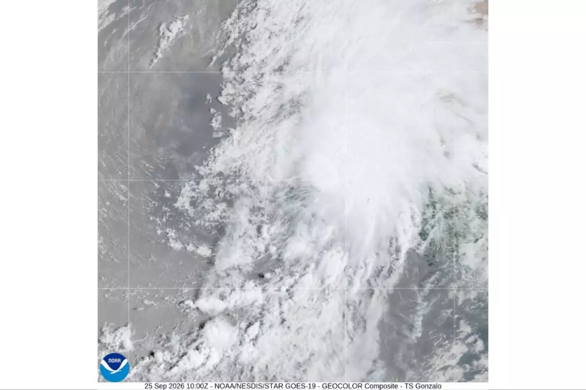
This satellite image from the National Oceanic and Atmospheric Administration shows Tropical Storm Gonzalo in the Atlantic Ocean, Friday, Sept. 25, 2026. (NOAA via AP)
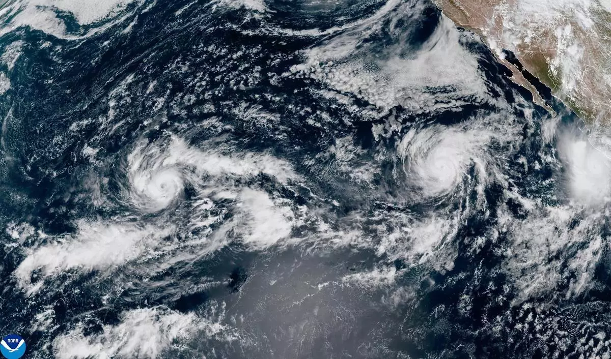
This satellite image provided by NOAA shows Tropical Storm Nolo, left, south of Hawaii; Hurricane Odalys, middle, and Hurricane Polo, right, off the coast of Mexico, in the Pacific Ocean on Thursday, Sept. 24, 2026. (NOAA via AP)
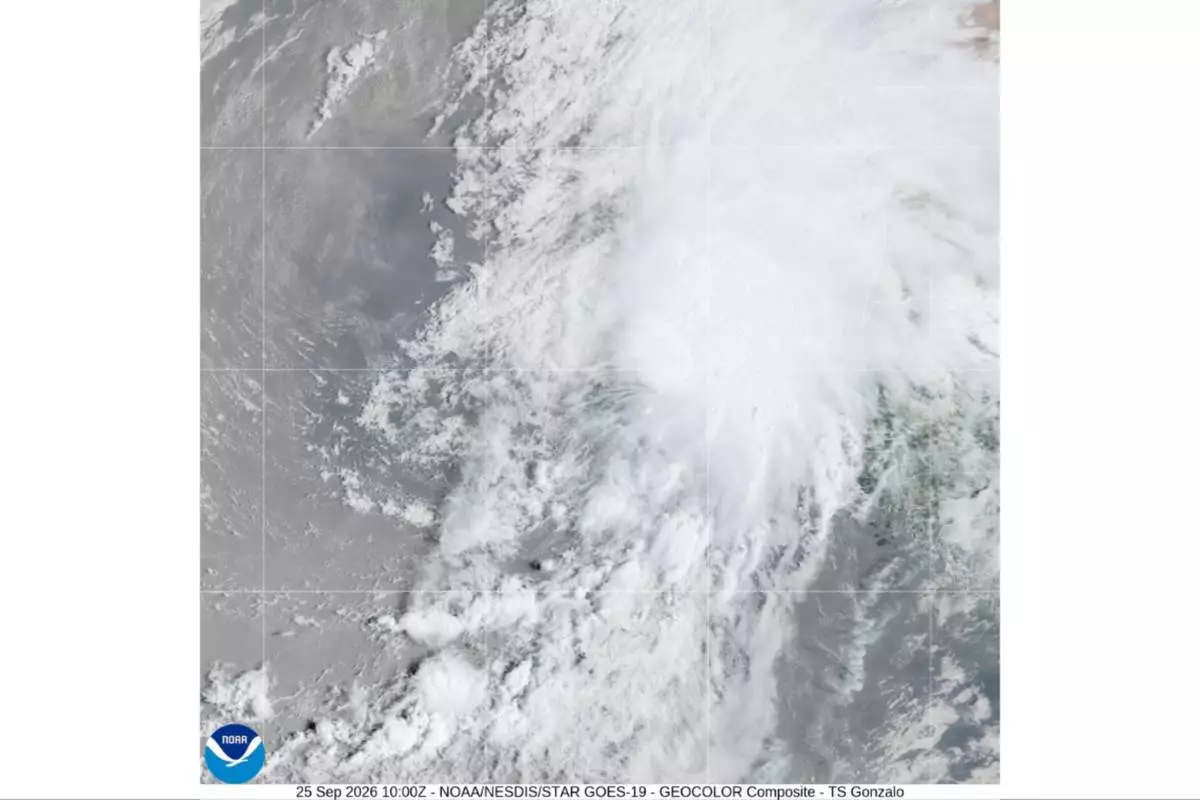
This satellite image from the National Oceanic and Atmospheric Administration shows Tropical Storm Gonzalo in the Atlantic Ocean, Friday, Sept. 25, 2026. (NOAA via AP)
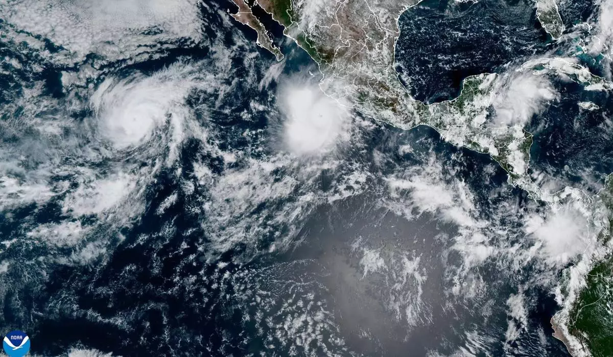
This satellite image provided by NOAA shows Hurricane Polo off the southwestern coast of Mexico and Hurricane Odalys, left, on Thursday, Sept. 24, 2026. (NOAA via AP) CORRECTION: Changes to Hurricane Odalys, not Tropical Storm Nolo.
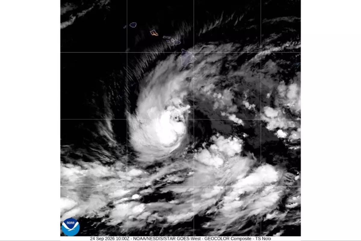
This satellite image from the National Oceanic and Atmospheric Administration shows Tropical Storm Nolo in the Pacific Ocean, Thursday, Sept. 24, 2026. (NOAA via AP)
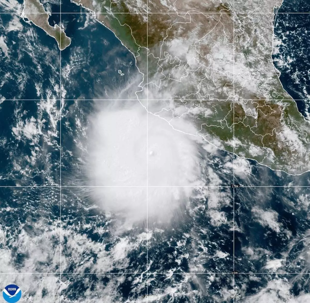
This photo provided by NOAA shows Hurricane Polo moving away from the southwestern coast of Mexico on Thursday, Sept. 24, 2026. (NOAA via AP)
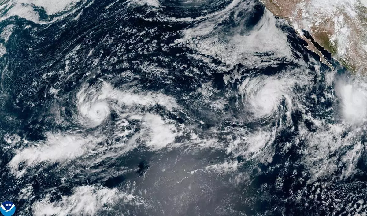
This satellite image provided by NOAA shows Tropical Storm Nolo, left, south of Hawaii; Hurricane Odalys, middle, and Hurricane Polo, right, off the coast of Mexico, in the Pacific Ocean on Thursday, Sept. 24, 2026. (NOAA via AP)