The world's first low-altitude gravity measurement system based on Unmanned Aerial Vehicle (UAV) made its public debut at the ongoing 15th China International Aviation and Aerospace Exhibition, or Airshow China 2024.
The system, developed by China State Shipbuilding Corporation's (CSSC) 707th Research Institute, was showcased at the event in Zhuhai, south China's Guangdong Province, where 1,022 companies from 47 countries and regions have gathered for the six-day event.
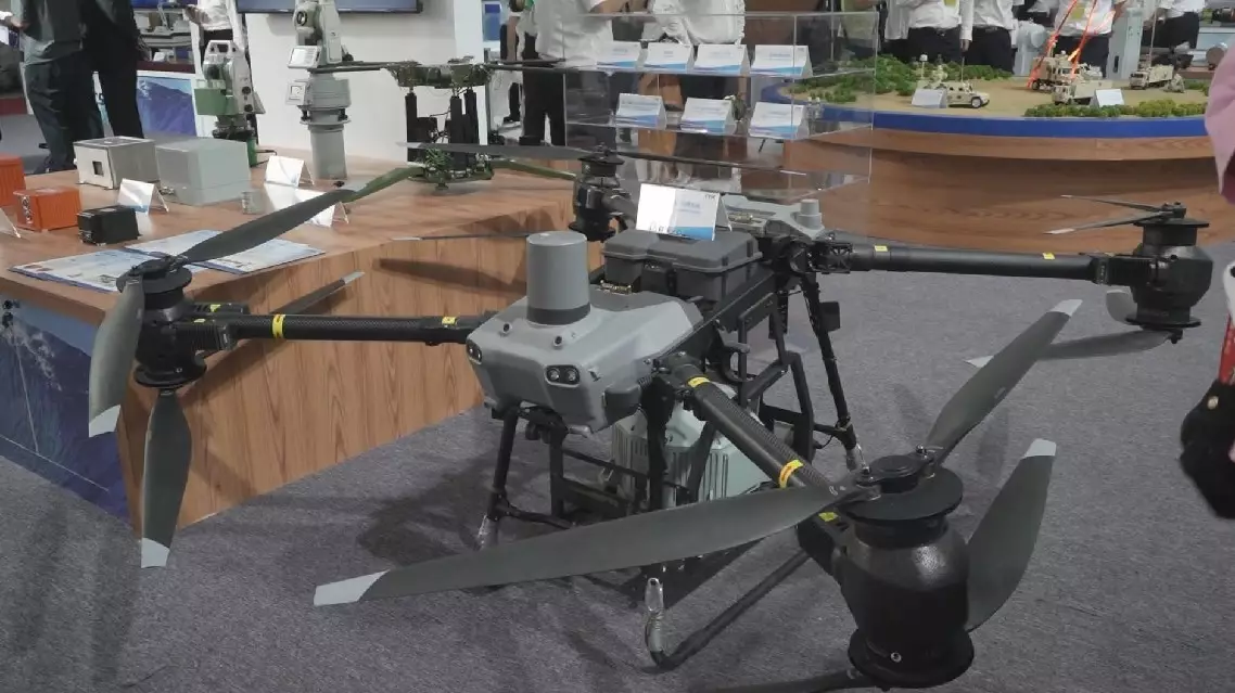
At the CSIC booths, the eight-rotor drone appears to be conventional, but it carries specialized equipment that sets it apart from other commercial UAVs.
"It is integrated with a high-precision gravity sensor. When the gravity changes, the gravity sensor can reflect the change of the Earth's gravitational field through high-precision current detection," said Chu Ning, head of gravity survey technology at 707th Research Institute CSSC, developer of the system.
Gravimetry is the measurement of the strength of a gravitational field, according to different purposes or requirements. Gravimeters may be used when either the magnitude of a gravitational field or the properties of matter responsible for its creation are of interest.
Measuring accurate gravity data can not only help aircraft and rockets and other aerospace spacecraft to calculate the trajectory and speed, but also help scientists carrying out scientific research in physics, geology and other fields.
"The UAV-based gravity measurement system features high precision, high measuring efficiency, wide coverage area, and it can make up the inaccessibility of manpower. It can be widely used in earth science research, including resource exploration and other fields. It fills a gap in the field of low altitude gravity measurement technology," said Song Chao, head of marketing department at 707th Research Institute.
World's first UAV gravity measurement system debuts at Airshow China