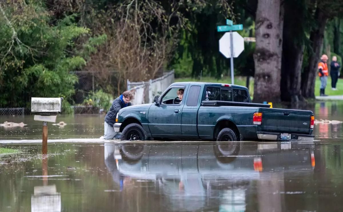
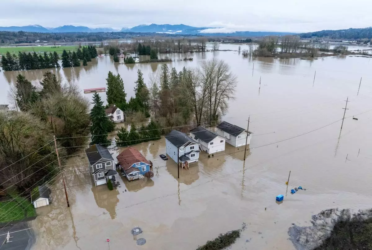
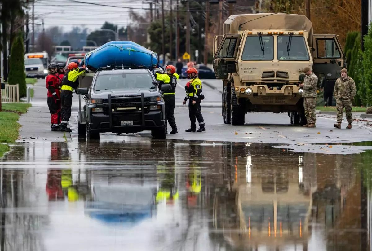
WASHINGTON (AP) — After deadly flooding in central Texas in 1987, some thought they'd proven they could handle Mother Nature's best punch. Then came this month's horrific flash floods, when unfathomable amounts of rain fell in only hours and more than 100 people died.
Before 2021, the typically temperate Pacific Northwest and western Canada seemed highly unlikely to get a killer heat wave, but they did. Tropical Hawaii once felt an ocean away from drought-fueled wildfires, until it wasn't. And many in inland North Carolina figured hurricanes were a coastal problem until the remnants of Helene blew in last year.
Click to Gallery
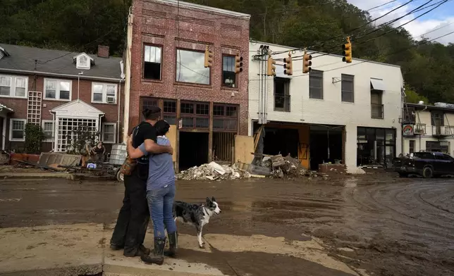
FILE - Resident Anne Schneider, right, hugs her friend, Eddy Sampson, as they survey damage caused by Hurricane Helene on Oct. 1, 2024, in Marshall, N.C. (AP Photo/Jeff Roberson, File)
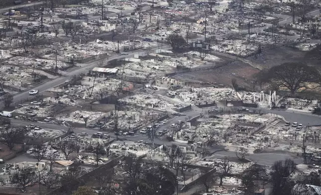
FILE - Wildfire wreckage is seen on Aug. 10, 2023, in Lahaina, Hawaii. (AP Photo/Rick Bowmer, File)
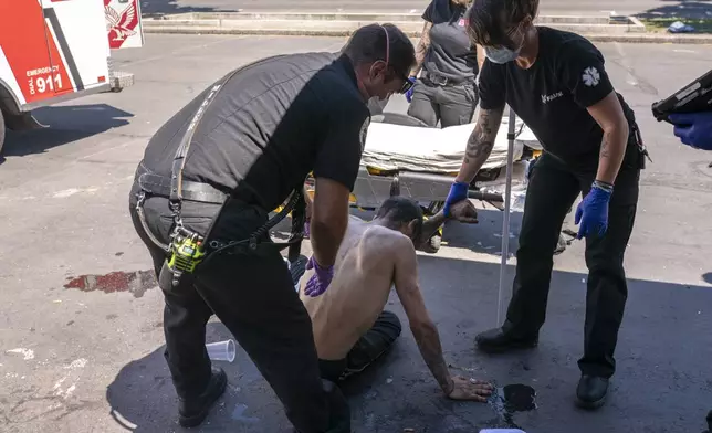
FILE - Salem Fire Department Capt. Matt Brozovich, left, and Falck Northwest ambulance personnel help treat a man experiencing heat exposure during a heat wave in Salem, Ore., June 26, 2021. (AP Photo/Nathan Howard, File)
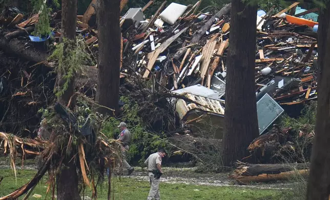
Officials comb through the banks of the Guadalupe River after a flash flood swept through the area Saturday, July 5, 2025, in Hunt, Texas. (AP Photo/Julio Cortez)
Climate change is making extreme weather events more frequent and intense, according to climate scientists and government data. But people and governments are generally living in the past and haven't embraced that extreme weather is now the norm, to say nothing about preparing for the nastier future that’s in store, experts in meteorology, disasters and health told The Associated Press.
“What happens with climate change is that what used to be extreme becomes average, typical, and what used to never occur in a human lifetime or maybe even in a thousand years becomes the new extreme,” Princeton University climate scientist Michael Oppenheimer said. “We start to experience things that just basically never happened before.”
The 10-year summer average of the National Oceanic and Atmospheric Administration's climate extreme index, which tracks hurricanes, heavy rain, droughts and high and low temperatures, is 58% higher than it was in the 1980s.
Despite the grim trajectory, society isn't acting with enough alarm, Oppenheimer said.
“There’s plenty of evidence that we sit there and do absolutely nothing while these risks are coming right at us like a moving railroad train and we’re standing in the tracks. And then all of a sudden, bam,” he said.
Although the changing climate is the biggest problem, the way we react to or ignore the changes could make a bad situation worse, experts said.
Marshall Shepherd, a University of Georgia meteorology professor who previously served as president of the American Meteorological Society, said people tend to base decisions on how they fared during past extreme weather events, including storms that didn't end up directly affecting them. This leaves them overly optimistic that they'll also fare well today, even though storms have grown more fierce.
He points to the Texas flooding.
“That is flash flood alley. We know that floods happen in that region all the time. ... I've already seen normalcy bias statements by people in the regions saying, well, we get flooding all the time,” Shepherd said, pointing out that the amount of rain that fell in only a few hours last week was anything but normal.
People need to shift how they think about disasters, even if they don’t live in the most disaster-prone locations, said Kim Klockow McClain, an extreme weather social scientist at the University Corporation for Atmospheric Research who studies communicating disaster warnings and risk.
“The message needs to be, if you’re used to some degree of nuisance flooding, every so often, look at what happened in Texas and realize that this is a shifting baseline,” she said.
Time and again after catastrophic storms and wildfires, people whose lives were upended say they didn't think it could happen to them. This mindset helps people cope, but with extreme weather happening more frequently and in more places, it can prevent them from adequately preparing.
“It's sort of a psychological mechanism to protect us that it can't happen to me,” said Susan Cutter, co-director of the Hazards Vulnerability & Resilience Institute at the University of South Carolina.
Surviving past extreme events can leave people believing that it won't happen again or, if it does, that they'll be fine, said Lori Peek, director of the Natural Hazards Center at the University of Colorado. She said this overconfidence can be dangerous: “Just because I’ve lived through a fire or a flood or a hurricane or a tornado, that does not mean that the next time is going to look like the last time.”
As the weather has grown more extreme, our ability to prepare for and react to it hasn't kept pace, the scientists said.
“Infrastructure is aging in our country and is more vulnerable given the fact that there are just simply, as a matter of fact, more people living in harm’s way,” Peek said. “As our population has continued to rise, it’s not only that we have more people in the country, it’s also that we have more people living in particularly hazardous areas like our coastal areas.”
The Trump Administration's mass layoffs and planned cuts to agencies that study climate and help warn of and deal with disasters — the Federal Emergency Management Agency, the National Weather Service and research labs at the National Oceanic Atmospheric Administration and the U.S. Geological Survey — could further worsen the situation, several experts said.
Smart and experienced people have already left these agencies and it could take years to make up for their knowledge and abilities, they said.
“We’re destroying the capability we have that we’re going to need more and more in the future,” Oppenheimer said.
As for future disasters, the country needs to figure out and plan for the worst-case scenario instead of looking to the past, Peek said.
“This is our future,” Peek said. “It’s obvious that we’re living into a future where there are going to be more fires and floods and heat waves."
The Associated Press’ climate and environmental coverage receives financial support from multiple private foundations. AP is solely responsible for all content. Find AP’s standards for working with philanthropies, a list of supporters and funded coverage areas at AP.org.
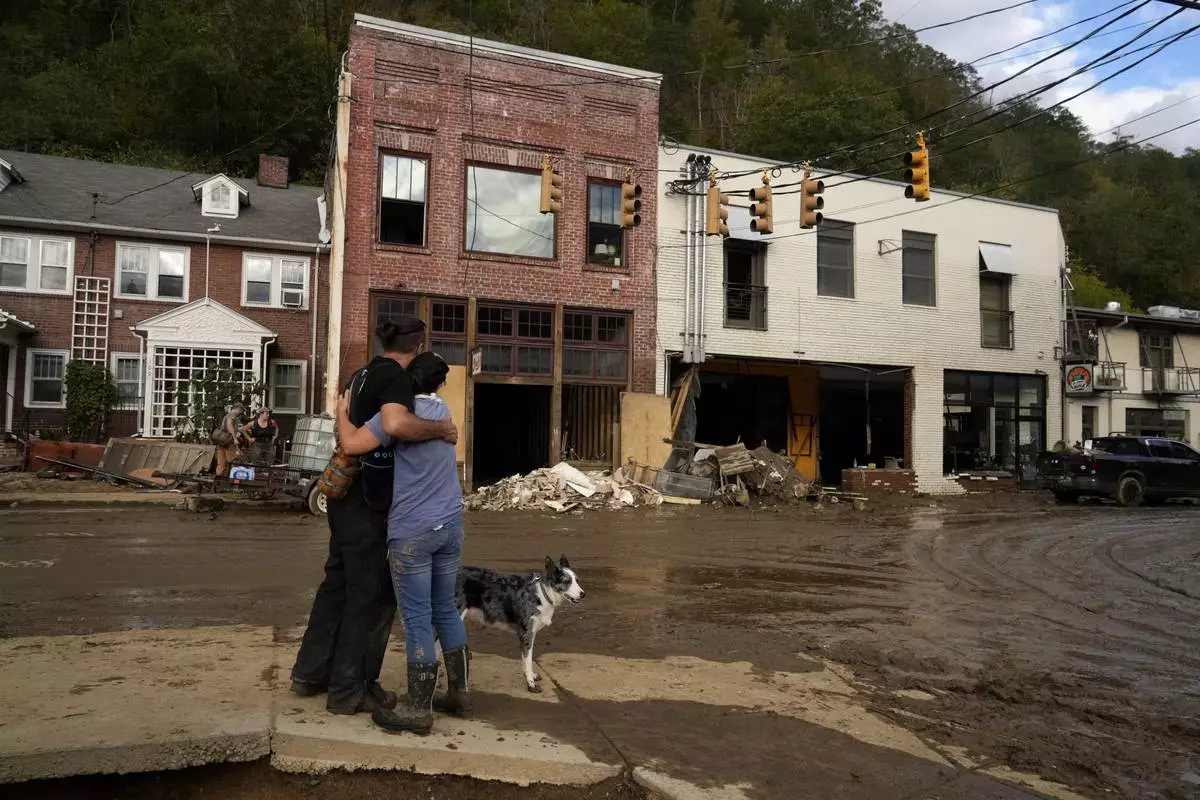
FILE - Resident Anne Schneider, right, hugs her friend, Eddy Sampson, as they survey damage caused by Hurricane Helene on Oct. 1, 2024, in Marshall, N.C. (AP Photo/Jeff Roberson, File)
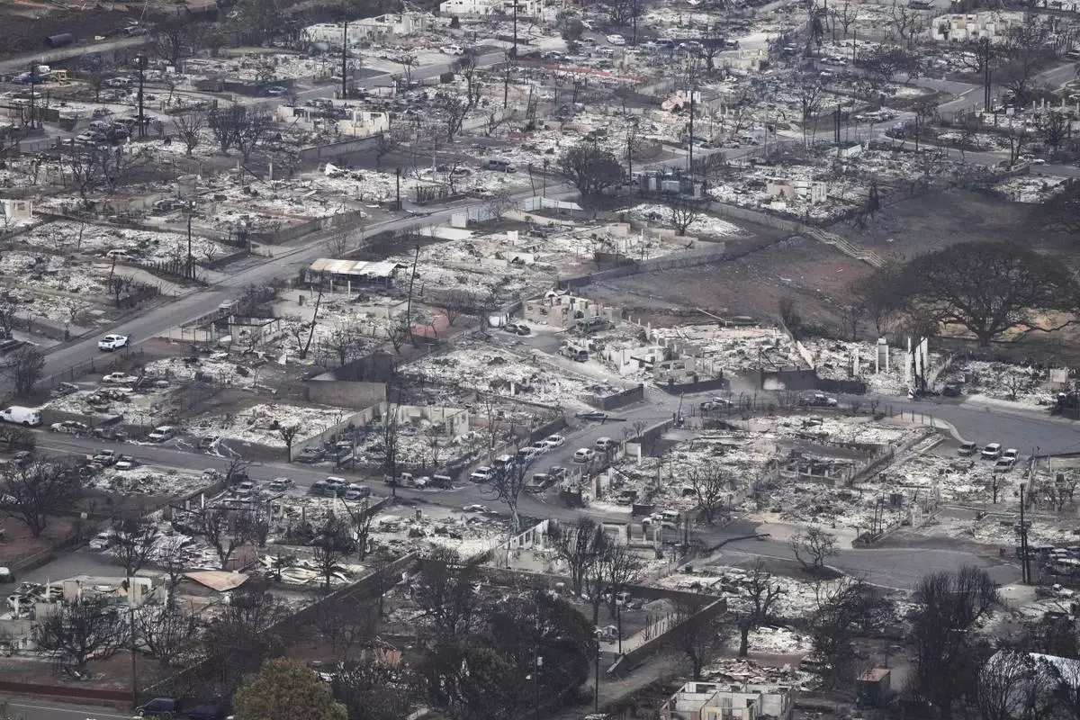
FILE - Wildfire wreckage is seen on Aug. 10, 2023, in Lahaina, Hawaii. (AP Photo/Rick Bowmer, File)
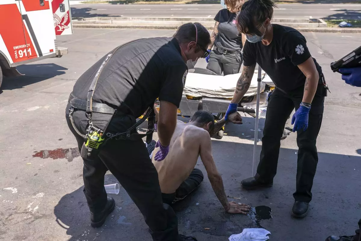
FILE - Salem Fire Department Capt. Matt Brozovich, left, and Falck Northwest ambulance personnel help treat a man experiencing heat exposure during a heat wave in Salem, Ore., June 26, 2021. (AP Photo/Nathan Howard, File)
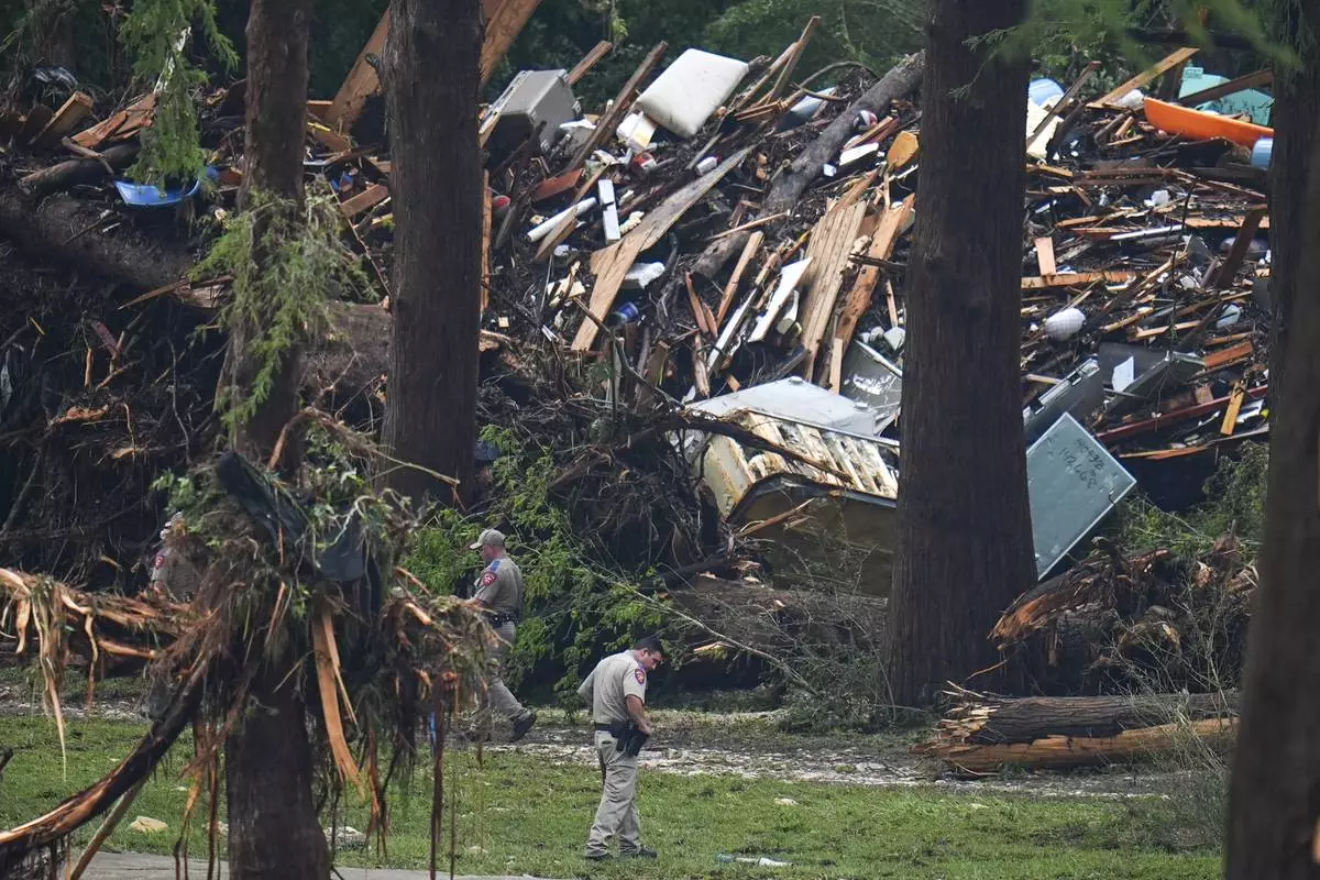
Officials comb through the banks of the Guadalupe River after a flash flood swept through the area Saturday, July 5, 2025, in Hunt, Texas. (AP Photo/Julio Cortez)