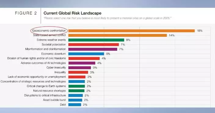
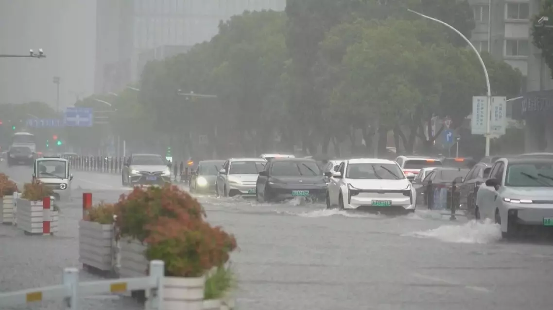
Typhoon Wipha, the sixth typhoon of the year, has strengthened and is expected to bring strong winds and heavy rain to south China and surrounding regions in the coming days, according to the China Meteorological Administration on Friday.
In the early hours of Friday, a tropical depression east of the Philippines strengthened into Typhoon Wipha at the level of tropical storm. As of 11:00, Wipha's center was located approximately 505 kilometers northeast of Manila, with maximum sustained winds around the center estimated at 62 to 74 kilometers per hour.
The tropical storm is moving northwestward at a speed of 20 to 25 kilometers per hour and is expected to intensify, possibly reaching typhoon or severe typhoon status in the coming days. Forecasts indicate that Wipha will enter the northern South China Sea between the early morning and late morning of Saturday, and then continue toward coastal regions from central Guangdong to eastern Hainan Island.
In response, the China Meteorological Administration issued a yellow typhoon warning Friday morning, the third-highest in its four-tier alert system.
From Friday through Tuesday, northern parts of China are also expected to see increased rainfall, with some areas experiencing heavy precipitation. In addition, some parts of south China will embrace strong winds and rain brought by the approaching typhoon.
Typhoon Wipha strengthens, set to impact south China and beyond