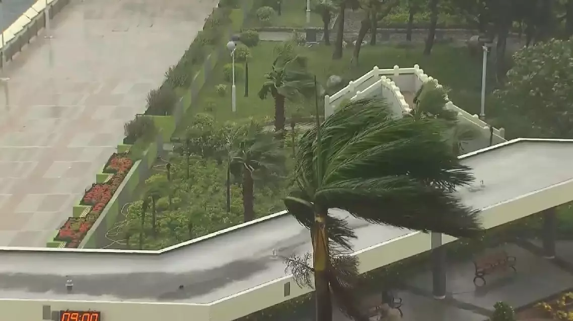
Hong Kong raised its storm warning to the highest level on Sunday as typhoon Wipha swept past the region, bringing powerful winds, heavy rain, and widespread disruption to transport and public services.
The Hong Kong Observatory hoisted the No. 10 hurricane signal, the region's top-level tropical cyclone warning, at 09:20 local time on Sunday, as typhoon Wipha approached the region from the south.
Click to Gallery
Hong Kong on high alert as typhoon Wipha strikes

Hong Kong on high alert as typhoon Wipha strikes
Hong Kong on high alert as typhoon Wipha strikes

Hong Kong on high alert as typhoon Wipha strikes
Hong Kong on high alert as typhoon Wipha strikes
Hong Kong on high alert as typhoon Wipha strikes
This warning level indicates sustained winds of 118 kilometers per hour or higher, with gusts potentially exceeding 220 kilometers per hour. In the hours following the issuance, widespread parts of Hong Kong experienced intense wind and rain, with many outdoor areas exposed to gale-force conditions.
Coastal roads saw trees and branches toppled by strong gusts, while rough seas churned violently offshore. On the streets, traffic came to a near standstill, with barely any vehicles or pedestrians in sight.
All daytime classes and public schools were suspended. Ferry terminals were closed, and the Hong Kong Airport Authority reported that approximately 500 flights had been canceled, while around 400 others were rescheduled, affecting over 80,000 travelers.
The storm, although beginning to move away, continues to bring hurricane conditions to parts of Hong Kong, particularly the southwestern districts. As wind intensity gradually weakens in Hong Kong, a No. 8 gale or storm signal was issued at 16:10.
Authorities have warned the public to stay indoors, remain vigilant, and avoid low-lying or mountainous areas that may be prone to flooding or landslides.
Hong Kong on high alert as typhoon Wipha strikes
Hong Kong on high alert as typhoon Wipha strikes
Hong Kong on high alert as typhoon Wipha strikes
Hong Kong on high alert as typhoon Wipha strikes
Hong Kong on high alert as typhoon Wipha strikes
Hong Kong on high alert as typhoon Wipha strikes