Hurricane Melissa, which struck Jamaica with record-tying 185 mph winds Tuesday, was a beast that stood out as extreme even in a record number of monster storms spawned over the last decade in a superheated Atlantic Ocean.
Melissa somehow shook off at least three different meteorological conditions that normally weaken major hurricanes and was still gaining power as it hit, scientists said, a bit amazed.
Click to Gallery
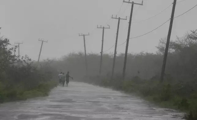
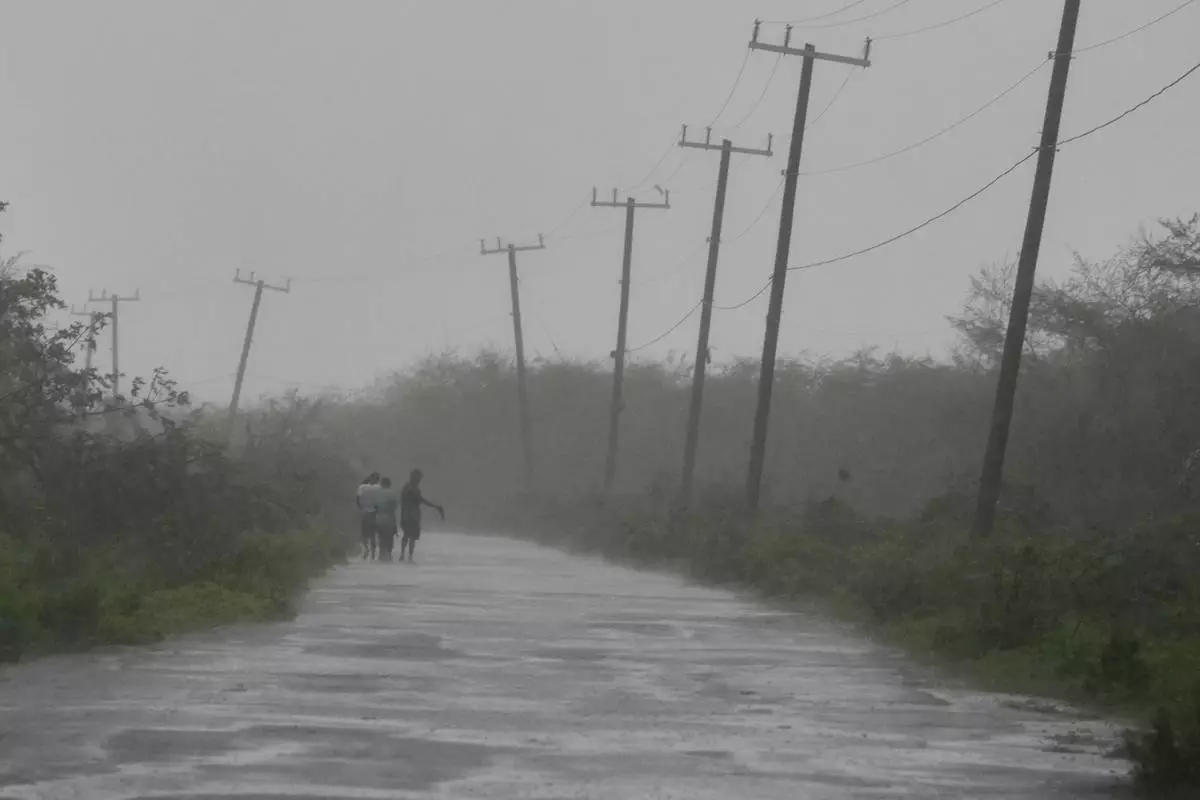
People walk along a road during the passing of Hurricane Melissa in Rocky Point, Jamaica, Tuesday, Oct. 28, 2025. (AP Photo/Matias Delacroix)
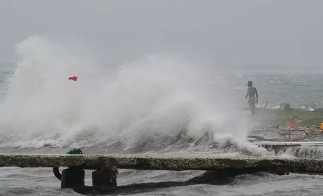
Waves splash in Kingston, Jamaica, as Hurricane Melissa approaches, Tuesday, Oct. 28, 2025. (AP Photo/Matias Delacroix)
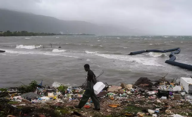
A man walks along the coastline during the passing of Hurricane Melissa in Kingston, Jamaica, Tuesday, Oct. 28, 2025. (AP Photo/Matias Delacroix)
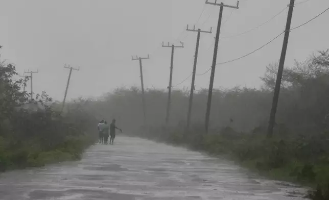
People walk along a road during the passing of Hurricane Melissa in Rocky Point, Jamaica, Tuesday, Oct. 28, 2025. (AP Photo/Matias Delacroix)
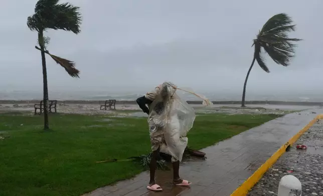
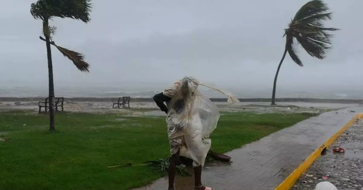
A man walks in Kingston, Jamaica, as Hurricane Melissa approaches, Tuesday, Oct. 28, 2025. (AP Photo/Matias Delacroix)
And while more storms these days are undergoing rapid intensification — gaining 35 mph in wind speed over 24 hours — Melissa did a lot more than that. It achieved what's called extreme rapid intensification — gaining at least 58 mph over 24 hours. In fact, Melissa turbocharged by about 70 mph during a 24-hour period last week, and had an unusual second round of rapid intensification that spun it up to 175 mph, scientists said.
“It's been a remarkable, just a beast of a storm," Colorado State University hurricane researcher Phil Klotzbach said.
When Melissa came ashore it tied strength records for Atlantic hurricanes making landfall, both in wind speed and barometric pressure, which is a key measurement that meteorologists use, said Klotzbach and University of Miami hurricane researcher Brian McNoldy. The pressure measurement tied the deadly 1935 Labor Day storm in Florida, while the 185 mph wind speed equaled marks set that year and during 2019's Hurricane Dorian. Hurricane Allen reached 190 mph winds in 1980, but not at landfall.
Usually when major hurricanes brew they get so strong that the wind twirling in the center of the storm gets so intense and warm in places that the eyewall needs to grow, so a small one collapses and a bigger one forms. That's called an eyewall replacement cycle, McNoldy said, and it usually weakens the storm at least temporarily.
Melissa showed some signs of being ready to do this, but it never did, McNoldy and Klotzbach said.
Another weird thing is that Melissa sat offshore of mountainous Jamaica for awhile before coming inland. Usually mountains, even on islands, tear up storms, but not Melissa.
“It was next to a big mountainous island and it doesn't even notice it's there,” McNoldy said in amazement.
Warm water is the fuel for hurricanes. The hotter and deeper the water, the more a storm can power up. But when storms sit over one area for awhile — which Melissa did for days on end — it usually brings cold water up from the depths, choking off the fuel a bit. But that didn't happen to Melissa, said Bernadette Woods Placky, chief meteorologist for Climate Central, a combination of scientists and journalists who study climate change.
“It's wild how almost easily this was allowed to just keep venting,” Woods Placky said. “This had enough warm water at such high levels and it just kept going.”
Melissa rapidly intensified during five six-hour periods as it hit the extreme rapid intensification level, McNoldy said. And then it jumped another 35 mph and “that's extraordinary,” he said.
For meteorologists following it “just your stomach would sink as you’d see these updates coming in,” Woods Placky said.
“We were sitting at work on Monday morning with our team and you just saw the numbers just start jumping again, 175. And then again this morning (Tuesday), 185," Woods Placky said.
“It's an explosion,” she said.
One key factor is warm water. McNoldy said some parts of the ocean under Melissa were 2 degrees Celsius (3.6 degrees Fahrenheit) warmer than the long-term average for this time of year.
Climate Central, using scientifically accepted techniques of comparing what's happening now to a fictional world with no human-caused climate change, estimated the role of global warming in Melissa. It said the water was 500 to 700 times more likely to be warmer than normal because of climate change.
A rapid Associated Press analysis of Category 5 hurricanes that brewed, not just hit, in the Atlantic over the past 125 years showed a large recent increase in those top-of-the-scale storms. There have been 13 Category 5 storms from 2016 to 2025, including three this year. Until last year, no other 10-year period even reached double digits. About 29% of the Category 5 hurricanes in the past 125 years have happened since 2016.
McNoldy, Klotzbach and Woods Placky said hurricane records before the modern satellite era are not as reliable because some storms out at sea could have been missed. Measuring systems for strength have also improved and changed, which could be a factor. And there was a period between 2008 and 2015 with no Atlantic Category 5 storms, Klotzbach said.
Still, climate science generally predicts that a warmer world will have more strong storms, even if there aren't necessarily more storms overall, the scientists said.
“We’re seeing a direct connection in attribution science with the temperature in the water and a climate change connection, Woods Placky said. ”And when we see these storms go over this extremely warm water, it is more fuel for these storms to intensify rapidly and push to new levels."
Science Writer Seth Borenstein has covered hurricanes for more than 35 years and has co-authored two books on them. Data journalist M.K. Wildeman contributed from Hartford, Connecticut.
The Associated Press’ climate and environmental coverage receives financial support from multiple private foundations. AP is solely responsible for all content. Find AP’s standards for working with philanthropies, a list of supporters and funded coverage areas at AP.org.
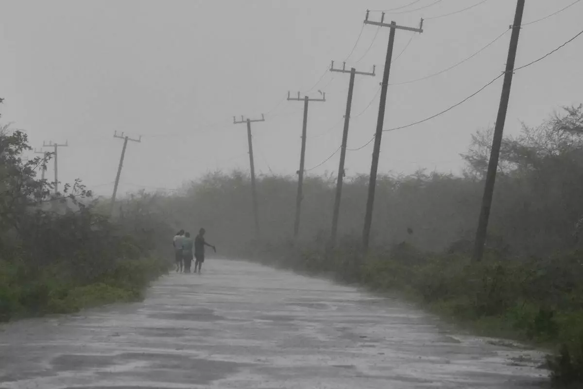
People walk along a road during the passing of Hurricane Melissa in Rocky Point, Jamaica, Tuesday, Oct. 28, 2025. (AP Photo/Matias Delacroix)
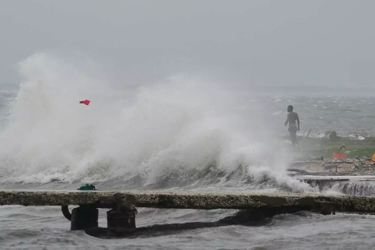
Waves splash in Kingston, Jamaica, as Hurricane Melissa approaches, Tuesday, Oct. 28, 2025. (AP Photo/Matias Delacroix)
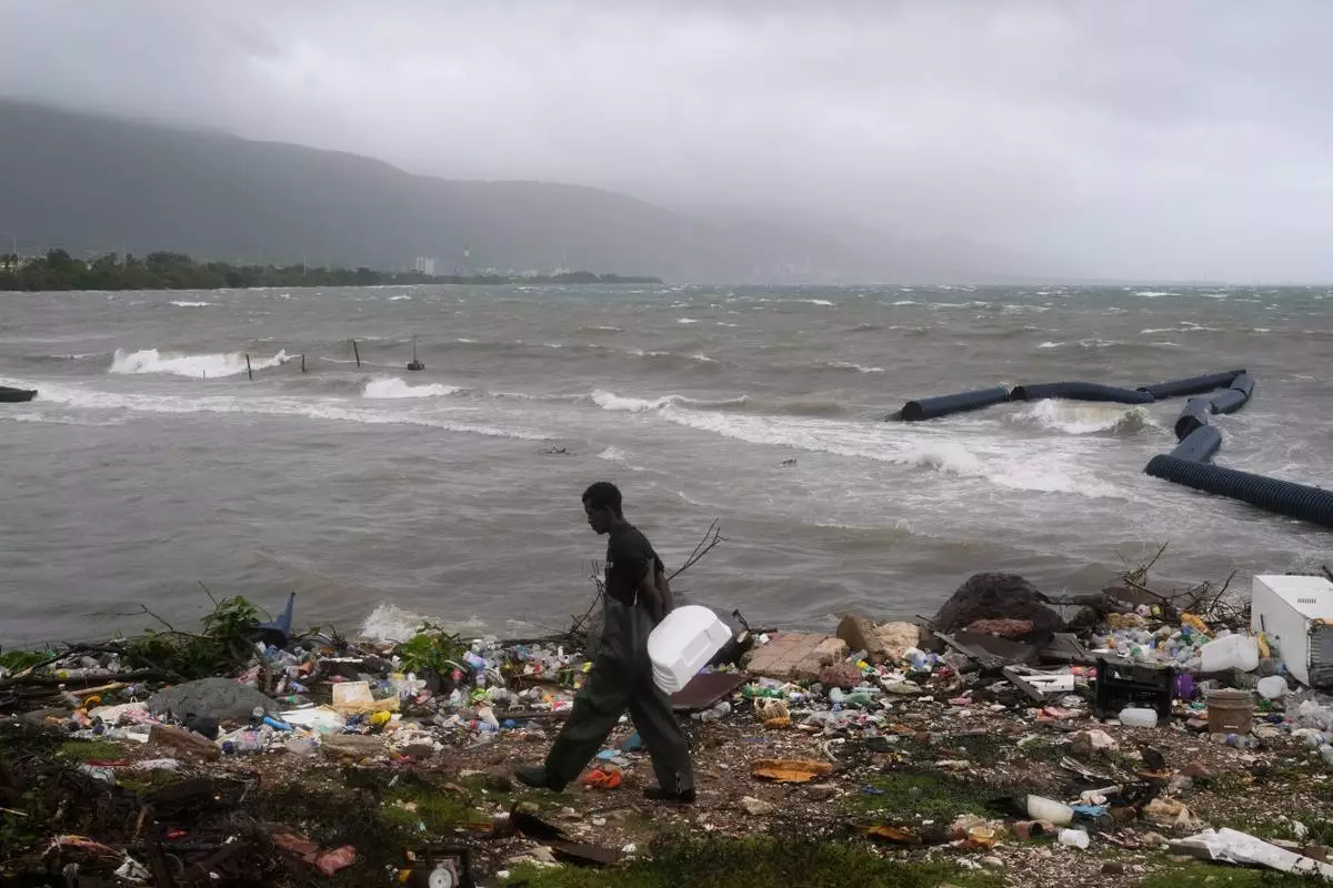
A man walks along the coastline during the passing of Hurricane Melissa in Kingston, Jamaica, Tuesday, Oct. 28, 2025. (AP Photo/Matias Delacroix)
People walk along a road during the passing of Hurricane Melissa in Rocky Point, Jamaica, Tuesday, Oct. 28, 2025. (AP Photo/Matias Delacroix)
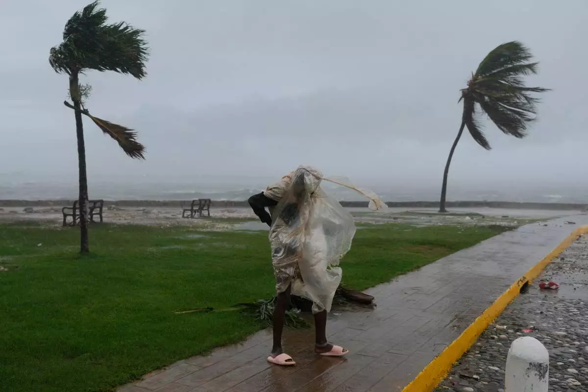
A man walks in Kingston, Jamaica, as Hurricane Melissa approaches, Tuesday, Oct. 28, 2025. (AP Photo/Matias Delacroix)