Skip to Content Facebook Feature Image

Everbridge Introduces Everbridge 360 AI, the Next Evolution of High Velocity Critical Event Management

Business

Everbridge Introduces Everbridge 360 AI, the Next Evolution of High Velocity Critical Event Management
Business

Business

Everbridge Introduces Everbridge 360 AI, the Next Evolution of High Velocity Critical Event Management

2026-09-14 20:33 Last Updated At:21:00

VIENNA, Va.--(BUSINESS WIRE)--Sep 14, 2026--

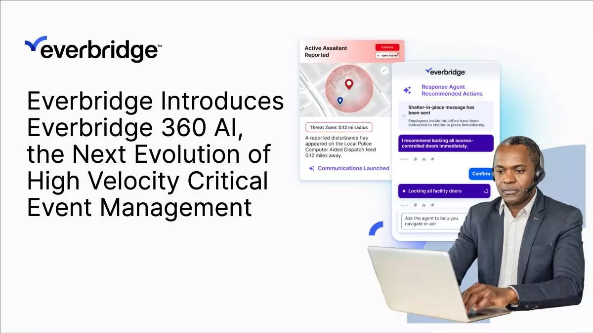
Everbridge, the global leader in High Velocity Critical Event Management (CEM), today introduced Everbridge 360 AI, the next evolution of its dynamically adaptive resilience platform. By combining proven resilience workflows with purpose-built artificial intelligence, Everbridge 360 AI helps organizations prepare for, respond to, and recover from critical events with greater speed, confidence, and operational consistency.

This press release features multimedia. View the full release here: https://www.businesswire.com/news/home/20260914624367/en/

As organizations face an increasing volume of natural disasters, cyber threats, infrastructure disruptions, workplace incidents, and other rapidly evolving risks, leaders need to quickly understand what matters, how their people and operations may be affected, and what to do next. Everbridge 360 AI combines the company's trusted resilience capabilities with AI to help teams cut through the noise, focus on what matters most, and accelerate response through guided workflows – while keeping people in control.

Unlike standalone AI assistants or point solutions, Everbridge 360 AI embeds AI directly into the enterprise workflows organizations rely on to manage critical events from preparedness through response and recovery. The platform helps organizations draft emergency communications, summarize evolving incidents, highlight key operational insights, assist with decision-making, and automate routine tasks so response teams can focus on protecting people, maintaining operations, and building resilience.

Everbridge 360 AI also puts expert guidance at users' fingertips through the new Everbridge 360 AI Advisor, a conversational guide tailored to an organization's priorities and operating context. Advisor helps teams assess evolving situations and potential impacts, determine next steps, and navigate response workflows. By providing AI-assisted guidance in the moment, Advisor helps users move more quickly from understanding what's happening to taking coordinated action.

“As threats become faster and more complex, organizations need to be able to understand what’s happening and respond just as quickly,” said Adam Good, Associate Director, Global Security at Merck & Co., Inc. “Bringing AI into critical event management can help teams turn intelligence into action faster and move from simply reacting to a crisis toward anticipating threats before they escalate. Everbridge is helping advance that shift by applying AI purposefully, pairing intelligent automation with human judgment to help protect our people and operations.”

“Everbridge 360 AI represents the next evolution of more than two decades of resilience expertise,” said Dave Wagner, Chief Executive Officer at Everbridge. “We're applying AI in thoughtful and practical ways to help organizations make more informed decisions and take more effective action. Just as important, we’re delivering those capabilities with the governance, transparency, and human oversight our customers need to confidently use AI in mission-critical operations.”

Everbridge recently achieved ISO/IEC 42001 certification, the international standard for artificial intelligence management systems. The certification reflects the company's commitment to AI governance, transparency, risk management, and human oversight as it continues to expand AI capabilities across the Everbridge 360 AI platform.

Across the platform, AI capabilities assist – not replace – operators by providing intelligent recommendations, accelerating routine tasks, and helping teams apply lessons from each event to strengthen future response. The result is a more dynamically adaptive approach to resilience – autonomous when you want it to be and human-guided when you need it to be – while maintaining enterprise governance and control.

Everbridge 360 AI is available in three editions:

To support customers as they adopt these new capabilities, Everbridge is also introducing forward-deployed engineering (FDE) support, offering hands-on technical expertise to help organizations integrate and apply AI within their critical event management workflows.

Everbridge will showcase Everbridge 360 AI during GSX 2026, taking place September 14–16 at the Georgia World Congress Center in Atlanta. Attendees can experience live demonstrations of the new AI-powered capabilities at Booth #1841.

Learn more about Everbridge 360 AI and how AI is advancing High Velocity Critical Event Management.

About Everbridge

Everbridge helps more than 6,500 enterprises and government organizations manage critical events by enabling them to know earlier, respond faster, and improve continuously. Through an all-in-one AI-powered platform, Everbridge High Velocity CEM™ is autonomous when you want it to be and human-guided when you need it to be, so every incident response is optimized. For more information, visit everbridge.com and follow us on LinkedIn.
Everbridge Introduces Everbridge 360 AI, the Next Evolution of High Velocity Critical Event Management

Everbridge Introduces Everbridge 360 AI, the Next Evolution of High Velocity Critical Event Management

MUNICH--(BUSINESS WIRE)--Sep 14, 2026--

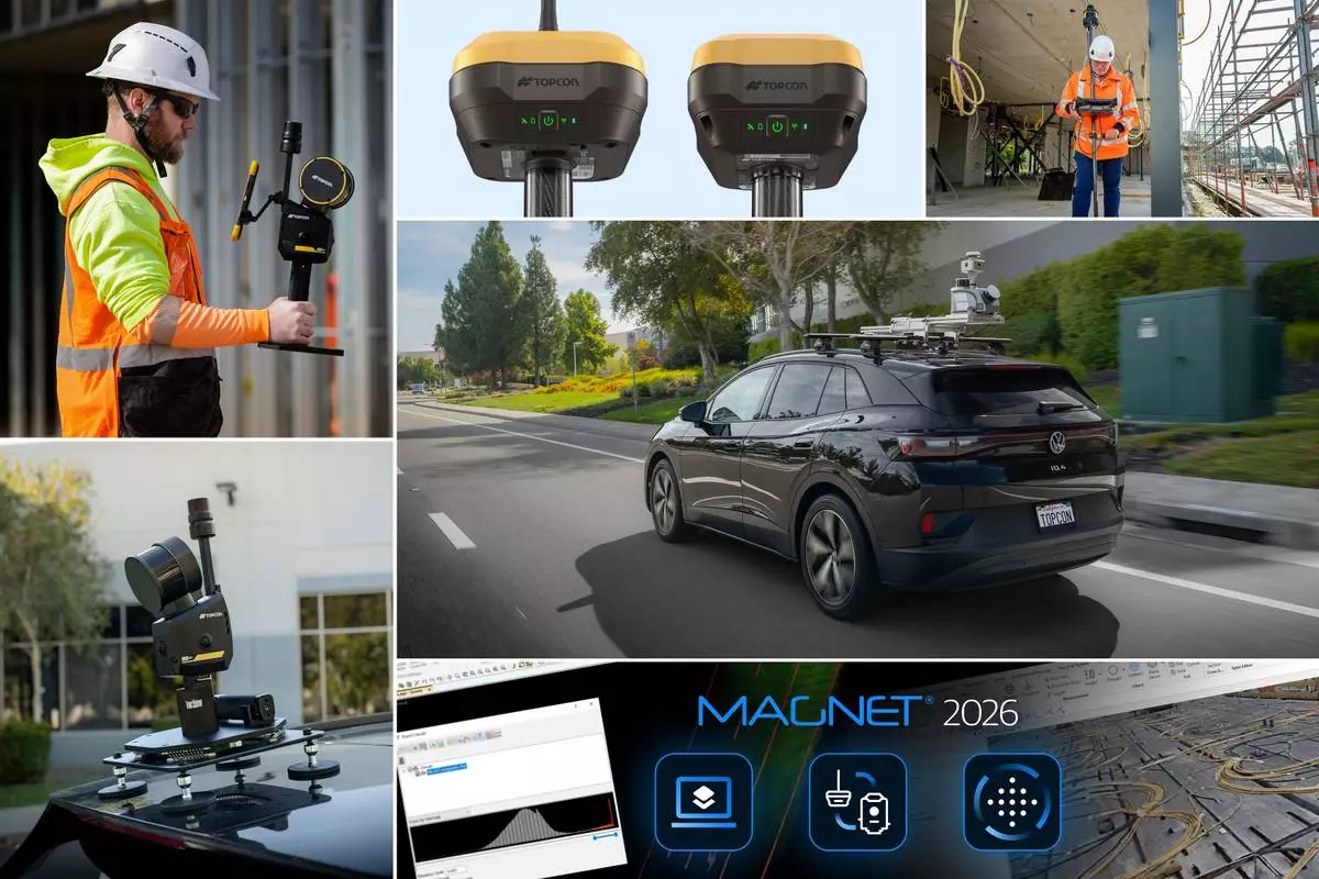
Topcon Positioning Systems announces additions to its geomatics portfolio designed to support integrated digital workflows for survey, construction, and infrastructure projects. The new solutions expand Topcon’s geospatial ecosystem, including reality capture, positioning, data management, monitoring, and subsurface intelligence technologies to improve accuracy and the flow of information on projects. The announcement was made in conjunction with INTERGEO 2026, the trade fair for geodesy, geoinformation, and land management, taking place September 15–17 in Munich, Germany.

This press release features multimedia. View the full release here: https://www.businesswire.com/news/home/20260914298196/en/

“Industry professionals are looking for flexible technologies that fit within their existing processes,” said Neil Vancans, head of Topcon Geomatics Sales. “Topcon addresses this need through open integrations, cross-platform compatibility, and connected workflows. We provide an ecosystem that helps users streamline processes, improve collaboration, and simplify the digital management of project data. These new solutions, together with continued AI integration, reflect our focus on practical, interoperable technologies for the geomatics industry.”

Additions to theCapture Reality portfolio of mass data solutions include:

The HiPer GNSS receiver portfolio is expanded with the new HiPer S1 and value-tier HiPer V1 receivers. The receivers support connected workflows by allowing positioning data collected in the field to flow directly into downstream processing and modeling software for surveying, mapping, construction, and related applications. Configurations include use as a network rover through an RTK correction service such as Topnet Live, via LongLink connectivity, or in a base and rover setup, providing flexibility for different project requirements. The receivers can be used for Hybrid Positioning, which connects robotic total stations and receivers in a single, uninterrupted workflow. The HiPer S1 and V1 support all major satellite constellations to improve positioning availability in a variety of environments.

MAGNET Field and Office 2026 software introduces workflow enhancements to the Topcon MAGNET software suite for survey and construction professionals, including expanded field-to-office connectivity, streamlined data management, and support for integrated positioning. The software is designed to help users collect, manage, and transfer project data more efficiently between field crews and office teams, supporting connected digital workflows across multiple projects and equipment platforms.

Delta Watch powered by GEOvis is a cloud-based workflow platform that brings advanced visualization, reporting, alarms, project administration, stakeholder communication, and geodetic network adjustment into the Delta Solutions deformation monitoring system. Developed with Amberg Infra 7D and based on GEOvis technology, Delta Watch integrates automated and manually collected data from total stations, GNSS receivers, and geotechnical, structural, and environmental sensors. The platform helps teams streamline monitoring workflows, improve accuracy through least-squares adjustment, and manage project data in one connected environment.

A collaboration is announced with Proceq, a Screening Eagle Company, enabling Proceq advanced ground penetrating radar (GPR) systems to be used with Topcon GNSS solutions and mass data workflow software. This collaboration will support applications across infrastructure and construction projects in Europe, the Middle East, and Africa (EMEA), connecting subsurface information with geospatial data to support more informed analysis and decision-making.

Visit the Topcon website for more information about solutions showcased at INTERGEO 2026.

About Topcon Positioning Systems

Topcon Positioning Systems is an innovation company focused on delivering precision technologies and workflow solutions for the global construction, geomatics, and agriculture markets. Topcon Positioning Systems ( topconpositioning.com ) is headquartered in Livermore, California, U.S. Its European head office is in Zoetermeer, Netherlands. Parent company Topcon Corporation (topcon.com), founded in 1932, is headquartered in Tokyo, Japan.

Topcon Positioning Systems announces additions to its geomatics portfolio designed to support integrated digital workflows for survey, construction, and infrastructure projects. The new solutions expand Topcon’s geospatial ecosystem, including reality capture, positioning, data management, monitoring, and subsurface intelligence technologies to improve accuracy and the flow of information on projects.

Topcon Positioning Systems announces additions to its geomatics portfolio designed to support integrated digital workflows for survey, construction, and infrastructure projects. The new solutions expand Topcon’s geospatial ecosystem, including reality capture, positioning, data management, monitoring, and subsurface intelligence technologies to improve accuracy and the flow of information on projects.

Recommended Articles