SAN FRANCISCO & MUNICH--(BUSINESS WIRE)--Sep 14, 2026--
Ouster, Inc. (Nasdaq: OUST), a leader in sensing and perception for Physical AI, today announced surging customer momentum for its Rev8 OS1 Max native color digital lidar, with payload integrators and drone OEMs across the aerial mapping market selecting the sensor for utility corridor inspection, infrastructure management, and defense applications.
This press release features multimedia. View the full release here: https://www.businesswire.com/news/home/20260914891265/en/
Aerial mapping teams have long worked around the same constraint: fly low enough to resolve a power line and a single mission covers a fraction of the corridor; fly high enough to cover ground and the thin objects that matter most start to disappear into the noise. Powered by Ouster's L4 Max chip, the Rev8 OS1 Max pairs 256 channels of survey-grade 3D range data with native 48-bit color, allowing operators to maintain detail at high survey altitudes.
Designed and developed in the U.S., Ouster's Rev8 OS digital lidar sensors comply with the statutory supply chain security standards under §164 of the FY2025 National Defense Authorization Act (NDAA). Ouster also offers Build America, Buy America Act (BABA) certified sensors, giving government, utility, and enterprise operators a trusted option for programs with domestic sourcing requirements.
Redefining High-Altitude Drone Mapping with Native Color and 2x Precision & Accuracy
Survey deliverables are only as good as the precision of their measurements. The Rev8 OS1 Max produces low-noise point clouds with thin surface walls, reaching ±0.25 cm 1σ precision and ±1.25 cm accuracy, twice the precision and accuracy of the previous Rev7 generation. Every sensor is calibrated across range, reflectivity, temperature, and beam angle before it ships, so the point cloud looks the same from one unit to the next. That consistency makes results repeatable for fleet operators: the same flight plan produces the same deliverable, whichever aircraft flies it.
Resolving a thin object from the air comes down to how tightly the beam stays focused. Tight collimation gives the Rev8 OS1 Max a spot size up to 50% smaller than Rev7, so power lines, wires, branches, and canopy gaps stay cleanly resolved rather than smearing into the surrounding surface. With 200 meters of range at 10% reflectivity, that detail holds at the altitudes where mapping teams typically fly, roughly 80 to 120 meters above ground. Higher lines mean wider swaths and fewer passes to cover the same corridor.
With 256 vertical channels and up to 4K horizontal resolution, point density holds up as ground speed increases, so operators can fly faster lines without thinning the data underneath them. This results in more corridors per battery, minimizing flights to fill any data gaps.
The Rev8 OS1 Max is the world's first native color lidar, assigning RGB values at the detector rather than aligning a separate camera afterward. Because the color and the geometry are captured by the same sensor, at the silicon level, there is no parallax between them and no separate calibration to maintain, which shortens the colorization step that normally sits between the flight and the deliverable.
Beyond aerial surveying, the same advances are drawing interest in confined-space inspection. Flyability's collision-tolerant Elios 3 flies Ouster's compact, rugged OS0 lidar today for spatial awareness and mapping in dark, GPS-denied environments. Building on five years of joint innovation, Flyability is evaluating Ouster's Rev8 OS0 lidar to unlock native color 3D mapping in hazardous and GPS-denied industrial environments.
"Our collaboration with Ouster began with a shared ambition: to capture reliable 3D data in places where people should not have to go," said Adrien Briod, CTO at Flyability. "Ouster's lidar has become a critical part of the Elios 3 mapping platform. Bringing our teams together at INTERGEO gives us the opportunity to show surveying professionals how aerial access and high-performance lidar are already changing the way complex industrial environments are documented and understood.”
High-Altitude Performance and Trusted Compliance
Sensor durability often determines how many days a year a mapping team can actually fly. The Rev8 OS1 Max carries IP68 and IP69K ingress protection, 100 G shock resistance, and an operating range of -40 °C to +85 °C, built to handle extreme weather conditions. Additionally, the sensor’s weight and power draw permit drone payload integration on both multirotor and fixed-wing aircraft.
“Seneca's fire agency partners operate in some of the most unforgiving environments -- obviously heat, but also sometimes cold. The Rev8 OS1 Max has been invaluable in minimizing concerns about sensor durability and performance,” said Stuart Landesberg, CEO of Seneca. “Its IP68/IP69K rating, shock tolerance, and broad temperature range mean we can fly in conditions that would ground other platforms, meaning we can support firefighters, utilities and communities on missions that were previously unsafe, inefficient, or impossible.”
As regulatory scrutiny around foreign-manufactured lidar increases across North America and Europe, Ouster’s NDAA §164 and Build America, Buy America Act (BABA) compliant offerings allow surveying firms and turn-key payload integrators to offer high performance solutions in competitive bids for U.S. federal, state DOT, and other critical infrastructure projects with domestic production requirements.
"We are moving America's drone surveying onto American sensing by pairing our TrueView payloads with Ouster's Rev8 OS1 Max," said Frank Darmayan, CEO of GeoCue. "This transition allows us to offer our customers a compliant, high-performance solution that delivers the survey-grade data they depend on for critical infrastructure monitoring and large-scale mapping projects."
"Rev8 is the most advanced digital lidar sensor family ever brought to market, setting a completely new standard for Physical AI and aerial mapping. We engineered the OS1 Max so operators no longer have to choose between extreme field durability, razor-sharp precision, and supply chain trust,” said Angus Pacala, CEO of Ouster. “Whether flying over frozen northern corridors or sun-baked desert utility sites, our customers get consistent, true-to-surface colorized data every single flight."
See the Rev8 OS1 Max Live at INTERGEO 2026
Ouster is showcasing the Rev8 OS1 Max native color digital lidar at INTERGEO in Munich, September 15-17, in Hall B5 at Booth B5I018. Attendees can view live point cloud demonstrations and speak with Ouster technical experts about integration workflows.
About Ouster
Ouster (Nasdaq: OUST) is a leader in sensing and perception for Physical AI across industrial, robotics, automotive, and smart infrastructure. With a unified platform of high-performance digital lidar, cameras, AI compute, sensor fusion and perception software, and AI models, Ouster delivers solutions that improve quality of life in the physical world. Headquartered in San Francisco, CA, Ouster has a global presence serving thousands of customers with offices in the Americas, Europe, and Asia-Pacific. For more information about our products, visit www.ouster.com, contact our sales team, or connect with us on X or LinkedIn.
Forward-Looking Statements
This press release contains forward-looking statements within the meaning of the Private Securities Litigation Reform Act of 1995. Ouster intends such forward-looking statements to be covered by the safe harbor provisions for forward-looking statements contained in Section 27A of the Securities Act of 1933, as amended and Section 21E of the Securities Exchange Act of 1934, as amended. Such statements are based upon current plans, estimates and expectations of management that are subject to various risks and uncertainties that could cause actual results to differ materially from such statements. The inclusion of forward-looking statements should not be regarded as a representation that such plans, estimates and expectations will be achieved. Words such as “anticipate,” “expect,” “intend,” “may,” “will,” “should,” “plan,” “could,” “estimate,” “possible,” “potential,” “pursue,” “likely,” and the negative of these terms and similar expressions are intended to identify forward-looking statements, though not all forward-looking statements use these words or expressions. All statements, other than statements of historical fact, including statements regarding the capabilities and benefits of Ouster’s products, including the mitigation of supply chain risks and their superiority and reliability under rugged conditions compared to 2D lidar solutions; the impact of Ouster’’s BABA-compliant product offerings on customers' ability to be eligible for or receive federal funding; uses for Physical AI; Ouster’s future growth and opportunities and its competitive position all constitute forward-looking statements. All forward-looking statements are subject to risks and uncertainties that may cause actual results to differ materially from those that we expected, including, but not limited to, Ouster’’s ability to maintain BABA compliance for its product offerings; Ouster’s ability to manage growth, including the supply of BABA-compliant products; inaccurate forecasts of market growth and customer demand; product quality and liability risks; supply chain constraints; cancellation or postponement of contracts or unsuccessful implementations; risks related to the use of AI tools by us and others, including risks related to product performance, cybersecurity, and data privacy; Ouster’s ability to respond to evolving regulations and standards; and other important factors discussed in Ouster’s Annual Report on Form 10-K for the year ended December 31, 2025, and as may be further updated from time to time in Ouster’’s Quarterly Reports on Form 10-Q and other filings with the SEC. Readers are urged to consider these factors carefully and in the totality of the circumstances when evaluating these forward-looking statements, and not to place undue reliance on any of them. Any such forward-looking statements represent management’s reasonable estimates and beliefs as of the date of this press release. While Ouster may elect to update such forward-looking statements at some point in the future, it disclaims any obligation to do so, other than as may be required by law, even if subsequent events cause its views to change.

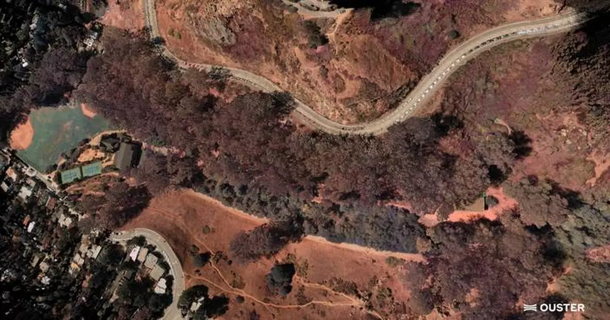
Ouster Rev8 OS1 Max native color lidar for survey-grade mapping

High precision drone mapping of Buena Vista Park using Ouster Rev8 OS1 Max native color lidar
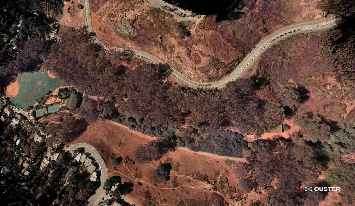
High altitude drone map of Glen Canyon in San Francisco using the Rev8 OS1 Max Native Color Radar