CHICAGO (AP) — Chicago Bears quarterback Tyson Bagent has been placed in the NFL concussion protocol, according to a person familiar with the situation, adding to the uncertainty surrounding the team's plans for Monday night's game against Philadelphia.
The person confirmed Bagent's status to The Associated Press on Tuesday on condition of anonymity because the Bears hadn't released their first injury report of the week.
Bagent was expected to take most of the first-team reps in practice after Caleb Williams left Sunday’s 9-3 loss to Minnesota with a right hamstring injury. Coach Ben Johnson said Monday that Williams is “week to week,” and he left open the possibility that the No. 1 pick in the 2024 draft could play against the Eagles.
If Williams and Bagent are unable to play in Week 3, the Bears likely would turn to Case Keenum. The 38-year-old Keenum has 66 career starts, but he hasn't thrown a pass in a regular-season game since Dec. 24, 2023, for Houston against Cleveland.
“I think we’ve got a really dynamic quarterback room in terms of guys that are challenging each other,” Johnson said Monday. "They’ve got great ideas, very smart, cerebral. They push each other, and I think we’ve got three guys that can win football games.”
Bagent was 5 for 9 for 54 yards against the Vikings. He was sacked by Dallas Turner on the final play of the game.
Bagent, 26, had a record-setting career at Division II Shepherd University before signing with the Bears in May 2023 as an undrafted free agent.
He made four starts while appearing in five games as rookie, passing for 859 yards and three touchdowns with six interceptions. He signed a two-year contract extension in August 2025.
“We’re ready for whatever,” offensive lineman Jonah Jackson said Monday. “We’ve had snaps with Tyson, we’ve had snaps with Case. It shouldn’t be too much of a change.”
Also Tuesday, Chicago made a change at long snapper. Scott Daly was signed from New Orleans' practice squad, and rookie Beau Gardner was waived. The Bears also signed defensive back Nick McCloud to their practice squad and released offensive lineman Kyle Hergel.
The 32-year-old Daly, who is from suburban Chicago, spent the previous two seasons with the Bears, appearing in 34 games.
See AP’s full NFL coverage here

Chicago Bears quarterback Tyson Bagent stands back to pass during the second half of an NFL football game against the Minnesota Vikings in Chicago, Sunday, Sept. 20, 2026. (AP Photo/Nam Y. Huh)

Chicago Bears quarterback Tyson Bagent (17) stands back to pass during the second half of an NFL football game in Chicago Minnesota Vikings, Sunday, Sept. 20, 2026. (AP Photo/David Banks)
MEXICO CITY (AP) — Hurricane Polo grew into one of the most powerful Pacific cyclones in decades on Tuesday, and it was expected to skirt Mexico’s southwestern coast as a Category 5 hurricane.
Polo was an “extremely dangerous” storm with maximum sustained winds of 175 mph (280 kph), the Miami-based National Hurricane Center said in an update from an NOAA Hurricane Hunter aircraft that was sent into the cyclone.
It was the third Category 5 hurricane of the Pacific season, following Genevieve and Lowell earlier this year. Category 5 is the highest level on the Saffir-Simpson scale, reflecting that a storm has maximum sustained winds exceeding 157 mph (253 kph).
Polo was centered 215 miles (345 kilometers) south of Zihuatanejo, Mexico, and nearly stationary over the Pacific Ocean on Tuesday evening. The hurricane center update said Polo was expected to travel in a generally west-northwestward direction over the next several days.
The hurricane set residents of Mexico's Pacific coast on edge once again after being walloped by powerful cyclones a number of times in recent years. Beaches emptied out and dark clouds swirled above choppy seas, while Mexican authorities temporarily suspended classes in a number of areas on Tuesday.
National Hurricane Center data shows that Polo has reached speeds comparable to only a few hurricanes to form in the region in recent decades, primarily Hurricane Patricia, which reached 215 mph (346 kph) in 2015.
“This is one of the strongest storms ever in the (Pacific) Basin,” said Kristen L. Corbosiero, professor at the University at Albany’s Department of Atmospheric & Environmental Sciences.
The U.S. Embassy in Mexico issued a weather alert, instructing citizens to avoid water and beaches and to heed warnings from Mexican authorities.
“Even if the storm does not make direct landfall, heavy rain may produce life-threatening flooding and mudslides. Hazardous ocean conditions—intensified by storms—may result in deadly rip currents and rogue waves,” the embassy wrote in a statement.
The rapid intensification of the storm has stunned scientists and authorities alike, with the NHC writing in a report that it was “truly remarkable” how quickly Polo gained strength in the past 24 hours.
Philip Klotzbach, research scientist in the Department of Atmospheric Science at Colorado State University, attributed the intensification to the weather phenomenon known as El Niño, which has fueled crippling droughts in Mexico and Central America and floods in other parts of the region.
In the Pacific, it has resulted in warmer waters and wind patterns that act as fodder for hurricanes, he said.
“There are all the ingredients that hurricanes need to get really strong really fast,” Klotzbach said.
For many on the Pacific coast, Polo brought back harsh memories of devastating Hurricane Otis in 2023, which tore through nearby port city Acapulco. The destruction and dozens of people killed by the storm were attributed, in part, to the rapid intensification of the hurricane because it gave residents little time to brace themselves, pull their boats onto shore or evacuate.
Mexican President Claudia Sheinbaum said in her morning press briefing that experts had indicated that the hurricane was not likely to touch land. Mexico’s navy shut down ports in the states of Guerrero and Michoacán as a precaution and warned civilians and fishermen to take care.
As Polo plowed by Acapulco on Tuesday, the swirling seas and normally packed beaches were left eerily empty and dark clouds churned overhead.
Heavy rain could produce flash flooding and mudslides. About 3 to 6 inches (8 to 15 centimeters) of rain was forecast for Guerrero and Michoacán states, with smaller amounts possible for coastal portions of Oaxaca, Colima and Jalisco states. Strong winds and rough surf were also expected.
Tropical Storm Odalys was also in the Pacific Ocean but far from land. The cyclone could become a hurricane sometime Tuesday, the hurricane center said. Odalys had maximum sustained winds of 70 mph (110 kph).
In the Atlantic Ocean, Fay weakened to a remnant. Maximum sustained winds were down to 35 mph (56 kph) Tuesday and the system was far southwest of the Azores.
No Atlantic hurricanes have formed yet this year, and this year has set a record for the longest start to a season without a hurricane. The effects of this year’s El Niño crush storms before they get going.
Brooks reported from Atlanta.
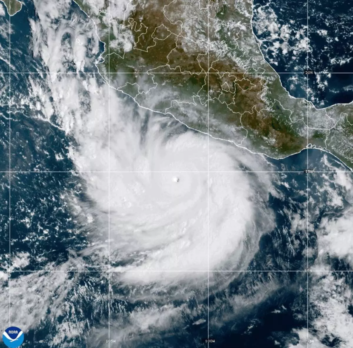
This photo provided by NOAA shows Hurricane Polo strengthening in the Pacific Ocean off the coast of Mexico on Tuesday, Sept. 22, 2026. (NOAA via AP)
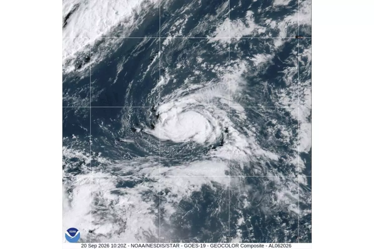
This satellite image from the National Oceanic and Atmospheric Administration shows Tropical Storm Fay, Sunday, Sept. 20, 2026. (NOAA via AP)
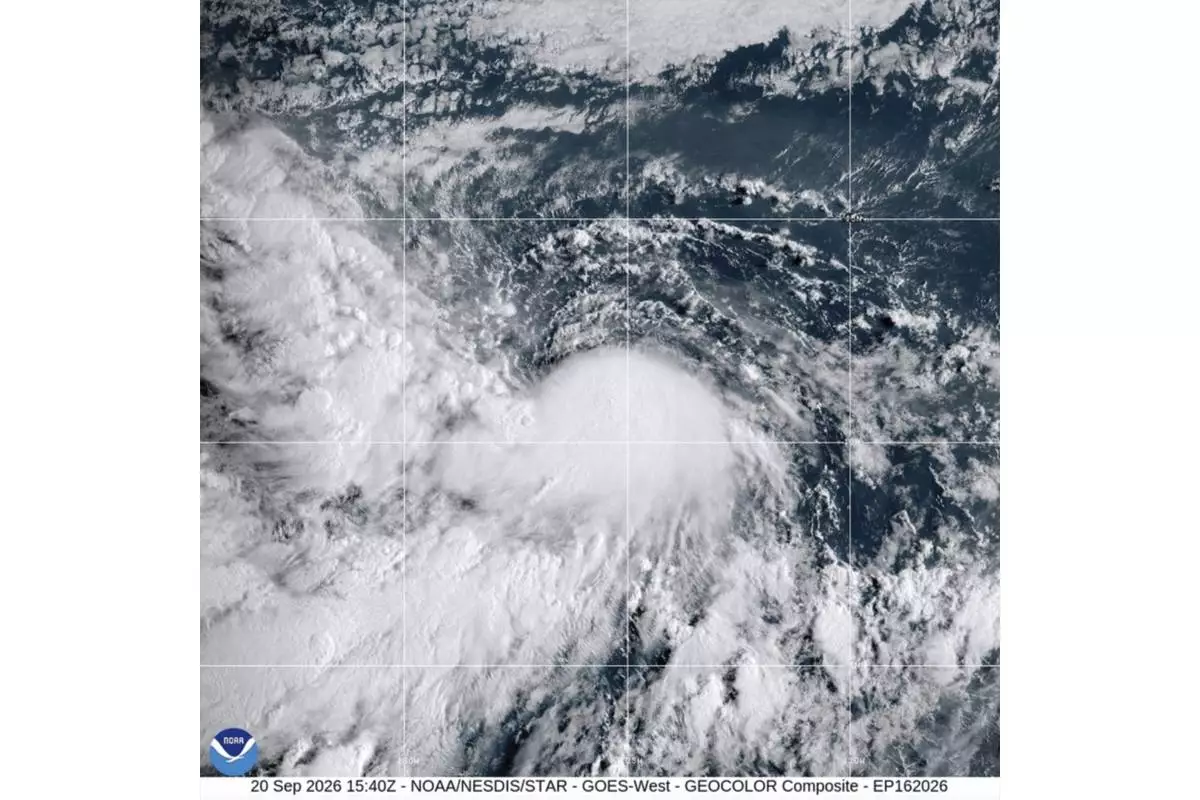
This satellite image from the National Oceanic and Atmospheric Administration shows Tropical Storm Odalys, Sunday, Sept. 20, 2026. (NOAA via AP)
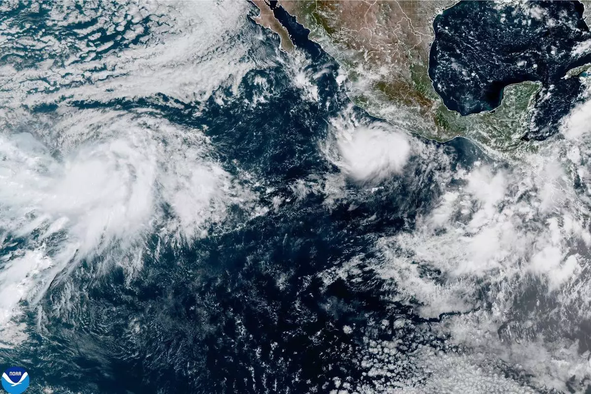
This photo provided by NOAA shows Hurricane Polo intensifying in the Pacific Ocean off the coast of Mexico on Monday, Sept. 21, 2026. (NOAA via AP)