Just because Google and Apple are now calling it Lake America doesn't mean everyone has to.
After President Donald Trump ordered a new name for Lake Ontario, the two U.S. tech giants quickly fell in line, relabeling the body of water on their digital maps.
The move sparked a backlash among some users, already unhappy with the companies' decisions to rename the Gulf of Mexico to the Gulf of America on their maps following a previous Trump edict.
The controversy and lingering worries about digital privacy have fueled interest in map services that aren't from Big Tech companies, especially Google Maps, which is the dominant player with about 80% of the market, according to most estimates.
Here’s a rundown of some of the most popular free map app alternatives:
MapQuest has been around for three decades but was overtaken by the rise of Google. It's now owned by California company System1.
Downloads of the MapQuest app surged in early September after Apple renamed Lake Ontario, topping the free app charts in both the U.S. and Canada on Apple's App Store.
The MapQuest app has real time traffic updates and turn by turn route guidance, and shows what's nearby, like gas stations and coffee shops.
However, the app isn't available outside the U.S. and Canada. But people in other countries can still use the MapQuest website.
The company is currently looking into making MapQuest more broadly accessible, after receiving requests for the app from “people in multiple countries," spokesperson Anne Brownlee said.
Another granddaddy in the mapping world, TomTom helped popularize GPS route mapping with the 2004 release of its TomTom GO, which the Dutch company says was the world’s first all-in-one portable satellite navigation device.
TomTom still sells physical devices but it also has a free map app for Google and Android phones that is designed “exclusively for drivers” with live traffic data and info on road hazards.
The TomTom app's mobile interface is clean and basic, with no ads and few extra features or settings. But its focus on drivers means there are no other route options such as walking or cycling.
HERE WeGo has been hailed by some as the closest non-Big Tech alternative to Google Maps. It began life as Nokia Maps and is now owned by a consortium of German carmakers including Audi, BMW, and Mercedes-Benz.
The free app, available for both iOS and Android devices, offers many of the same features as Google Maps. There's route mapping for various modes of transport — car, public transport, walking, bike and, in some regions, taxi.
Like Google Maps, drivers can add multiple stops to routes and users can choose different maps views like terrain, traffic and satellite — but there's no Street View.
If mobile signal is spotty or nonexistent, users can download country maps to navigate offline. Offline maps can also be downloaded on Google Maps, but the area is limited and they expire after a year.
HERE WeGo is just one of many lesser-known map apps based in the European Union that embrace the bloc’s strict privacy framework known as GDPR. Unlike Google, they don’t rely on vacuuming up masses of user data to sell ads targeted at those users.
HERE WeGo's business model is based on licensing deals with businesses like trucking companies. Others sell premium subscriptions alongside free versions.
Estonia's Organic Maps is completely free and based on data from the volunteer-run OpenStreetMap database. Netherlands-based OSMand is similar, but a subscription is needed for more than just basic functions.
Magic Earth is a Dutch route planner that says it never collects personal data or tracks user movements.
Sygic, from Slovakia, is a GPS route navigation app that offers free offline maps, but you’ll have to buy a subscription to get extra features including traffic updates, speed camera warnings and a dashcam function.
Mapy.com, from a Czech technology company, is an outdoor route planner known for detailed hiking and trail maps that can be downloaded for use offline.
Need to get across town without a car? Citymapper is a free journey planning app that’s a major rival to Google Maps when it comes to finding the best routes around a city on public transportation.
The app covers 430 cities around the world and options include bus, subway and ferry routes as well as taxi, rental bike and scooter options.
This GPS navigation map is focused on providing route guidance for drivers. It’s known for crowdsourcing real time traffic information such as car accidents and police speed cameras from other drivers.
But don’t be fooled by the name. Although it has its own distinct app and branding, Waze is actually owned by Google, which bought it in 2013.
Is there a tech topic that you think needs explaining? Write to us at onetechtip@ap.org with your suggestions for future editions of One Tech Tip.
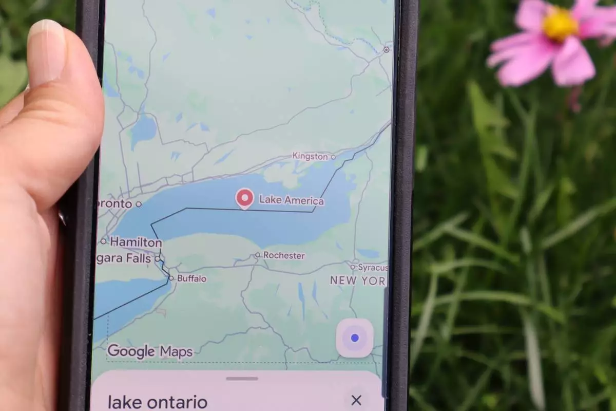
FILE - A search for "Lake Ontario" on Google Maps shows up as "Lake America" on Aug. 30, 2026, in Bellemont, Ariz. (AP Photo/Felicia Fonseca, File)
Isaias strengthened into the first hurricane of the Atlantic season late Wednesday as it surged towards the U.S. Gulf Coast, the National Hurricane Center said.
Forecasters warned that it was on track to make landfall between the Mississippi coast and the Florida Panhandle late Friday or early Saturday and was expected to bring heavy rains and potentially flash flooding.
The center of the cyclone was about 460 miles (745 kilometers) south-southwest of the Mississippi River, with maximum sustained winds around 75 mph (120 kph), according to an advisory from the Miami-based hurricane center.
Isaias is developing more than four months into the Atlantic hurricane season, nearly tying a 121-year-old record for the area’s latest-forming hurricane. According to the National Weather Service, the record dates to 1905, when the year’s first Atlantic hurricane formed on Oct. 8.
The Atlantic hurricane season has been unusually quiet this year because of a strong El Niño, which disrupts storm formation over that ocean. Storm activity has been ab After Isaias (pronounced ees-ah-EE’-ahs, according to the hurricane center) became a tropical storm Wednesday in the warm waters off eastern Mexico, communities in its potential path worked quickly to prepare. Some Gulf oil wells paused production while governors in Florida and Alabama declared a state of emergency for dozens of counties.
Isaias is expected to strike along a wide swath of coastline that’s very familiar with major hurricanes.
One of the 20th century’s worst storms, Hurricane Camille, killed more than 250 people after hitting land near Waveland, Mississippi, in 1969. Hurricane Katrina in 2005 razed neighborhoods in Mississippi, flooded New Orleans and killed nearly 1,400 people. And Hurricane Michael leveled homes and buildings near Panama City, Florida, in 2018.
Ahead of the storm, oil and gas producers shut down a significant share of offshore production in the Gulf, which accounts for almost 15% of crude pumped annually in the U.S.
As of Wednesday about 25% of the oil production in the region was temporarily halted, taking about 511,000 barrels a day off the market, according to the Marine Minerals Administration. It said eight of the Gulf's 371 manned oil platforms were evacuated.
With oil prices already high, the production cuts are steep enough to affect markets, though other Gulf hurricanes have caused larger disruptions, said Jim Burkhard, global head of crude oil market research for S&P Global Energy. More concerning, he said, is whether Isaias strikes as a powerful storm near refineries.
“I would characterize the oil market risk as moderate, but rising,” Burkhard said in an email.
In Gulf Shores, Alabama, organizers canceled the National Shrimp Festival, which had been scheduled for Thursday through the weekend. The event drew an estimated 325,000 people last year. Gulf Shores and Orange Beach issued a statement encouraging people in low-lying areas to voluntarily evacuate.
Gulf Shores resident Maranie Adams gathered water and other supplies as her family moved belongings, including a hot tub motor, to higher ground.
Adams said she, her husband and two adult sons planned to ride out the storm at home, roughly a half-mile from shore, sheltering indoors alongside their flock of chickens.
“We’re having to get crates to bring them into the house so they don’t blow away,” Adams said. “It’s going to be noisy.”
Alabama Gov. Kay Ivey issued a state of emergency for 40 counties, saying on the social platform X that, “While I hope for minimal impacts, we must take preparations seriously.”
Florida Gov. Ron DeSantis declared one for 25 counties in the Panhandle and Big Bend regions. The declaration activates the state's emergency management plan for hurricanes, allowing officials to deploy disaster responders and equipment. The state also planned to deploy a Miami-based urban search and rescue task force.
In Pensacola, electric utilities were pre-positioning crews to quickly repair any power outages. City officials provided sand for residents to fill sandbags to protect their homes against flooding. And Mayor D.C. Reeves urged people to check on older adult neighbors and others who might need help.
“Obviously no need to panic at this point,” Reeves told a news conference. “This is really about preparation.”
This story was updated to correct that Isaias was one day short of tying the record for the area’s latest-forming hurricane, it didn't tie it.
Rico reported from Atlanta, and Collins from Hartford, Connecticut. Associated Press journalists Russ Bynum in Savannah, Georgia, Julie Walker in New York and Hallie Golden in Seattle contributed to this report.
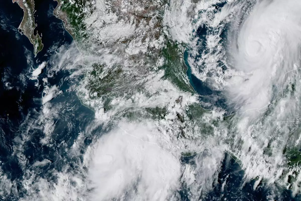
This GOES-19 GeoColor satellite image provided by the National Oceanic and Atmospheric Administration (NOAA) and taken at 4:57 p.m. EDT, Wednesday, Oct. 7, 2026, shows Tropical Storm Simon, bottom center, in the Pacific Ocean, off the southwestern coast of Mexico, and Tropical Storm Isaias, upper right, east of Mexico in the Gulf of Mexico. (NOAA via AP)
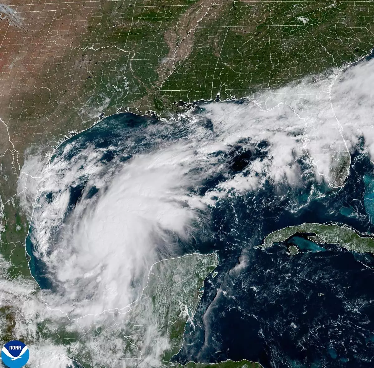
This satellite image from the National Oceanic and Atmospheric Administration shows Tropical Storm Isaias off the eastern coast of Mexico on Wednesday, Oct. 7, 2026. (National Oceanic and Atmospheric Administration via AP)
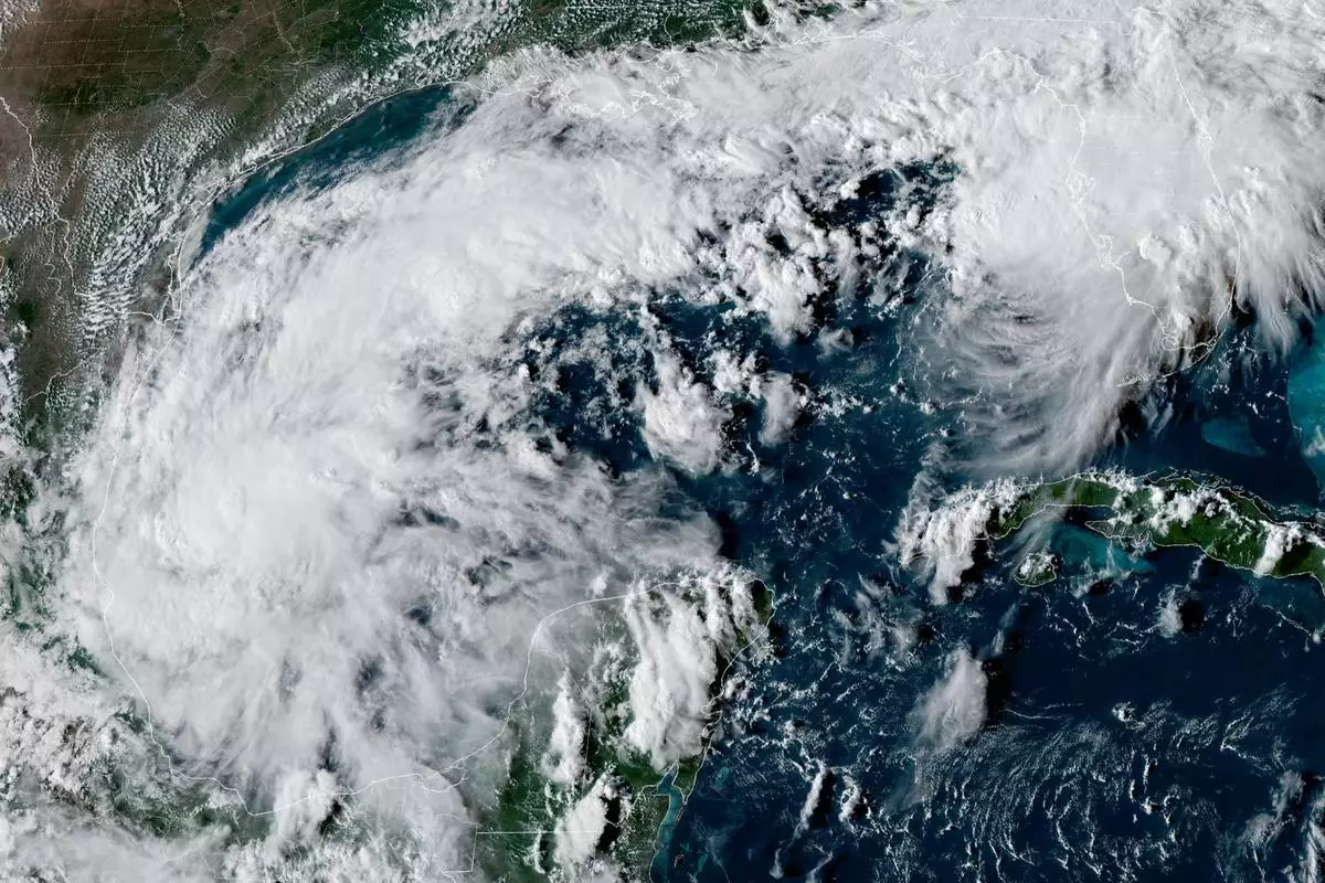
This satellite image from the National Oceanic and Atmospheric Administration shows Tropical Depression Nine forming over the Gulf of Mexico on Tuesday, Oct. 6, 2026. (NOAA via AP)