LAUSANNE, Switzerland & San Jose, Calif.--(BUSINESS WIRE)--Oct 8, 2026--
Today, Logitech (SIX: LOGN) (NASDAQ: LOGI) debuted Rally Speaker 2 Pro and Rally Speaker 2 Max, audio systems engineered to bring highly-precise sound targeting to extra-large conference rooms and training environments. Rally Speaker 2 Pro and Max house Logitech’s proprietary Sound Shape technology and mark Logitech’s entry into the Pro AV market.
This press release features multimedia. View the full release here: https://www.businesswire.com/news/home/20261008507902/en/
Acoustics are particularly tricky in high-value spaces such as executive boardrooms and divisible rooms. Ceiling speakers—the usual fix—are costly to install, involve complex wiring, and result in voices coming from unnatural directions while sound waves crash into each other, creating echo and cognitive fatigue. Rally Speaker 2 Pro and Max—speakers at the front of the room only—present a less expensive, simpler way to guarantee uniform sound coverage throughout these spaces.
"Today, we cross the boundary from science fiction into a bold new era of human interaction,” said Karthik Rajagopal, Head of VC Engineering at Logitech. “We’ve replaced the brute-force approach of cranking up room volume with wave-field physics—essentially steering sound waves through open air with surgical precision.”
Here is how the technology in Rally Speakers Pro and Max works:
International Boardrooms of the Future: A Peek at What’s Possible
In an early preview, Logitech showed an exciting multilingual concept in development. Because it targets sound so precisely, a Rally Speaker 2 Max mounted at the front can aim two entirely different audio feeds at opposite sides of the room at the same time—allowing, for example, English speakers on the left and French speakers on the right to hear their respective languages without hearing the other side, without requiring separate speakers distributed across each area. Logitech is working closely with partners to integrate Interpreter in Microsoft Teams meetings and Voice Translator in Zoom Meetings with this technology.
"The international boardroom of the future isn't about finding a single universal dialect—it’s about translation coexisting in the same acoustic space. Sound Shape unlocks big potential for cross-border diplomacy, global M&A negotiations, and multi-regional training environments," Rajagopal added.
Availability
Rally Speaker 2 Pro and Rally Speaker 2 Max can be demoed at Logitech Experience Center in Silicon Valley. Commercial availability is slated for summer 2027.
About Logitech
Logitech designs software-enabled hardware solutions that help businesses thrive and bring people together when working, creating and gaming. As the point of connection between people and the digital world, our mission is to extend human potential in work and play, in a way that is good for people and the planet. Founded in 1981, Logitech International is a Swiss public company listed on the SIX Swiss Exchange (LOGN) and on the Nasdaq Global Select Market (LOGI). Find Logitech and more of its business products and enterprise solutions at www.logitech.com/business, the company blog, Logitech Business or @LogitechBiz.

Logitech Rally Speaker 2 Pro and Rally Speaker 2 Max feature exclusive Sound Shape audio technology.
MIAMI (AP) — Isaias strengthened into a Category 2 hurricane as it barreled toward the U.S. Gulf Coast on Thursday, as communities raced to prepare for its arrival by stacking sandbags, closing schools and offices, and cautioning people in flood-prone areas to move to higher ground.
The storm’s sustained top winds eclipsed 96 mph (154 kph), bumping it into the higher category.
Isaias, the first hurricane of the Atlantic season, was forecast to intensify rapidly and bring strong winds and potentially life-threatening storm surges to the Florida Panhandle, southern Alabama and southern Mississippi. Landfall was expected on the northern Gulf Coast late Friday or early Saturday. Heavy rain with the risk of flooding was possible into the weekend as far inland as the Tennessee Valley.
The hurricane had maximum sustained winds of 100 mph (155 kph) and was moving northeast at 12 mph (19 kph), the hurricane center in Miami said. It was centered about 325 miles (525 kilometers) south of the mouth of the Mississippi River.
Coastal communities moved quickly to prepare. Some Gulf oil wells paused production, and several school districts canceled late-week classes. Okaloosa and Walton counties, in the Florida Panhandle, announced mandatory evacuations for some coastal areas. Communities closed government offices as of Thursday afternoon, and officials in some other areas urged voluntary evacuations.
The governors of Florida and Alabama, meanwhile, declared a state of emergency for dozens of counties.
THIS IS A BREAKING NEWS UPDATE. Check back for updates. AP’s earlier story follows below.
Hurricane Isaias strengthened Thursday as it barreled toward the U.S. Gulf Coast, prompting orders for tourists to trade beaches for safer spots inland, sending locals scurrying for gas and groceries, and leading fishing crews to secure their boats before the destructive storm's arrival.
The first hurricane of the Atlantic season was forecast to intensify rapidly and cause dangerous conditions in the Florida Panhandle, southern Alabama and southern Mississippi when it makes landfall late Friday or early Saturday. Heavy rain and flooding were possible into the weekend as far north as Tennessee and North Carolina.
“We are expecting Isaias to be a dangerous hurricane when it makes landfall,” Michael Brennan, director of the National Hurricane Center in Miami, said Thursday.
He added: “Today is the day to prepare and get ready and be in your safe place by tomorrow as conditions will rapidly deteriorate along the northern Gulf Coast as Isaias approaches.”
The hurricane had maximum sustained winds of about 85 mph (140 kph) and was moving east-northeast at 10 mph (17 kph) as of early Thursday afternoon, the hurricane center said. It was centered about 355 miles (570 kilometers) south of the mouth of the Mississippi River.
Coastal communities moved quickly to prepare, as Alabama Gov. Kay Ivey ordered non-residents to immediately evacuate Gulf Shores, Orange Beach and Dauphin Island. Videos on social media Thursday showed traffic at a standstill on a highway leading out of Gulf Shores, where double-red beach flags signaled water access was closed.
At least four Florida school districts canceled late-week classes, while several counties announced mandatory evacuations for some coastal areas. The governors of Florida and Alabama declared states of emergency for dozens of counties ahead of Isaias' arrival, and Florida Gov. Ron DeSantis said about 5,000 National Guard troops were expected to mobilize by Friday.
On Dauphin Island, a 15-mile-long (24-kilometer-long) barrier island off the Alabama coast, officials encouraged voluntary evacuations, particularly on its popular western section, which is vulnerable to storm surge.
Mayor Jeff Collier said he didn't anticipate substantial damage, “but at the same time, these things are very fickle and a little jog here or there, or some last-minute increase in strength — we just have to be prepared for the worst.”
Water from the storm surge and high tide could reach heights of 5 to 7 feet (1.5 to 2 meters) in parts of Alabama and Mississippi, forecasters said. Isaias also could dump up to 15 inches (38 centimeters) of rain on coastal areas and spawn tornadoes overnight Friday into Saturday from Alabama to the Florida Panhandle and southwestern Georgia. The hurricane is expected to quickly weaken after coming ashore.
The National Weather Service told communities from Ocean Springs, Mississippi, to Gulf County, Florida, to prepare for the possibility of “long-duration power outages.”
Isaias developed more than four months into the Atlantic hurricane season and was one day short of tying a 121-year-old record for the area’s latest-forming hurricane. That record dates to 1905, when the year’s first Atlantic hurricane formed on Oct. 8.
The Atlantic hurricane season has been unusually quiet this year because of a strong El Niño, which disrupts storm formation over the Atlantic. Storm activity has been above average in the Pacific, where Tropical Storm Simon formed Wednesday off Mexico and was forecast to strengthen into a Category 4 hurricane. Farther north, Tropical Storm Rachel was expected to reach Baja California, Mexico, and Southern California this weekend.
Isaias is expected to strike a swath of coastline that’s familiar with major hurricanes.
One of the 20th century’s worst storms, Hurricane Camille, killed more than 250 people after hitting land near Waveland, Mississippi, in 1969. Hurricane Katrina in 2005 razed neighborhoods in Mississippi, flooded New Orleans and killed nearly 1,400 people. And Hurricane Michael leveled homes and buildings near Panama City, Florida, in 2018.
Ahead of the storm, oil and gas producers shut down a significant share of offshore production in the Gulf, which accounts for almost 15% of crude pumped annually in the U.S.
As of Thursday, about 63% of the oil production in the region had been temporarily halted, taking nearly 1.3 million barrels a day off the market, according to the Marine Minerals Administration. It said 121 of the Gulf’s 371 manned oil platforms had been evacuated.
With oil prices already high, the production cuts are steep enough to affect markets, though other Gulf hurricanes have caused larger disruptions, said Jim Burkhard, global head of crude oil market research for S&P Global Energy. More concerning, he said, is whether Isaias strikes as a powerful storm near refineries.
As it moves inland, Isaias might also disrupt Saturday’s college football showdown between rivals Georgia and Alabama, a game President Donald Trump planned to attend.
In Loxley, a small Alabama community where county officials urged voluntary evacuations, Nichole Eubanks and her husband prepared to ride out the storm on their farm, which is home to dozens of animals, including pigs, donkeys and about 20 rescued cats.
They planned to put contact information on the hooves of their goats, donkeys and pigs in case they got loose.
“It’s definitely scary, and you never really know where these storms are going to go and how bad it’s going to be until it gets there,” said Eubanks, 35.
In the Alabama fishing village of Bayou La Batre, Tony Rice and Lance Connor installed doors on their fishing boat Thursday to protect the vessel. The boat was one of many moored there, and Rice said they planned to move it to a less-crowded spot to decrease the chances of it bumping into others.
In Pensacola, Florida, officials said the airport will close to commercial flights Friday morning. Mayor D.C. Reeves urged residents to check on older adult neighbors and others who might need help.
“Obviously no need to panic at this point,” Reeves told a news conference. “This is really about preparation.”
Rico reported from Atlanta and Collins reported from Hartford, Connecticut. Also contributing were Associated Press reporters Kim Chandler in Montgomery, Alabama; Hallie Golden in Seattle; Kathy McCormack in Concord, New Hampshire; John Raby in Charleston, West Virginia; Laura Turbay in Little Rock, Arkansas; and Julie Walker in New York.
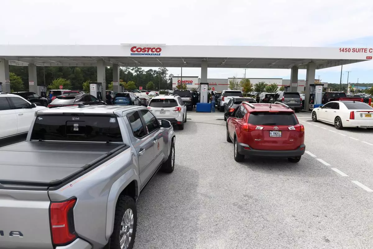
Residents line up to refuel at Costco Wholesale Gas Station ahead of Hurricane Isaias' expected landfall along the Gulf Coast in Mobile, Alabama, Thursday, Oct. 8, 2026. (AP Photo/Octavio Jones)
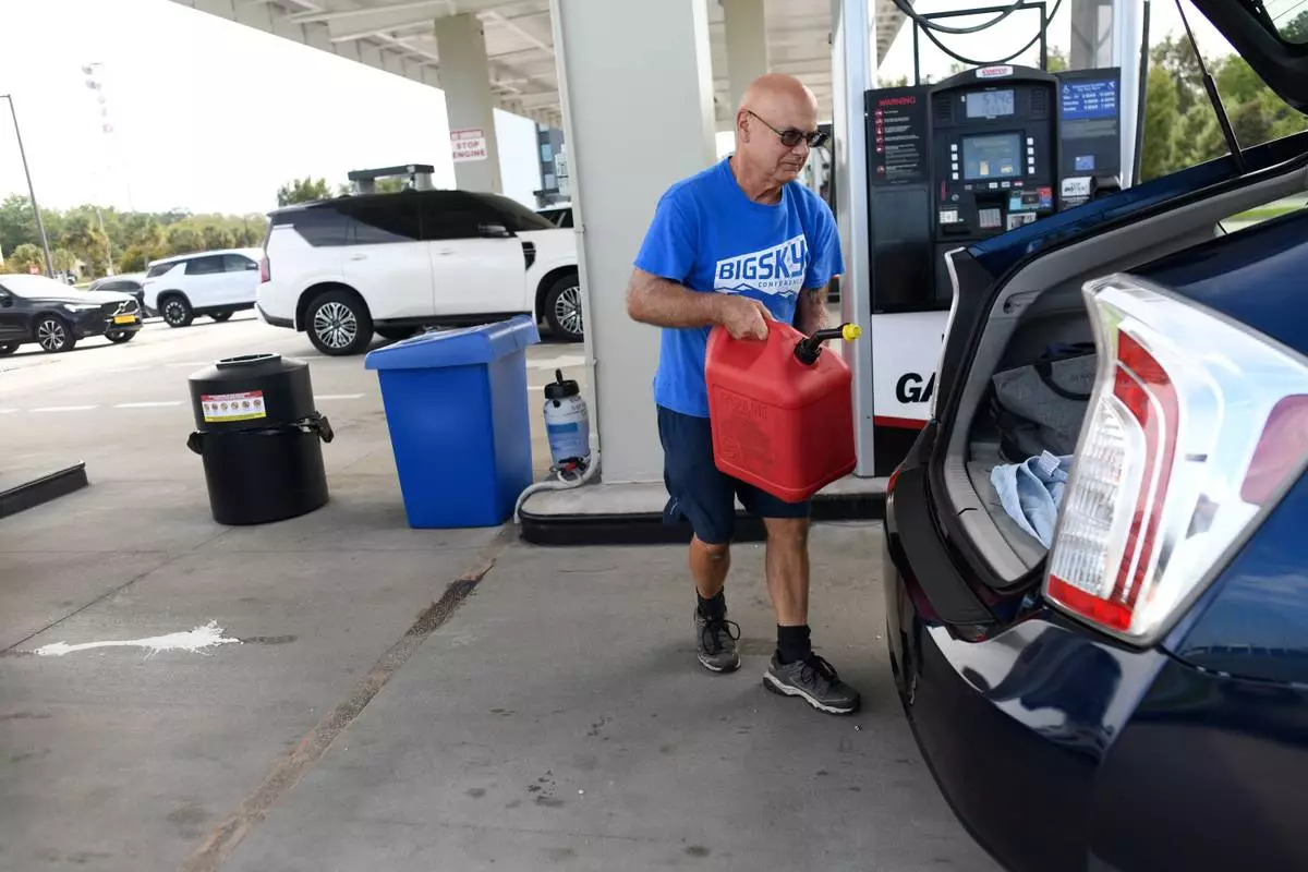
A resident walks to his vehicle after filling up a gas container at the Costco Wholesale Gas Station ahead of Hurricane Isaias' expected landfall along the Gulf Coast in Mobile, Alabama, Thursday, Oct. 8, 2026. (AP Photo/Octavio Jones)
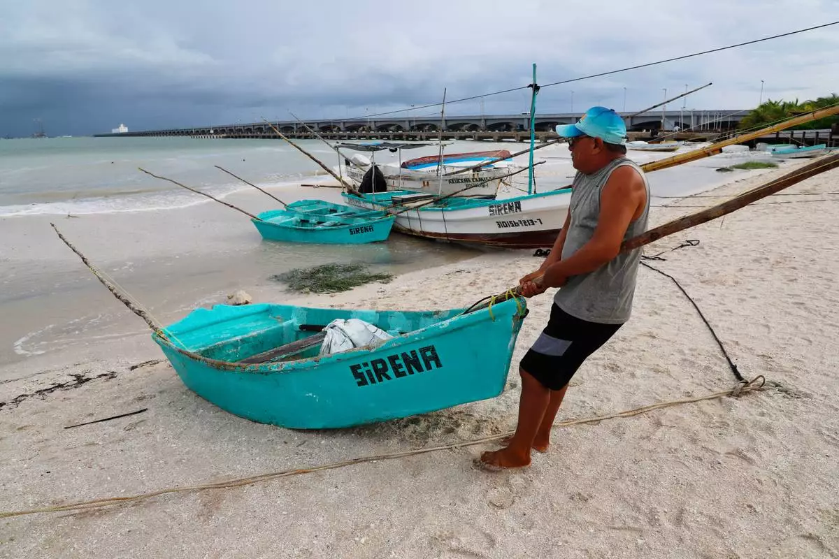
Gaspar Amalla pulls his boat out of the water as Hurricane Isaias passes through the Gulf of Mexico, north of Progreso, Yucatan state, Mexico, Thursday, Oct. 8, 2026. (AP Photo/Martin Zetina)
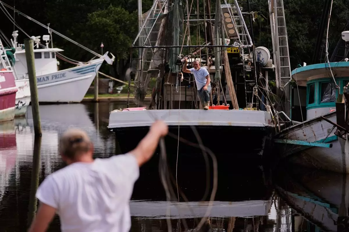
Boat owner Tony Rice, foreground, and his friend Lance Connor haul doors onto his boat to secure it as Hurricane Isaias approaches Bayou La Batre, Ala., Thursday, Oct. 8, 2026. (AP Photo/Gerald Herbert)
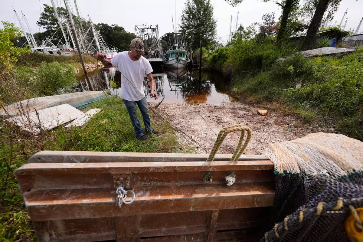
Boat owner Tony Rice prepares to haul doors onto his boat to secure it as Hurricane Isaias approaches Bayou La Batre, Ala., Thursday, Oct. 8, 2026. (AP Photo/Gerald Herbert)

Residents pick up sandbags for storm preparation at the James Seals Jr. Parks & Recreation Center ahead of Hurricane Isaias' expected landfall along the Gulf Coast, Thursday, Oct. 8, 2026, in Mobile, Ala. (AP Photo/Octavio Jones)
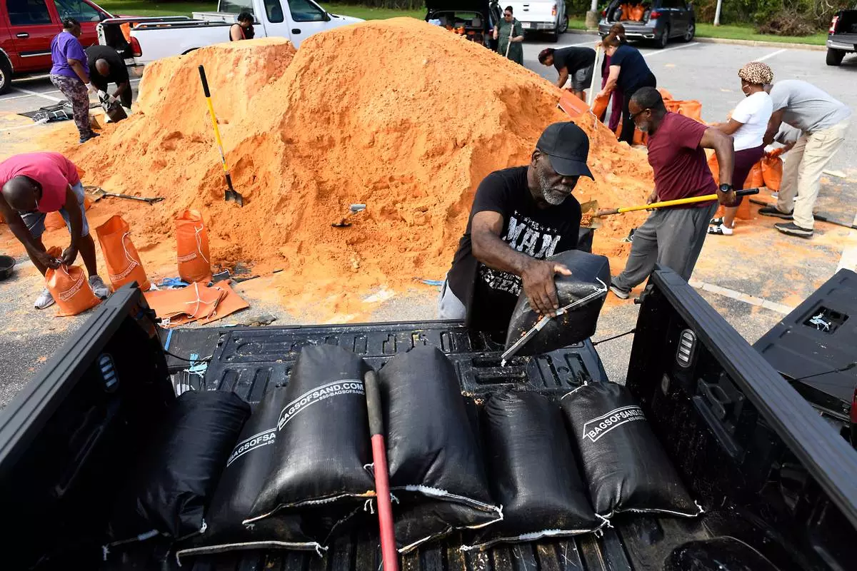
Residents pick up sandbags for storm preparation at the James Seals Jr. Parks & Recreation Center ahead of Hurricane Isaias' expected landfall along the Gulf Coast, Thursday, Oct. 8, 2026, in Mobile, Ala. (AP Photo/Octavio Jones)
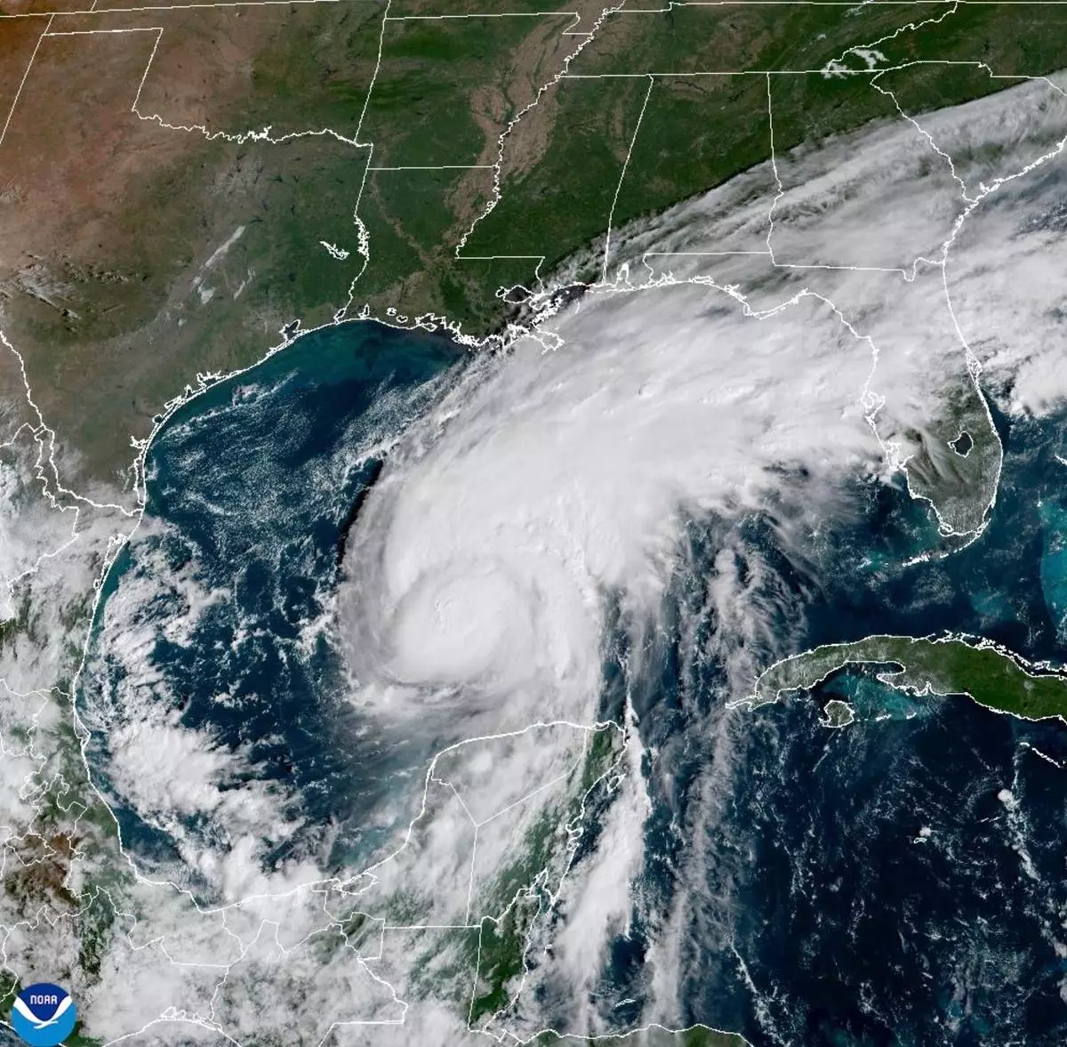
This satellite image from the National Oceanic and Atmospheric Administration shows Hurricane Isaias surging toward the U.S. Gulf Coast on Thursday, Oct. 8, 2026. (National Oceanic and Atmospheric Administration via AP)

Residents pick up sandbags at the James Seals Jr. Parks & Recreation Center as they prepare for Hurricane Isaias expected landfall along the Gulf Coast, Thursday, Oct. 8, 2026, in Mobile, Ala. (AP Photo/Octavio Jones)
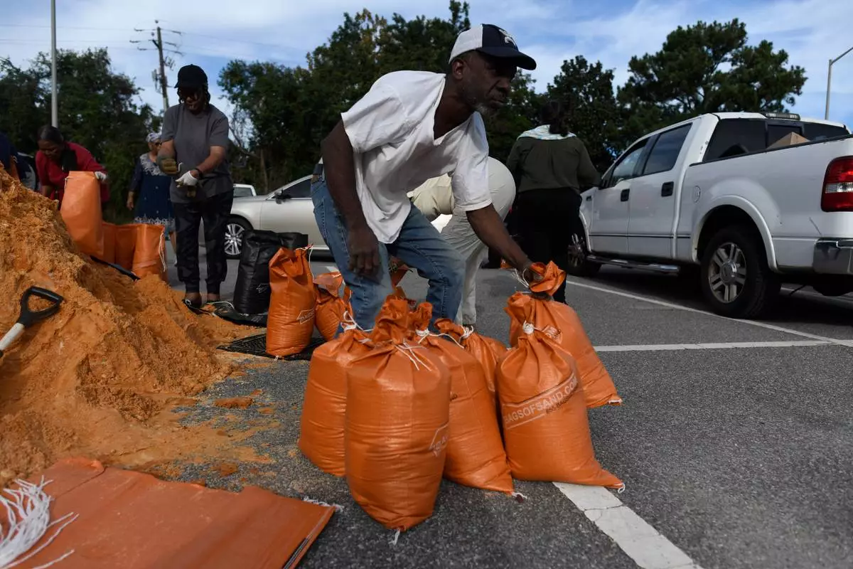
Residents pick up sandbags for storm preparation at the James Seals Jr. Parks & Recreation Center ahead of Hurricane Isaias, expected landfall along the Gulf Coast, Thursday, Oct. 8, 2026, in Mobile, Ala. (AP Photo/Octavio Jones)
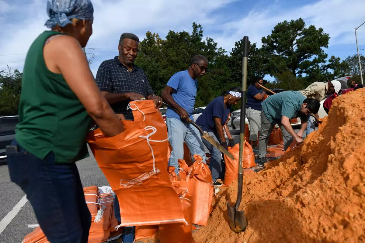
Residents pick up sandbags for storm preparation at the James Seals Jr. Parks & Recreation Center ahead of Hurricane Isaias' expected landfall along the Gulf Coast, Thursday, October 8, 2026, in Mobile, Alabama (AP Photo/Octavio Jones)

Residents pick up sandbags at the James Seals Jr. Parks & Recreation Center as they prepare for Hurricane Isaias expected landfall along the Gulf Coast, Thursday, Oct. 8, 2026, in Mobile, Ala. (AP Photo/Octavio Jones)
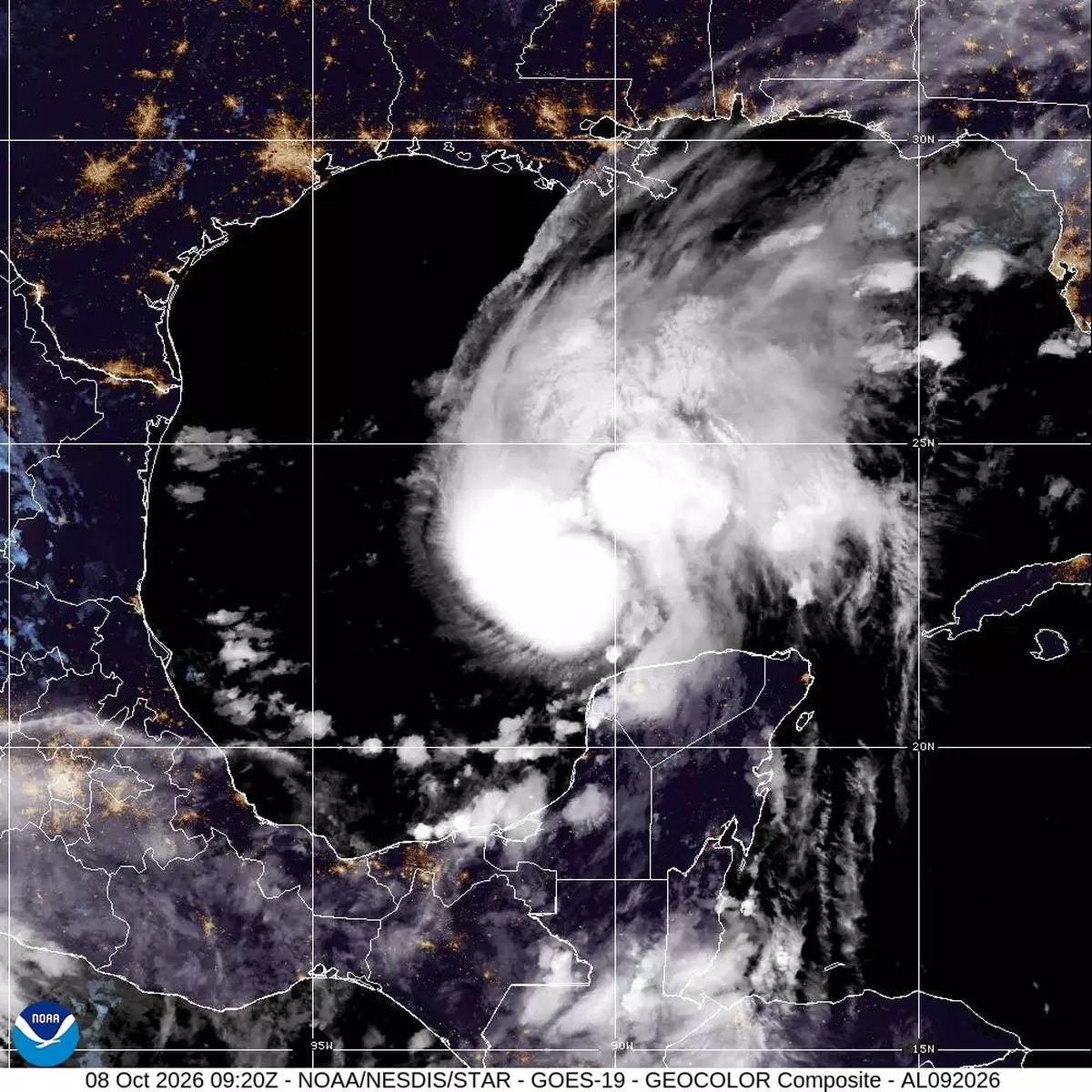
This satellite image from the National Oceanic and Atmospheric Administration shows Hurricane Isaias in the Gulf of Mexico, Thursday, Oct. 8, 2026. (National Oceanic and Atmospheric Administration via AP)
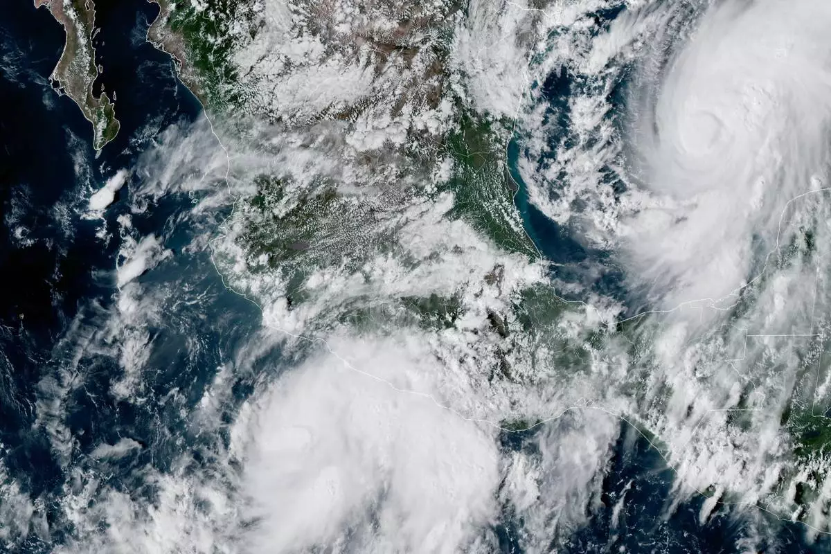
This GOES-19 GeoColor satellite image provided by the National Oceanic and Atmospheric Administration (NOAA) and taken at 4:57 p.m. EDT, Wednesday, Oct. 7, 2026, shows Tropical Storm Simon, bottom center, in the Pacific Ocean, off the southwestern coast of Mexico, and Tropical Storm Isaias, upper right, east of Mexico in the Gulf of Mexico. (NOAA via AP)
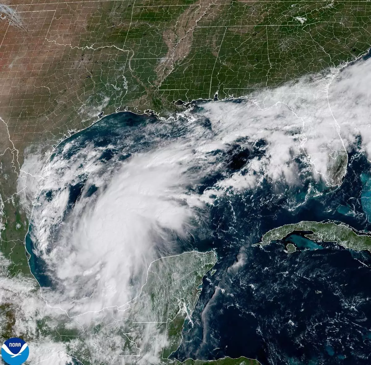
This satellite image from the National Oceanic and Atmospheric Administration shows Tropical Storm Isaias off the eastern coast of Mexico on Wednesday, Oct. 7, 2026. (National Oceanic and Atmospheric Administration via AP)