A powerful winter storm was sweeping east from the Plains on Sunday, driven by what meteorologists describe as an intense cyclone that is taking aim at much of the country with a mixture of snow, ice, rain and strong winds.
“Part of the storm system is getting heavy snow, other parts of the storm along the cold front are getting higher winds and much colder temperatures as the front passes," said Bob Oravec, a lead forecaster at the National Weather Service office in College Park, Maryland. "They’re all related to each other — different parts of the country will be receiving different effects from this storm."
Click to Gallery
Heavy snow falls along Nicollet Mall Sunday Dec.28, 2025 in Minneapolis. (Jerry Holt /Star Tribune via AP)
Devon Jordan, of Brainerd , helps a person start their car durning heavy snow fall on Sunday, Dec. 28, 2025 in downtown Minneapolis. (Jerry Holt /Star Tribune via AP)
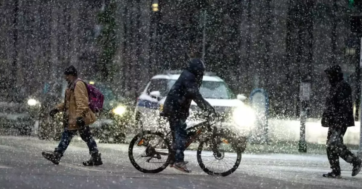
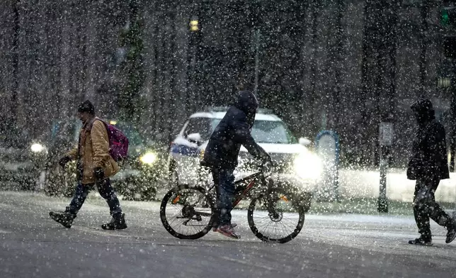
People cross 7th street in the heavy snow on Sunday Dec. 28, 2025 in downtown Minneapolis. (Jerry Holt /Star Tribune via AP)
A Christmas mural overlooks fresh snow in Lowville, N.Y., on Saturday, Dec. 27, 2025. (AP Photo/Cara Anna)
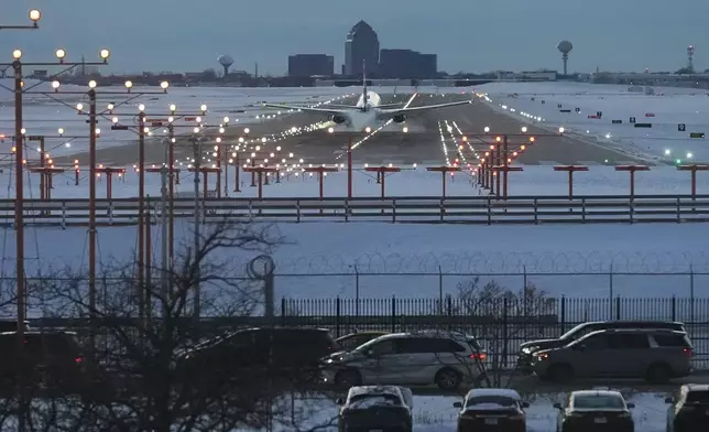
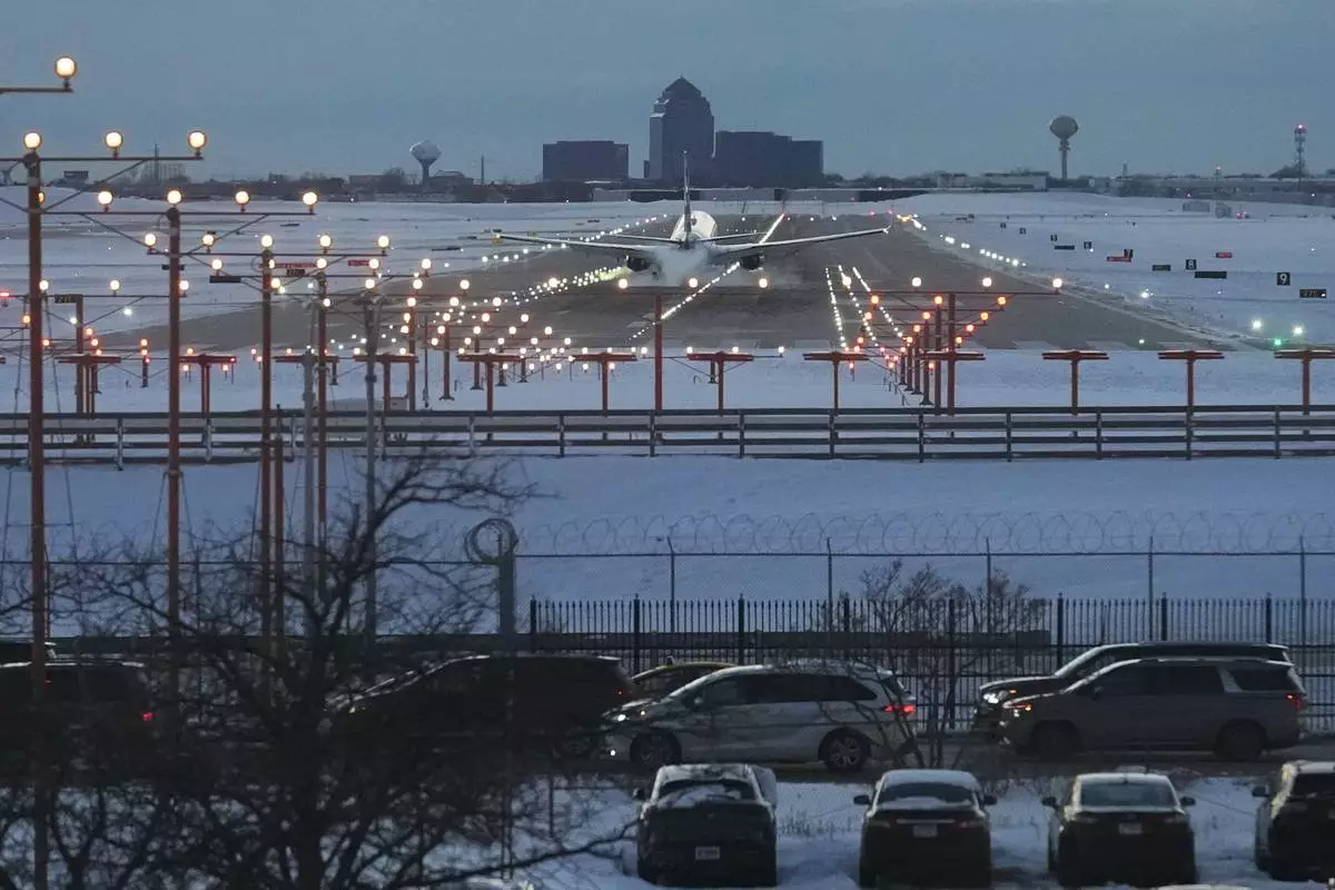
FILE - An American Airlines plane arrives at the O'Hare International Airport in Chicago, Sunday, Nov. 30, 2025. (AP Photo/Nam Y. Huh, File)
Snow and strengthening winds spread Sunday across the Upper Midwest, where the National Weather Service warned of whiteout conditions and possible blizzard conditions that could make travel impossible in some areas. Snowfall totals were expected to exceed a foot (30 centimeters) across parts of the upper Great Lakes, with up to 2 feet (60 centimeters) possible along the south shore of Lake Superior.
Waves on Lake Superior will likely top 25 feet (7.6 meters) by dawn Monday, with towering waves also projected for the other Great Lakes, forecasters said.
“Since the infamous Edmund Fitzgerald storm in ’75, we’ve had zero major incidents on the lake,” said Ben Warren, a National Weather Service meteorologist in Marquette, Michigan.
Forecasts have improved substantially since 29 people perished when the Edmund Fitzgerald iron ore freighter was swallowed by Lake Superior on Nov. 10, 1975. The weather service had forecast waves of up to 16 feet (4.9 meters) shortly before the Edmund Fitzgerald sank.
The National Weather Service warned of “dangerous wind chills” as low as minus 30 degrees Fahrenheit (minus 34.4 degrees Celsius) in North Dakota and into Minnesota from Sunday night into Monday.
In the South, meteorologists warned of severe thunderstorms expected to signal the arrival of a sharp cold front — sometimes referred to as a “Blue Norther” — bringing a sudden plunge in temperatures and strong north winds that will end days of record warmth around the region.
The snowy holiday season in the Upper Midwest and Northeast comes as springlike warmth continued in much of the nation’s midsection and South amid record high temperatures.
The high temperature in Atlanta was around 72 F (22 C) on Sunday, continuing a warming trend after climbing to 78 F (about 26 C) to shatter the city’s record high temperature for Christmas Eve, the National Weather Service said. Numerous other record high temperatures were seen across the South and Midwest on the days after Christmas.
But that record heat is quickly coming to an end, forecasters say.
A cold front is expected to bring rain to much of the South late Sunday night into Monday, bringing much colder weather by Tuesday. The abrupt change will drop the low temperature in Atlanta to 25 F (minus 3.9 C) by early Tuesday morning. The colder temperatures in the South are expected to persist through New Year’s Day.
In Dallas, Sunday temperatures in the lower 80s (upper 20s C) could drop down to the mid 40s (single digits Celsius). In Little Rock, high temperatures of around 70 (21 C) on Sunday could drop down to highs in the mid-30s on Monday.
“We’re definitely going back towards a more winter pattern," Oravec said.
Over the next 48 hours, the cyclone is expected to produce heavy snow and blizzard conditions in the Midwest and Great Lakes, freezing rain in New England, thunderstorms across the eastern U.S. and South, and widespread strong winds.
The storm is expected to intensify as it moves east, drawing energy from a sharp clash between frigid air plunging south from Canada and unusually warm air that has lingered across the southern United States, according to the National Weather Service.
It follows thousands of flight delays and cancellations across the Northeast and Great Lakes regions earlier this weekend due to snow, as thousands took to the roads and airports during the busy travel period between Christmas and New Year’s. Delays and cancellations continued Sunday.
On the other side of the country, California was experiencing a fairly dry weekend after powerful storms battered the state with heavy rains, flash flooding and mudslides.
Willingham reported from Concord, New Hampshire. Martin reported from Kennesaw, Georgia.

Heavy snow falls along Nicollet Mall Sunday Dec.28, 2025 in Minneapolis. (Jerry Holt /Star Tribune via AP)

Devon Jordan, of Brainerd , helps a person start their car durning heavy snow fall on Sunday, Dec. 28, 2025 in downtown Minneapolis. (Jerry Holt /Star Tribune via AP)
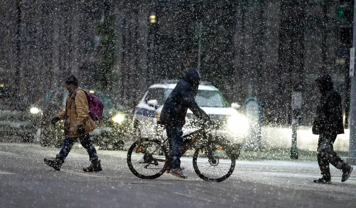
People cross 7th street in the heavy snow on Sunday Dec. 28, 2025 in downtown Minneapolis. (Jerry Holt /Star Tribune via AP)

A Christmas mural overlooks fresh snow in Lowville, N.Y., on Saturday, Dec. 27, 2025. (AP Photo/Cara Anna)
FILE - An American Airlines plane arrives at the O'Hare International Airport in Chicago, Sunday, Nov. 30, 2025. (AP Photo/Nam Y. Huh, File)
CHICAGO (AP) — A broad and erratic patchwork of severe weather rumbled across much of the U.S. on Sunday, dumping heavy snow and making roads impassable in the Upper Midwest while damaging high winds swept across the Plains. Hawaii also continues to be affected by severe flooding.
And portions of the mid-South readied for late-day thunderstorms that forecasters say will spread eastward and by Monday threaten a large swath of the Eastern U.S., with mid-Atlantic states — including Washington, D.C. — most at risk for high winds and tornadoes.
Successive punches of snow, wind and severe weather are “going to impact the eastern half of the United States," AccuWeather senior meteorologist Tyler Roys said in an interview. Beyond the threat to lives and property, “whether it’s wind gusts from a squall line, blizzard or snow, or just wind because of the storm, you’re looking at several major airports being impacted.”
More than a foot (30.5 centimeters) of snow fell in some portions of the Minnesota and Wisconsin as of Sunday morning, according to National Weather Service reports, with another several inches likely to fall in the Minneapolis area amid blizzard warnings by the weather service.
Warnings of hazardous road conditions were issued across Minnesota, Michigan and Wisconsin, where transportation officials warned of worsening conditions Sunday with low visibility and snow-covered roadways.
More than 600 flights flying out of and into the Minneapolis-Saint Paul International Airport were canceled Sunday, according to FlightAware, a website that tracks flight disruptions. Dozens more through Detroit were also scrapped.
Areas of central Wisconsin and Michigan's Upper Peninsula are likely to see over 2 feet (61 centimeters) of snow, with higher isolated totals, Roys said. Lower snow accumulations in places like Chicago and Milwaukee will still likely create troubles for commuters, he added.
Wisconsin snowplow driver Aaron Haas said it was one of the worst storms he had seen in years. On Sunday, he was stacking piles of snow as high as his truck in the town of Marshfield.
“You can’t see anything when you’re on the highways outside of the city,” he said.
Jim Allen, 45, who lives on the Upper Peninsula, said his family stocked up on necessities and he was ready to clear snow several times Sunday with the shovel and snowblower.
"We’re basically prepared to just kind of hunker down for a few days if we need to,” Allen said.
Rain continued falling Sunday in Hawaii, where acres of farmland and homes have been flooded, roads have been closed and shelters opened. PowerOutage.us, which tracks outages nationwide, reported over 50,000 electric customers in Hawaii without power as of early Sunday.
Flash flooding has been a major problem in recent days in places like Maui, Molokai and the Big Island, where rain had been falling from 1 to 2 inches (2.5 to 5.1 centimeters) an hour overnight, according to the Hawaii Emergency Management Agency.
Maui County Mayor Richard Bissen said in a social media post late Saturday that some areas of Maui had received 20 inches (51 centimeters) of rain in the previous 24 hours.
“We’re seeing flooding, landslides, sinkholes, debris and downed power lines across the county,” he said. Expressing gratitude in the Hawaiian language, the mayor added "mahalo for continuing to look out for one another.”
Footage incorporated into the mayor's video showed washed out or collapsed roads, a car stuck in floodwaters and raging waters. National Guard and fire department workers have made multiple floodwater rescues, Bissen said.
Tom and Carrie Bashaw said they could do little to prevent part of their home in Maui's Iao Valley from collapsing beneath rising waters on Friday. The water's force starting overtaking nearby trees.
“When we lost the mango and monkey pod, we started throwing stuff in bags and packing up,” Tom Bashaw told HawaiiNewsNow. They returned Saturday morning and “the whole backside of the house” was gone, he said.
About 180,000 utility customers in five Great Lakes states were without electricity as of Sunday afternoon, according to PowerOutage.us. A significant portion occurred Friday when gusts in the region reached 85 mph (137 km).
About 30 Nebraska National Guard have been deployed to help combat multiple wildfires across a broad swath of range and grassland, the state's Emergency Management Agency said.
Three of the largest wildfires have damaged well over 900 square miles (2,331 square kilometers), the agency said. One fire-related fatality was reported on Friday, and in a news release Nebraska Gov. Jim Pillen urged residents to follow locally-issued evacuation orders, adding that winds were "supposed to be extraordinary” on Sunday.
The weather service issued a high-wind warning Sunday for most of Nebraska, with wind gusts of up to 60 mph (97 kph) possible amid falling snow. Roys said high winds will affect a region from the U.S.-Mexico border to the Great Lakes, and from Denver eastward to the Appalachian Mountains.
The National Weather Service warned that a line of severe storms with damaging winds would cross much of the Eastern U.S. by late Monday. It was to begin Sunday afternoon in the Mississippi, Tennessee and Ohio valleys.
The storm threat was expected to enter the Appalachians late Sunday and early Monday, then move toward the East Coast, where “severe thunderstorms with widespread damaging winds and several tornadoes” were expected during the day Monday, a weather service report said.
A stretch from parts of South Carolina to Maryland appeared most likely to experience particularly damaging winds Monday afternoon, the weather service said. That could include Raleigh, North Carolina; Richmond, Virginia and the nation's capital. The weather service said an increased — albeit much lower — risk stretched north to a portion of New York and south to northern Florida.
__
Robertson reported from Raleigh, North Carolina. Associated Press writer Julie Walker in New York also contributed to this report.

Malcolm and Lincoln firefighters respond to a wildfire in Denton, Neb., on Thursday, March 12, 2026. (Kenneth Ferriera/Omaha World-Herald via AP)

In this photo provided by Maui County, a boat is grounded on a beach off Kihei, Hawaii, during heavy rain on Friday, March 13, 2026. (Maui County via AP)

This photo provided by Maui County shows flooding from days of downpours in Hana, Hawaii, on Friday, March 13, 2026. (Maui County via AP)

This photo provided by Maui County shows flooding from days of downpours in Hana, Hawaii, on Friday, March 13, 2026. (Maui County via AP)