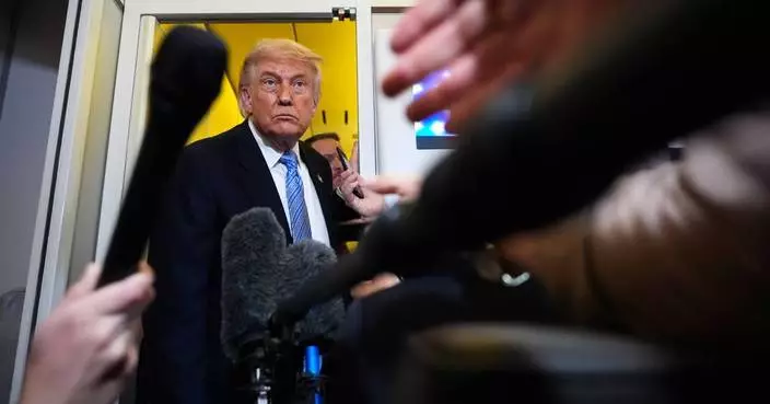
NEW YORK (AP) — Silver and gold futures fell sharply Monday after the Chicago Mercantile Exchange, one of the world’s largest trading floors for commodities, asked traders to put up more cash to make bets on precious metals with prices surging this year.
This year, gold futures are up 65% and silver has more than doubled.
The CME raised margin requirements for gold, silver and other metals in a notice posted to the exchange's website Friday. These notices require traders to put up more cash on their bets in order to insure against the possibility that the trader will default when they take delivery of the contract.
Exchanges sometimes boost margin requirements when a commodity or other security goes on a significant run. In its notice, the CME said it was raising margin requirements “per the normal review of market volatility.”
Silver futures tumbled 8% early Monday while gold slid 5%
Silver prices have skyrocketed this year, topping records dating back to the early 1980s when traders tried and failed to corner the silver market. Supplies have dwindled, with production at major mines slowing. At the same time there's been an increased industrial need for silver for solar panels as well as data centers.
Silver futures were roughly $30 an ounce at the beginning of 2025, and briefly touched $80 an ounce before the CME's announcement.
Gold futures have risen due in part to geopolitical uncertainty and fears that a bubble is forming in some stock markets.
The new requirements for traders dragged down almost all major goldminers as well on Monday. Newmont, the world's largest goldminer, was the biggest decliner on the S&P 500, falling 6%. Smaller goldminers like Vista and Anglogold and Gold Fields, fell even more sharply. .

FILE - An employee of Pro Aurum gold house lifts 1 Kg silver bars of 999.9 purity besides 1 Kg gold bars in the safe deposit boxes room in Munich, Germany, Friday, April 25, 2025. (AP Photo/Matthias Schrader, File)
WASHINGTON (AP) — When acting Attorney General Todd Blanche signed off on a nearly $1.8 billion fund meant to compensate President Donald Trump's allies for alleged political prosecution, he may have pleased his boss.
But the eyebrow-raising move — the latest in his push to prove his loyalty to Trump — has agitated the same Republican lawmakers he would need to secure the permanent job.
Blanche insists he’s not auditioning for the job of attorney general. But a succession of splashy steps the Justice Department has taken under his watch since he took the position on an acting basis last month, including an indictment of former FBI Director James Comey, has left no doubt about the impression he’s hoping to make on the president who appointed him.
The fund in particular has put Blanche at the center of a Republican firestorm at a time when he aims to establish himself as the perfect person for the job for the remainder of Trump’s term. And it sharpened concerns from Democrats and other Blanche critics that he has not shed his mantle as the president’s personal attorney.
“So the nation’s top law enforcement official is asking for a slush fund to pay people who assault cops? Utterly stupid, morally wrong — Take your pick,” Republican Sen. Mitch McConnell of Kentucky, the former majority leader, said in a statement.
A former federal prosecutor in New York, Blanche came to public prominence for his lead role on Trump's defense team, including during the Republican's hush money trial in New York. That perch afforded him, he has said, a firsthand look at what he contends was the weaponization of the criminal justice system against Trump.
He was brought into the Justice Department as deputy attorney general, the No. 2 job, then was elevated last month after Trump ousted Pam Bondi.
Now he finds himself the latest Trump-appointed attorney general to simultaneously confront expectations from subordinates to uphold institutional norms and demands from the president to do his bidding.
Trump's first attorney general, Jeff Sessions, was forced out after the 2018 midterms after infuriating the president over his recusal from an investigation into ties between Russia and the 2016 presidential campaign. Another, William Barr, resigned after their relationship fizzled over Barr's refusal to back Trump's baseless claims of massive election fraud. Bondi was removed after struggling to bring successful prosecutions against Trump's political opponents.
Two weeks after becoming acting attorney general, Blanche announced the appointment of Joseph diGenova, an 81-year-old former Justice Department prosecutor from the Reagan administration, to a special position inside the department. He'll oversee a Florida-based investigation into whether former law enforcement and intelligence officials conspired over the last decade to undermine Trump.
“At some point, at the right time, that will be made public and the American people will see exactly what happened to this administration and President Trump over the past decade," Blanche told Fox News.
Prior government reviews of the FBI's Trump-Russia investigation, a centerpiece of the current conspiracy investigation, have failed to produce criminal charges against senior officials or evidence of criminal conduct by them. It's not clear what, if any, new information the continuing investigation has developed.
The Justice Department also last month obtained an indictment charging Comey, a Trump foe whose prosecution the president has long called for, with threatening Trump through a social media photo of seashells in the numerical arrangement of “86 47" — a case legal experts say will be challenging for prosecutors. Comey has said he wouldn't be surprised if the Justice Department pursues additional indictments.
In other moves, Blanche announced an indictment of the Southern Poverty Law Center, a nonprofit that has been the target of conservative outrage, with misleading donors about its activities, and has publicly defended a Justice Department crackdown on leaks to the news media, including subpoenas to reporters.
Arguably the most audacious demonstration of loyalty to Trump came this week when the Justice Department announced the creation of a $1.776 billion fund to compensate people who feel they've been unjustly investigated and prosecuted, coupled with a guarantee of immunity from tax audits for Trump and his eldest sons.
As Republican concerns grew, Blanche held a tense meeting with GOP lawmakers Thursday. Shortly afterward, Senate Republicans abruptly left Washington without voting on a roughly $70 billion bill to fund immigration enforcement agencies.
Blanche, who defended the fund at a congressional hearing this week, has said anyone who believes they've been persecuted can apply for compensation regardless of political affiliation. But the fund has been widely understood as a boon to Trump allies investigated during the Biden administration.
“It’s pretty clear that he’s not the attorney general for the United States as much as he's the attorney general for President Trump,” said Stephen Saltzburg, a George Washington University law professor and senior Justice Department official in the 1980s. He said Blanche would get an A+ if report cards were issued for fealty to Trump.
David Laufman, a former chief of staff to the deputy attorney general in President George W. Bush's administration, said that rather than protecting the Justice Department's independence, Blanche has been a “willing and ardent accomplice for carrying out any partisan or corrupt scheme the White House may devise.”
Blanche’s supporters dismiss the suggestion he is trying to curry favor with Trump to secure the permanent job.
“What he is doing is he is seeking justice based on facts and the law,” said Jay Town, who served as a U.S. attorney in Alabama during the first Trump administration. “And I don’t think that will ever change about him, whether he is the attorney general going forward or doesn’t spend another day in the administration. He is an honorable man and anybody that knows him knows that to be true.”
Blanche also says he is not angling to keep his job or feeling pressure to placate Trump.
He has told reporters he would be honored to be nominated but, "if he chooses to nominate somebody else and asks me to go do something else, I will say, ‘Thank you very much. I love you, sir.’ I don’t have any goals or aspirations beyond that.”
In recent days, he's functioned as the fund's public face and most visible defender, a role consistent with his comfort in the spotlight. He sometimes holds multiple press conferences a week and grants interviews to a variety of news outlets, a contrast to Bondi, who largely stuck to Fox News appearances.
His defenders say his experience as a federal prosecutor has made him a more sophisticated communicator for the department than Bondi, but his statements have at times invited backlash, including his refusal to rule out that violent Jan. 6 rioters could be eligible for payouts.
Though Blanche will appoint the five commissioners tasked with processing claims, his precise role in the fund’s implementation is unclear. He told CNN it was developed through negotiations with Trump’s private lawyers, not him.
For some Democrats, that's a difference without a distinction.
“Mr. Attorney General, you are acting today like the president's personal attorney," Sen. Chris Van Hollen, a Maryland Democrat, told Blanche during a combative exchange in a Senate hearing, "and that's the whole problem."
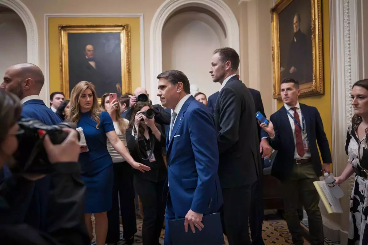
Acting Attorney General Todd Blanche arrives for a closed-door meeting with Republican senators who are expected to abandon a proposal for $1 billion in security money for the White House complex and President Donald Trump's ballroom after it has failed to win enough party support, at the Capitol in Washington, Thursday, May 21, 2026. (AP Photo/J. Scott Applewhite)
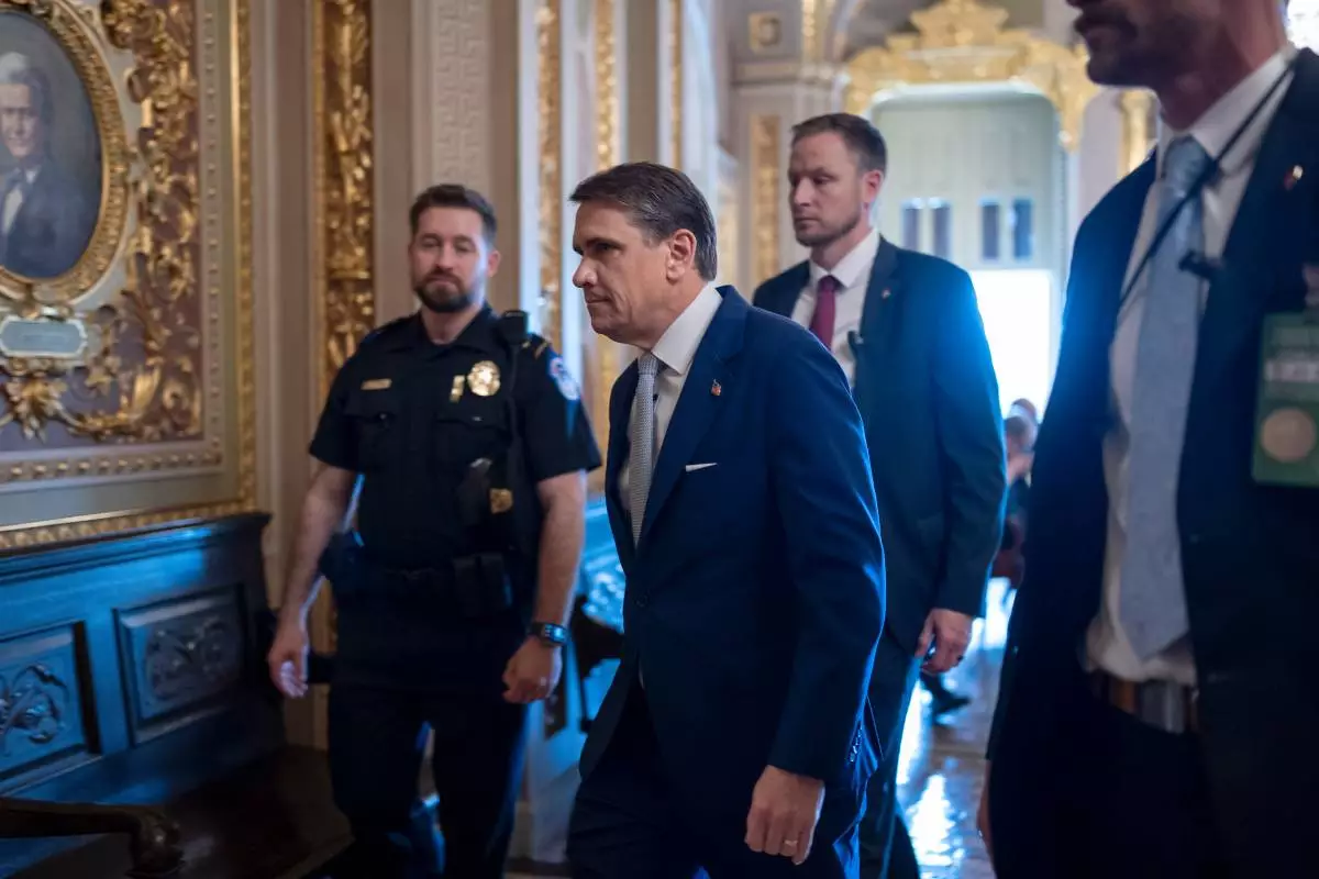
Acting Attorney General Todd Blanche arrives for a closed-door meeting with Republican senators who are expected to abandon a proposal for $1 billion in security money for the White House complex and President Donald Trump's ballroom after it has failed to win enough party support, at the Capitol in Washington, Thursday, May 21, 2026. (AP Photo/J. Scott Applewhite)