Chinese scientists have established a new technology platform that reveals how genetic mutations in tumors reshape the microenvironment and modulate immune responses, a discovery that could explain why modern cancer treatments often fail in patients whose cancers have spread.
The study, published in the journal Cell on Thursday, was jointly conducted by a Shanghai-based team from the Center for Excellence in Molecular Cell Science at the Chinese Academy of Sciences, in collaboration with teams from Shanghai Jiao Tong University, and Guangzhou Laboratory.
Using the new technology platform called CLIM-TIME (CRISPR-Laser-captured microdissection Integration Mapping of Tumor Immune Microenvironment), the researchers analyzed 391 common tumor suppressor genes to see how they reshape the tumor microenvironment — the biological neighborhood surrounding a tumor, and classified them into seven distinct subtypes.
The researchers found that the loss of certain tumor suppressor genes — genes that normally prevent cancer growth — triggers a massive buildup of collagen. This excess collagen makes the tumor structure so dense that it acts like a wall, preventing T cells — the body's natural "assassin" cells — from reaching and killing the cancer.
"It acts like a spider weaving a web. This web not only supports itself but also recruits and reshapes other normal cells from the body into accomplices that help shape this suppressive environment, blocking T cells' entry," said Wang Guangchuan, researcher at the Center for Excellence in Molecular Cell Science.
The team identified a specific molecule called LOXL2 as the architect of this barrier. In tests on mice, researchers found that by blocking LOXL2, they could dissolve the collagen wall. This allowed T cells to penetrate the tumor and significantly boosted the power of immunotherapy drugs.
We combined this with current CAR-T cell therapy. One major issue with CAR-T is that it can't enter solid tumors. When treating human tumors with CAR-T, if we use a small molecule to target this protein we've identified, it could significantly improve CAR-T treatment outcomes. Of course, when it comes to clinical application, we still need to evaluate its safety [and other indicators]," Wang said.
CAR-T is an immunotherapy involving the genetic engineering of a patient's T-cells to recognize and attack cancer cells.
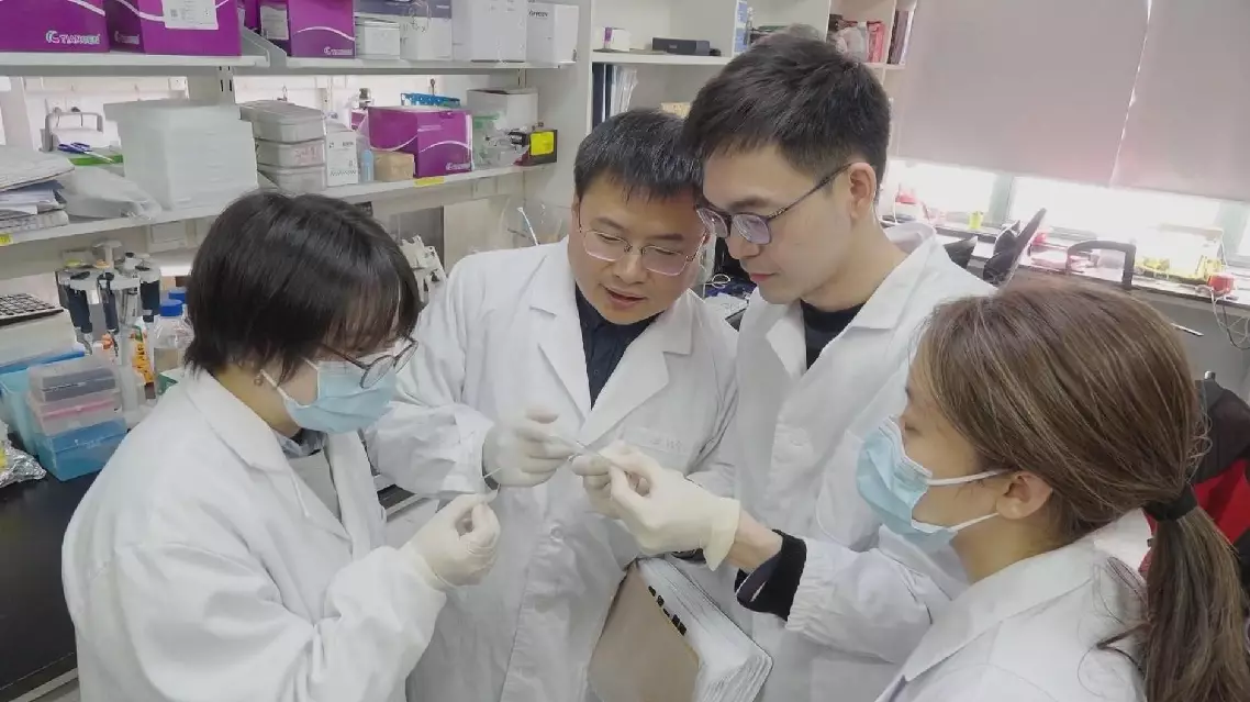
Chinese scientists develop new technology to decode immunotherapy resistance in tumor microenvironment

A documentary has revealed how generations of fishermen in south China's Hainan Province navigated the South China Sea for centuries with no GPS, no weather forecasts, relying only on a handwritten manual known as the Genglubu.
The documentary, Genglubu: Charting the South China Sea, premiered Thursday on China Global Television Network (CGTN).
Unintelligible to outsiders, the Genglubu was an invaluable navigational guide for fishermen and one of the most important items they carried on board.
"What Tanmen fisherman do is dive into the sea and catch fish ourselves. Finding better reefs means catching more fish. And that's why we keep going back to the South China Sea. My grandfather and father would study it like homework before setting out," said Wang Zhendong, curator of the Genglubu Museum in Hainan's Qionghai City.
Wang cannot personally interpret the old manuscript, but he understands its importance: his father studied it before every voyage, and his grandfather trusted it with his life.
"When electronic equipment fails, if you don't understand navigation, how are you going to bring everyone home safely? A captain needs to understand experience. So where does that experience come from? It comes from the Genglubu. It's the ancient knowledge recorded generation after generation," said Wang Shubao, Wang Zhendong's father.
Over generations, that knowledge was written down in the Genglubu.
"Geng" referred to both time and distance traveled at sea. One "geng" was about two hours of sailing, or roughly 10 nautical miles.
"Lu" referred to compass bearings and direction, while "bu" meant "book."
Without modern instruments, fishermen learned to read the sea -- its currents, its depths, its changing moods.
Knowledge shaped their navigation. The Genglubu recorded that knowledge.
One line in it says: From Tanmen port to the Xisha Islands' Zhaoshu (Paracel's Tree Island), follow the direction of the Qian, Sun, which is northwestward. It covers a distance of some 150 nautical miles.
Just a few lines, enough to guide a boat across open water.
One surviving manuscript, copied by Wang Shitao, records 279 routes, making it one of the most detailed versions of the Genglubu known today. Its routes link Hainan with island groups across the South China Sea, with some extending even farther.
"Before Zheng He's voyages (1405-1433) to the Western Seas, the fishermen had already been working these waters of the South China Sea," said Zhou Weimin, a professor at Hainan University.
Experts say the Genglubu is more than a practical guide to navigation; it is also a record of China’s maritime history, cultural heritage and the accumulated wisdom of a people shaped by the sea.
"The Genglubu is a navigation handbook born of experience accumulated through long-term practice. It forms an integral part of China's maritime system. It is a cultural legacy created by our ancestors and a crystallization of the wisdom of a people with a long maritime tradition," said Liu Yijie, a professor at the Center for Studies of Fujian and Taiwan at Fujian Normal University.
Documentary decodes Genglubu - South China Sea's ancient GPS