PARIS (AP) — French President Emmanuel Macron on Tuesday ordered France’s nuclear-powered aircraft carrier to move from the Baltic Sea to the Mediterranean to help protect allied assets during the war in the Middle East.
Macron said the Charles de Gaulle carrier will be escorted by frigates and its air wing. In a prerecorded speech on French TV, Macron added that Rafale fighter jets, air-defense systems and airborne radar systems have been deployed over the past few hours in the Middle East.
“And we will continue this effort as much as necessary,” Macron said.
France, the U.K. and Germany have previously said that they weren’t involved in the strikes on Iran by the United States and Israel that began late last week, but were prepared to take defensive action to destroy Iran’s capability to fire missiles and drones.
Macron, however, said that French forces had shot down drones “in legitimate self-defense in the very first hours of the conflict, to defend the airspace of our allies, who know they can rely on us.” He did not elaborate.
In explaining the need to move France's aircraft carrier, Macron cited Monday's strike on a British air force base on Cyprus, adding that Cyprus was a member of the European Union with which France has recently signed a strategic partnership.
“This requires our support," Macron said.
Macron also said that France has defense agreements binding the EU nation to Qatar, Kuwait, and the United Arab Emirates, as well as strong commitments to Jordan and Iraq.
Noting that the war had spread to Lebanon, Macron said the Iran-backed militant Hezbollah group made “the grave mistake of striking Israel” and putting the Lebanese people in danger but warned against Israel launching a ground operation.
“This, too, would be a dangerous escalation and a strategic error,” he said. “Hezbollah must imperatively cease all strikes, and I call on Israel to respect Lebanese territory and its integrity.”
Reflecting France’s traditional support for rules‑based international order, Macron noted that France “cannot approve” of the strikes by Israel and the U.S. on Iran because they were carried outside of the framework of “international law.”
He said it would it be “desirable” to end the strikes as quickly as possible, and that lasting peace in the region can only be achieved through the resumption of diplomatic negotiations.
“And I also wish here to express the hope that the Iranian people may themselves freely decide their own destiny,” Macron added.
“That said, history never weeps for the executioners of their own people, and none of them will be mourned,” he said in reference to the killings of Iran’s supreme leader Ayatollah Ali Khamenei and other Iran top officials.
Macron also insisted on Iran's responsibility for the conflict.
“It is Iran that developed a dangerous nuclear program and unprecedented ballistic capabilities; that armed and financed terrorist groups in neighboring countries—Hezbollah in Lebanon, the Houthis in Yemen, Shiite militias in Iraq—and that supported Hamas, while always affirming its objective of destroying the State of Israel,” he said.

French President Emmanuel Macron leaves the podium afer his speech at the Nuclear submarines Navy base of Ile Longue in Crozon, France, Monday March 2, 2026. (Yoan Valat/Pool Photo via AP)

French President Emmanuel Macron with members of the army at the end of his speech at the Nuclear submarines Navy base of Ile Longue in Crozon, France, Monday March 2, 2026. (Yoan Valat/Pool Photo via AP)
Isaias strengthened into a major hurricane Friday as it headed toward the U.S. Gulf Coast, where final preparations were underway for potentially life-threatening storm surges and high winds.
Meanwhile, Hurricane Simon was headed toward Mexico’s Pacific coast and strengthened into a Category 2 storm late Friday morning. U.S. forecasters issued a hurricane warning for parts of the central and southwest coast, where hurricane-force winds were expected within 36 hours.
Tropical storm activity has been above average this season in the Pacific because of a strong El Niño, a natural, temporary warming of parts of the Pacific that warps weather worldwide. In the Atlantic, El Niño’s decapitating winds and the Gulf of Mexico’s toasty, storm-fueling waters are battling over Isaias’s future strength.
Here's the latest:
Florida Gov. Ron DeSantis said he’ll keep “butchering” the pronunciation of Isaias, but you don’t have to.
Here’s how to say it:
Hurricane Isaias is pronounced “ee-sah-EE-ahs,” not Isaiah.
And Hurricane Simon is pronounced “SY-muhn.”
Hurricane Isaias is forecast to miss the oil industry’s biggest hubs along the Gulf Coast, but could still nudge fuel prices higher if it triggers power outages that shut down refineries for processing crude, according to experts.
An extended refinery shutdown would impact fuel supplies that already have taken a hit from the U.S. war against Iran and Russia’s war against Ukraine.
Experts say that could increase fuel prices by a few cents or even as much as a dollar per gallon. Refineries in Pascagoula, Mississippi, and Mobile, Alabama, account for 2.4% of the nation’s refining capacity.
If the storm moves through quickly with minimal impacts, refineries would continue to run at reduced capacity, and gasoline and diesel prices could rise just a few cents, said Carl Larry with the energy analysis firm Enverus.
Refineries could take weeks to fully recover from a major hit, he added.
▶ Read more
National Hurricane Center Director Michael Brennan says strong winds arriving at the coast in the early afternoon are expected to spread well inland during the hurricane — reaching as far as metro Atlanta and Tennessee.
Inland areas are also at risk of scattered power outages and tree damage, he said.
Storm surge will be a major concern with Isaias, with the highest water levels expected from the Alabama-Florida border to Grayton Beach in the western Florida Panhandle. Significant storm surge is also expected in Florida’s Big Bend region, Brennan said.
“So if you’re in these evacuation zones and you’ve been asked to leave by your local officials, please get out as soon as you can before conditions deteriorate further,” he said.
Brennan said the highest tornado risk will be Friday afternoon into the evening in central parts of the Panhandle to southwestern Georgia. That risk will expand Saturday to much of central and southern Georgia and parts of South Carolina, he added.
Double red flag warnings prohibiting swimming and wading were posted Friday morning as beachgoers were asked to evacuate. The surf was at about 6 feet (2 meters) and rising, officials said in a social media post.
Lifeguards were expected to leave the beach mid-morning after urging people to leave and stay safe during the storm.
“Bottom line is to just please be smart. Please be smart,” Pensacola Mayor D.C. Reeves said in a social media post. “You wouldn’t consciously put your lives in danger. Make sure that you don’t put the fire, the police — please do not put them in danger. They are not going to be able to respond.”
Reeves warned that bridges may be closed as conditions worsen.
The center said maximum sustained winds have increased to nearly 100 mph (155 kph), and that Simon, which was headed toward part of Mexico’s Pacific coast, is expected to continue strengthening rapidly during the next day or so. Simon is forecast to become a major hurricane by late Friday and strengthen further on Saturday.
U.S. forecasters earlier issued a hurricane warning for parts of the central and southwest coast, where hurricane-force winds were expected within 36 hours.
The super El Niño has been a nonstop machine cranking out tropical storms that have seemingly rolled through the Pacific region like rush-hour traffic. Now, it’s the U.S. Gulf Coast’s turn.
Isaias is the ninth named storm of the season. None of the previous ones reached hurricane strength. A normal hurricane season has 14 named storms, seven becoming hurricanes and three reaching major hurricane level, which is more than 110 mph (177 kph).
“The season has been completely dead — and we’re still going to have an impactful storm hitting the northern Gulf,” Colorado State University hurricane expert Phil Klotzbach said Wednesday. “How impactful it is remains to be seen.”
El Niño involves a natural, temporary warming of parts of the equatorial Pacific, setting off a chain of unusual weather around much of the world. While it’s one of many factors in play in the formation of Isaias, the current El Niño “still is certainly driving the bus,” Klotzbach said.
▶ Read more
Teams from Tennessee, Texas, Indiana and Florida have staged near predicted impact areas, according to a briefing email from the Federal Emergency Management Agency and statements from the Miami-Dade Fire Rescue Department.
Florida Task Force 1 is staged in Tallahassee with 88 members, four canine teams and high-water rescue equipment. The team responded last June to the earthquakes in Venezuela.
The U.S. has a network of 28 elite urban search and rescue teams trained in water rescue, emergency medical care, structural evaluations and more.
When hurricanes tear through Southeastern towns, the hot meals and bold yellow signs of the local Waffle House provide another kind of comfort.
If a Waffle House stays open in town, even in a limited capacity, neighbors are reassured that the coming storm is unlikely to cause devastation. A closed location of the dependable diner chain has come to indicate impending disaster. The metric is known as the Waffle House Index.
What might sound like silly logic has become one of the most reliable ways for Southerners — and even federal officials — to gauge a storm’s severity and identify communities most in need of immediate aid.
The restaurant chain’s reputation for remaining open when people desperately needed a place to warm up, charge devices and grab a hot meal became a fairly reliable — albeit amusing — resource to help track recovery efforts. The company even operates its own storm center.
▶ Read more
Florida Gov. Ron DeSantis on Thursday requested an emergency declaration which, if approved by President Donald Trump, would authorize federal support for the state’s emergency protective measures.
Be wary of hurricanes that start with the letter “I.”
The ninth letter of the alphabet leads all others in the number of named Atlantic storms that have been retired over the decades due to their destruction or high death tolls. The names may be out of circulation, but storms including Ian, Ida, Igor, Ike, Inez, Ingrid, Iota, Irene, Irma, Isabel and Ivan left lasting legacies.
Next up is Isaias, which became the first hurricane of the Atlantic season Wednesday night. Whether it lives up to the misery of others whose first letter it shares remains to be seen. The latest forecast suggested Isaias could be less dramatic, but still “extremely dangerous.”
“It’s the ‘I’ storm, which usually we have a lot earlier in the year,” said Kristen Corbosiero, a professor of atmospheric and environmental sciences at the University at Albany. “It’s always the ‘I’ storms that seem to cause problems.”
▶ Read more
The Federal Emergency Management Agency urged Gulf Coast residents on Thursday to prepare for the hurricane and said that its offices were “fully engaged.”
FEMA staff were embedded in state emergency operations centers and incident management teams deployed to Alabama and Florida. The agency prepositioned emergency supplies at Maxwell Air Force Base in Montgomery, Alabama, and has activated multiple national urban search and rescue teams “for potential movement if needed.”
Disaster response is led by local and state jurisdictions, with FEMA in a supporting role to coordinate federal support as needed and requested.
A supersized El Niño’s decapitating winds and the Gulf of Mexico’s toasty, storm-fueling waters are battling over the future strength of Hurricane Isaias. And the storm’s tilt and eye show who’s winning.
For now, it’s the waters charged by climate change.
All Atlantic hurricane season, there has been “this battle between shear and just the overall conducive conditions,” said Colorado State University hurricane researcher Phil Klotzbach.
El Niño — the natural temporary warming of parts of the Pacific that warps weather worldwide — dominated. Its wind patterns smothered almost any wisp of a storm from strengthening in the Atlantic, while boosting what will soon be record-high levels in the Pacific, Klotzbach said.
▶ Read more
At a Friday morning news conference, Florida Gov. Ron DeSantis warned of significant storm surge and likely wind damage.
“But the surge is really what puts a lot of people’s lives in jeopardy if they haven’t heeded evacuation orders, and does the most significant damage from these storms,” he said. “Everywhere from Pensacola all the way into the Big Bend section of north Florida, you could see storm surge. So please take caution of that.”
He added, “And we always say you hide from the wind, but you run from the water. When the water’s rising and things are happening, it’s a very, very difficult conundrum — and you do not want to be caught in that.”
Some areas, including several counties in the Florida Panhandle, are under mandatory evacuation orders. Alabama Gov. Kay Ivey has told tourists and visitors in the state’s coastal areas to leave immediately.
There are three shelters opening Friday morning at schools in Mobile County, Alabama. At least four churches in Dothan, Alabama, are being offered as shelters Friday, and they’re even providing snacks and drinks. The Red Cross has opened overnight shelters in the Florida panhandle, including one at Northwest Florida State College’s arena.
Isaias is forecast to make landfall late Friday.
Isaias strengthened Friday into a major hurricane as it headed toward the U.S. Gulf Coast, where final preparations were being made for potentially life-threatening storm surges and high winds.
The hurricane is forecast to make landfall late Friday somewhere along the Alabama-Florida line and create dangerous conditions in the Florida Panhandle, southern Alabama and southern Mississippi, the National Hurricane Center said. Rain began falling along the coast Friday morning, and tropical storm conditions were expected to begin early in the afternoon.
The Category 3 storm was packing 120 mph (193 kph) winds and was expected to continue strengthening. Category 3 storms, considered major hurricanes, are capable of causing devastating damage, the center said.
Isaias was expected to weaken quickly as it hits shore and be downgraded to a tropical storm by Saturday afternoon as it moves north and inland along the Alabama-Mississippi line, the center said.
Read more
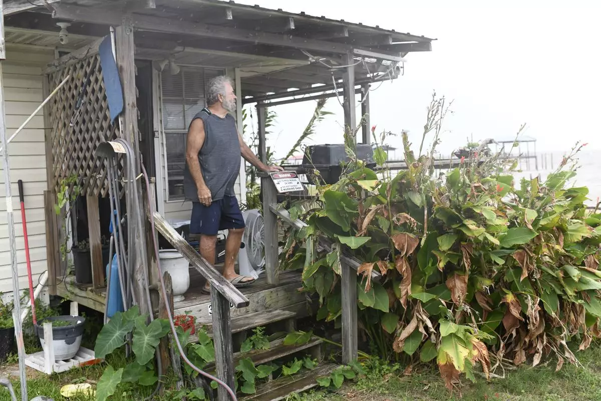
Jim McKenzie looks out over an empty beach as the effects of Isaias keep beachgoers away on Friday, Oct. 9, 2026, on Mon Louis Island, Ala.(AP Photo/Octavio Jones)
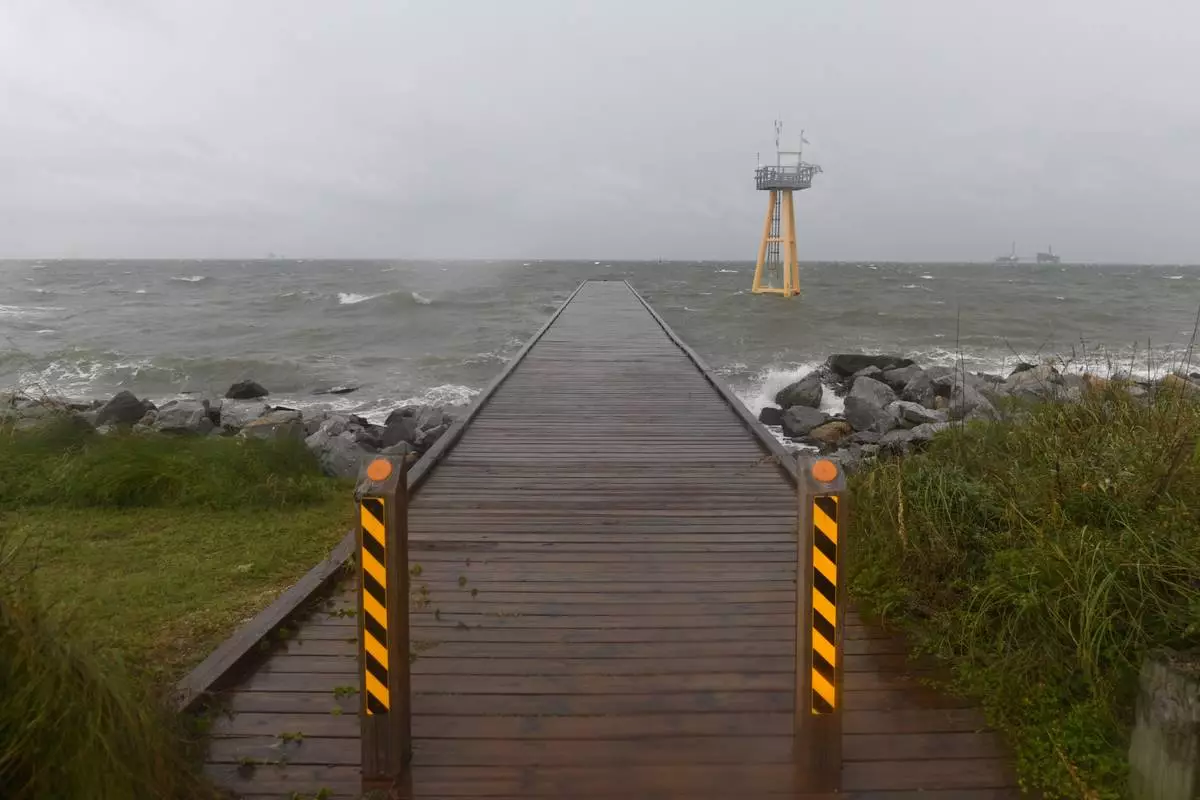
High waves generated by the effects of Isaias crash onto the empty beach on Friday, Oct. 9, 2026, in Dauphin Island, Ala. (AP Photo/Octavio Jones)
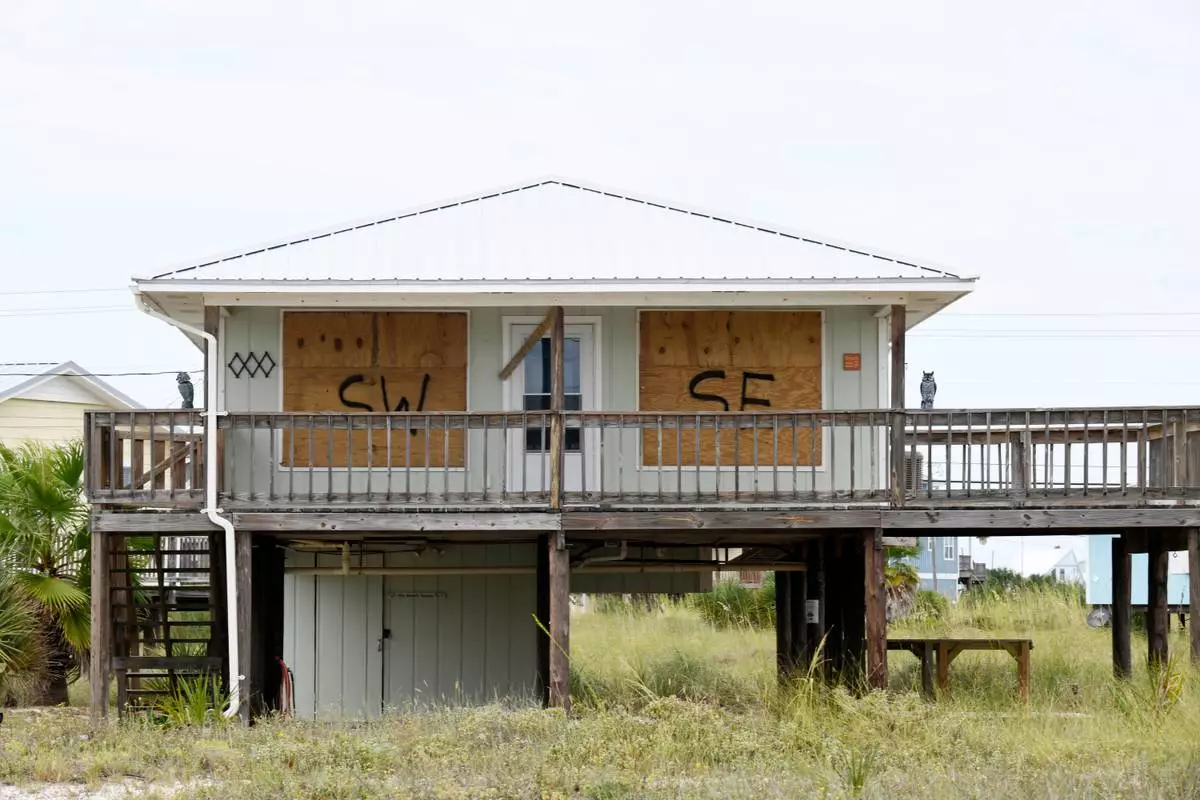
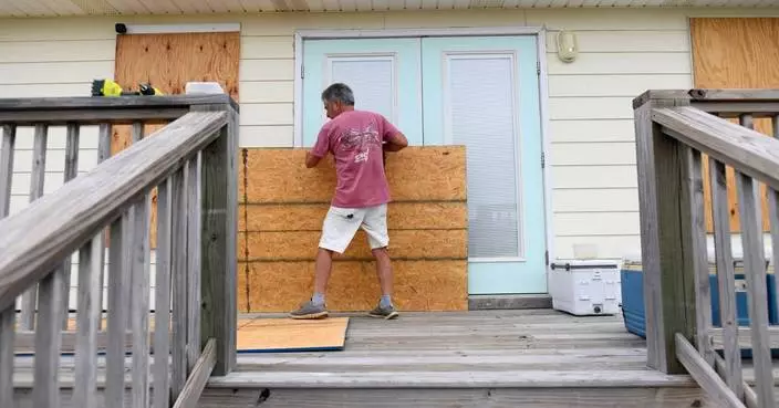
A home is boarded up with plywood ahead of Hurricane Isaias’ expected landfall along the Gulf Coast in Dauphin Island, Alabama, Thursday, Oct. 8, 2026. (AP Photo/Octavio Jones)
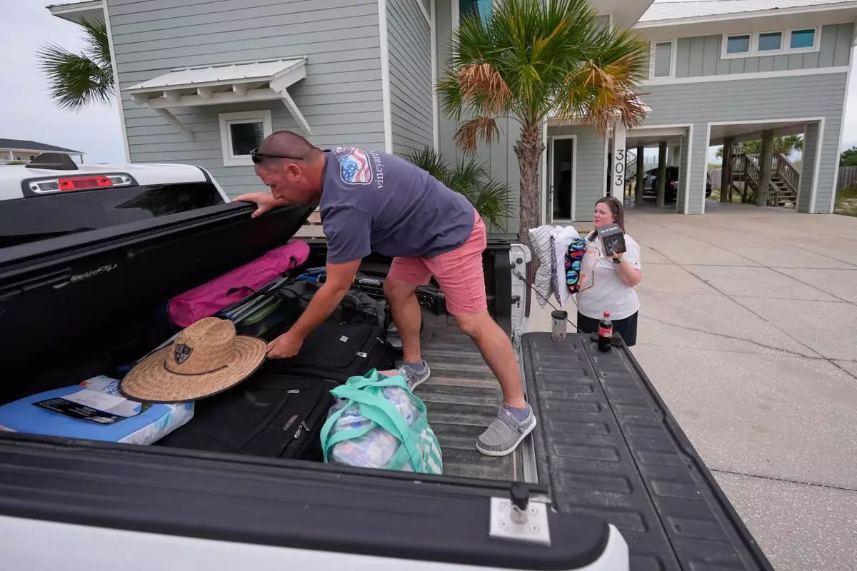
Daniel and Brand Harp, of Lebanon Tenn., here on vacation, pack their belongings to evacuate in the morning as Hurricane Isaias approaches Pensacola Beach, Fla., Thursday, Oct. 8, 2026. (AP Photo/Gerald Herbert)
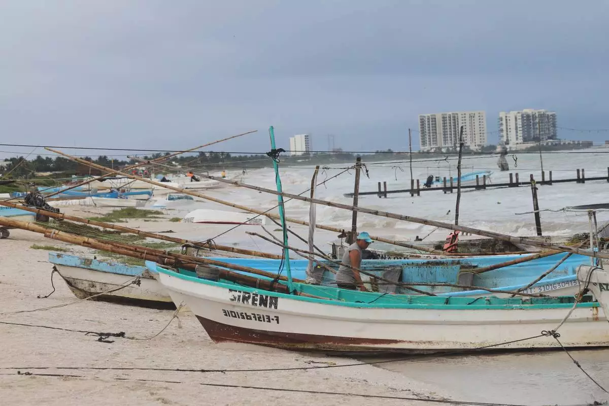
Mexican fishermen inspect their boats as Hurricane Isaias passes through the Gulf of Mexico, north of Progreso, Yucatan state, Mexico, Thursday, Oct. 8, 2026. (AP Photo/Martin Zetina)
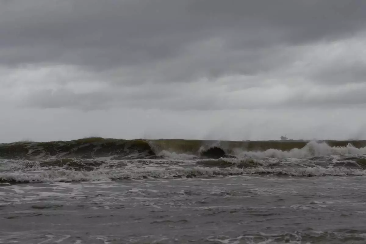
High waves generated by the effects of Isaias crash onto the beach on Friday, Oct. 9, 2026, in Dauphin Island, Ala. (AP Photo/Octavio Jones)
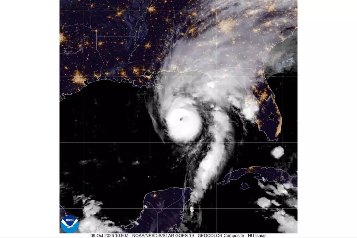
This satellite image from the National Oceanic and Atmospheric Administration shows Hurricane Isaias in the Gulf of Mexico, Friday, Oct. 9, 2026. (National Oceanic and Atmospheric Administration via AP)