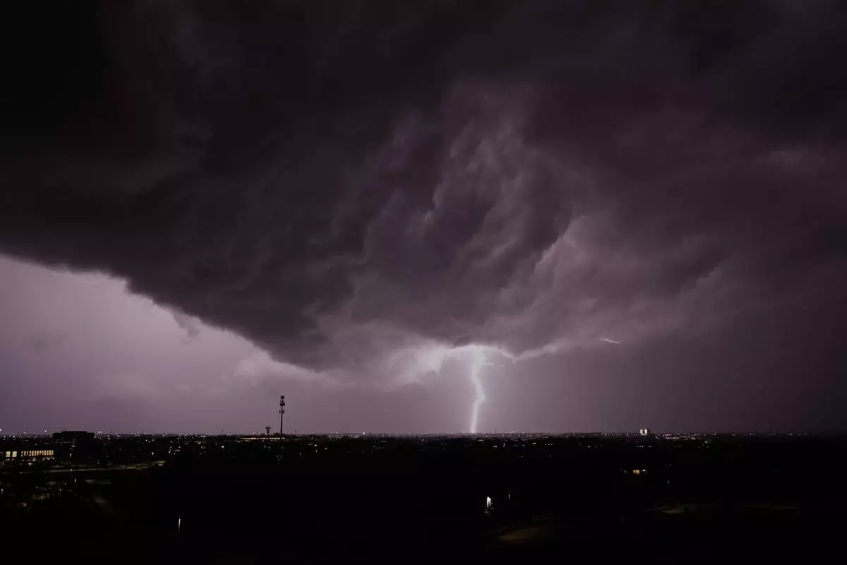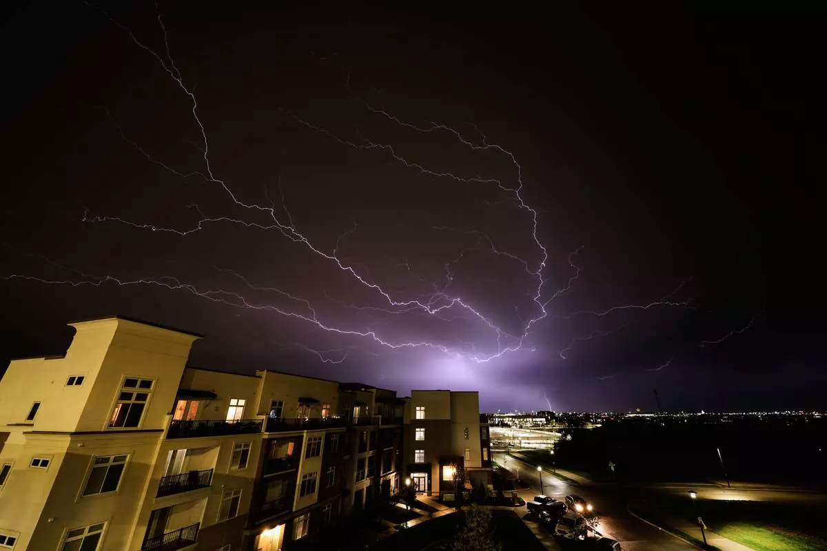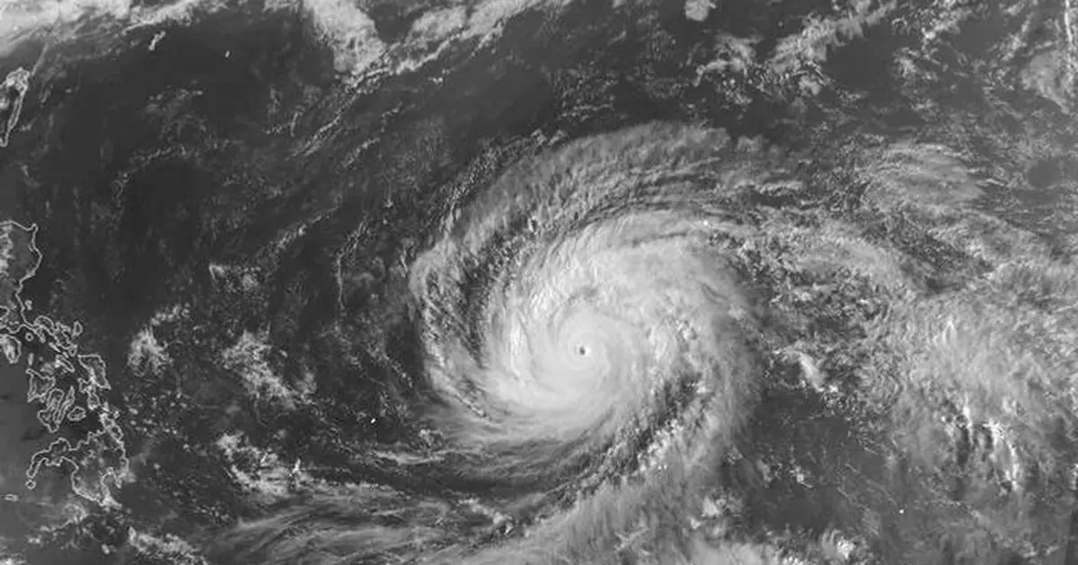
A super typhoon with ferocious winds and relentless rains was battering a group of remote U.S. islands in the Pacific Ocean, forcing residents to seek shelter from flying tree limbs and collapsed buildings.
The center of the Super Typhoon Sinlaku pounded the Northern Mariana Islands early Wednesday, the National Weather Service said.
It's the strongest tropical typhoon on Earth so far this year and was packing sustained winds of up to 150 mph (240 kph) that were likely to bring widespread power outages to the islands, home to roughly 50,000 people.
Some areas already were seeing extensive flooding.
“It’s hitting us hard,” Mayor Ramon “RB” Jose Blas Camacho of Saipan, told The Associated Press late Tuesday. “It’s so difficult for us to respond with this heavy rain, heavy wind to rescue people. Objects are just flying left and right.”
Camacho said some people have been rescued. He said trees were thrown about and wooden and tin structures had collapsed. He said he hoped the glass door to his office doesn't break.
“It’s already bending. That’s how powerful this is,” he said.
Farther south, in Guam, a U.S. territory with several U.S. military installations and about 170,000 residents, tropical force winds and torrential rainfall were leading to flash flooding, the weather service said.
The monster storm slowed to a crawl as it approached the islands, raising fears that the fierce winds won’t go away quickly and worsen its impact.
“This is not going to be an easy night for anyone across Tinian or Saipan. This is going to be a loud night,” said Landon Aydlett, a meteorologist with the weather service. Many “will wake up to a different island,” he said during a Facebook video broadcast.
Saipan is the largest of the Northern Mariana Islands. The worst of the storm was hitting hit during darkness and was expected to last for hours until at least daybreak Wednesday, the weather service said.
Camacho was concerned about the slow speed of the storm.
“That’s the scary part, ” He said, saying “it's better to speed up so it can just exit.”
About 50,000 people live on the Northern Mariana Islands, with most on Saipan, known for its laid-back resorts, snorkeling and golf as well as the capital.
While it’s expected to weaken slightly over the next few days, Sinlaku was crossing the islands as a Category 4 typhoon.
In Guam, where Typhoon Mawar knocked out power for days in 2023, U.S. military officials warned personnel to shelter in place. The military controls about one-third of the land on the island, a critical hub for U.S. forces in the Pacific.
Before turning toward Guam and the Northern Marianas, the storm left significant damage to the outer islands and atolls of Chuuk in the Federated States of Micronesia, Aydlett said from his weather service station on Guam.
Glen Hunter, who grew up on Saipan, has weathered numerous typhoons.
“We sit in what they call ‘Typhoon Alley,’” he said early Tuesday after waking up to strong gusts and seeing downed trees.
For the most part, residents live in sturdy, fully concrete homes and those in substandard wooden houses with tin roofs tend to stay with family or in government shelters, he said.
Tourism-dependent Saipan — the site of one of World War II’s bloodiest battles in the Pacific — was still recovering from 2018's Super Typhoon Yutu when the coronavirus pandemic hit in 2020, he said. The economy has yet to rebound, Hunter said.
President Donald Trump has approved emergency disaster declarations for Guam and the Northern Mariana Islands, allowing for additional help with emergency services.
The Federal Emergency Management Agency said it was coordinating support across multiple agencies, dispatching nearly 100 FEMA staff as well as other personnel.
A super typhoon is a name given to the strongest tropical cyclones. Monitored by the Joint Typhoon Warning Center in Guam, super typhoons are the equivalent of Category 4 or 5 hurricanes in the Atlantic, with winds of at least 150 mph (240 kph). There have been more than 300 super typhoons identified over the past 80 years.
Typhoons and super typhoons are “very common” in the Pacific, but the peak season is similar to the Atlantic hurricane season, which runs from summer to fall, said Jason Nicholls, AccuWeather’s lead international forecaster.
“As we’ve seen this year, you can get tropical systems in the West Pacific any time of year,” Nicholls said. “But getting them in April is a little unusual.”
Associated Press reporters Gabriela Aoun Angueira in San Diego; Jennifer Sinco Kelleher in Honolulu and Seth Borenstein in Washington contributed to this report.
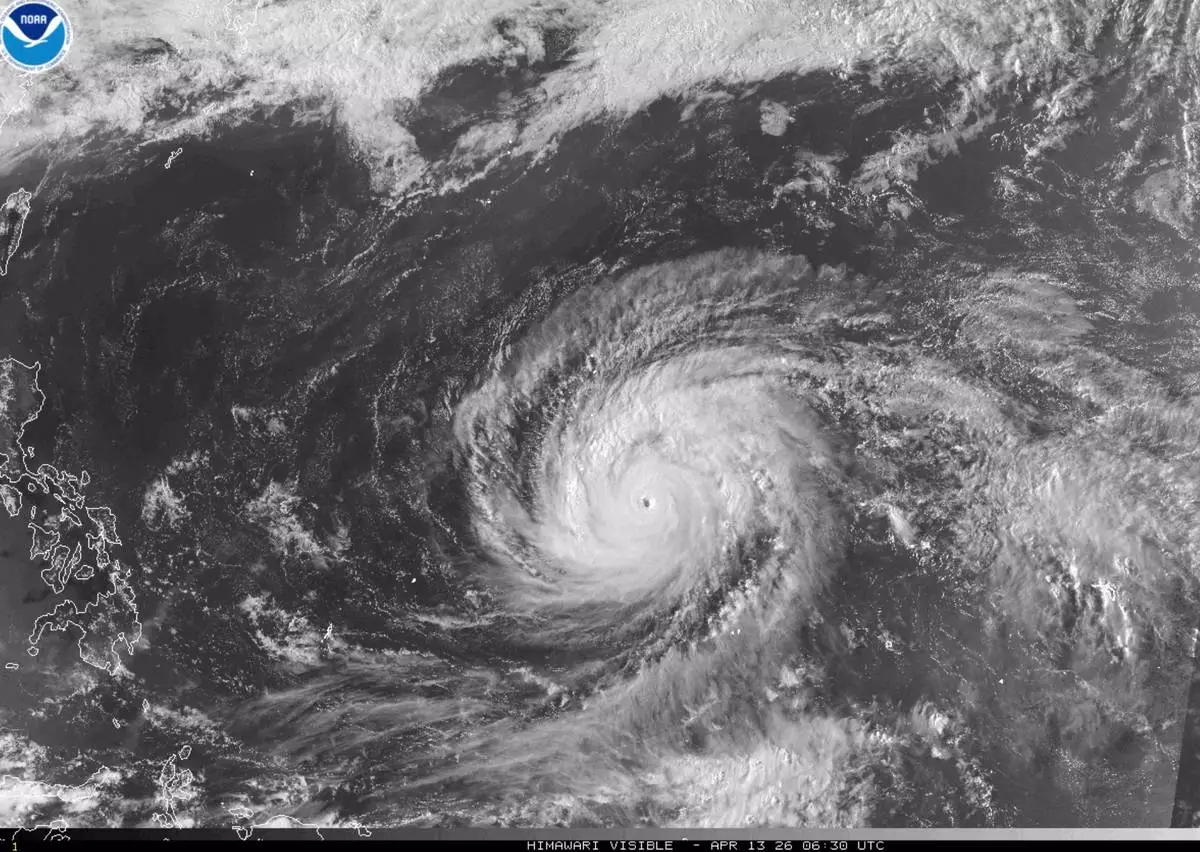
This satellite image provided by the National Oceanographic and Atmospheric Administration (NOAA) shows super typhoon Sinlakua in the Pacific Ocean, Monday, April 13, 2026. (NOAA via AP)