HARARE, Zimbabwe (AP) — Eighteen children were among more than 70 people killed when an overloaded ferry capsized on Lake Kariba in Zimbabwe this week, police said Saturday after rescuers recovered more bodies.
The ferry capsized in strong waves on Tuesday. Police said that 26 more bodies had been recovered since then, bringing the death toll to 72.
The aging ferry was traveling from the town of Kariba to rural and fishing communities in the country's northwest, where roads are damaged and public transportation is scarce. Authorities have not said how many people were aboard or how many remain missing.
Estimates have put the number of passengers as high as 153, while authorities say the ferry’s capacity is 90. Zimbabwe’s disaster management agency has said 77 people were rescued.
Authorities initially said the number of children aboard was unknown because those below ticketing age were not included in passenger estimates. A police list released later showed that 16 of the child victims were aged 10 or younger, with the youngest just 1.
Kariba is the world’s largest human-made lake by volume, created by damming the mighty Zambezi River in the late 1950s and early 1960s. It stretches more than 200 kilometers (124 miles) and is up to 40 kilometers (25 miles) wide in places.
Zimbabwe and Zambia share the lake, with their border running through its middle.
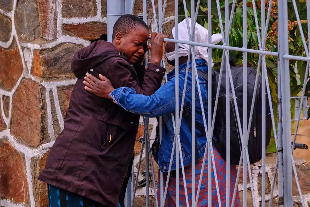
Philis Hamandise, center, is embraced through a gate by a colleague at a victim identification center after losing her 9-year-old daughter and 6-year-old nephew in a ferry capsizing on Lake Kariba, in Kariba, Zimbabwe, Thursday, Aug. 13, 2026. (AP Photo/Mkhululi Thobela)

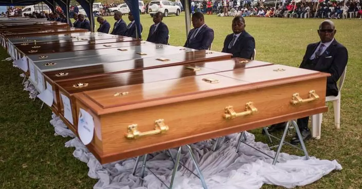
Funeral pallbearers sit behind caskets during a memorial service for the victims of a ferry that capsized on Lake Kariba in Kariba, Zimbabwe, Thursday, Aug. 13, 2026. (AP Photo/Mkhululi Thobela)
HONOLULU (AP) — Hurricane Lala formed Saturday on a path to make a rare landfall on Hawaii’s Big Island.
The National Hurricane Center said Lala’s maximum sustained winds increased to 75 mph (120 kph), making it a Category 1 hurricane, and the eyewall was forecast to move over or near the island’s southern end by Saturday evening, lashing its worst winds at volcanic slopes thousands of feet above sea level.
The Big Island has not experienced a direct hurricane landfall in 155 years. Whether or not that happens, forecasters said higher elevations on the island dominated by the towering Mauna Kea volcano could get as much as 25 inches (63.5 centimeters) of rain.
That could cause life-threatening mudslides in a mountainous area where people live off the grid in improvised housing, and authorities urged them to find safe shelters quickly.
Even if the storm remains just shy of a hurricane, the NHC said wind speeds atop mountains and on the windward and leeward slopes “are often up to 30% stronger than the near-surface winds” indicated in its advisory.
“This is an enormous storm,” Gov. Josh Green said. Tropical storm force winds extended outward for as much as 220 miles (350 km), and were expected to hit the islands of Oahu and Kauai by Sunday morning.
Destructive flooding and even wildfires kicked up by the strong winds were possible across the island chain.
Mike Caputo, who lives in Keaau, near the east coast of the Big Island, said the main concern is flash flooding and fallen trees, especially albizia, a common tree.
“They’re not very sturdy but they grow extremely large,” Caputo, 50, a local fire captain, said. “They can make roads impassable. I made sure my trees were trimmed a few days ago.”
Tropical storm warnings were issued for the islands of Maui, Molokai, Lanai, Kahoolawe, Oahu, Kauai and Niihau.
According to a University of Hawaii atmospheric scientist's research of newspaper accounts, a Category 3 hurricane hit the northeast corner of the Big Island in 1871. The latest forecast has Lala striking "very close to the southern tip of the Big Island,” said Vanessa Almanza, a weather service meteorologist in Honolulu.
Officials and residents braced for Lala regardless. Shelters were opened, events were canceled and ranchers were urged to leave their cattle in pastures, rather than structures that might collapse. “It doesn’t take landfall to create destruction,” Almanza said.
The hurricane center predicted 8 to 12 inches (20.3 to 30.5 centimeters) of total rainfall across Maui and the lower elevations of the Big Island, and 4 to 6 inches (10.2 to 15.2 centimeters) across the island chain.
The center also warned that the storm could cause “life-threatening flooding and mudslides, especially in areas of steep terrain,” along with a dangerous storm surge and ocean swells “likely to cause life-threatening surf and rip current conditions.”
As of 8 a.m. in Hawaii, Tropical Storm Lala was located about 90 miles (145 kilometers) southeast of South Point, Hawaii and about 300 miles (485 kilometers) southeast of Honolulu, with maximum sustained winds strengthening to 70 mph (110 kph). Lala was moving toward the west-northwest at 12 mph (19 kph), the hurricane center said.
State Rep. Jeanné Kapela urged people to remain alert. The southern end of the island is remote and rural, with agriculture including coffee and cattle, but it's growing in population because of its affordability. Kapela was especially worried about people who live off the grid in unpermitted structures.
“If you feel now that your house doesn’t have a great roof or might not be able to withstand hurricane force winds, then first things first you go to a family or friend’s house and you kind of hunker down there,” she texted to The Associated Press. “We're hopeful the storm moves through quickly, but we're preparing for whatever comes.”
Many Hawaiians are still dealing with the aftermath of devastating flooding in March. Growers still recovering are worried about suffering more damage, according to Hawaii Farm Bureau director Brian Miyamoto.
As winds ramped up across the islands, Almanza said dry and breezy conditions outside the storm would elevate fire concerns.
In 2023 the Maui town of Lahaina burned during extreme winds as a hurricane passed far to the south.
“Since the fire, everybody is way more aware of weather in general and our environment and things that are happening,” said Archie Kalepa of Lahaina, who is well known in the area for his surfing, paddling and other ocean skills and has been watching the storm closely.
Kauai, which is several islands northwest up the archipelago from the Big Island, is where Hurricane Iniki made landfall as a Category 4 hurricane in 1992 — an El Nino year like this one, when a warming of the Pacific near the equator increases Pacific hurricane activity and affects weather patterns across the globe.
“It did $3 billion worth of damage. It destroyed thousands of homes, and it did kill six people,” said Steven Businger, the professor who researched the 1871 hurricane. “We just can never know if a storm is going to turn.”
__
Associated Press reporter Alexa St. John contributed from Detroit.
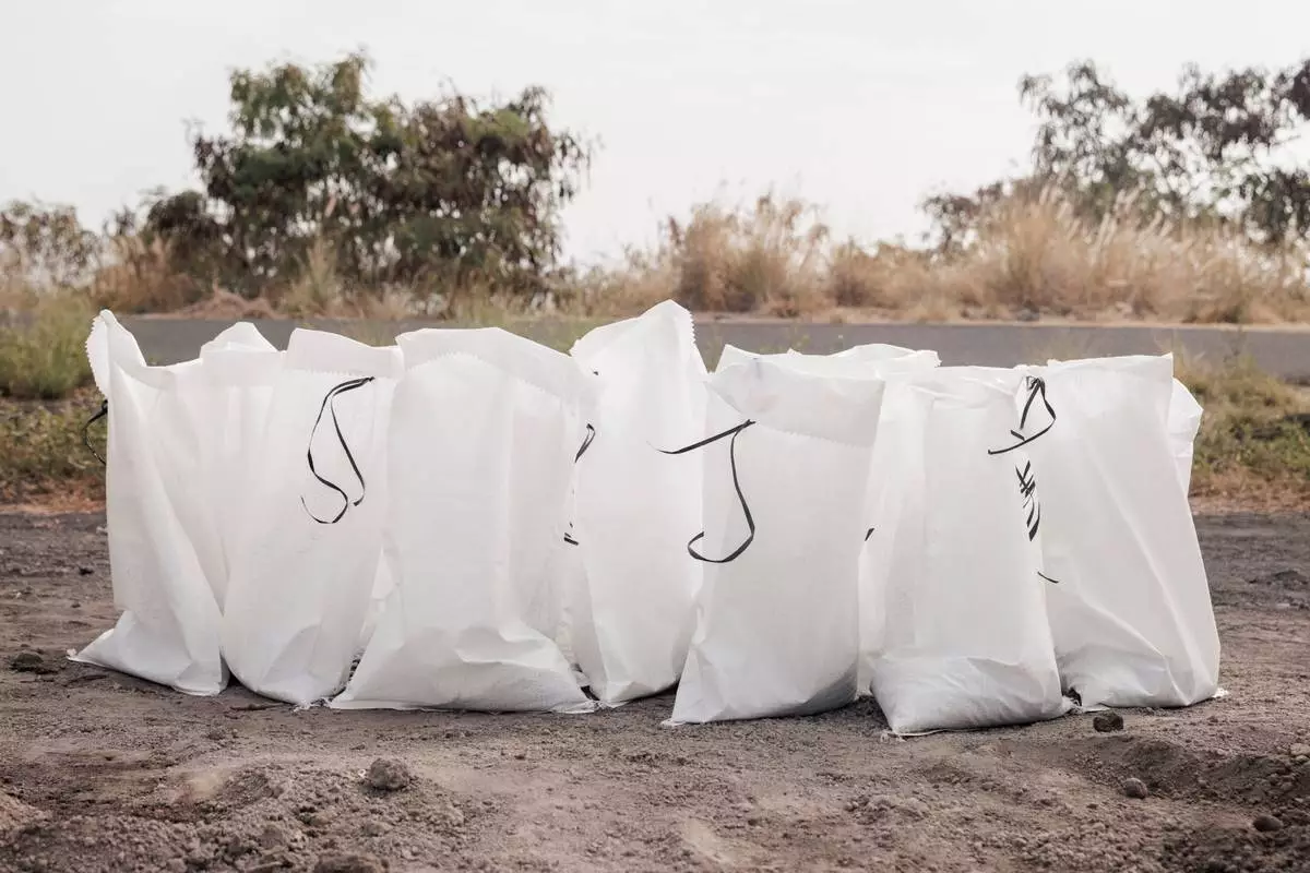
Sandbags are seen at a Hawaii County Department of Public Works sand pile ahead of Tropical Storm Lala in Kailua-Kona, Hawaii, Friday, Aug. 14, 2026. The tropical storm is forecast to strengthen into a hurricane as it approaches Hawaii, with up to 25 inches of rain possible on the island of Hawaii, also commonly known as the Big Island. (Stephen Lam/San Francisco Chronicle via AP)
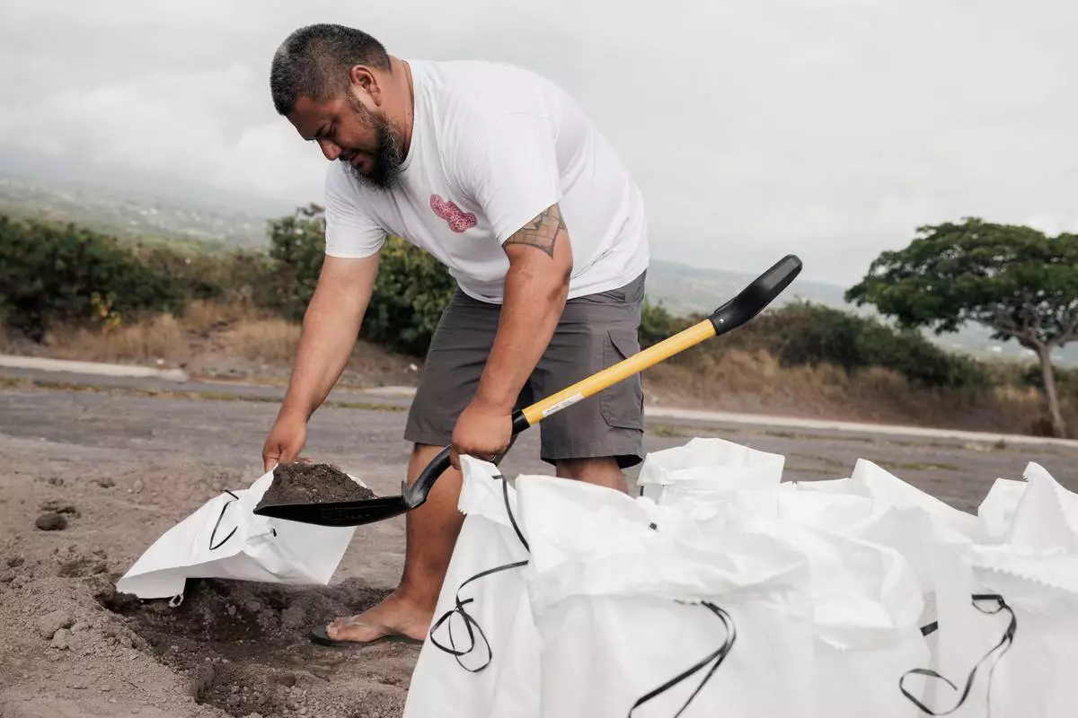
Casey Delaries makes a sandbag in preparation for Tropical Storm Lala in Kailua-Kona, Hawaii, Friday, Aug. 14, 2026. The tropical storm is forecast to strengthen into a hurricane as it approaches Hawaii, with up to 25 inches of rain possible on the island of Hawaii, also commonly known as the Big Island. (Stephen Lam/San Francisco Chronicle via AP)
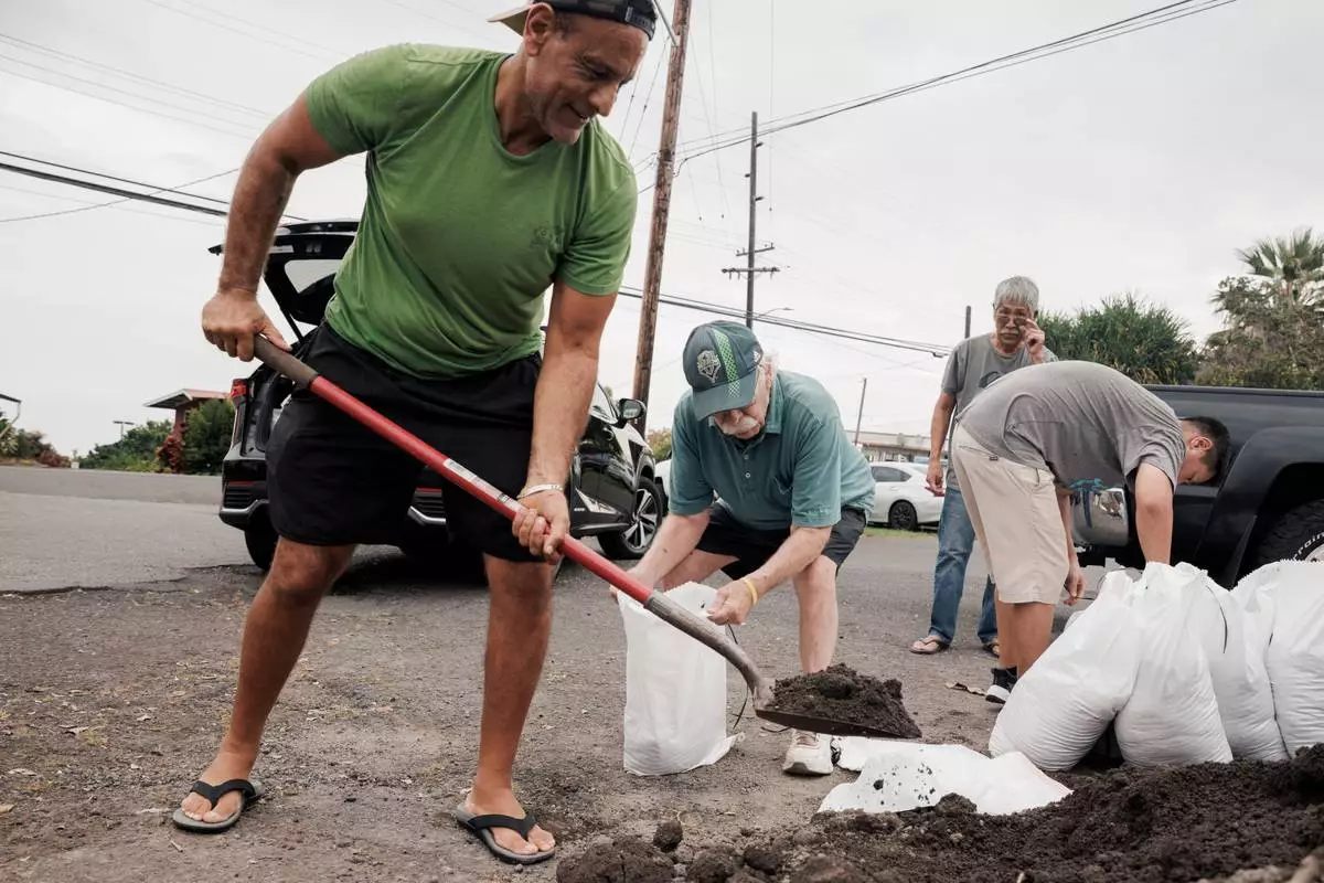
Shaheer Faltas, left, and his father-in-law, Joe Brosnan, fill sandbags in preparation for the arrival of Tropical Storm Lala in Captain Cook, Hawaii, Friday, Aug. 14, 2026. (Stephen Lam/San Francisco Chronicle via AP)
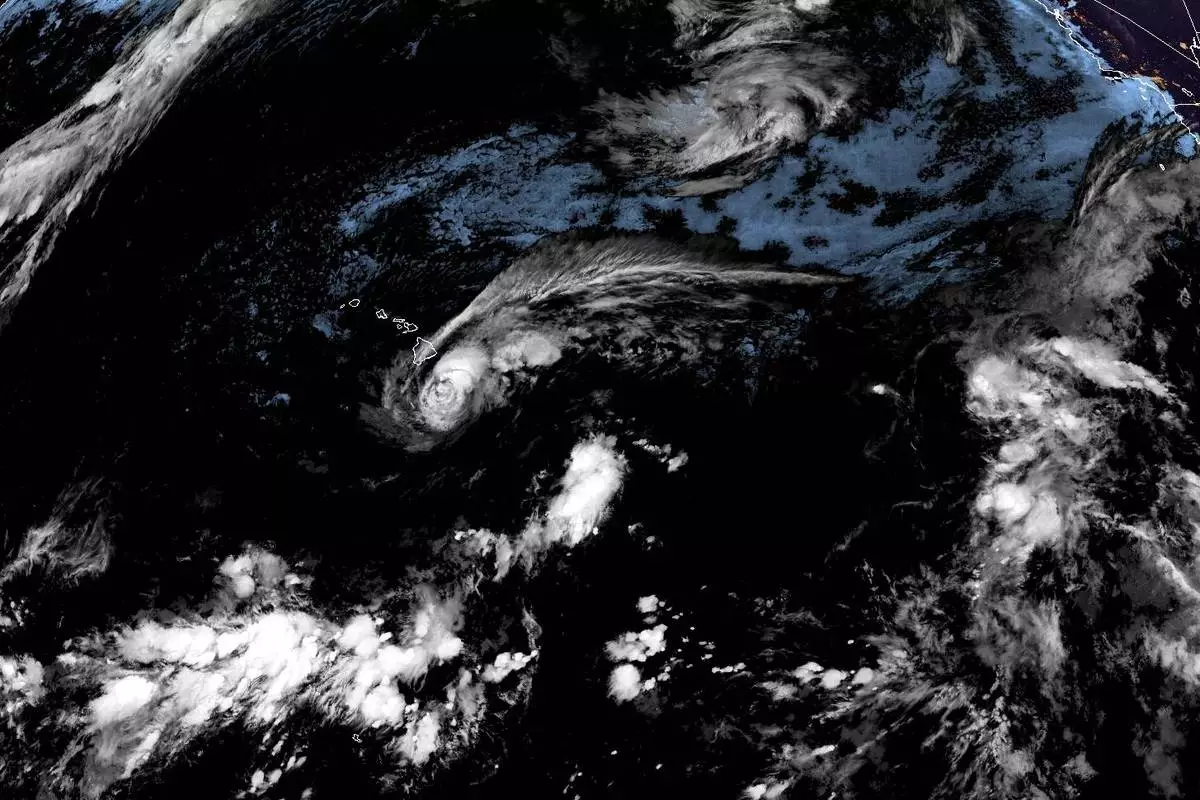
This satellite image released by NOAA shows Tropical Storm Lala over the Pacific Ocean, near Hawaii, Saturday, Aug. 15, 2026. (NOAA via AP)