WASHINGTON--(BUSINESS WIRE)--Sep 1, 2026--
Global Water Challenge (GWC) and Cargill announced today the expansion of their Cargill Currents partnership into Bolivia, Colombia, Costa Rica and Türkiye . Launched by GWC and Cargill in 2021, Cargill Currents is a joint initiative that works in partnership with communities, governments and local organizations to help address the water challenges facing each region. As part of a global partnership, these new country activities join ongoing programming underway in Brazil, Ghana, Côte d'Ivoire, and North America. Planned activities include improving access to safe water and sanitation, repairing water systems and supporting their long-term maintenance, promoting more efficient water use in farming, and restoring and monitoring watersheds.
This press release features multimedia. View the full release here: https://www.businesswire.com/news/home/20260901402071/en/
Since the partnership’s launch, Cargill Currents has supported programming across five continents, with outcomes that include improving water access, sanitation and hygiene (WASH) for nearly 200,000 people in Brazil and West Africa. Across North America, the partnership has supported regenerative agriculture across nearly 42,000 hectares, restored more than 1,700 hectares of forests, wetlands, and grasslands, and planted more than 283,000 trees.
“Water is essential to people and agriculture, which makes it essential to our business,” said Pete Dahm, Senior Director, Sustainability and Global Water Lead at Cargill. “We’re excited to further expand our partnership with GWC through this next phase of Cargill Currents and build on the strong progress we've made together over the past five years.”
New Cargill Currents country activities include the following expected outcomes:
Expanded Cargill Currents country initiatives include the following expected outcomes:
“Water security looks different in every community, and the solutions must be designed accordingly. Our Cargill Currents partnership brings together the resources, expertise, and local leadership needed to respond to those differences – from strengthening water systems and expanding access to safe water and sanitation, to helping farmers use water more efficiently and protecting the watersheds communities depend on. As we reflect after World Water Week, expanding this work into four new countries is an important step in building lasting water security where it is needed most.” said Monica Ellis, CEO of Global Water Challenge.
This work supports Cargill's ambition of enabling a water positive impact across its operations, supply chains and communities by 2030.
Learn more about how Cargill works to improve water access, availability and quality around the world.
About Cargill
Cargill is committed to providing food, ingredients, agricultural solutions, and industrial products to nourish the world in a safe, responsible, and sustainable way. Sitting at the heart of the supply chain, we partner with farmers and customers to source, make, and deliver products that are vital for living.
Our 155K+ employees innovate with purpose, providing customers with life’s essentials so businesses can grow, communities prosper, and consumers live well. With 160 years of experience as a family company, we look ahead while remaining true to our values. We put people first. We reach higher. We do the right thing – today and for generations to come. For more information, visit Cargill.com and our News Center.
About Global Water Challenge (GWC)
Global Water Challenge (GWC) is a sector leader in mobilizing clean water access and advancing water security and community empowerment in high need regions around the world. Since 2006, GWC has positively impacted millions of people across Africa, the Americas, and Asia with improved WASH delivery and water security. With over 600+ multi-sector partners, we engage for action – catalyzing financial resources and driving innovative programming for sustainable, local solutions. For more information, please visit globalwaterchallenge.org.
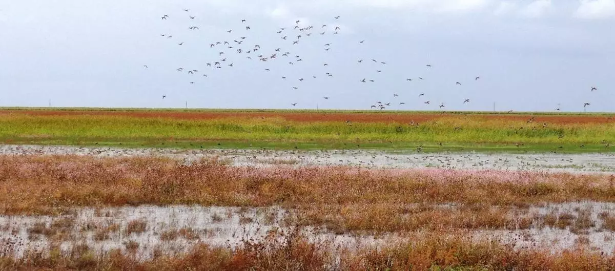
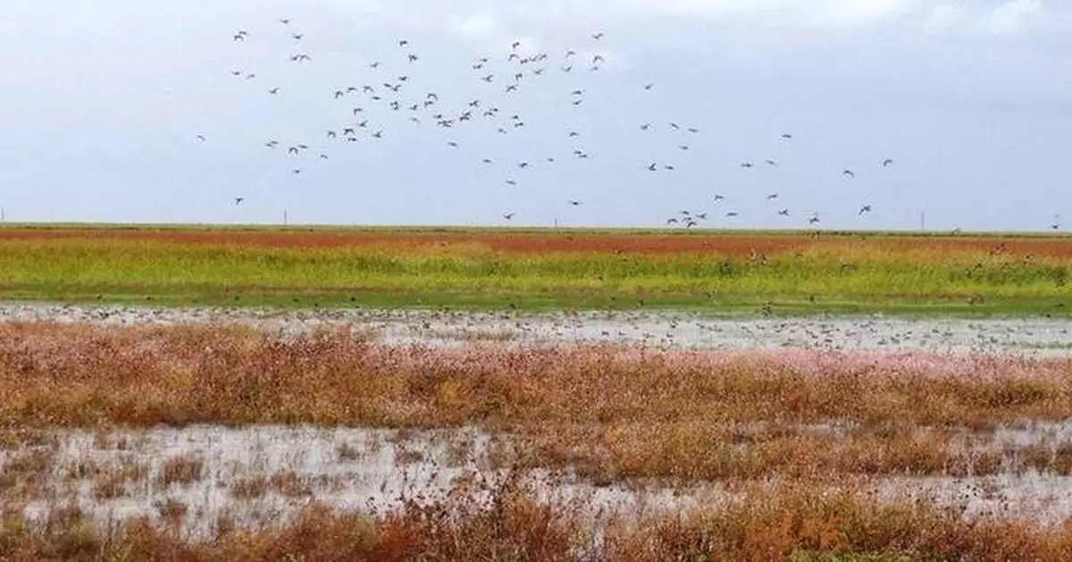
Through Cargill Currents, landowners in Texas received support to protect and restore playas. These shallow wetlands play a vital role in replenishing groundwater and maintaining watershed health.
Rain fell across parts of Texas and Louisiana on Tuesday as Tropical Storm Edouard moved toward the Gulf Coast, bringing the possibility of flooding as it was expected to strengthen significantly and possibly reach hurricane force, the National Hurricane Center warned.
Forecasters expected the storm to to make landfall in Texas on Tuesday and then rapidly weaken. In the meantime, several storms were brewing in the Pacific Ocean, including Lowell, which reached hurricane strength Tuesday morning.
Edouard was about 25 miles (35 kilometers) southeast of the Texas coastal city of Port Arthur, near the Louisiana border and close to the area where it was expected to make landfall. Maximum sustained winds were at 50 mph (85 kph).
The hurricane center said Edouard was expected to dump 3 to 6 inches (8 to 15 centimeters) of rain along the Texas coast through east-central Texas, but some areas could see up to 9 inches (23 centimeters). Southwestern Louisiana was expected to see lesser amounts.
“That rainfall could produce some flash flooding and river flooding,” said Brad Reinhart, a senior hurricane specialist at the National Hurricane Center.
Texas Gov. Greg Abbott said the biggest problem expected from the storm is flooding.
“This is our first big storm of the season, and I’ll tell you, Texas is prepared,” Orlando Alanis of the Texas Division of Emergency Management said during a news conference.
Crews worked Monday to clear dry vegetation that could ignite from a lightning strike and cause fast-spreading fires, Abbott said.
In Cameron, Louisiana, the winds had picked up and rain was coming through on and off Tuesday morning, said Connor Salvador, who owns an RV park there near the coast. “Nothing too crazy yet,” he said.
He said while there could be a “little bit” of flooding if they get a lot of rain, he wasn't too worried about Edouard.
“We’re pretty used to all these types of storms that come through,” he said.
Newly formed Hurricane Lowell in the Pacific Ocean was centered about 575 miles (925 kilometers) southeast of Hilo, Hawaii, on Tuesday morning. The storm’s maximum sustained winds had increased to 80 mph (130 kph). Forecasters said the hurricane was expected to remain several hundred miles away from Hawaii for the next several days at least, but swells from Lowell were likely to impact parts of the islands beginning Wednesday.
“This hurricane is likely to increase the surf and make for dangerous beach conditions and marine conditions for any boaters near the Hawaiian islands over the next few days,” said Andrew Hagan, a forecaster with the National Hurricane Center.
Tropical Storm Marie formed in the Pacific Ocean early Tuesday well offshore of southwest Mexico and wasn’t threatening land, the center said. The storm was about 400 miles (643 kilometers) southwest of Manzanillo with maximum sustained winds of 45 mph (72 kph) and was moving northwest. Forecasters said Marie was gradually strengthening and was expected to become a hurricane by Wednesday night.
Elsewhere in the Pacific, Karina became a hurricane Sunday, fueled by warm waters far from any shore. It strengthened Monday into a powerful Category 4 storm but forecasters said Tuesday that it was expected to weaken. Forecasters said the storm centered 1,280 miles (2,059 kilometers) west-southwest of the southern tip of the Baja California peninsula of Mexico carried maximum sustained winds of 140 mph (222 kph) but wasn't threatening land.
Meanwhile, the remnants of Tropical Storm Dolly brought rain and thunderstorms to parts of Haiti and the Dominican Republic, the Turks & Caicos, and the Bahamas, the hurricane center said.
Associated Press journalist Julie Walker in New York contributed to this report.
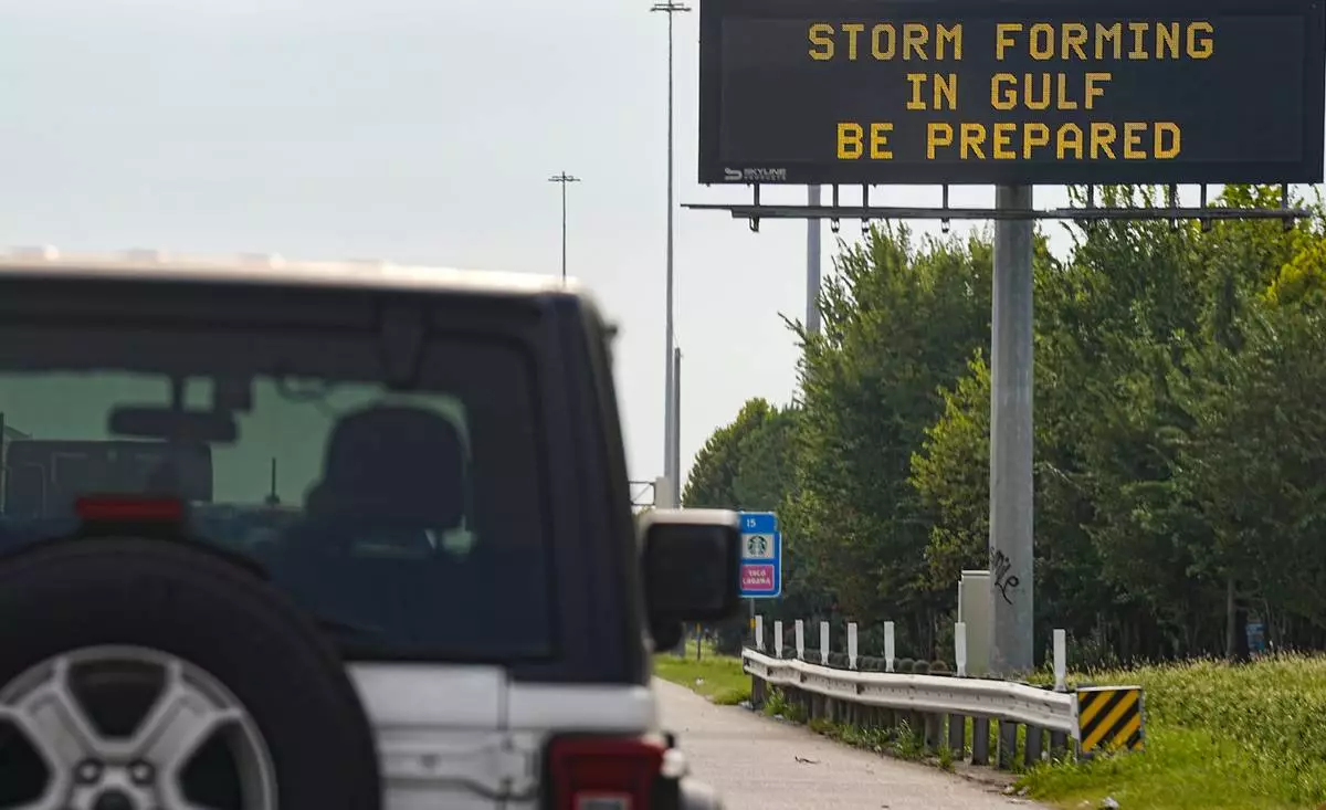
Motorists drive by Texas Department of Transportation signs on I-610 as Tropical Storm Edouard approaches in Houston, Tuesday, Sept. 1, 2026. (Elizabeth Conley/Houston Chronicle via AP)
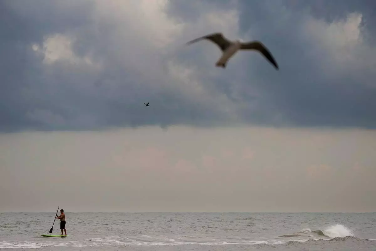
Dark clouds hand low over the horizon as Tropical Storm Edouard makes its way towards landfall in Galveston, Texas, Tuesday, Sept. 1, 2026. (Brett Coomer/Houston Chronicle via AP)
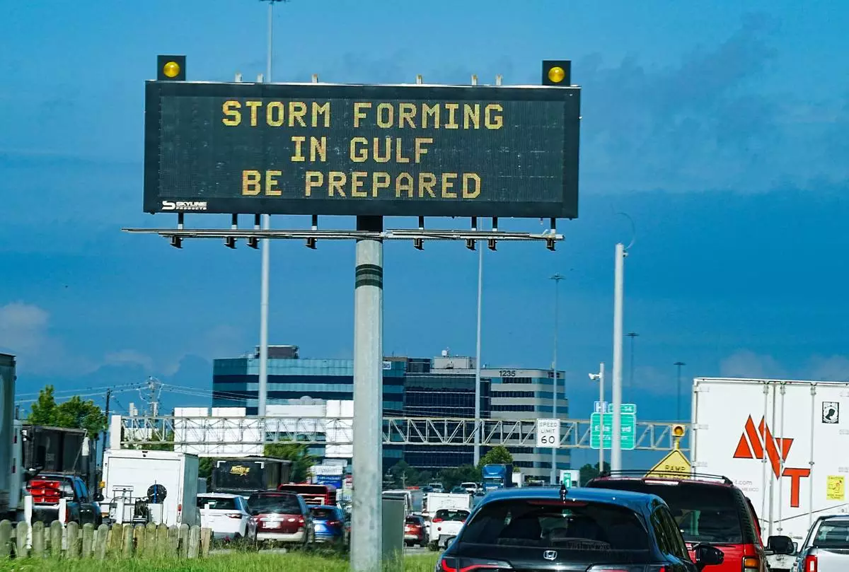
Motorists drive by Texas Department of Transportation signs on I-610 as Tropical Storm Edouard approaches in Houston, Tuesday, Sept. 1, 2026. (Elizabeth Conley/Houston Chronicle via AP)
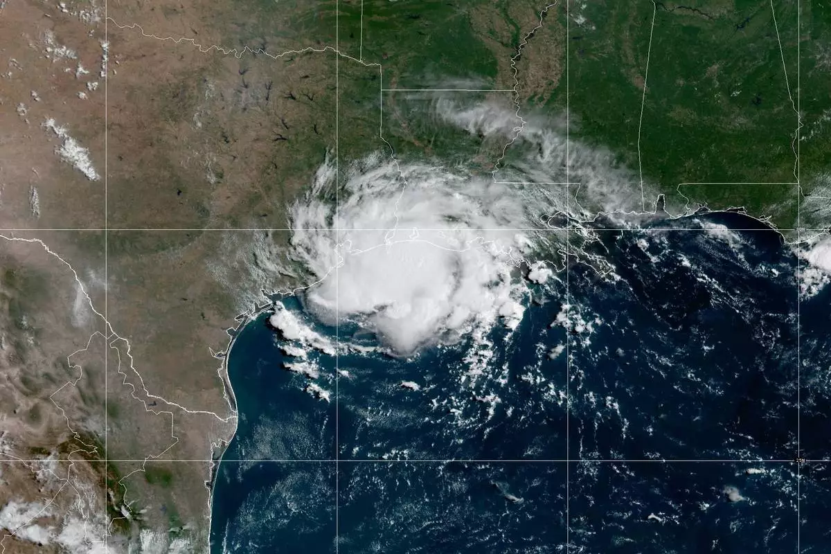
This satellite image provided by NOAA shows Tropical Storm Edouard over the Gulf of Mexico, Tuesday, Sept. 1, 2026. (NOAA via AP)
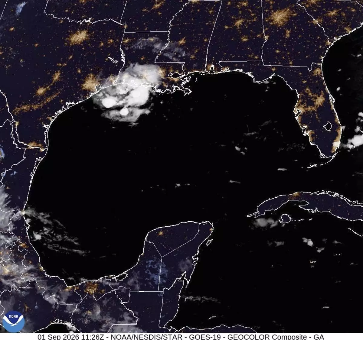
This satellite image from the National Oceanic and Atmospheric Administration taken shows Tropical Storm Edouard heading toward the Gulf Coast, Tuesday, Sept. 1, 2026. (NOAA via AP)
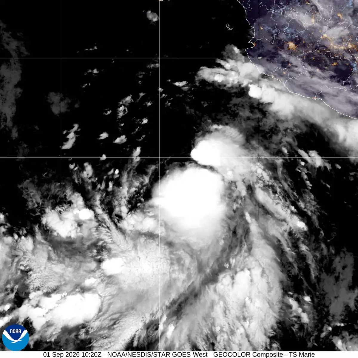
This satellite image released by NOAA shows Tropical Storm Marie in the North Pacific Ocean on Tuesday, Sept.1, 2026 . (NOAA via AP)
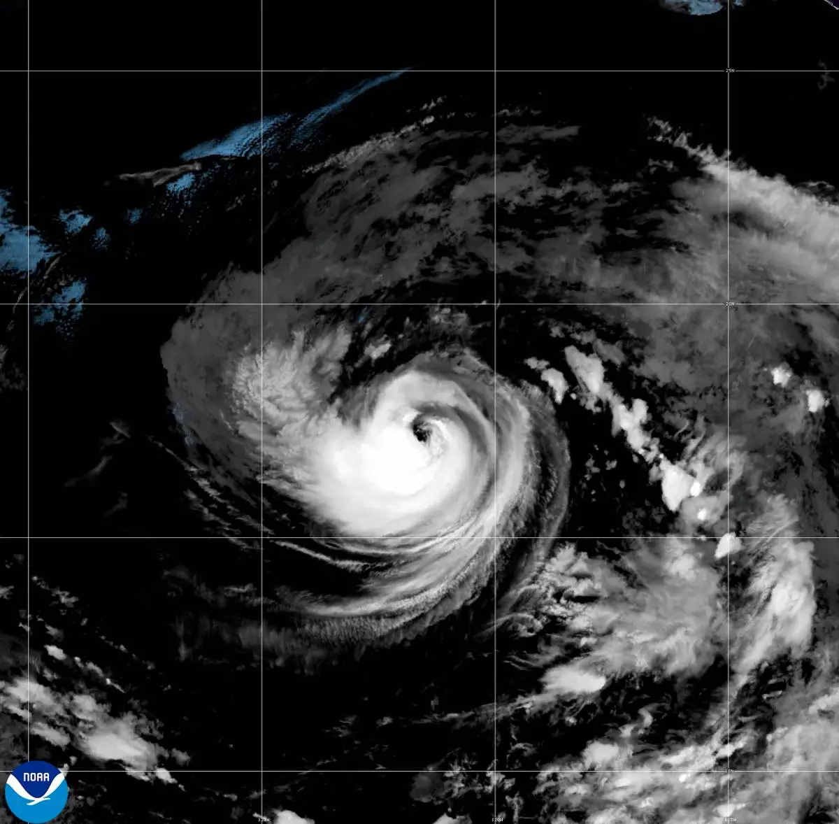
This satellite image released by NOAA shows Hurricane Karina strengthening off the southern tip of Baja California on Sunday, Aug. 30, 2026. (NOAA via AP)
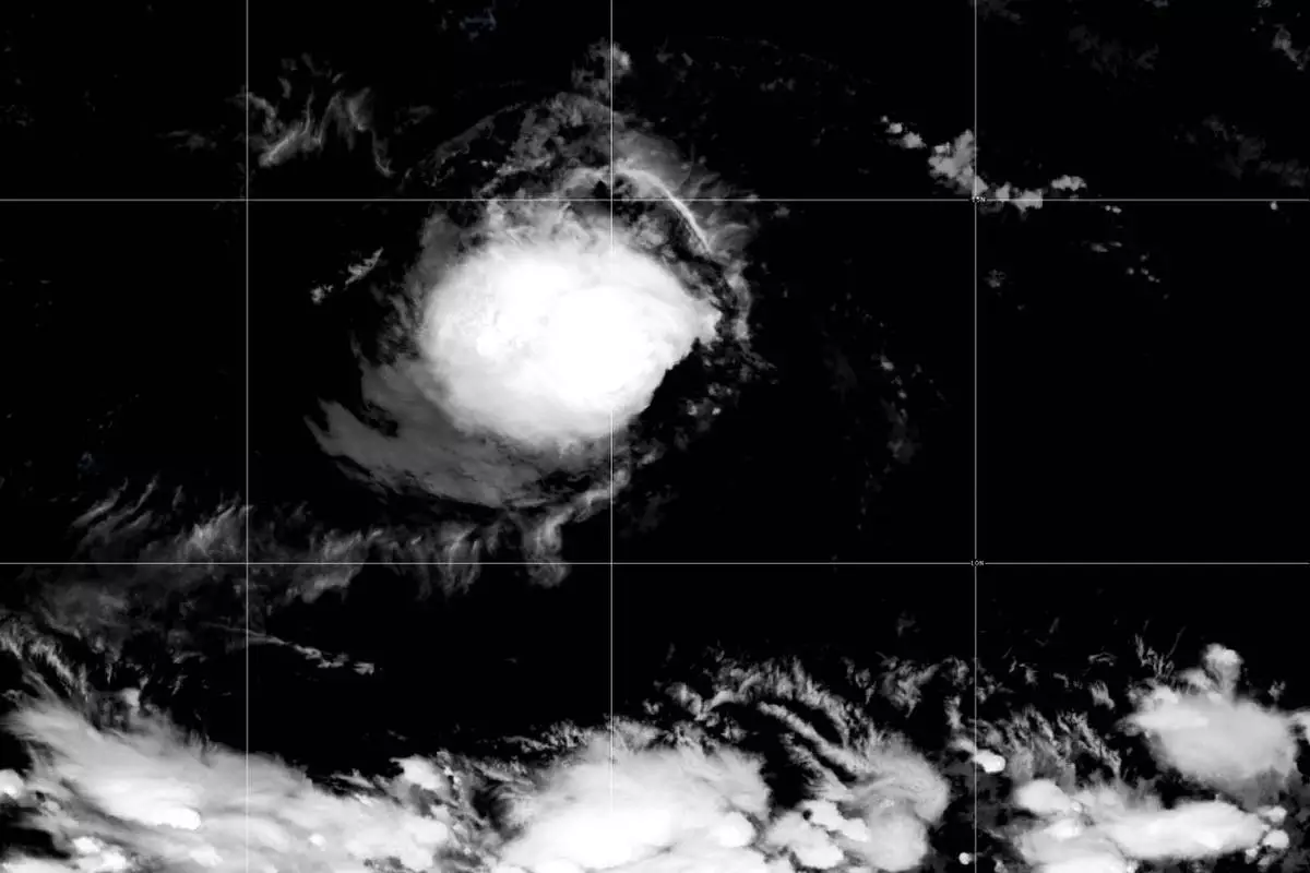
This satellite image released by NOAA shows Tropical Storm Lowell over the Pacific Ocean, Monday, Aug. 31, 2026. (NOAA via AP)
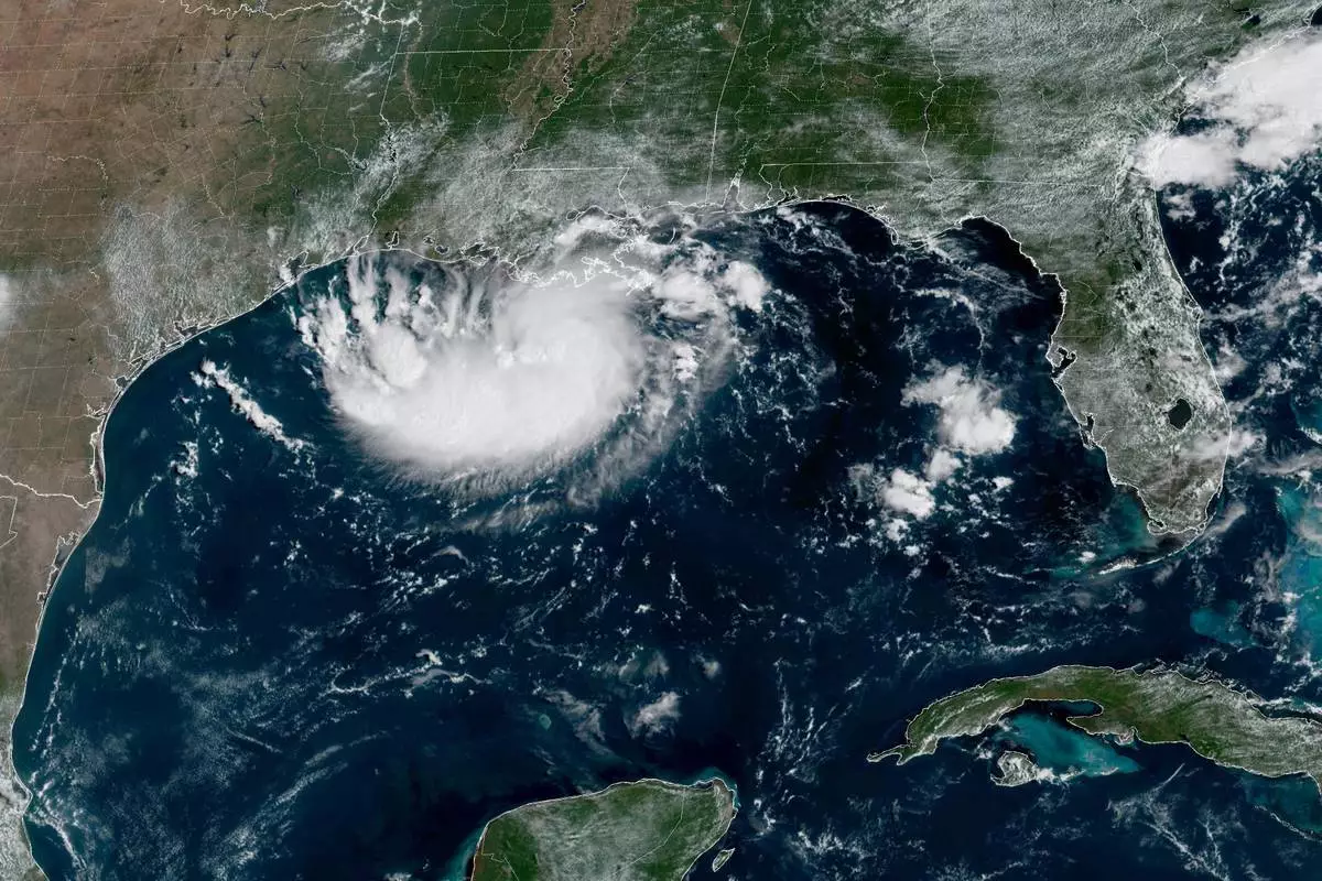
This satellite image released by NOAA shows Potential Tropical Cyclone Five forming over the Gulf of Mexico on Monday, Aug. 31, 2026. (NOAA via AP)