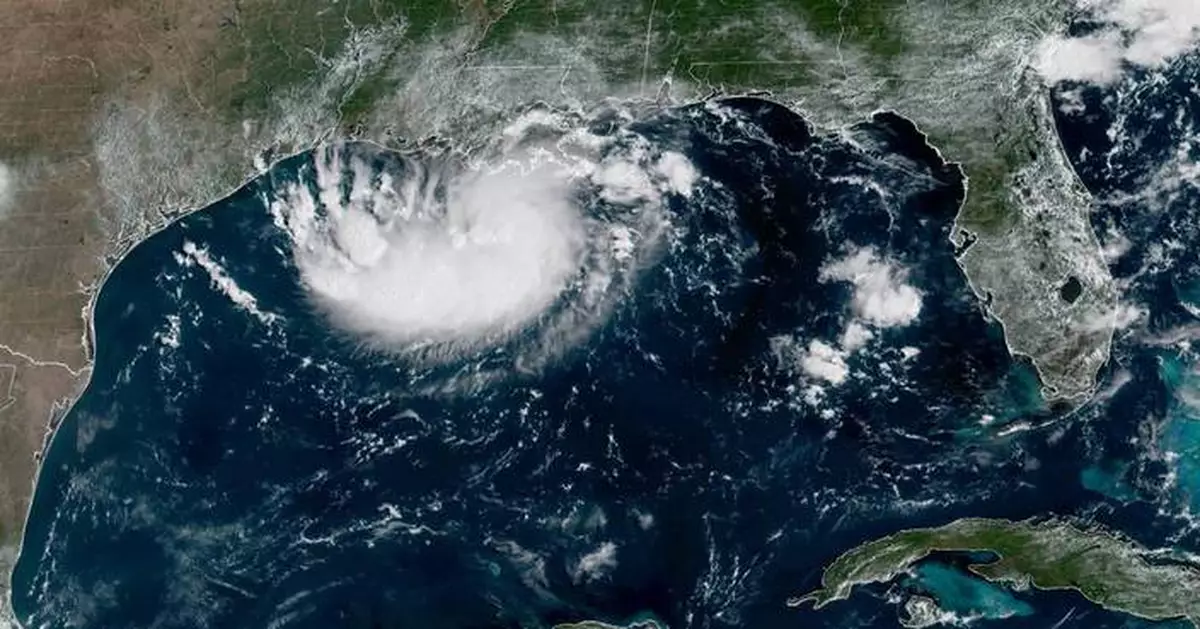
MIAMI (AP) — Tropical Storm Edouard headed toward the Gulf Coast early Tuesday and expected to gain strength before bringing potentially heavy rains and flooding into parts of Texas and Louisiana.
The storm was upgraded Monday night from a tropical depression and forecasters with the National Hurricane Center expect it will make landfall in Texas later on Tuesday.
Early Tuesday the storm was about 65 miles (100 kilometers) south-southeast of Cameron, Louisiana, and 90 miles (145 kilometers) southeast of Port Arthur, Texas, with maximum sustained winds of 40 mph (65 kph) while moving west-northwest at 8 mph (13 kph).
Texas Gov. Greg Abbott said the biggest problem expected from the storm is flooding. Forecasters are anticipating 3-6 inches (7-15 centimeters) of rain in the greater Houston area, with some areas of the state’s upper coast getting up to 9 inches (22 centimeters). More than 4 inches (10 centimeters) per hour could fall and will likely cause flash flooding in low-lying and urban areas, according to the National Hurricane Center.
“This is our first big storm of the season, and I’ll tell you, Texas is prepared,” Orlando Alanis of the Texas Division of Emergency Management said during a news conference.
Crews worked Monday to clear dry vegetation that could ignite from a lightning strike and cause fast-spreading fires, Abbott said.
Meanwhile, the remnants of Tropical Storm Dolly brought rain and thunderstorms to parts of Haiti and the Dominican Republic, the Turks & Caicos, and the Bahamas, the hurricane center said.
In the Pacific Ocean on Monday evening, Tropical Storm Lowell was about 630 miles (1,015 kilometers) southeast of Hilo, Hawaii, with maximum sustained winds of 70 mph (110 kph) while moving west at 10 mph (17 kph). Forecasters said Lowell could rapidly intensify and become a major hurricane by Wednesday.
Also in the Pacific, Tropical Storm Marie formed early Tuesday well offshore of southwest Mexico and wasn’t threatening land, the center said. The storm was about 470 miles (756 kilometers) southwest of Manzanillo with maximum sustained winds of 45 mph (72 kph) and was moving northwest. Marie was expected to become a hurricane in the coming days.
Elsewhere in the Pacific, Hurricane Karina became a hurricane Sunday, fueled by warm waters far from any shore, and strengthened Monday into a powerful Category 4 storm. But it did not threaten land, forecasters said.
On Tuesday morning, Karina remained a Category 4 hurricane and was centered 1,210 miles (1,950 kilometers) west-southwest of the southern tip of the Baja California peninsula of Mexico with maximum sustained winds of 140 mph (222 kph) while moving west-northwest at 10 mph (17 kph), the center said.
The story has been updated to correct that Dolly was a tropical storm, not a hurricane.
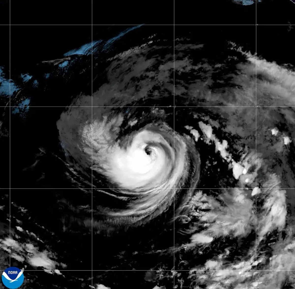
This satellite image released by NOAA shows Hurricane Karina strengthening off the southern tip of Baja California on Sunday, Aug. 30, 2026. (NOAA via AP)
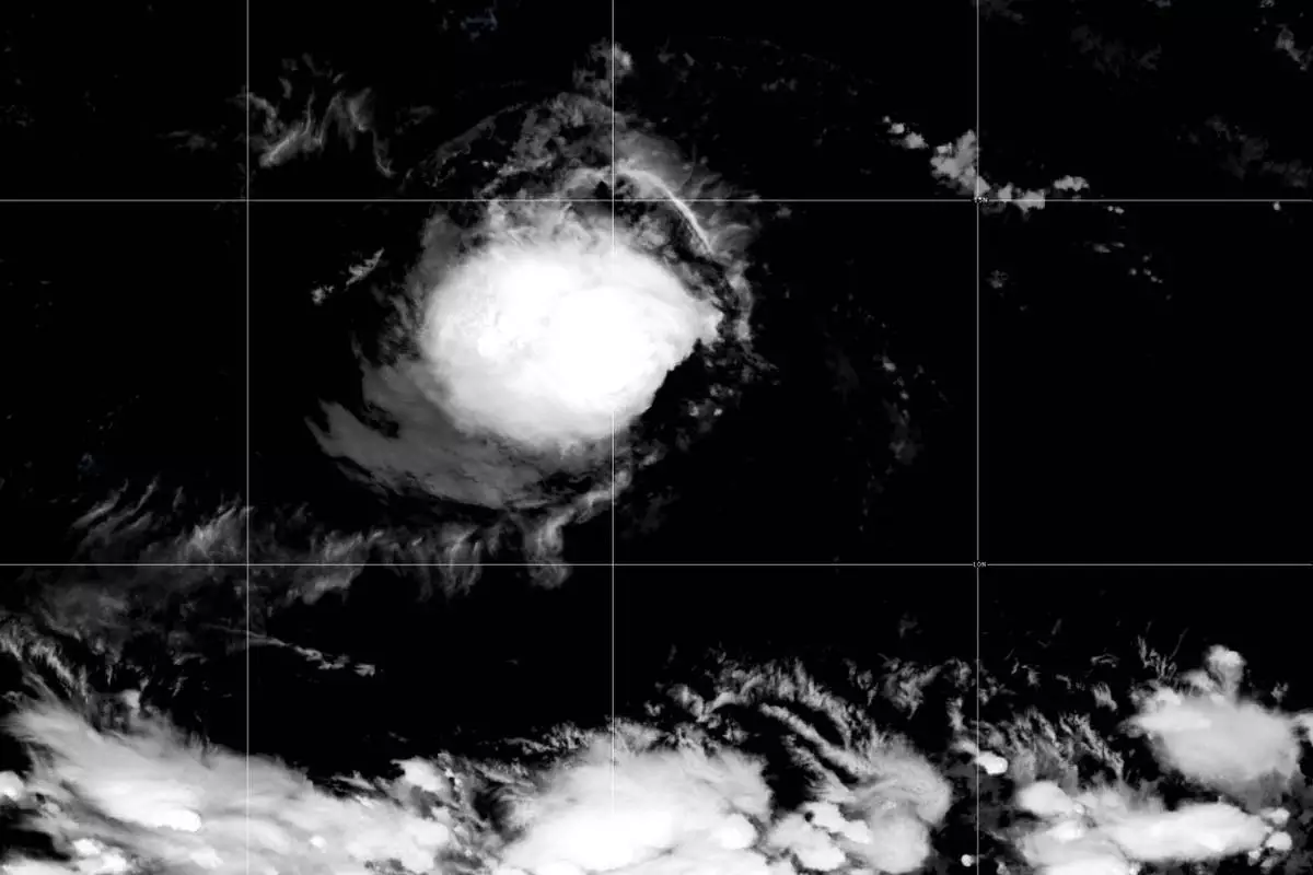
This satellite image released by NOAA shows Tropical Storm Lowell over the Pacific Ocean, Monday, Aug. 31, 2026. (NOAA via AP)
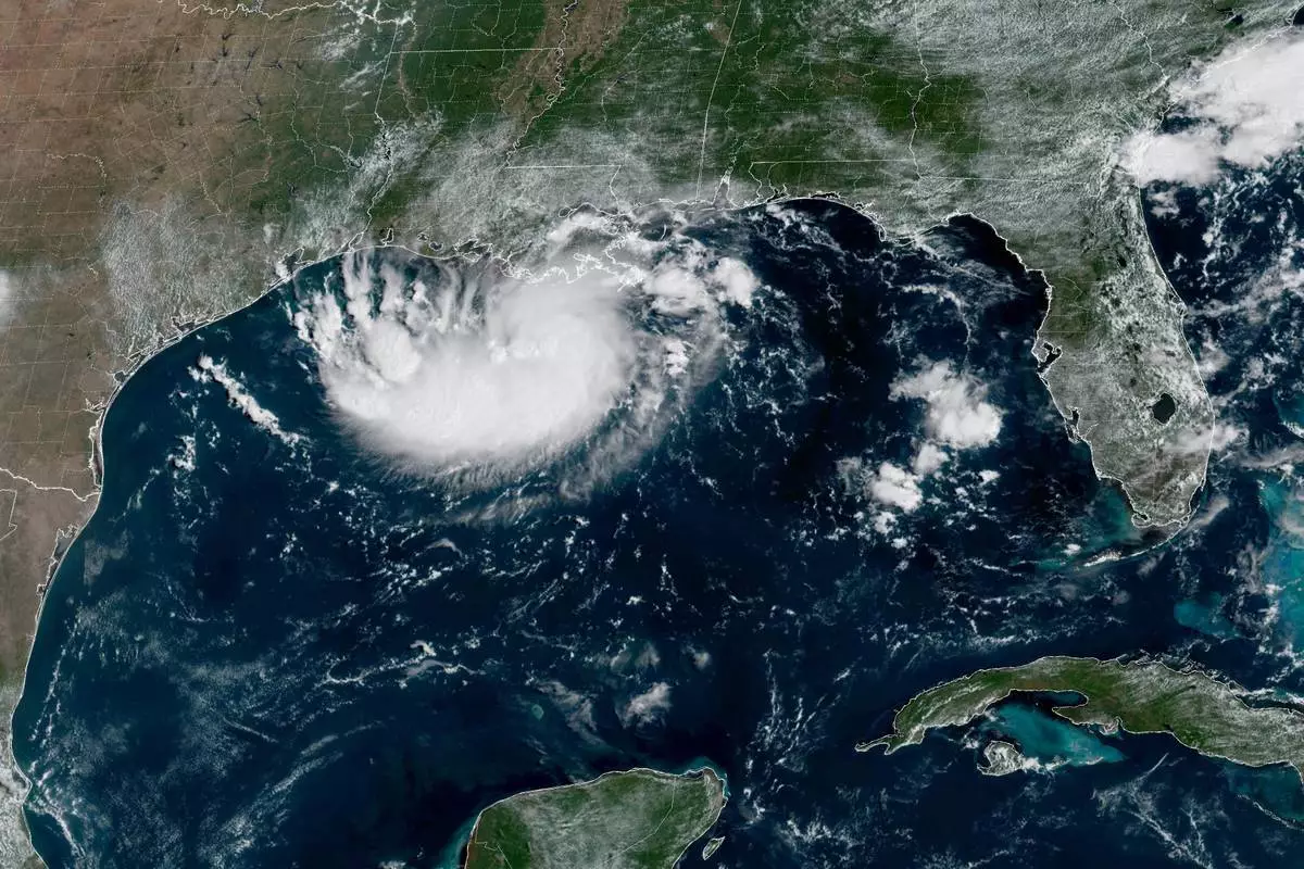
This satellite image released by NOAA shows Potential Tropical Cyclone Five forming over the Gulf of Mexico on Monday, Aug. 31, 2026. (NOAA via AP)
KATHMANDU, Nepal (AP) — Filmmaker and drone pilot Manish Maharjan crossed into Nepal from China’s Tibet through Rasuwagadhi, a border crossing closest to where last week's catastrophic flooding began, two days before the disaster. Returning home, little did he know he would be using his professional skills to help with rescue efforts along a route he has known intimately from years of travel for work.
As authorities mobilized dozens of rescue and relief teams, Maharjan joined the Nepal Army’s rescue efforts a day after the flash floods, which have since killed more than 1,000 people and left thousands missing in Nepal and China.
Maharjan has been operating thermal drones to assist rescue teams, focused on locating and finding at least 900 workers who are still missing from 12 hydropower projects buried under mud and debris. About 500 of them are believed to be trapped inside power plant tunnels.
He said drones were effective in locating people who were stranded on hillsides and in isolated places, including caves.
“We used microphone speakers to call out to them. In some places, we even played songs and then waited for a response. That worked in a few cases and helped us locate people,” Maharjan said.
While drones have helped him rescue some stranded people in open areas, the tunnels present an entirely different challenge, he said.
“We found tunnels were filled with mud like toothpaste in a tube,” Maharjan said. “There was no hollow or empty space inside.”
The Aug. 26 flash floods started after a glacial collapse high in the Himalayan region. Scientists who studied satellite images said bedrock underneath a glacier high in the Himalayan region had collapsed, taking part of the glacier with it. The rockfall was so extreme that it registered as a magnitude 5.2 seismic event.
The rocks and melted water then swelled the rivers in the valleys below, causing a torrent of water in Tibet and Nepal and causing widespread damage to critical infrastructure, including hydropower plants, roads, buildings and bridges in the region.
Some workers in the power plant tunnels managed to call for help when the disaster struck, and others who managed to flee reported their colleagues were still in the tunnels, according to Mohan Kumar Dangi, president of the Independent Power Producers’ Association. It was unclear whether rescuers have had any contact with the trapped workers since the initial calls for help.
As time slips away, rescuers are finding it increasingly difficult to locate these missing people. Experts say the first 72 hours are critical as the chances of survival drop without access to clean water. Access to breathable air is another key to survival.
Maharjan said the tunnel searches were challenging because of their difficult access and the absence of any empty space.
“I can only fly drones in tunnels that are long and straight,” he said. “Once there are bends, turns or zigzags, it becomes much harder to operate and search effectively.”
At the Rasuwagadhi hydropower project, Maharjan managed to send a drone to search deep inside and all the way to the end of the tunnel but found no sign of any life.
“We checked repeatedly but it was filled with mud and debris,” he said. “Looking at it, I could only imagine the force of the flood.”
Hussain reported from New Delhi.
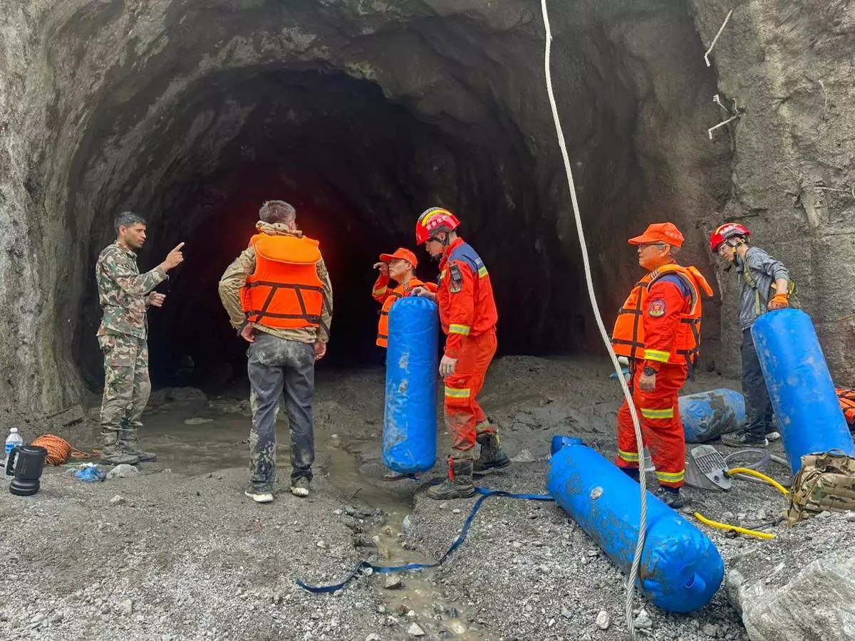
This photo provided by the Nepal Army, shows Nepal army soldiers undertake rescue operation at the site of a hydropower project in Upper Trishuli, Nepal, Monday, Aug. 31, 2026. (Nepal Army via AP)