The Philadelphia Eagles are bringing back fan favorite tight end Zach Ertz, three people familiar with the situation told The Associated Press.
Ertz will join the practice squad in hopes of shoring up a tight end room depleted by injuries, the people said Monday on condition of anonymity because the move had not been announced.
Ertz's return comes with multiple Eagles tight ends dealing with injuries.
Dallas Goedert is expected to miss several weeks with an MCL sprain suffered in Sunday's 24-20 win over the Tennessee Titans, one person told the AP. Backups Eli Stowers and Grant Calcaterra also are injured.
“We’ll see where he is by the end of the day here,” Eagles coach Nick Sirianni said of Goedert. “But I love the room. I love where we are in that room. Obviously, we had an injury yesterday with Dallas. Eli is out right now. We’re a little banged up there, as you guys know, but I like the pieces that we have there, and we’ll see where we are with Dallas. I don’t want to go anywhere yet until we figure out some things there.”
Ertz spent his first eight seasons with the Eagles, earning three Pro Bowl appearances, and made two key plays late in their Super Bowl win over the New England Patriots after the 2017 season. He played three seasons for Arizona after being traded in 2021 and spent the last two in Washington.
The 35-year-old suffered a torn ACL with the Commanders in December, but has been cleared to play.
Ertz is fifth on the NFL's career list for catches by a tight end with 825 and his 8,952 yards receiving are eighth. He's scored 57 touchdowns.
Ertz is 11 receptions away from breaking Hall of Famer Harold Carmichael's franchise record for Philadelphia. Carmichael had 589 catches with the Eagles from 1971-83. Ertz has 579.
See AP’s full NFL coverage here

Philadelphia Eagles tight end Dallas Goedert (88) is grabbed by Washington Commanders cornerback Darius Rush (29) as he runs for a touchdown during the second half of an NFL football game, Sunday, Sept. 13, 2026, in Philadelphia. (AP Photo/Matt Rourke)

FILE - Washington Commanders tight end Zach Ertz stands on the field during the first half of an NFL football game against the Minnesota Vikings, Dec. 7, 2025, in Minneapolis. (AP Photo/Abbie Parr, File)
MIAMI (AP) — Hurricane Polo will rapidly intensify in the Pacific Ocean and become a major hurricane later this week, forecasters said Monday.
Polo could bring heavy rain, rough surf and tropical-storm-force winds to parts of Mexico late Tuesday into early Wednesday, the Miami-based National Hurricane Center said.
On Monday, Polo was moving east. But forecasters said it would make a “sharp turn” in a west-northwest or northwest direction by late Tuesday, according to an advisory. The hurricane was expected to travel along the coast of western Mexico but stay offshore.
Polo was centered about 290 miles (470 kilometers) south-southeast of Manzanillo, Mexico, and 180 miles (290 kilometers) south-southwest of Zihuatanejo, Mexico. Maximum sustained winds were 90 mph (150 kph).
The forecast called for 4 to 8 inches (10 to 20 centimeters) of rain, with isolated totals near 12 inches (30 centimeters), across coastal portions of the Mexican states of Guerrero and Michoacán through Thursday. Flooding and mudslides were possible.
Farther west in the Pacific Ocean, Tropical Storm Odalys was far from land but expected to become a hurricane by midweek.
Odalys had maximum sustained winds Monday of 50 mph (85 kph). It was located just over 1,400 miles (2,253 kilometers) west-southwest of the southern tip of Mexico's Baja California peninsula. It was moving northwest at 8 mph (13 kph).
In the Atlantic Ocean, Tropical Storm Fay was weakening. Top winds were down to 45 mph (75 kph) and Fay was 445 miles (720 kilometers) southwest of the Azores.
No Atlantic hurricanes have formed yet this year, and this year has set a record for the longest a season has begun without a hurricane. The effects of this year's El Nino crush storms before they get going.
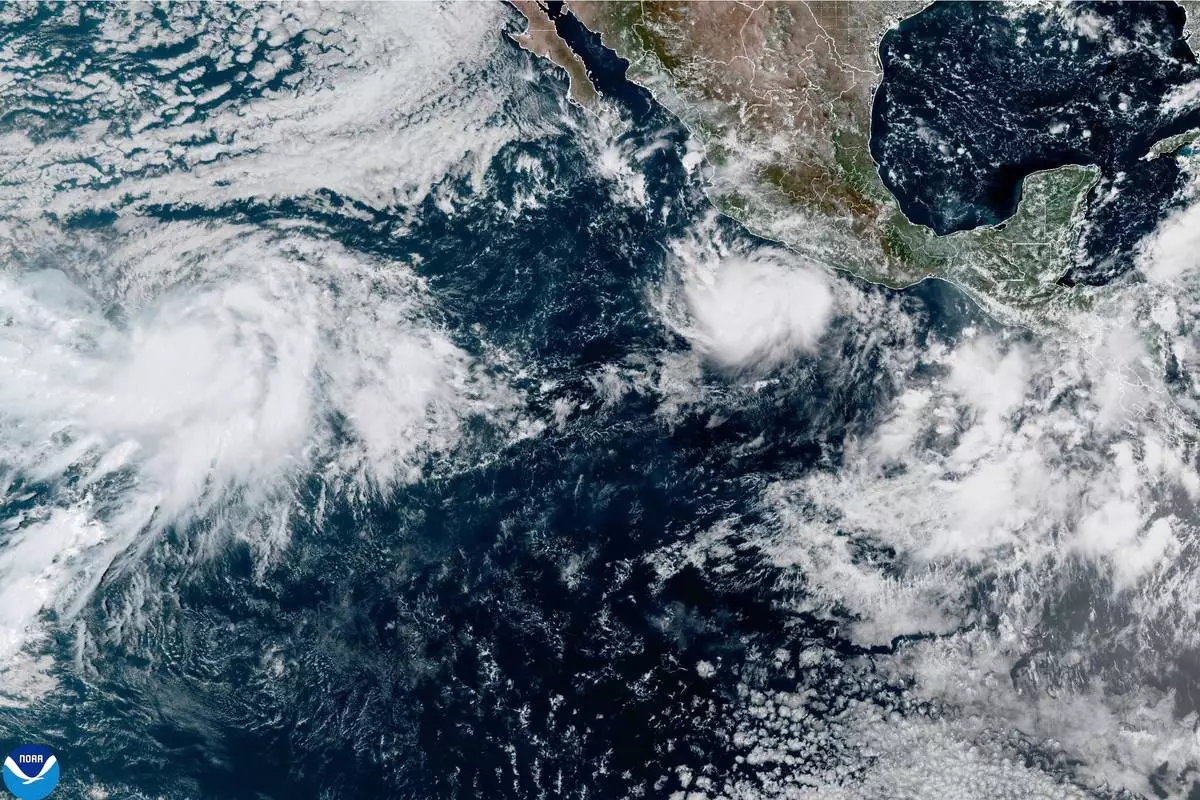
This photo provided by NOAA shows Hurricane Polo intensifying in the Pacific Ocean off the coast of Mexico on Monday, Sept. 21, 2026. (NOAA via AP)
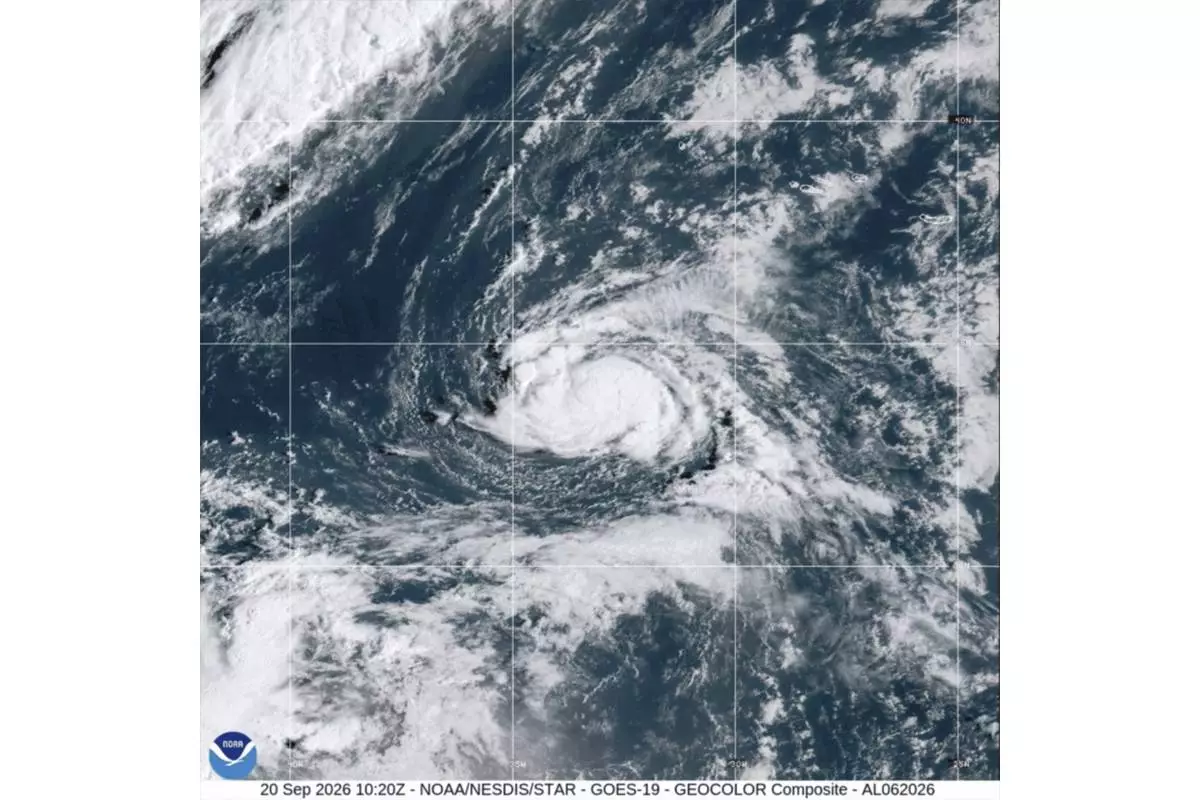
This satellite image from the National Oceanic and Atmospheric Administration shows Tropical Storm Fay, Sunday, Sept. 20, 2026. (NOAA via AP)
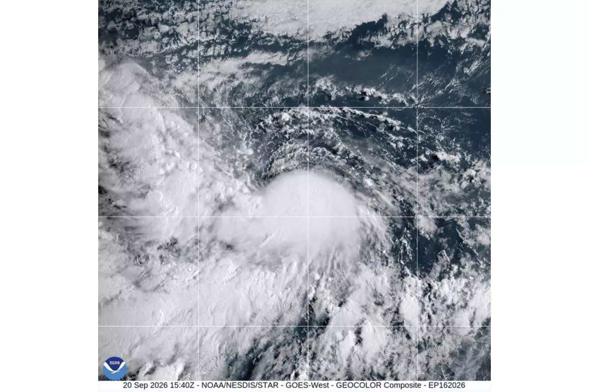
This satellite image from the National Oceanic and Atmospheric Administration shows Tropical Storm Odalys, Sunday, Sept. 20, 2026. (NOAA via AP)
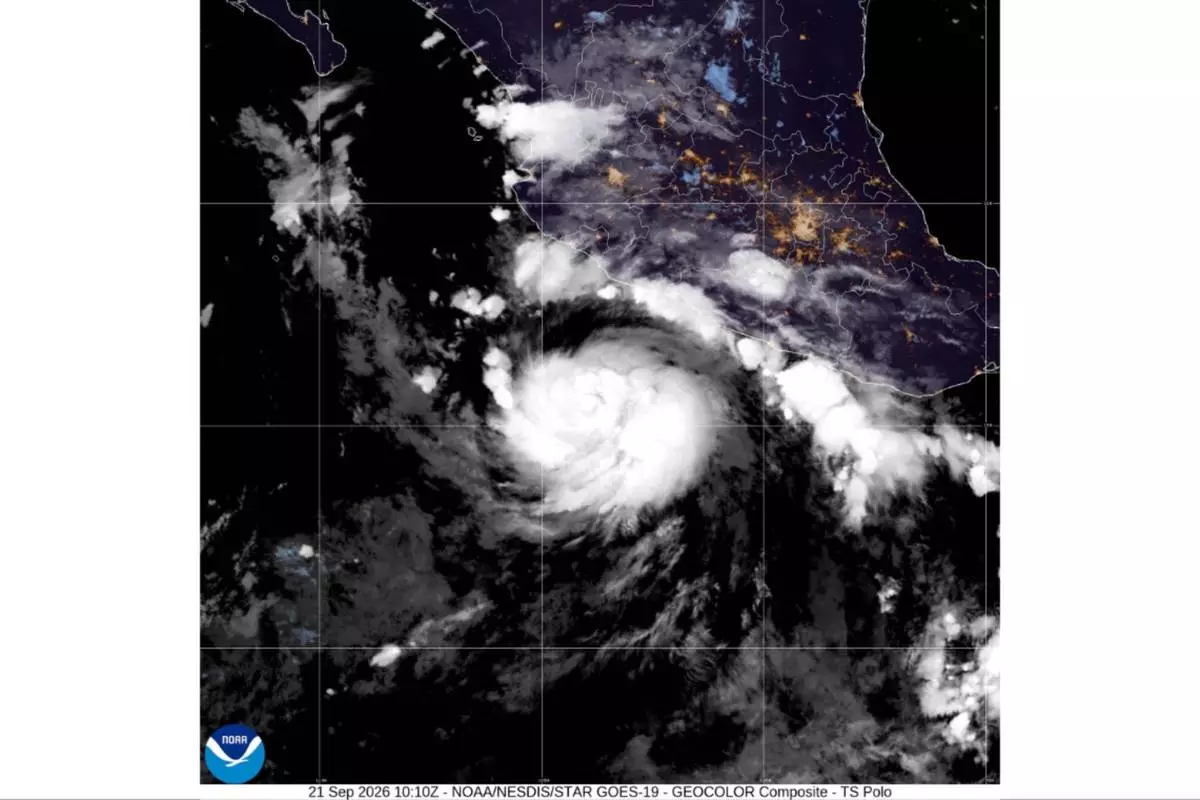
This satellite image from the National Oceanic and Atmospheric Administration shows Tropical Storm Polo, Monday, Sept. 21, 2026. (NOAA via AP)