CAPE CANAVERAL, Fla. (AP) — NASA and India paired up to launch an Earth-mapping satellite on Wednesday capable of tracking even the slightest shifts in land and ice.
The $1.3 billion mission will help forecasters and first responders stay one step ahead of floods, landslides, volcanic eruptions and other disasters, according to scientists.
Click to Gallery

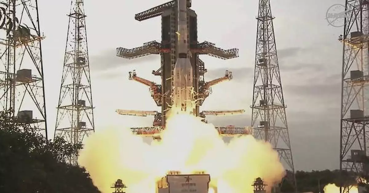
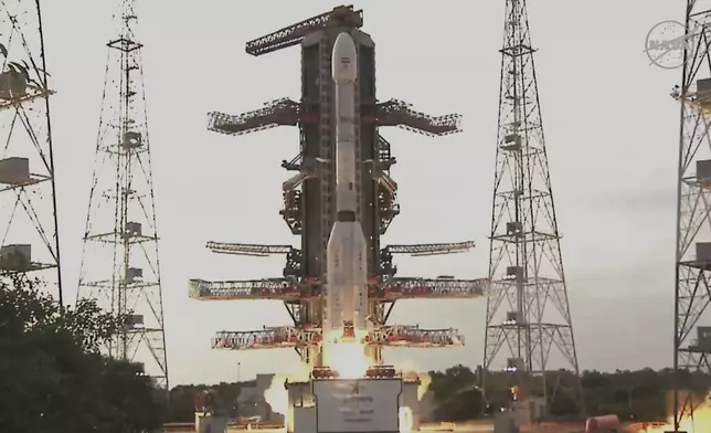
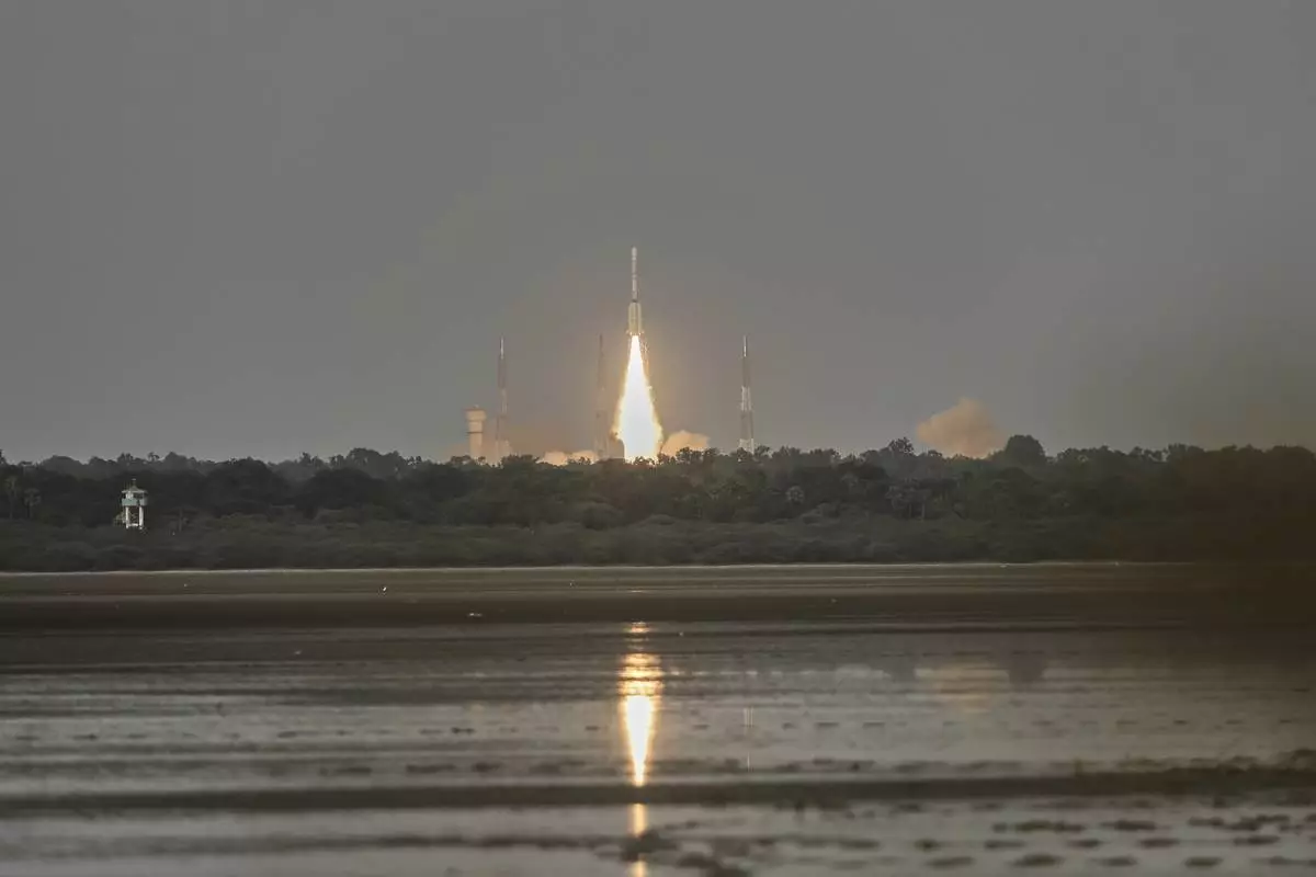
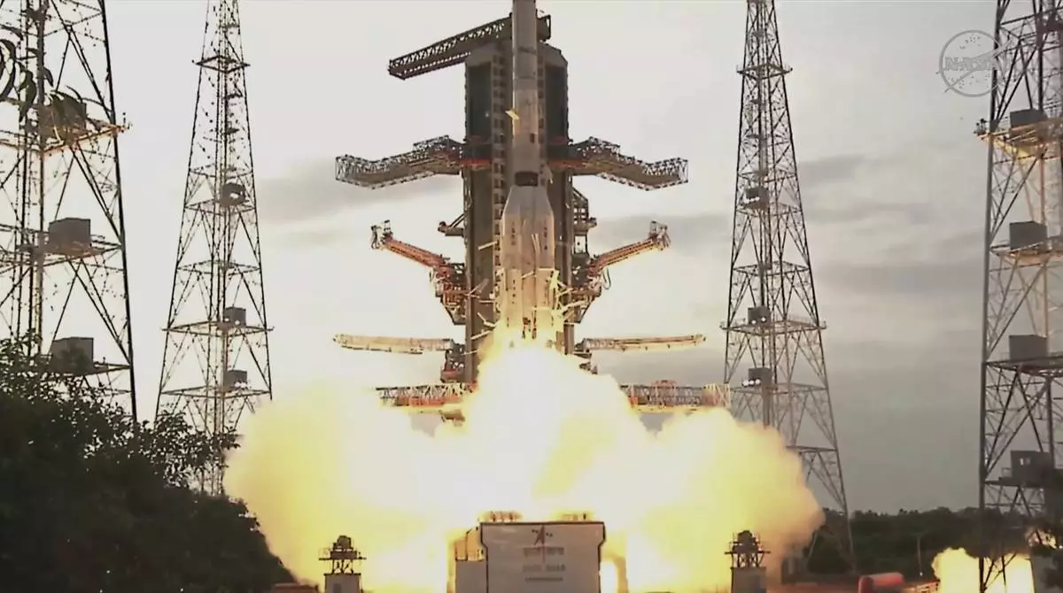
The NISAR satellite, a joint mission by NASA and ISRO, lifts off aboard a GSLV-F16 rocket, from the Satish Dhawan Space Centre in Sriharikota, India, Wednesday, July 30, 2025. (AP Photo/R. Parthibhan)

The NISAR satellite, a joint mission by NASA and ISRO, lifts off aboard a GSLV-F16 rocket, from the Satish Dhawan Space Centre in Sriharikota, India, Wednesday, July 30, 2025. (AP Photo/R. Parthibhan)
The NISAR satellite, a joint mission by NASA and ISRO, lifts off aboard a GSLV-F16 rocket, from the Satish Dhawan Space Centre in Sriharikota, India, Wednesday, July 30, 2025. (AP Photo/R. Parthibhan)
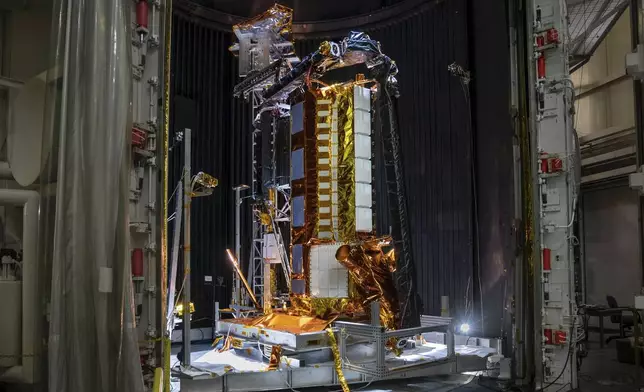
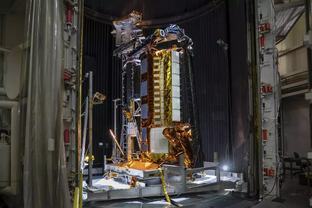
This photo provided by NASA shows part of the NISAR (NASA-ISRO Synthetic Aperture Radar) satellite resting in a thermal vacuum chamber in August 2020 at NASA's Jet Propulsion Laboratory in La Cañada Flintridge, Calif. (NASA/JPL-Caltech via AP)
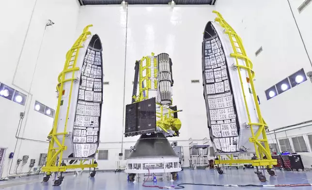
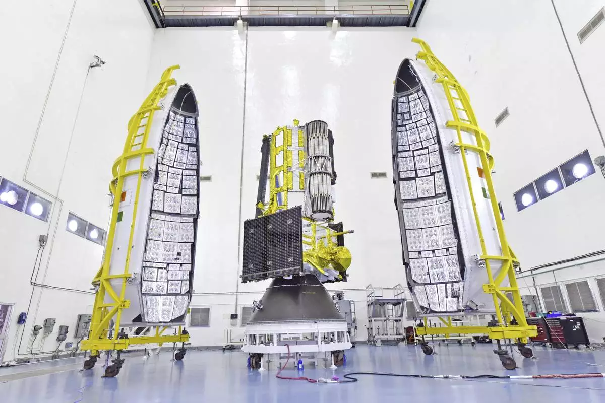
This photo provided by NASA shows the NISAR (NASA-ISRO Synthetic Aperture Radar) satellite on July 18, 2025, at the Indian Space Research Organization's Satish Dhawan Space Center in Sriharikota, Tirupati district, Andhra Pradesh, India. (Indian Space Research Organization/NASA via AP)
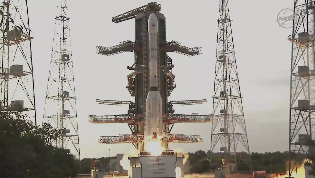
This image provided by NASA shows an Earth-mapping satellite, the first collaborative mission between NASA and the Indian Space Research Organization, launching from India on Wednesday, July 30, 2025. (NASA via AP)
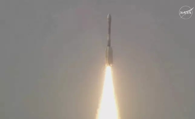
This image provided by NASA shows an Earth-mapping satellite, the first collaborative mission between NASA and the Indian Space Research Organization, launching from India on Wednesday, July 30, 2025. (NASA via AP)
This image provided by NASA shows an Earth-mapping satellite, the first collaborative mission between NASA and the Indian Space Research Organization, launching from India on Wednesday, July 30, 2025. (NASA via AP)
Rocketing to orbit from India, the satellite will survey virtually all of Earth’s terrain multiple times. Its two radars — one from the U.S. and the other from India — will operate day and night, peering through clouds, rain and foliage to collect troves of data in extraordinary detail.
Microwave signals beamed down to Earth from the dual radars will bounce back up to the satellite’s super-sized antenna reflector perched at the end of a boom like a beach umbrella. Scientists will compare the incoming and outgoing signals as the spacecraft passes over the same locations twice every 12 days, teasing out changes as small as a fraction of an inch (1 centimeter).
“Congratulations India!” India’s minister of science and technology, Jitendra Singh, said via X once the satellite safely reached orbit. The mission “will benefit the entire world community.”
NASA’s deputy associate administrator Casey Swails, part of a small delegation that traveled to India for the launch, said it “really shows the world what our two nations can do. But more so than that, it really is a pathfinder for the relationship building,.”
It will take a full week to extend the satellite’s 30-foot (9-meter) boom and open the 39-foot-in-diameter (12-meter) drum-shaped reflector made of gold-plated wire mesh. Science operations should begin by the end of October.
Among the satellite’s most pressing measurements: melting glaciers and polar ice sheets; shifting groundwater supplies; motion and stress of land surfaces prompting landslides and earthquakes; and forest and wetland disruptions boosting carbon dioxide and methane emissions.
It's “a first-of-its-kind, jewel radar satellite that will change the way we study our home planet and better predict a natural disaster before it strikes," NASA’s science mission chief Nicky Fox said ahead of liftoff. She was part of the NASA delegation that attended the launch in person.
NASA is contributing $1.2 billion to the three-year mission; it supplied the low-frequency radar and reflector. The Indian Space Research Organization’s $91 million share includes the higher-frequency radar and main satellite structure, as well as the launch from a barrier island in the Bay of Bengal. It’s the biggest space collaboration between the two countries.
The satellite called NISAR — short for NASA-ISRO Synthetic Aperture Radar — will operate from a near-polar-circling orbit 464 miles (747 kilometers) high. It will join dozens of Earth observation missions already in operation by the U.S. and India.
The Associated Press Health and Science Department receives support from the Howard Hughes Medical Institute’s Department of Science Education and the Robert Wood Johnson Foundation. The AP is solely responsible for all content.

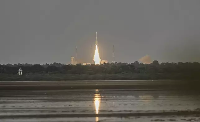
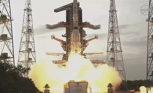
The NISAR satellite, a joint mission by NASA and ISRO, lifts off aboard a GSLV-F16 rocket, from the Satish Dhawan Space Centre in Sriharikota, India, Wednesday, July 30, 2025. (AP Photo/R. Parthibhan)
The NISAR satellite, a joint mission by NASA and ISRO, lifts off aboard a GSLV-F16 rocket, from the Satish Dhawan Space Centre in Sriharikota, India, Wednesday, July 30, 2025. (AP Photo/R. Parthibhan)
The NISAR satellite, a joint mission by NASA and ISRO, lifts off aboard a GSLV-F16 rocket, from the Satish Dhawan Space Centre in Sriharikota, India, Wednesday, July 30, 2025. (AP Photo/R. Parthibhan)
This photo provided by NASA shows part of the NISAR (NASA-ISRO Synthetic Aperture Radar) satellite resting in a thermal vacuum chamber in August 2020 at NASA's Jet Propulsion Laboratory in La Cañada Flintridge, Calif. (NASA/JPL-Caltech via AP)
This photo provided by NASA shows the NISAR (NASA-ISRO Synthetic Aperture Radar) satellite on July 18, 2025, at the Indian Space Research Organization's Satish Dhawan Space Center in Sriharikota, Tirupati district, Andhra Pradesh, India. (Indian Space Research Organization/NASA via AP)
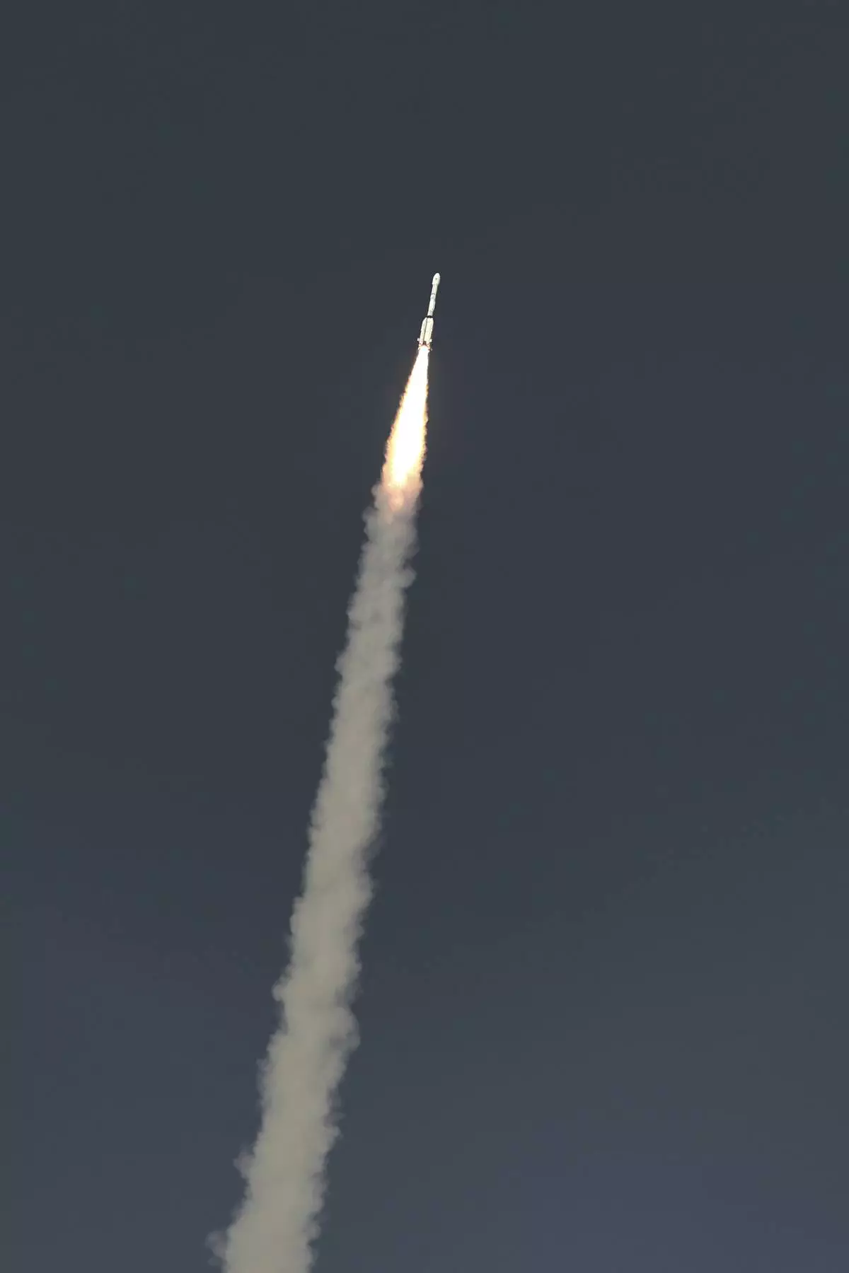
This image provided by NASA shows an Earth-mapping satellite, the first collaborative mission between NASA and the Indian Space Research Organization, launching from India on Wednesday, July 30, 2025. (NASA via AP)
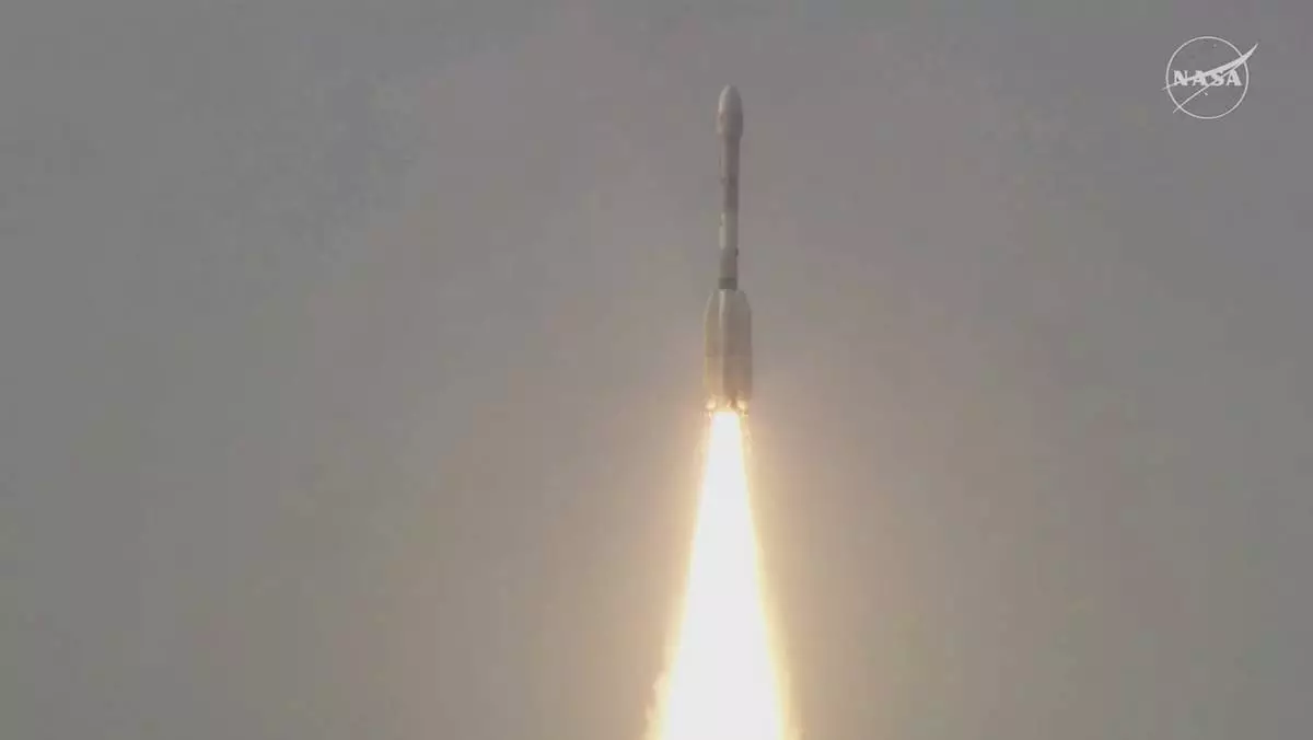
This image provided by NASA shows an Earth-mapping satellite, the first collaborative mission between NASA and the Indian Space Research Organization, launching from India on Wednesday, July 30, 2025. (NASA via AP)
This image provided by NASA shows an Earth-mapping satellite, the first collaborative mission between NASA and the Indian Space Research Organization, launching from India on Wednesday, July 30, 2025. (NASA via AP)