At least eight people were injured when an Avianca flight encountered severe turbulence and had to make an emergency landing in Miami early Friday.
Miami-Dade Fire Rescue said that one person was rushed to a trauma center with severe injuries while seven others were taken to area hospitals in ambulances after the plane landed shortly after 3 a.m. Friday. The airline said nine people — three crew members and six passengers — were affected by the turbulence and needed to be taken to a medical facility.
The Federal Aviation Administration said the Avianca flight was en route from Medellin, Colombia, to John F. Kennedy International Airport in New York when the Airbus A320 had to divert to Miami.
Avianca said the passengers who were not hurt were flown to New York on Friday morning. The airline said “the safety of our customers and employees is, and will remain, the foundation of our operations.”
Serious injuries from in-flight turbulence are rare, but scientists say they may be becoming more common as climate change alters the jet stream. The International Air Transport Association said the number of reports it received about turbulence incidents surged more than 25% last year.
Last summer, 24 people were taken to the hospital after a Delta Air Lines flight encountered turbulence caused by a thunderstorm over Wyoming. The National Transportation Safety Board has said passengers and flight attendants were thrown into the ceiling with enough force to crack some of the interior panels before tossing them back to the floor and then up again. The seat belt sign was off at the time so some passengers were up and drinks were being served when that plane hit the turbulence.
At least 20 passengers have filed lawsuits against Delta over that incident, arguing the airline could have avoided the severe weather.
The FAA recommends that passengers stay buckled whenever possible to protect against unexpected turbulence.

In this image from video, the Avianca Airlines plane which had encountered severe turbulence and had to make an emergency landing, is parked at Miami International Airport in Miami, on Friday, Oct. 9, 2026. (WSVN/ABC Miami via AP)

FILE - The logo of the Miami International Airport is seen on mobile boarding stairs in Miami on March 6, 2026. (AP Photo/Mark Schiefelbein, File)
PENSACOLA, Fla. (AP) — Residents along the U.S. Gulf Coast boarded up windows and picked up last-minute supplies on Friday as Isaias strengthened into a major hurricane and carved a path toward the Alabama-Florida line.
The Category 3 hurricane — the first of an unusually quiet Atlantic season — is expected to make landfall Friday night and bring significant storm surge, damaging winds, flooding and possibly even tornadoes before scattering strong winds and rain well north into Atlanta.
Isaias is expected to come ashore between Mobile Bay on the Alabama coast and the city of Destin in the Florida Panhandle — a region known for powdery white sand beaches dotted with vacation homes, waterfront bars and seafood shacks.
Anne Petzold, who lives with her husband in the panhandle beach community of Gulf Breeze, said Friday that they and all of their neighbors plan to ride out the storm. The couple put up hurricane shutters, put away anything in their yard that could turn into a projectile, stocked up on food and water, and have two generators ready if they lose power.
“Everybody does what they can do, everybody asks if they need help — they ask for help, they offer help. All good,” she said. “It’s just another adventure.”
Dangerous conditions are expected throughout the western panhandle, southern Alabama and southern Mississippi, the National Hurricane Center said. Rain began falling along the coast Friday morning, and tropical storm-force winds were expected by early afternoon.
A storm surge as high as 6 to 9 feet (1.8 to 2.7 meters) is likely in some coastal areas, according to the hurricane center. Places most at risk include Florida's Pensacola Beach and the Gulf Islands National Seashore.
Florida Gov. Ron DeSantis warned residents to expect flooding, wind damage, power outages and gasoline shortages.
“When the water’s rising and things are happening, it’s a very, very difficult conundrum and you do not want to be caught in that,” he said.
The hurricane center said Friday morning that time was running out to make preparations “as the weather will go downhill quickly today.”
As of late morning, the storm was centered less than 200 miles (320 kilometers) south of Pensacola and moving to the north-northeast, the center said. It was packing 120 mph (193 kph) sustained winds Friday morning and picking up speed. Category 3 storms are considered major hurricanes and are capable of causing devastation.
Once Isaias comes ashore, it is expected to weaken until it is downgraded to a tropical storm by Saturday afternoon, the hurricane center said.
Still, heavy rain is forecast as it moves inland, with 4 to 8 inches (10 to 20 centimeters) or even more expected through the weekend from southern Alabama to southwestern Georgia.
Isaias, which will be the first hurricane to hit the eastern U.S. since Milton tore up the Gulf Coast of Florida in 2024, also is expected to bring heavy rain and potential flooding to much of the Southeast over the weekend, and then to parts of the Midwest and Northeast into Monday.
A hurricane warning was in place from Ocean Springs, Mississippi, to the western Florida Panhandle.
Preparations have been going on for days. On Thursday, residents boarded up windows and stacked sandbags while thousands of National Guard soldiers were deployed.
Alabama Gov. Kay Ivey on Thursday ordered non-residents to immediately evacuate Gulf Shores, Orange Beach and Dauphin Island. Videos on social media showed traffic at a standstill on a highway leading out of Gulf Shores, where double-red beach flags signaled water access was closed.
Several counties announced mandatory evacuations for some coastal areas while Florida and Alabama declared states of emergency for dozens of counties.
On Dauphin Island, a barrier island off the Alabama coast, Mayor Jeff Collier said he did not anticipate substantial damage, “but at the same time, these things are very fickle and a little jog here or there, or some last-minute increase in strength — we just have to be prepared for the worst.”
Meanwhile in the Pacific, Hurricane Simon became a Category 2 hurricane on Friday and was expected to strengthen further before making landfall in Mexico this weekend.
Collins reported from Hartford, Connecticut, and Bates reported from Gulf Breeze, Florida. These Associated Press journalists also contributed: Gerald Herbert in Pensacola, Florida; Kim Chandler in Montgomery, Alabama; John Seewer in Toledo, Ohio; Hallie Golden in Seattle; John Raby in Charleston, West Virginia; and Laura Turbay in Little Rock, Arkansas.
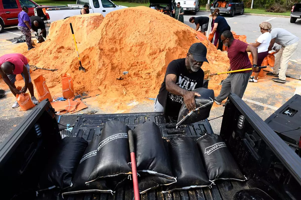
Residents pick up sandbags for storm preparation at the James Seals Jr. Parks & Recreation Center ahead of Hurricane Isaias' expected landfall along the Gulf Coast, Thursday, Oct. 8, 2026, in Mobile, Ala. (AP Photo/Octavio Jones)
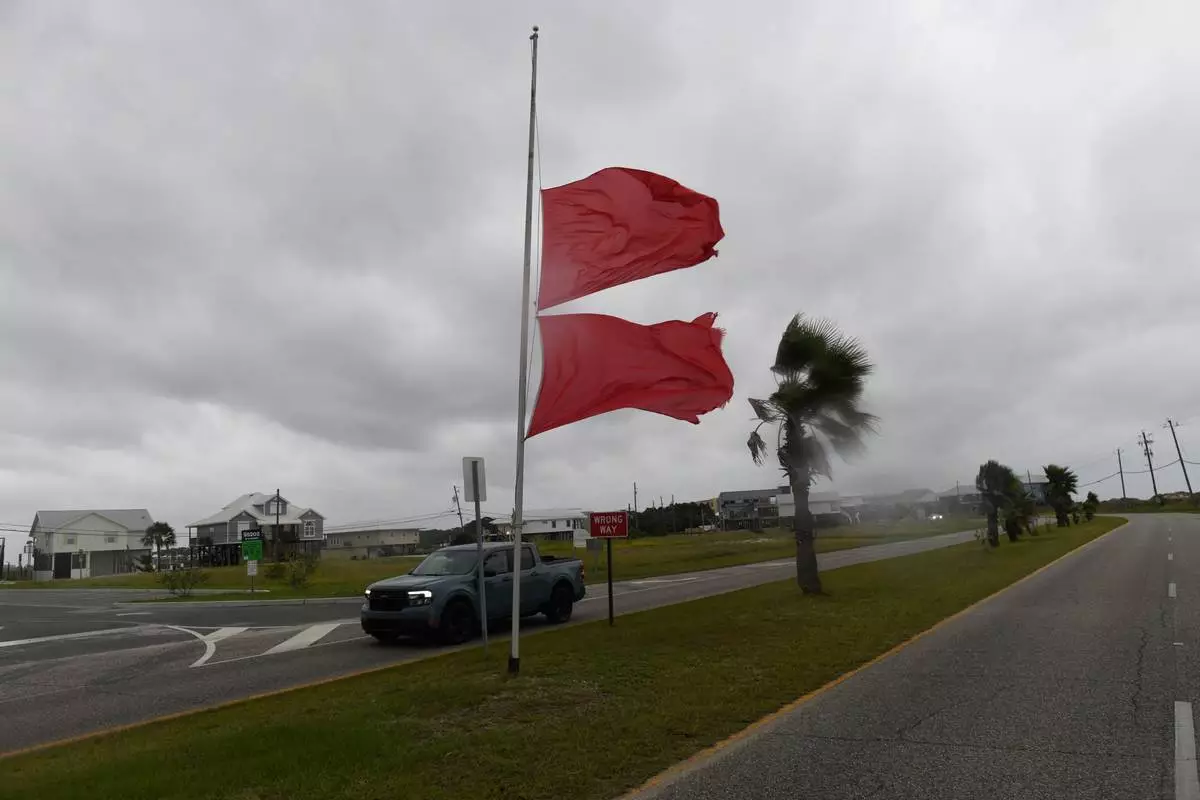
Marine flags flap in the wind generated by the effects of Isaias as a vehicle passes on Friday, Oct. 9, 2026, in Dauphin Island, Ala. (AP Photo/Octavio Jones)
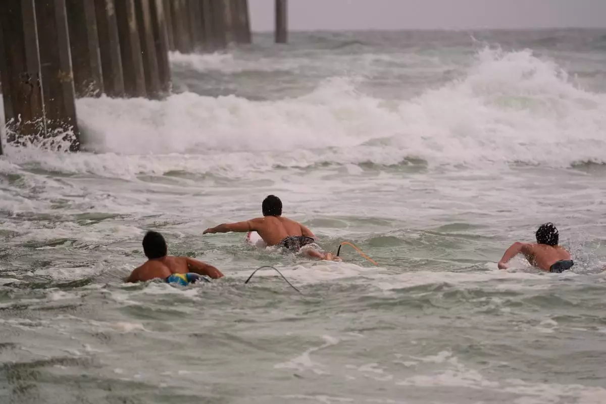
Surfers swim out to waves as Hurricane Isaias approaches Pensacola Beach, Fla., Friday, Oct. 9, 2026. (AP Photo/Gerald Herbert)
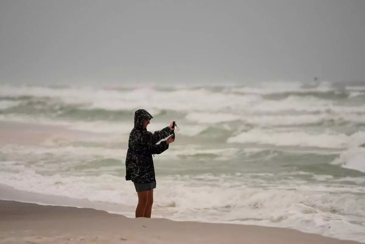
Silas Bowles, of Gulf Breeze, Fla. films the surf as Hurricane Isaias approaches Pensacola Beach, Fla., Friday, Oct. 9, 2026. (AP Photo/Gerald Herbert)
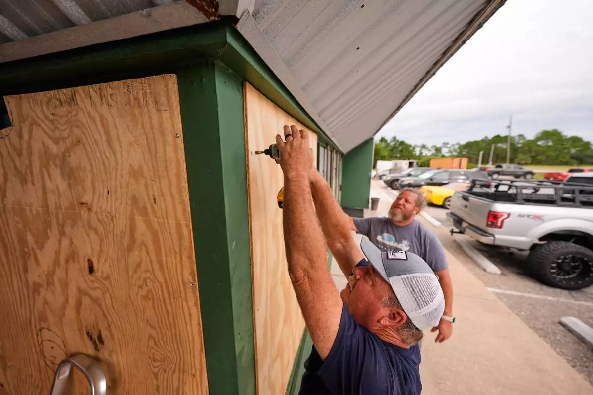
Mike Howard, foreground, and Joshua Brown board up Perdido Key Sports Bar as Hurricane Isaias approaches Perdido Key, Fla., Thursday, Oct. 8, 2026. (AP Photo/Gerald Herbert)
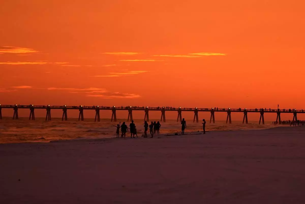
People walk on the beach at sunset as Hurricane Isaias approaches Pensacola Beach, Fla., Thursday, Oct. 8, 2026. (AP Photo/Gerald Herbert)
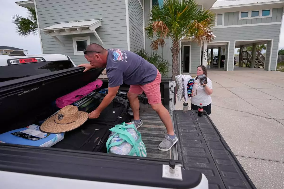
Daniel and Brand Harp, of Lebanon Tenn., here on vacation, pack their belongings to evacuate in the morning as Hurricane Isaias approaches Pensacola Beach, Fla., Thursday, Oct. 8, 2026. (AP Photo/Gerald Herbert)
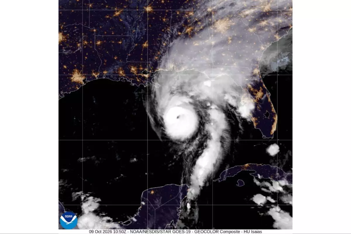
This satellite image from the National Oceanic and Atmospheric Administration shows Hurricane Isaias in the Gulf of Mexico, Friday, Oct. 9, 2026. (National Oceanic and Atmospheric Administration via AP)
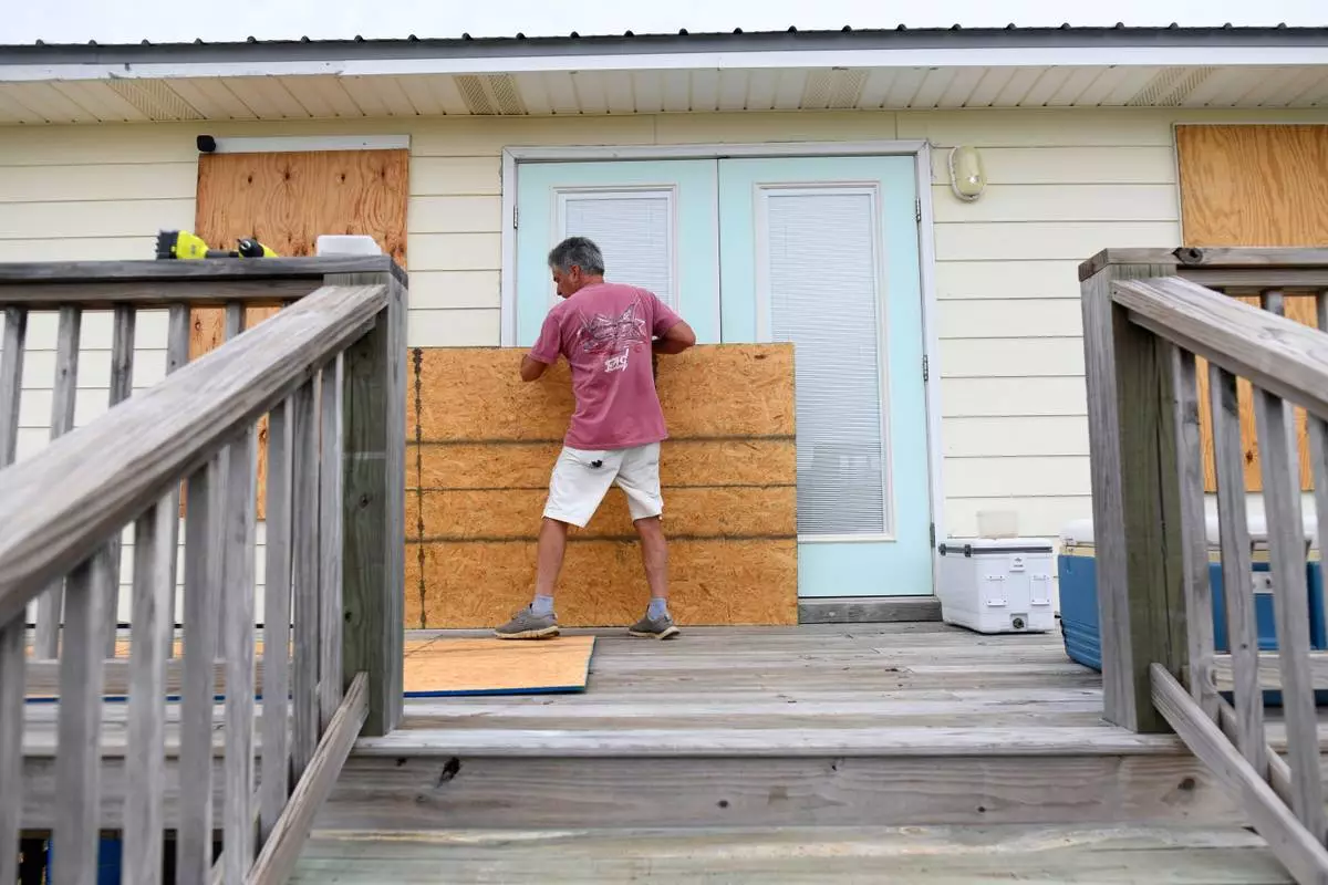
Larry Smith boards up his home with plywood ahead of Hurricane Isaias' expected landfall along the Gulf Coast in Dauphin Island, Alabama, Thursday, Oct. 8, 2026. (AP Photo/Octavio Jones)