Typhoon Noul, the 12th typhoon of the year, made landfall in Huidong County of Huizhou City in south China's Guangdong Province, at about 03:50 Sunday, bringing strong winds and heavy rain, according to the National Meteorological Center (NMC).
At the time of landfall, the storm packed maximum winds near its center reaching Force 14, the NMC said.
By 05:00, the typhoon had moved to Daya Bay in Huizhou, with its intensity downgraded slightly to Force 13. The storm is moving northwestward at a speed of 10 to 15 kilometers per hour and is expected to weaken gradually as it progresses further inland.
Typhoon Noul marks the most powerful typhoon to make landfall east of the Pearl River Estuary in the past ten years. Meteorologists warn that the storm brings a dangerous compounding effect of high winds, torrential rain, and massive waves, significantly elevating the risk of severe secondary disasters, including urban waterlogging, flash floods, mudslides, and landslides.
In response to the threat, local authorities issued an advisory early Sunday morning, urging the public to closely monitor official weather updates and strictly adhere to local emergency protocols. Officials warned that evacuated residents must not leave designated shelters to ensure their safety.
The NMC on Saturday activated a red alert, the highest level in the country's typhoon warning system, before the landfall.
It expects heavy to torrential rainfall to impact central, eastern, and southern Guangdong, southern Fujian Province, southern Jiangxi Province, southeastern Hunan Province, and southeastern Taiwan Island through 22:00 on Sunday.
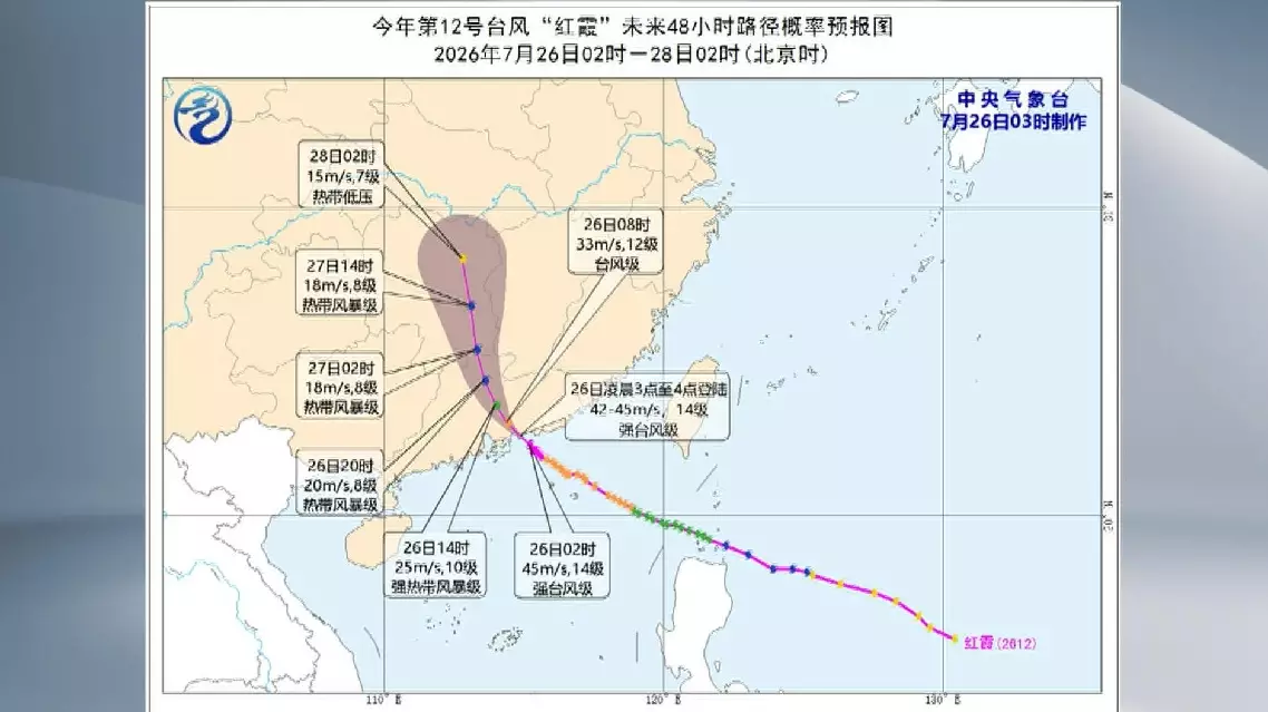
Typhoon Noul makes landfall in south China's Guangdong, bringing strong wind, heavy rain