A newly launched Chinese satellite constellation equipped with artificial intelligence (AI) technology can significantly shorten warning times for wildfires, landslides, and other surface anomalies.
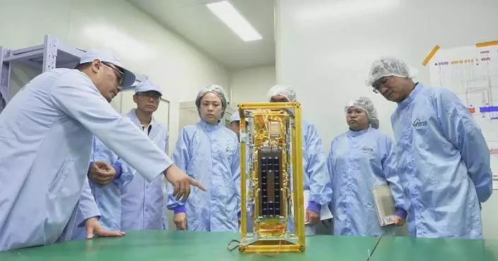
The "Muduo 1" scientific experimental satellite constellation, developed by Beijing Normal University (BNU), was launched Tuesday aboard a Long March-6C rocket from the Taiyuan Satellite Launch Center in north China. It was among seven satellites sent into orbit.
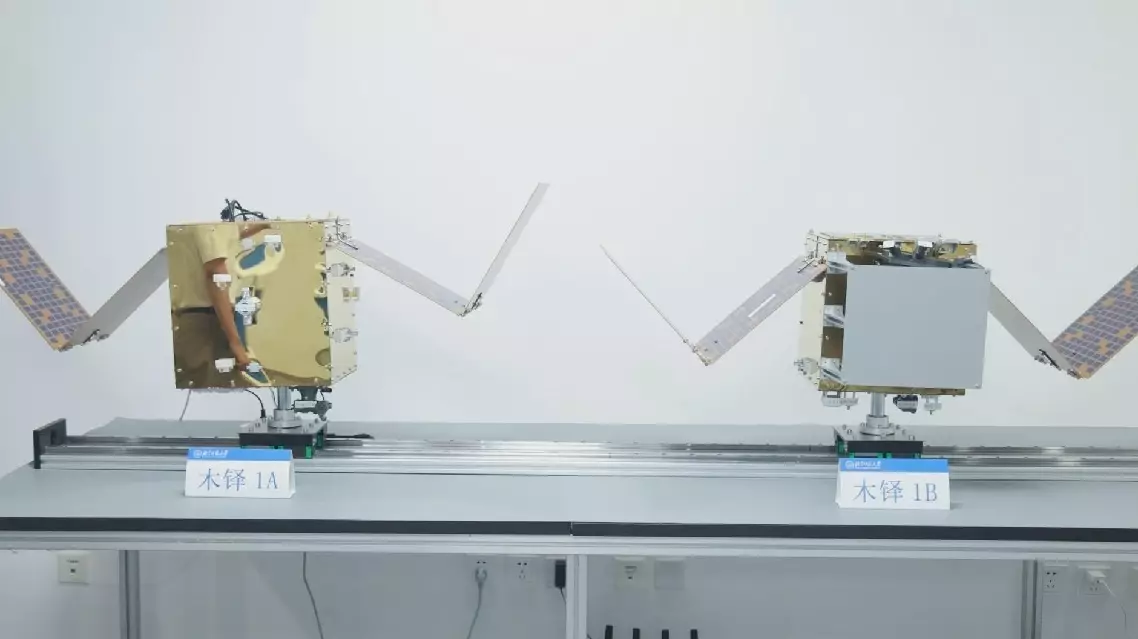
The constellation consists of two satellites, Muduo 1A and 1B, both equipped with high-performance AI computing capabilities capable of performing more than 100 trillion operations per second.
The satellites carry onboard AI models and computing chips, giving them the ability to independently detect and assess surface anomalies while capturing images and generating analysis results directly in orbit.
Traditional remote sensing satellites typically take two to six hours to capture and downlink images for ground-based processing after surface anomalies such as geological disasters occur.
The Muduo constellation uses a coordinated two-satellite system. Muduo 1A, a multispectral satellite, conducts wide-area surveys to identify surface anomalies, while Muduo 1B, a hyperspectral satellite with 26 channels, carries out detailed examinations of specific areas.
The two satellites work together in an efficient way via inter-satellite laser communication, enabling data to be processed directly in orbit. "We have achieved onboard detection and intelligent analysis, with the results directly downlinked to the ground. In our laboratory tests, the entire process from detecting a surface anomaly to analyzing and processing it and transmitting the information to the ground can be completed within one minute," said Wang Guoqiang, director of the Advanced Interdisciplinary Institute of Satellite Applications at BNU.
The constellation operates through a coordinated two-satellite system, with Muduo 1A conducting extensive surveys and Muduo 1B carrying out detailed examinations of specific targets via inter-satellite laser communication, Wang said. "When satellite A detects a problem, it transmits the location to satellite B, which then focuses on the area to identify the problem and assess its severity. Through direct satellite-to-ground data transmission, we are immediately informed of what is happening on the ground and how serious it is. We also have corresponding algorithms on the ground, and together with our ground-based large model, we can carry out joint analysis between the satellite and ground systems," Wang said. The onboard AI models can identify and provide early warnings for more than 10 types of surface anomalies, including landslides, floods, forest fires and illegal mining, and can also be updated while in orbit.
"Our algorithm can detect temperature anomalies with a sensitivity of up to 5 degrees Celsius, meaning it can issue an alert during the early smoldering stage of a fire before it breaks out," said Cao Biao, a professor from the institute.
The research team plans to expand the Muduo satellite constellation and upgrade its onboard remote sensing AI models to provide early warning services for disaster prevention, ecological protection and natural resource management.
China's AI-equipped satellite constellation launched to boost early warnings