ROCHESTER, N.Y.--(BUSINESS WIRE)--Oct 9, 2026--
Just in time for Halloween, Nalgene Outdoor is adding a little inspiration to spooky season and trick-or-treat traditions with three new designs in its limited-edition Mythical Creatures collection: Mothman, the Loch Ness Monster and Jackalope.
This press release features multimedia. View the full release here: https://www.businesswire.com/news/home/20261008052651/en/
The new designs join aliens, werewolves and Sasquatch, bringing six legendary characters to Nalgene’s iconic 32-ounce bottles just in time for fall traditions. Whether they inspire a last-minute Halloween costume, come along for a fall hike or simply add some personality to an everyday essential, the collection offers a playful take on creatures people have been spinning tales about for generations.
“We often say ‘every Nalgene bottle has a story,’” said Eric Hansen, Marketing Director at Nalgene Outdoor. “Expanding Mythical Creatures allows us to bring that concept even further to life. These designs take creatures people grew up hearing about and reimagine them with the bold color, illustration and personality our community expects from Nalgene Outdoor. ”
Mythical Creatures debuted earlier in 2026 and now expands with three new creatures, brought to life through hand-illustrated artwork on standout bottle-and-cap color combinations:
For more than 75 years, Nalgene Outdoor has set the standard for durable, reusable bottles. Since pioneering bold color in the category in the early ’90s, the brand has continued to bring personality to hydration through unique designs and limited-edition collections. That same mix of personality and performance carries through the Mythical Creatures collection.
Sourced and made in the USA from Tritan™ Renew, these bottles are dishwasher safe, lightweight, and deliver the durability and functionality for which Nalgene bottles are known. Each 32-ounce wide-mouth Mythical Creatures bottle is available at www.nalgene.com and www.amazon.com with an MSRP of $18.99.
Download high-res photos here. To request samples, or more information, contact Marcia Gray at mgray@graycreate.com. Follow @Nalgene on Instagram, TikTok and Facebook for updates. Tag #MythicalCreatures to share the imaginative ways this collection elevates your everyday adventures.
About NALGENE Outdoor
NALGENE ® Outdoor Products is based in Rochester, New York and part of Thermo Fisher Scientific. Founded in 1949 as a manufacturer of the first plastic pipette holder, the company soon expanded its product line to include state-of-the-art polyethylene labware under the NALGENE brand. By the mid-1970s, outdoor enthusiasts had discovered the taste and odor-resistant, leak-proof and rugged properties of NALGENE's large selection of plastic containers. In response to this emerging demand, NALGENE Outdoor Products was formed and today the consumer-oriented business offers its customers a wide choice of safe, environmentally friendly, BPA- and BPS- free products that meet their lifestyle needs. For more information, contact NALGENE Consumer Products or visit www.nalgene.com.
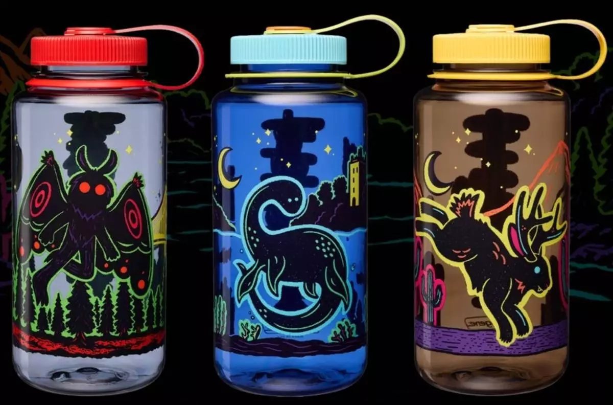
Nalgene Outdoor adds three new designs in its limited-edition Mythical Creatures collection: Mothman, the Loch Ness Monster and Jackalope. The new designs join aliens, werewolves and Sasquatch, bringing six legendary characters to Nalgene’s iconic 32-ounce bottles just in time for fall traditions.
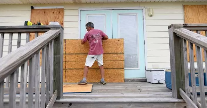
A supersized El Niño’s decapitating winds and the Gulf of Mexico’s toasty, storm-fueling waters are battling over the future strength of Hurricane Isaias. And the storm’s tilt and eye show who’s winning.
For now, it's the waters charged by climate change.
All Atlantic hurricane season there has been “this battle between shear and just the overall conducive conditions,” said Colorado State University hurricane researcher Phil Klotzbach.
El Niño — the natural temporary warming of parts of the Pacific that warps weather worldwide — dominated. Its wind patterns smothered almost any wisp of a storm from strengthening in the Atlantic, while boosting what will soon be record high levels in the Pacific, Klotzbach said.
It's called wind shear and it pushes the tops and middle of storms around, making them lopsided and keeping them from making a complete circular eyewall, which is when storms can really power up, Klotzbach and University at Albany's Kristen Corbosiero said.
The other ingredients for a storm to turbocharge a storm are pushing back. There is plenty of fuel in warm water and moisture. The Gulf of Mexico is about 2.7 degrees Fahrenheit (1.5 degrees Celsius) warmer than normal. The 86 degree waters (30 degrees Celsius) are 100 to 500 times more likely to be that extra hot because of climate change from the burning of coal, oil and gas, said climate scientist Kristina Dahl, vice president of the nonprofit Climate Central, which calculates the boost global warming causes to extreme weather.
“But there’s a certain point where it’s like, I don’t care how hot the waters are and how much moisture you have, if shear gets to a certain point, the shear is gonna win,” Klotzbach said.
The thunderstorm seeds of something bigger earlier in the week grew from circular winds over Central America but often were lopsided and couldn’t quite form a crucial eyewall, all because of El Niño’s high-level strong winds that pushed a would-be storm's top sideways, experts said.
Then a window of moderation opened for just a couple of days, but it was enough, Corbosiero said. It makes sense it was in the Gulf of Mexico and in October, because El Niño has less of an effect in the Gulf than it does in the main Atlantic, she said. And storms often pop up in that region in October because of more northerly storm systems that help foster the right conditions.
Wind shear wasn’t exactly low, but it was a moderate level, when other factors like unusually warm waters and heavy moisture can kick in. Isaias rapidly intensified from 40 mph to 80 mph (64 kph to 129 kph) in a day and by late Wednesday, Isaias became the latest-in-the-season first Atlantic hurricane to form since 1914, Klotzbach said.
“The warm waters and high moisture won,” Klotzbach said. Isaias Friday was not tilting and had a strong eye, the hurricane center said.
By Friday morning, Isaias blew past the threshold for becoming a major hurricane with winds of 111 mph (178 kph), strengthening to 120 mph winds (195 kph). The National Hurricane Center forecasts it to weaken to a strong Category 2 storm before landfall.
Before Isaias comes ashore — forecast for probably somewhere from the Mississippi and Alabama coast to the Florida Panhandle late Friday night or early Saturday — the wind shear will strengthen from moderate levels of around 20 mph (32 kph) to 52 mph (84 kph) and then Isaias will start to struggle, which is good news for coastal residents, Klotzbach said.
But as of Friday morning, hurricane center forecasters said the coast is in “a tenuous spot” because it would only take a six-hour delay in the onset of that more intense wind shear for Isaias to bring a stronger-than-expected landfall. Regardless of what will happen with wind shear, it will still be a dangerous hurricane when it hits land, forecasters said.
“Once it gets to the coast, we know that the storm surge is going to be deeper and farther reaching because of sea level rise caused by climate change,” Dahl said. “So in this part of the world, there’s been about six and a half inches of sea level rise over the past 100 years or so that’s attributable directly to climate change.”
The National Hurricane Center is calling the surge “life-threatening.”
A warmer atmosphere means storms hold and then dump more rain, worsening flooding, Dahl said. The hurricane center is warning about urban, river and flash flooding in the Southeast this weekend.
“There’s a little bit of a battle here going on, but I think the really important thing to remember is that climate change is like this long-term big kahuna warming everywhere, and El Niño’s like a little icing on the cake,” Dahl said.
The Associated Press’ climate and environmental coverage receives financial support from multiple private foundations. AP is solely responsible for all content. Find AP’s standards for working with philanthropies, a list of supporters and funded coverage areas at AP.org.
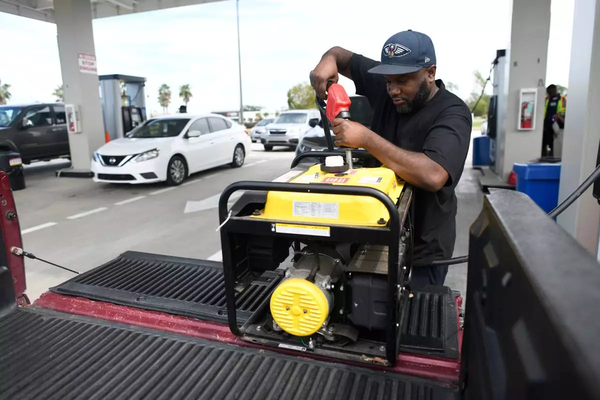
Residents fill up their gas tanks and generators at the Costco Wholesale Gas Station ahead of Hurricane Isaias' expected landfall along the Gulf Coast, Thursday, Oct. 8, 2026, in Mobile, Ala. (AP Photo/Octavio Jones)
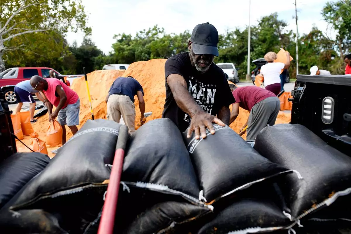
Residents pick up sandbags for storm preparation at the James Seals Jr. Parks & Recreation Center ahead of Hurricane Isaias' expected landfall along the Gulf Coast, Thursday, Oct. 8, 2026, in Mobile, Ala. (AP Photo/Octavio Jones)
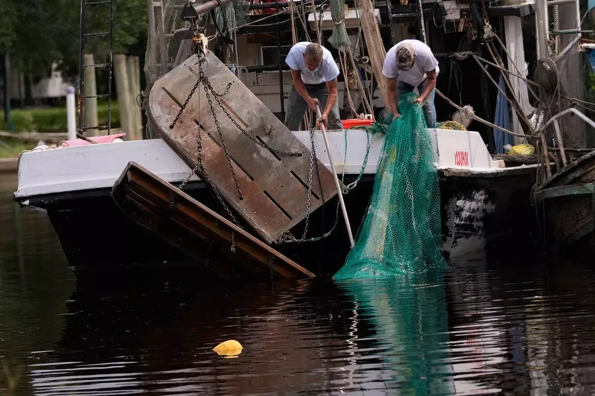
Boat owner Tony Rice, right, and his friend Lance Connor haul doors onto his boat to secure it as Hurricane Isaias approaches Bayou La Batre, Ala., Thursday, Oct. 8, 2026. (AP Photo/Gerald Herbert)
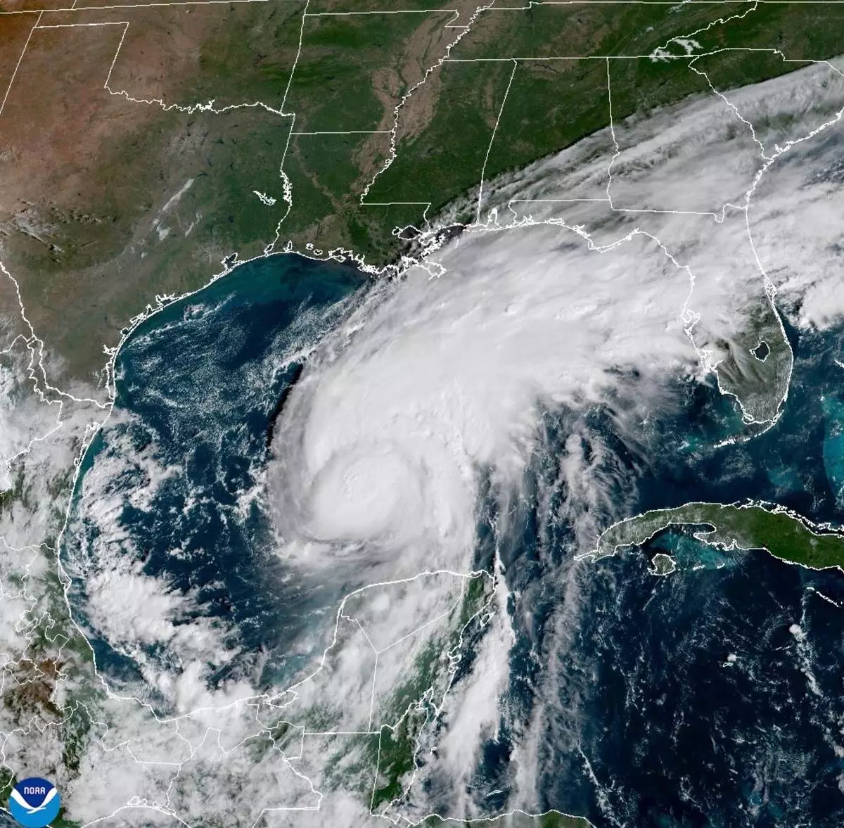
This satellite image from the National Oceanic and Atmospheric Administration shows Hurricane Isaias surging toward the U.S. Gulf Coast on Thursday, Oct. 8, 2026. (National Oceanic and Atmospheric Administration via AP)