Feature · News

China holds memorial ceremonies for Nanjing Massacre victims
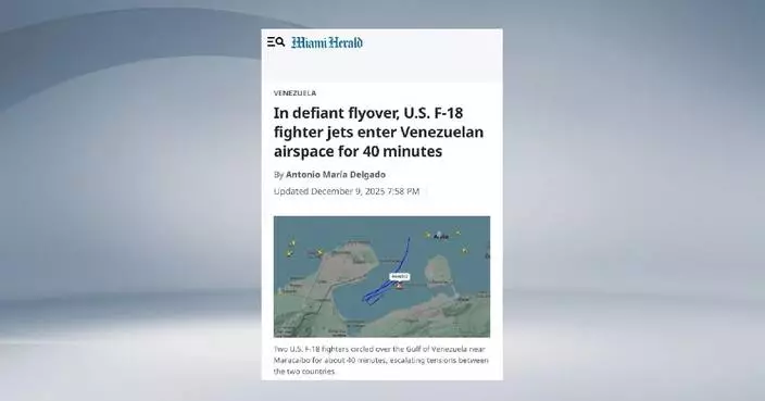
U.S. fighter jets enter Venezuelan airspace as tensions escalate

China's trade momentum increasingly powered by Global South: experts

Newly released Soviet archives provide fresh evidence of Unit 731's atrocities

Russia-provided evidence on Japanese Army Unit 731 verifies evidence preserved in China

Central gov't firmly supports HKSAR in punishing crimes endangering national security: spokesman

Chinese economy performs better than expected in major indicators this year: official

China commemorates Nanjing Massacre victims in National Memorial Ceremony

Only 24 survivors of Nanjing Massacre remain alive today

BP China Insight: Amid the trade war, China's trade surplus first exceeds $1 trillion

EV sales face challenges due to cancellation of US gov't incentives

Hong Kong Customs Seizes 11 Kilograms of Cannabis Buds at Airport, Arrests Passenger from Bangkok.

Holiday fair in Hong Kong raises support for families after Tai Po tragedy

Thailand-Cambodia border clashes displace thousands before ceasefire

Hong Kong Customs Seizes 714 Endangered Bird Eggs Worth $10 Million at Airport

Democratic former Sen. Doug Jones launches campaign for Alabama governor
Chinese economy performs better than expected in major indicators this year: official
China commemorates Nanjing Massacre victims in National Memorial Ceremony
Only 24 survivors of Nanjing Massacre remain alive today

BP China Insight: Amid the trade war, China's trade surplus first exceeds $1 trillion
China holds memorial ceremonies for Nanjing Massacre victims
U.S. fighter jets enter Venezuelan airspace as tensions escalate
China's trade momentum increasingly powered by Global South: experts
Newly released Soviet archives provide fresh evidence of Unit 731's atrocities
Russia-provided evidence on Japanese Army Unit 731 verifies evidence preserved in China

Central gov't firmly supports HKSAR in punishing crimes endangering national security: spokesman
EV sales face challenges due to cancellation of US gov't incentives

Hong Kong Customs Seizes 11 Kilograms of Cannabis Buds at Airport, Arrests Passenger from Bangkok.
Holiday fair in Hong Kong raises support for families after Tai Po tragedy
Thailand-Cambodia border clashes displace thousands before ceasefire

Hong Kong Customs Seizes 714 Endangered Bird Eggs Worth $10 Million at Airport

Democratic former Sen. Doug Jones launches campaign for Alabama governor
Feature·Bloggers

【What Say You?】Trump and Starmer Barely Bother with Jimmy Lai – Just Lip Service to Check the Box

【Mark Pinkstone】Committee to investigate Tai Po fire will expedite closure for the bereaved

【Ariel】9 Arrested for Illegal Drills: Tai Po Fire Lurkers Ready to Strike

【Mark Pinkstone】The return of Roach and his poisoned tongue

【What Say You?】UK Agitators Hijack Grief: The "Triplet" Protest Strategy

【Bastille Commentary】Tightening the Net on Subversive “Parliaments” Is Exactly the Point

Belarus frees Nobel Prize laureate Bialiatski, opposition figure Kolesnikova as US lifts sanctions
- Arctic air plunges south as residents of the Pacific Northwest remain on guard after severe flooding
- Ukrainian drone attack kills 2 in Russia as millions in Ukraine lose power
- UK police won't probe claim former prince asked bodyguard to investigate Virginia Giuffre
- Israel says it has killed a top Hamas commander in Gaza
- Some Native Americans draw shocked response over contract to design immigration detention centers
- Affable comedy acting legend Dick Van Dyke turns 100 years old
- Spain's leader finds himself alone in defending immigration as other EU heads take a tougher line
- Higher cost, worse coverage: Affordable Care Act enrollees say expiring subsidies will hit them hard
- Photos of amputees in Gaza, struggling to survive after losing limbs to Israeli airstrikes

Video offers details of Japan's germ-warfare crimes in northeast China
- Torrential rain brings more deaths, destruction to war-torn Gaza
- 15 Thai soldiers killed in Thailand-Cambodia border clashes
- Chinese archives' evidence of Unit 731 biological war crimes aligns with Russian Khabarovsk trials records
- Twenty U.S. states sue Trump's fee hike of H-1B visas
- China's poverty alleviation experience worth global study: former Singaporean diplomat
- China maps out innovation-focused economic agenda for 2026
- Shenzhen-Zhongshan Link facilitates Greater Bay Area connectivity
- Khabarovsk Trial exposes Japan's germ-warfare crimes in China
- Former Singaporean diplomat highlights significance of World Openness Report

Official streaming platform for the Games of the Future Abu Dhabi 2025 powered by ADNOC launches ahead of opening competition
- In Alaska’s warming Arctic, photos show an Indigenous elder passing down hunting traditions
- Bulgaria's president will start talks on new cabinet after government collapse
- SmallRig and FamilyLens Launch Global Family Filmmaking Initiative at 3rd FamilyLens International Film Festival
- SEAX Global Acquires Major Stake in Interlink Telecom to Accelerate ASEAN Expansion
- HiTHIUM Launches Three Breakthrough Innovations at Its Third Eco-Day, Unlocking an Intelligent Future with Long-Duration Energy Storage
- M7 World Championship unveils first Opening Ceremony, tournament draw, and M7 Pass—elevates Indonesia on global stage
- Ohio State’s Caleb Downs Named 2025 Paycom Jim Thorpe Award Winner
- AI Infrastructure Company EverMind Released EverMemOS, Responding to Profound Challenges in AI
- Second WiresConnect Concludes with Consensus that AI Is Leveling the Commerce Playing Field in Fashion and Beauty

More loons are filling Maine's lakes with their ghost-like calls
- Humanoid robots take center stage at Silicon Valley summit, but skepticism remains
- Winter virus season so far is not too bad, but doctors worry about suffering to come
- Ford turns to stepped-up tech and cooperation with police to thwart F-150 pickup thieves
- A Chinese whistleblower now living in the US is being hunted by Beijing with help from US tech
- Appeals court backs contempt finding against Apple, but reopens a door for iPhone app fees
- Disney invests $1B in OpenAI in deal to bring characters like Mickey Mouse to Sora AI video tool
- These are the key AI players on the cover of Time's 'Architects of AI' magazine
- Open AI, Microsoft face lawsuit over ChatGPT's alleged role in Connecticut murder-suicide
- NASA loses contact with its Maven spacecraft orbiting Mars for the past decade

Hailee Steinfeld and NFL husband Josh Allen are expecting their first child
- Meet the Indigenous women behind Mexican President Claudia Sheinbaum's 'most stylish' looks
- Oscar winner Morricone’s lost opera debuts in Naples after 30 years
- Bestselling British writer Joanna Trollope dies at 82
- It feels good to be Jelly Roll. And now, he's ready to win a Grammy
- Photos show Ennio Morricone's opera 'Partenope' as it premieres in Naples
- A dance hall in Buenos Aires guarantees tango sessions with professional partners
- Director convicted of scamming $11M from Netflix and going on lavish spending spree
- Eurovision champion Nemo returns the winner's trophy to protest Israel's inclusion
- UNESCO gives a shout-out to Switzerland's yodeling by adding it to list of cultural heritage

Salah returns to help Liverpool beat Brighton in Premier League. Palmer scores in Chelsea win
- Agnelli family affirms Juventus ownership and rejects buyout offer from cryptocurrency firm
- Japan forward Ritsu Doan steers Frankfurt to much-needed Bundesliga win
- JuJu Watkins attends USA Basketball camp and focuses on leadership during ACL rehab
- Salah comes on as early sub and gets an assist for Liverpool against Brighton after recall
- Johannes Lochner edges out Francesco Friedrich in Lillehammer World Cup bobsled race
- Alabama vows to address Oklahoma's 'disrespect' when they meet in the CFP's opening round
- Messi's tour of India gets off to chaotic start as angry fans storm field
- Loic Meillard leads Swiss podium sweep at World Cup giant slalom in Val d'Isere
- Heisman Trophy finalists include 3 quarterbacks and Notre Dame's Jeremiyah Love

Government Task Forces Mobilize $3.7 Billion Fund for Wang Fuk Court Fire Relief Efforts
- Hong Kong Reports No New Chikungunya Cases, Tsing Yi Trails Closed for Mosquito Control Efforts
- Hong Kong Launches GoGlobal Platform to Support Mainland Enterprises in Global Expansion
- James McDonald officially accepts LONGINES World’s Best Jockey award
- Former SCED Gregory So Remembered for Contributions to Hong Kong's Economic Development
- Interdepartmental Committee Updates Progress on Mosquito Control and Chikungunya Prevention at Tsing Yi Nature Trails
- Nine arrested in Hong Kong for unlawful drilling related to national security, police seize offensive weapons
- Task Force Enhances Mental Health Support for Tai Po Fire Victims and Families
- Two Passengers Sentenced for Importing Duty-Not-Paid Cigarettes, Highlighting Customs Enforcement Efforts
- Hong Kong Customs Seizes $8.9 Million in Drugs, Arrests Three in Major Trafficking Busts

Japan's Chukiren Peace Memorial Hall brings historical truth to more people
- Macao holds commemoration for Nanjing Massacre victims
- Chinese academic warns of Japan's regression in historical accountability
- Japanese civil group calls for remembrance of Nanjing Massacre
- Sense of uncertainty looms over Venezuelan university amid escalating tensions with US
- Hainan streamlines entry procedures for int'l travelers ahead of independent customs operation
- Nanjing Massacre testimonies renew calls in Japan to confront aggression history
- Taxi feet offers free rides to residents, victims in wake of deadly Hong Kong residential building fire
- Favorable policies boost cruise, yacht industries in China's Hainan
- China to move toward AI's wide, secure integration across economy, society in 2026: expert
Category · News

Belarus frees Nobel Prize laureate Bialiatski, opposition figure Kolesnikova as US lifts sanctions

Arctic air plunges south as residents of the Pacific Northwest remain on guard after severe flooding

Salah returns to help Liverpool beat Brighton in Premier League. Palmer scores in Chelsea win

Agnelli family affirms Juventus ownership and rejects buyout offer from cryptocurrency firm

Japan forward Ritsu Doan steers Frankfurt to much-needed Bundesliga win

Ukrainian drone attack kills 2 in Russia as millions in Ukraine lose power

UK police won't probe claim former prince asked bodyguard to investigate Virginia Giuffre

JuJu Watkins attends USA Basketball camp and focuses on leadership during ACL rehab

Israel says it has killed a top Hamas commander in Gaza

Salah comes on as early sub and gets an assist for Liverpool against Brighton after recall

Some Native Americans draw shocked response over contract to design immigration detention centers

Johannes Lochner edges out Francesco Friedrich in Lillehammer World Cup bobsled race

Affable comedy acting legend Dick Van Dyke turns 100 years old

Spain's leader finds himself alone in defending immigration as other EU heads take a tougher line

Higher cost, worse coverage: Affordable Care Act enrollees say expiring subsidies will hit them hard

Photos of amputees in Gaza, struggling to survive after losing limbs to Israeli airstrikes
Video offers details of Japan's germ-warfare crimes in northeast China

Alabama vows to address Oklahoma's 'disrespect' when they meet in the CFP's opening round

Fighting rages on Thai-Cambodian border despite Trump's ceasefire claim

Official streaming platform for the Games of the Future Abu Dhabi 2025 powered by ADNOC launches ahead of opening competition

UN chief visits Iraq to mark end of assistance mission set up after 2003 invasion
Torrential rain brings more deaths, destruction to war-torn Gaza

Messi's tour of India gets off to chaotic start as angry fans storm field
15 Thai soldiers killed in Thailand-Cambodia border clashes

Loic Meillard leads Swiss podium sweep at World Cup giant slalom in Val d'Isere
Chinese archives' evidence of Unit 731 biological war crimes aligns with Russian Khabarovsk trials records

Heisman Trophy finalists include 3 quarterbacks and Notre Dame's Jeremiyah Love

Government Task Forces Mobilize $3.7 Billion Fund for Wang Fuk Court Fire Relief Efforts

More loons are filling Maine's lakes with their ghost-like calls

Grassley built a reputation for government oversight. Has he abandoned it under Trump?

In Alaska’s warming Arctic, photos show an Indigenous elder passing down hunting traditions

Lindsey Vonn places 2nd in a World Cup downhill a day after becoming oldest winner at age 41
Twenty U.S. states sue Trump's fee hike of H-1B visas

What to know about King Charles III's cancer treatment and his message to the public

Bulgaria's president will start talks on new cabinet after government collapse
China's poverty alleviation experience worth global study: former Singaporean diplomat
China maps out innovation-focused economic agenda for 2026
Shenzhen-Zhongshan Link facilitates Greater Bay Area connectivity
Khabarovsk Trial exposes Japan's germ-warfare crimes in China
Former Singaporean diplomat highlights significance of World Openness Report
Japan's Chukiren Peace Memorial Hall brings historical truth to more people
Macao holds commemoration for Nanjing Massacre victims

Hong Kong Reports No New Chikungunya Cases, Tsing Yi Trails Closed for Mosquito Control Efforts
Chinese academic warns of Japan's regression in historical accountability

Hong Kong Launches GoGlobal Platform to Support Mainland Enterprises in Global Expansion
China's "Jiutian" large drone takes first flight, aims for versatile roles
Japanese civil group calls for remembrance of Nanjing Massacre
Sense of uncertainty looms over Venezuelan university amid escalating tensions with US
Nanjing Massacre testimonies renew calls in Japan to confront aggression history
Hainan streamlines entry procedures for int'l travelers ahead of independent customs operation
Taxi feet offers free rides to residents, victims in wake of deadly Hong Kong residential building fire
Favorable policies boost cruise, yacht industries in China's Hainan
China to move toward AI's wide, secure integration across economy, society in 2026: expert
US seeks to revive Monroe Doctrine to reinforce influence in Americas: Cuban scholar
Voices of Asia should be heard, valued by world: former Singaporean diplomat
China's Five-Year Plans indispensable for long-term high-quality development: former senior diplomat
Russian central bank warns of legal action over EU plan on assets
Int'l observers look to China as stabilizing force in coming five-year period
Khabarovsk Trial exposes Japan's bacteriological warfare during WWII: Russian historians
At least 14 killed as winter storms batter Gaza: civil defense

Eritrea withdraws from regional bloc as UN expresses concern over tensions with Ethiopia
Russia reports seizing settlements as Ukraine claims gains in direction of Kupyansk
New U.S. national security strategy represents shift in transatlantic relations: expert

Curry scores 39 in return but Timberwolves top Warriors 127-120 without Edwards
Truth of Nanjing Massacre allows no distortion: Canadian historian

James McDonald officially accepts LONGINES World’s Best Jockey award
Prompt clearing efforts begin amid season's first snowfall in northern China

Gaza amputees struggle to rebuild lives as the enclave faces shortages of prosthetic limbs

Guenther scores tiebreaking goal in 3rd period as Mammoth beat Kraken 5-3 to end three-game skid

SmallRig and FamilyLens Launch Global Family Filmmaking Initiative at 3rd FamilyLens International Film Festival

Historic rains and flooding trigger dramatic rescues in Washington state

What to know about Kilmar Abrego Garcia's release from immigration custody

Former SCED Gregory So Remembered for Contributions to Hong Kong's Economic Development

Blackhawks' Bedard injured on last-second faceoff, to miss game against Red Wings on Saturday

Trump says he's sealed Thailand-Cambodia ceasefire, but fighting continues
Attempts to stop China's sci-tech development doomed to fail: former Singaporean diplomat

Ja Morant has 21 points and 10 assists in return to Grizzlies lineup after 10-game absence
China's Kuaizhou-11 Y8 rocket launches experimental spacecraft

Anthony Davis has 24 points and 14 rebounds to lead Mavericks past Nets 119-111

Keyonte George scores a career-high 39 points as Jazz beat Grizzlies 130-126

Mailloux, Luff get first goals of season as Blues beat rival Blackhawks 3-2

With 24 points, Donovan Mitchell produces the highest-scoring 4th quarter of the NBA season so far

SEAX Global Acquires Major Stake in Interlink Telecom to Accelerate ASEAN Expansion

Wild acquire star defenseman Quinn Hughes from the Canucks in a blockbuster NHL trade


