TOKYO--(BUSINESS WIRE)--Sep 1, 2026--
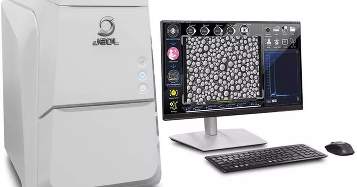
JEOL Ltd. (President & CEO: Izumi Oi) has developed the benchtop scanning electron microscope (SEM) “JCM-7000Plus” and will begin sales on September 1, 2026.
This press release features multimedia. View the full release here: https://www.businesswire.com/news/home/20260825564112/en/
[Development Background]
Benchtop scanning electron microscopes are increasingly used in fields including electrical and electronics, automotive and machinery, steel and metals, chemical and pharmaceuticals. They are utilized not only in research and development but also in manufacturing-related applications, such as quality control and product inspection. In addition, they are adopted in educational settings at middle and high schools as well as universities. Given these diverse applications, there is growing demand for improved operational efficiency, simpler and more automated operation, and enhanced observation, analysis, and measurement performance.
To meet these needs, we have expanded the landing voltage (accelerating voltage) to 20 kV. This has improved resolution to 6 nm, enabling measurements at higher magnification.
On the software side, the new JCM-7000Plus retains the simple, user-friendly GUI of the current JCM-7000, including Zeromag, which enables a seamless transition from optical imaging to SEM observation, and the Live Analysis function, which allows real-time elemental analysis during observation. It also adds the enhanced automation feature Neo Action.
In addition to the three existing Live functions (Live Analysis, Live Map, and Live 3D), we have added two new features: Live Particle, which automatically measures particle size and count in real time while observing, and Live Report, which automatically acquires data and generates reports while moving the field of view, a feature available in high-end FE-SEMs. These features simplify routine tasks, making them more intuitive and efficient while significantly supporting users' analytical workflows.
[Main Features]
1. Expanding landing voltage to 20 kV for improved resolution (secondary electron image: 6 nm, backscattered electron image: 8 nm)
2. Improved backscattered electron detector for enhanced image quality
3. New Live Particle function automatically measures particle size and count, simplifying workflow
4. Live Report enables data acquisition and report creation while moving the field of view, improving work efficiency
5. Simple and user-friendly GUI retained, with added automation functions for more intuitive and easier operation
[Sales target]
300 units/year
[Related link]
Product Information: JCM-7000Plus NeoScope™ Benchtop SEM
https://www.jeol.com/products/scientific/sem/jcm-7000plus.php
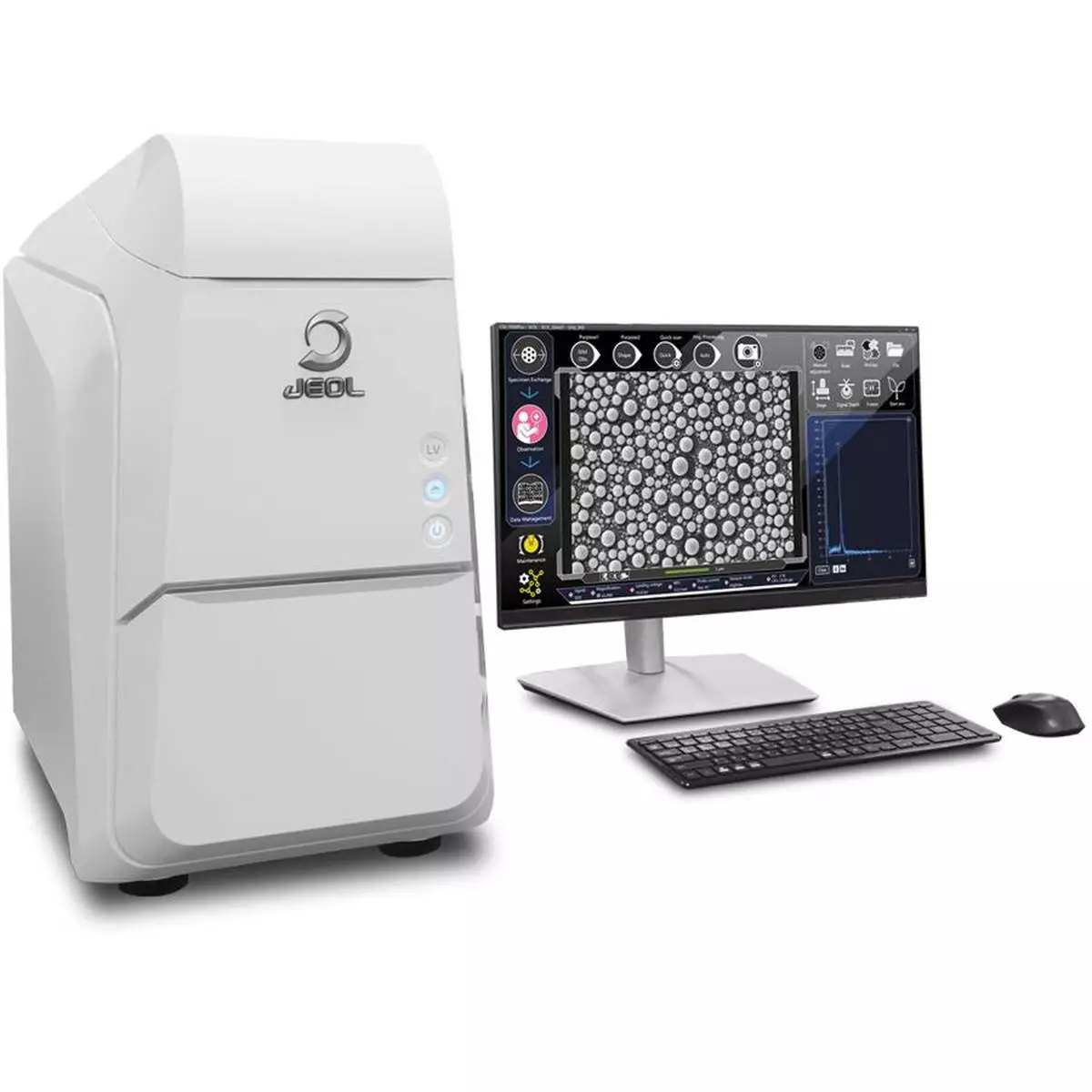
JCM-7000Plus NeoScope™
MIAMI (AP) — Tropical Storm Edouard headed toward the Gulf Coast early Tuesday and expected to gain strength before bringing potentially heavy rains and flooding into parts of Texas and Louisiana.
The storm was upgraded Monday night from a tropical depression and forecasters with the National Hurricane Center expect it will make landfall in Texas later on Tuesday.
Early Tuesday the storm was about 65 miles (100 kilometers) south-southeast of Cameron, Louisiana, and 90 miles (145 kilometers) southeast of Port Arthur, Texas, with maximum sustained winds of 40 mph (65 kph) while moving west-northwest at 8 mph (13 kph).
Texas Gov. Greg Abbott said the biggest problem expected from the storm is flooding. Forecasters are anticipating 3-6 inches (7-15 centimeters) of rain in the greater Houston area, with some areas of the state’s upper coast getting up to 9 inches (22 centimeters). More than 4 inches (10 centimeters) per hour could fall and will likely cause flash flooding in low-lying and urban areas, according to the National Hurricane Center.
“This is our first big storm of the season, and I’ll tell you, Texas is prepared,” Orlando Alanis of the Texas Division of Emergency Management said during a news conference.
Crews worked Monday to clear dry vegetation that could ignite from a lightning strike and cause fast-spreading fires, Abbott said.
Meanwhile, the remnants of Tropical Storm Dolly brought rain and thunderstorms to parts of Haiti and the Dominican Republic, the Turks & Caicos, and the Bahamas, the hurricane center said.
In the Pacific Ocean on Monday evening, Tropical Storm Lowell was about 630 miles (1,015 kilometers) southeast of Hilo, Hawaii, with maximum sustained winds of 70 mph (110 kph) while moving west at 10 mph (17 kph). Forecasters said Lowell could rapidly intensify and become a major hurricane by Wednesday.
Also in the Pacific, Tropical Storm Marie formed early Tuesday well offshore of southwest Mexico and wasn’t threatening land, the center said. The storm was about 470 miles (756 kilometers) southwest of Manzanillo with maximum sustained winds of 45 mph (72 kph) and was moving northwest. Marie was expected to become a hurricane in the coming days.
Elsewhere in the Pacific, Hurricane Karina became a hurricane Sunday, fueled by warm waters far from any shore, and strengthened Monday into a powerful Category 4 storm. But it did not threaten land, forecasters said.
On Tuesday morning, Karina remained a Category 4 hurricane and was centered 1,210 miles (1,950 kilometers) west-southwest of the southern tip of the Baja California peninsula of Mexico with maximum sustained winds of 140 mph (222 kph) while moving west-northwest at 10 mph (17 kph), the center said.
The story has been updated to correct that Dolly was a tropical storm, not a hurricane.
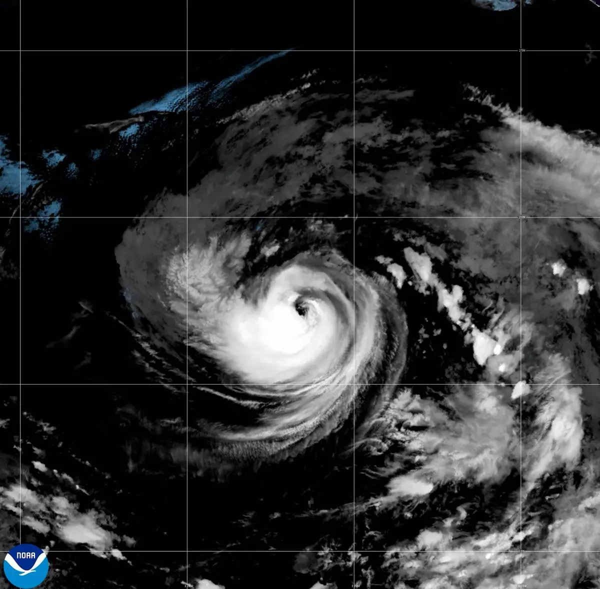
This satellite image released by NOAA shows Hurricane Karina strengthening off the southern tip of Baja California on Sunday, Aug. 30, 2026. (NOAA via AP)
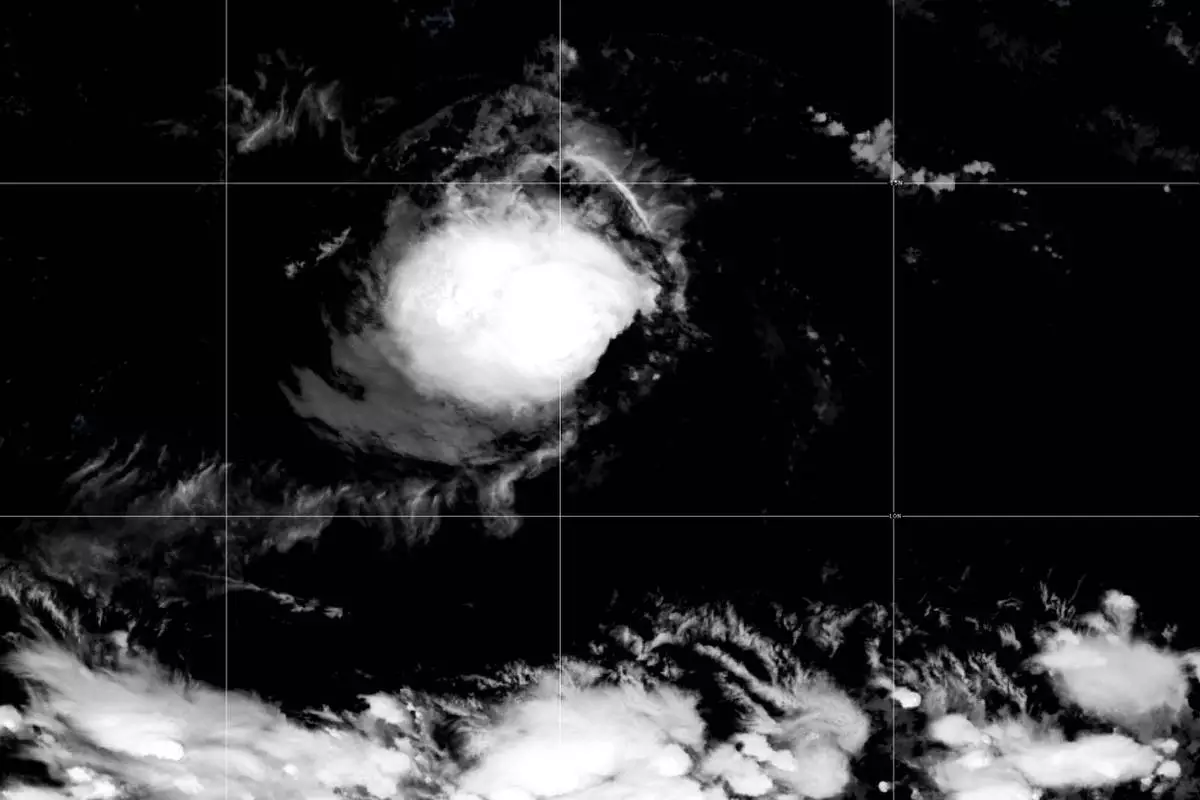
This satellite image released by NOAA shows Tropical Storm Lowell over the Pacific Ocean, Monday, Aug. 31, 2026. (NOAA via AP)
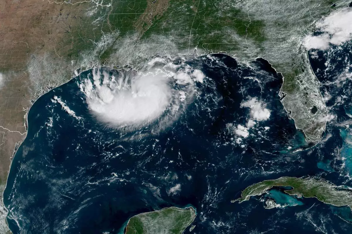
This satellite image released by NOAA shows Potential Tropical Cyclone Five forming over the Gulf of Mexico on Monday, Aug. 31, 2026. (NOAA via AP)