Apple's new CEO John Ternus takes the helm of the iconic tech giant on Tuesday, ending Tim Cook's 15-year tenure during which the company's value skyrocket to $4.6 trillion thanks to the iPhone's enormous popularity.
The transition to a new CEO comes at a pivotal time for Apple. Artificial intelligence has unleashed the greatest upheaval within the industry since Steve Jobs unveiled the first iPhone in 2007. Apple has gotten off to a rough start in AI after stumbling in its efforts to deliver new features built on the technology, as promised nearly two years ago.
Earlier this year, it unveiled new artificial intelligence advances, including upgrades to its Siri assistant, emphasizing a focus on privacy and day-to-day use as the iPhone maker tries to catch up with rivals.
Ternus faces challenges that will force him to step outside his comfort zone in hardware engineering. Beyond finding ways to keep Apple competitive in the artificial intelligence race, he will need to navigate supply chain questions and relationships with figures such as President Donald Trump, who offered public praise for his predecessor on Tuesday.
Serving as Apple CEO will also require soft skills, including developing relationships with important figures. Cook cultivated ties with Trump as he navigated the company through business challenges, including Trump’s trade and tariff war targeting countries in Asia, where Apple has extensive manufacturing supply chains. Although he is handing over the CEO reins at Apple, Cook is widely expected to help the company maintain a good relationship with Trump after he shifts to his new role as executive chairman.
Ternus worked on some of Apple’s signature products under Cook, including the Apple Watch, AirPods and Apple Vision Pro. He will headline next week's launch of the latest iPhone at Apple's Cupertino, California, headquarters.
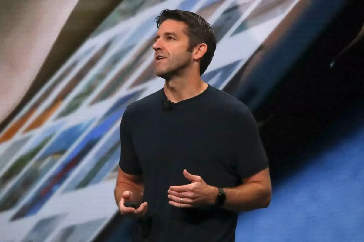
FILE - John Ternus, Apple's V.P. of Hardware Engineering, discusses the latest development for the iPad Pro during an event to announce new products Oct. 30, 2018, in the Brooklyn borough of New York. (AP Photo/Bebeto Matthews, File)
MIAMI (AP) — Tropical Storm Edouard headed toward the Gulf Coast early Tuesday and expected to gain strength before bringing potentially heavy rains and flooding into parts of Texas and Louisiana.
The storm was upgraded Monday night from a tropical depression and forecasters with the National Hurricane Center expect it will make landfall in Texas later on Tuesday.
Early Tuesday the storm was about 65 miles (100 kilometers) south-southeast of Cameron, Louisiana, and 90 miles (145 kilometers) southeast of Port Arthur, Texas, with maximum sustained winds of 40 mph (65 kph) while moving west-northwest at 8 mph (13 kph).
Texas Gov. Greg Abbott said the biggest problem expected from the storm is flooding. Forecasters are anticipating 3-6 inches (7-15 centimeters) of rain in the greater Houston area, with some areas of the state’s upper coast getting up to 9 inches (22 centimeters). More than 4 inches (10 centimeters) per hour could fall and will likely cause flash flooding in low-lying and urban areas, according to the National Hurricane Center.
“This is our first big storm of the season, and I’ll tell you, Texas is prepared,” Orlando Alanis of the Texas Division of Emergency Management said during a news conference.
Crews worked Monday to clear dry vegetation that could ignite from a lightning strike and cause fast-spreading fires, Abbott said.
Meanwhile, the remnants of Tropical Storm Dolly brought rain and thunderstorms to parts of Haiti and the Dominican Republic, the Turks & Caicos, and the Bahamas, the hurricane center said.
In the Pacific Ocean on Monday evening, Tropical Storm Lowell was about 630 miles (1,015 kilometers) southeast of Hilo, Hawaii, with maximum sustained winds of 70 mph (110 kph) while moving west at 10 mph (17 kph). Forecasters said Lowell could rapidly intensify and become a major hurricane by Wednesday.
Also in the Pacific, Tropical Storm Marie formed early Tuesday well offshore of southwest Mexico and wasn’t threatening land, the center said. The storm was about 470 miles (756 kilometers) southwest of Manzanillo with maximum sustained winds of 45 mph (72 kph) and was moving northwest. Marie was expected to become a hurricane in the coming days.
Elsewhere in the Pacific, Hurricane Karina became a hurricane Sunday, fueled by warm waters far from any shore, and strengthened Monday into a powerful Category 4 storm. But it did not threaten land, forecasters said.
On Tuesday morning, Karina remained a Category 4 hurricane and was centered 1,210 miles (1,950 kilometers) west-southwest of the southern tip of the Baja California peninsula of Mexico with maximum sustained winds of 140 mph (222 kph) while moving west-northwest at 10 mph (17 kph), the center said.
The story has been updated to correct that Dolly was a tropical storm, not a hurricane.
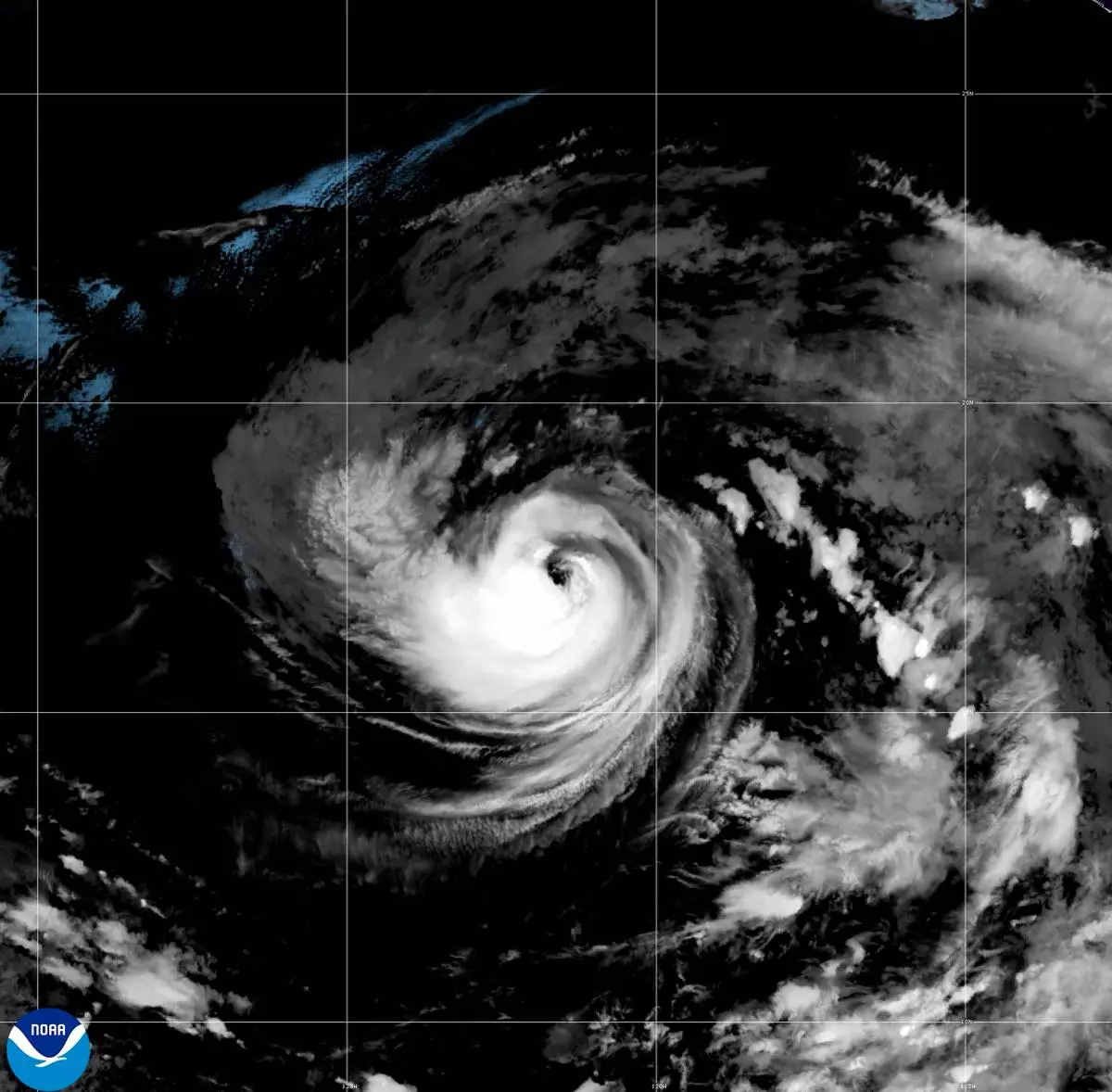
This satellite image released by NOAA shows Hurricane Karina strengthening off the southern tip of Baja California on Sunday, Aug. 30, 2026. (NOAA via AP)
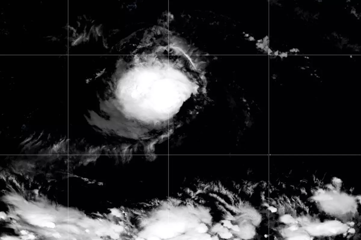
This satellite image released by NOAA shows Tropical Storm Lowell over the Pacific Ocean, Monday, Aug. 31, 2026. (NOAA via AP)
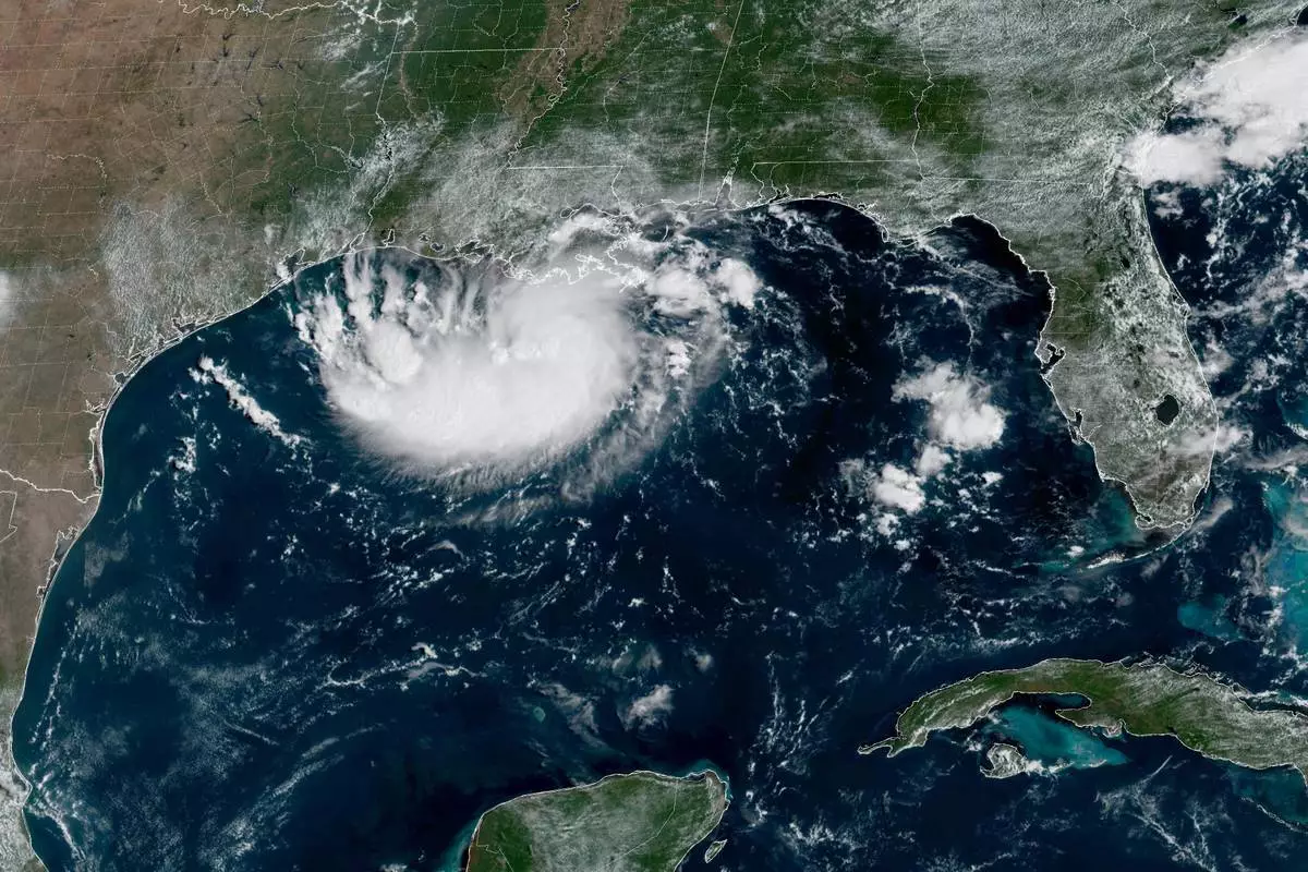
This satellite image released by NOAA shows Potential Tropical Cyclone Five forming over the Gulf of Mexico on Monday, Aug. 31, 2026. (NOAA via AP)