美國國家海洋暨大氣總署(NOAA)氣候預測中心最新預測警告,厄爾尼諾現象(El Niño)正在太平洋中快速形成,且發展速度超出預期。
Strongest El Niño on record this year?!
— Ben Noll (@BenNollWeather) April 6, 2026
New ECMWF guidance shows a *75% chance of a super El Niño* by October, with some scenarios suggesting the most intense event in more than a century.
It will bring wide-reaching weather impacts that last into 2027 🧵 pic.twitter.com/cRZrxGCxAa
海水升溫超預期 關鍵海域逼近臨界點
綜合外媒報導,過去數週熱帶太平洋升溫速度驚人。目前關鍵海域平均水溫雖仍略低於攝氏0.5度的弱聖嬰門檻,但NOAA預期下個月將突破該線。
若升幅超過攝氏1.5度視為強聖嬰;若達攝氏2度以上則為非常強厄爾尼諾,即「超級厄爾尼諾」。歐洲中期天氣預報中心(ECMWF)數據更顯示,超過半數模型預測到秋季時,關鍵海域溫度可能飆升超過攝氏2.5度。
Some forecasters predict 'super' El Nino conditions during the second half of 2026, with hotter, drier weather across much of Asia and more rain in parts of North and South America. But how likely and extreme will it be? https://t.co/4lJ84D4HS2 pic.twitter.com/r3BHKXCQ0p
— Reuters (@Reuters) May 6, 2026
96%機率橫掃北半球冬季
NOAA預報指出,厄爾尼諾現象將在一個月內正式成形,並在未來數月持續增強,有96%機率持續到北半球冬季,並在秋冬之際達到高峰。屆時有三分之二機率發展為強厄爾尼諾或超級厄爾尼諾。雖然預報員對厄爾尼諾形成信心大增,但對於其峰值強度仍存變數。
El Niño is emerging even faster than expected in the Pacific Ocean and odds are increasing that it could become historically strong — a rare "Super" El Niño — by fall or winter. https://t.co/rMg9twp0sK pic.twitter.com/676kUoqmqH
— CNN (@CNN) May 14, 2026
極端天氣風險激增 今年恐成最熱年份之一
超級厄爾尼諾將劇烈改變全球天氣型態,強化乾旱、熱浪與野火風險,同時引發部分地區的極端暴雨與洪災,並可能抑制大西洋颶風季的活動。NOAA本週初已示警,今年「非常可能」成為有紀錄以來前5熱的年份之一,若疊加超級厄爾尼諾的暖化效應,全球氣溫恐再創新高。
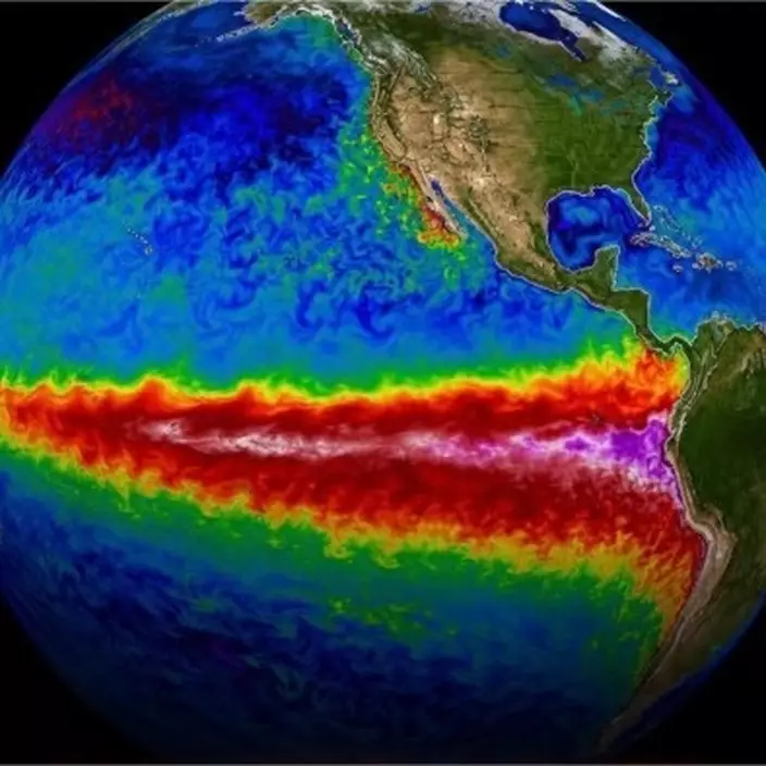
超級厄爾尼諾將劇烈改變全球天氣型態。X圖片